Quote:
Originally Posted by nixcity

^Idk why you don't spend more time being productive than trying to just contradict everybody.
|
You say, when your posting was simply contradicting the 2014 rail route. Irony.
Quote:
Originally Posted by nixcity
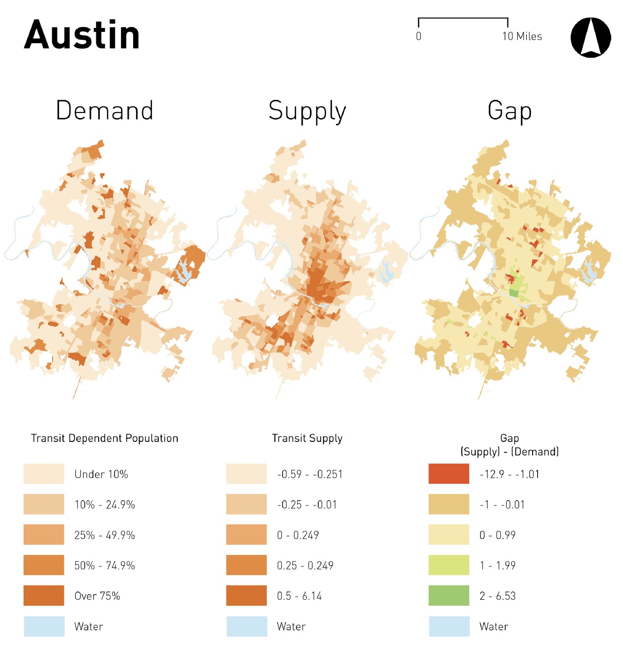
All that report showed is that where they wanted to send rail doesn't need it
|
It shows nothing of the sort. It's a garbage study.
When your model shows something that contradicts expectations, maybe it's showing something new, or maybe your model is bad, and you need to revisit it. When it shows a "transit desert" where there's a bunch of transit, maybe the model is bad.
Real scientists and planners need to do that. Instead of just publishing, like this grad student did.
1)
This is a bad model. Just look at it critically.
Many of the factors it counted don't actually scale. Once every road in a block group has a bike lane, doubling the number of people doesn't double the demand for bike lanes. Or intersections. Or sidewalks.
So the model actually
penalizes density. The exact opposite of what you'd want.
It only looked at stops within the block group. Stops on the east side of Guadalupe? Don't count for west campus, they're outside the block.
So it doesn't count stops/routes/frequency that are accessible but outside the block. Something that happens more and more as density increases and the block size decreases.
Again, the model
penalizes density. Even if it's actually well served with transit.
2)
Real planners don't just look at where transit dependent populations are. They also look at where they're going. And how.
Why would you send rail north/south along Guadalupe so those students can go
east/west to campus?
Why would you put in a rail system to capture trips that are
already captured by biking and walking?





 Prev
Prev




 Linear Mode
