Quote:
Originally Posted by OCCheetos

It's probably the lead to the southern connector track coming out of the yard (since the city started using it last year).
|
I'm not convinced that this is correct. First of all it doesn't explain why CN doesn't own that small section of track in the middle of the spur. Secondly, it is only 0.02 miles, which converts to 32 meters and your ruler shows 85 meters.
The more I think about it, I am convinced it is the diamond. The diamond itself is likely jointly owned, and if one discontinues it, the ownership transfers to the other owner (in this case the city). Part of it may also be that they don't want the responsibility of dismantling the diamond.
I drew things out with Google MyMaps, and using 33m around the Walkley Diamond aa 4.09 to 4.11, the measurements work out pretty well:
- 0.00 to 4.09 (4.09 miles or 6.58 km) measures 6.60 km.
- 4.11 to 5.83 (1.72 miles or 2.77 km ) measures 2.75 km
So my measurements are within 20 m or 0.012 miles, which is probably just a combination of measurement and round-off error. Below you can see my map zoomed in on the diamond.

Yellow = Discontinue
Orange = Discontinue Operating rights only
Red = O-Train Line
Quote:
|
Seems like a waste to have upgraded the yard's signals only to abandon it right afterwards, although I guess it was probably the city who wanted the upgrades.
|
I strongly suspect that the city will take over the yard. They use it for the the trillium line MSF and can rent out other parts of the yard that they don't use.
Quote:
|
Was the industrial spur going up to the Museum of Science and Tech already abandoned? I assume it was.
|
Much of it was removed but some of it is there. I'm not sure if it is owned by the industry that uses it or it is considered a siding and thus not listed.
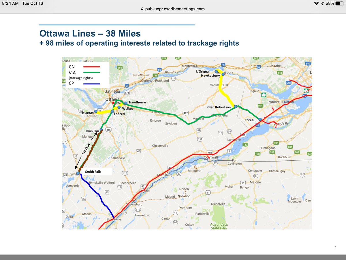
While I was at it, I drew all of the changes in the plan on my map (along with existing ROWs). It is similar to the map J.OT13 referenced, but I think it is better (though not necessarily perfect).

Yellow = Discontinue
Orange = Discontinue Operating rights only (City of Ottawa Owner)
Green = Discontinue Operating rights only (VIA Rail Owner)
Sage Green = Discontinue (used by VIA Rail)
Red = City of Ottawa (Active)
Blue = VIA Rail ROW
Purple = Unknown owner
Olive Green = CN Retain (out of view,
see full map)
Tuscan Red = CPR Active (out of view,
see full map)





 Prev
Prev



 )
)


 Linear Mode
