I've posted this over at Urban Toronto but I'm not sure everyone here will see it and thought folks here might be interested.
Quote:
Joseph:
"The Agency ... may conclude that a railway company has failed to respect that process if the company has (a) removed infrastructure, (b) created physical barriers, or (c) allowed one of its lines to fall into a state of disrepair such that operation of the line by the company or by another company granted running rights is not possible within a reasonable period of time." (Letters added for clarity.)
Discussion on this blog has focused on (c), which primarily involves the PoWB itself.
What of the (a) dismantled approach track, and the (b) purposeful design of the new Bayview Station to permanently block the corridor?
So far the City's spokespeople imply that (a) and (b) were necessary to accommodate the OLRT project. That is false.
|
^ For (b), I thought you said the Bayview Station design that's under construction right now for the Confederation Line LRT wouldn't impact your plan?
Here's what your letter said:
"REMISZ also drafted, and MOOSE has already proposed to the City and to the Agency, a way to reconnect the dismantled approach track to the bridge connecting Ottawa and Gatineau. This essential remediation project would cost of approximately $25M, but it leaves the City of Ottawa's new Bayview Station design exactly as it is, and would not interfere with the delivery timeline of the OLRT Project."
Can you elaborate how your recent letter says your plan "wouldn't interfere" but you have concerns about (b)?
Also, from your plan and the Stage 2 Ottawa plan, my understanding is that you want to run heavy rail commuter trains (via two routes interlined - red and purple). A heavy rail MP40-3C is shown on your bridge diagram.
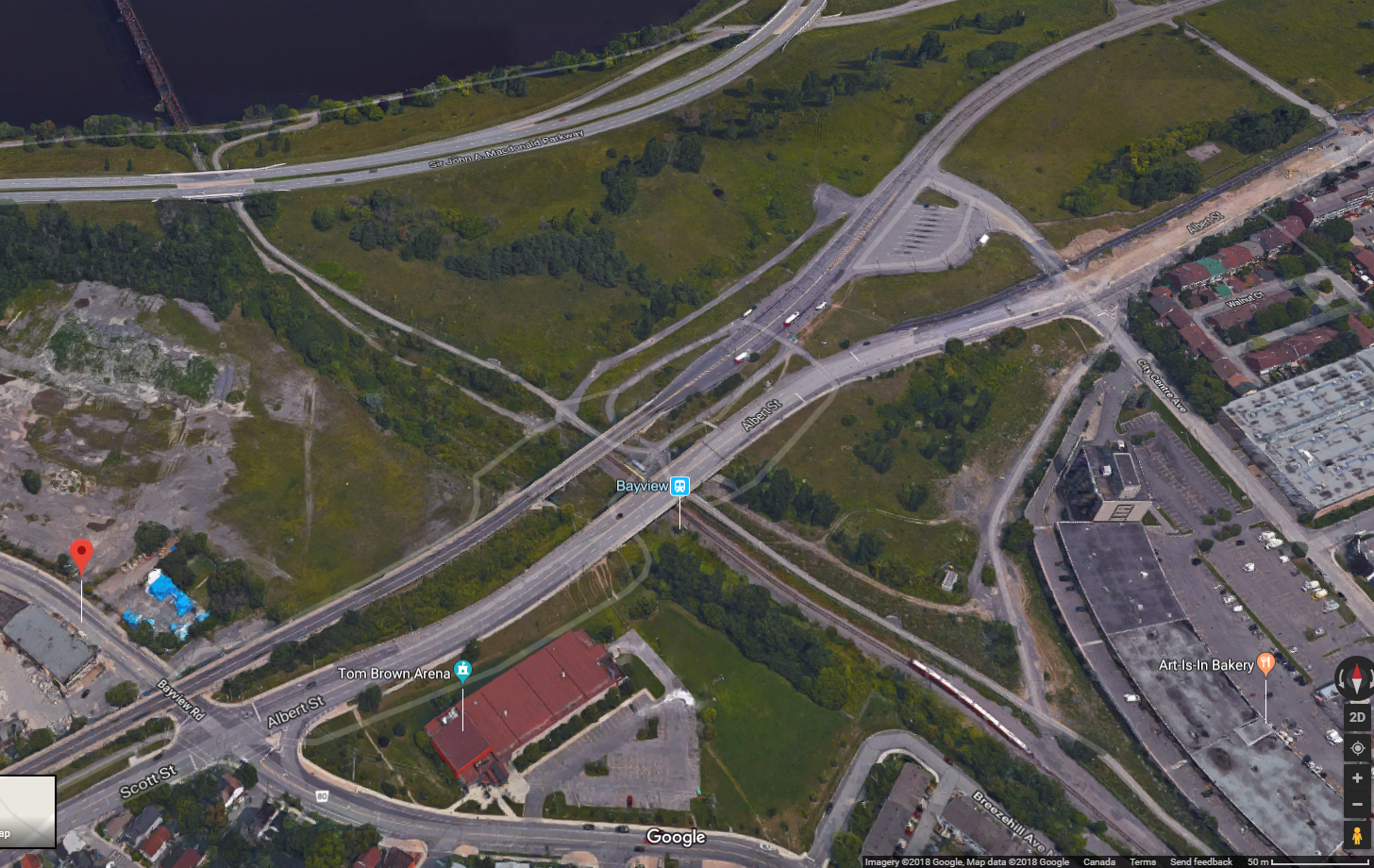
I've also included a shot from Google maps but I realize it doesn't show Bayview Station under construction. Just context. Feel free to create your own maps marked up to explain further. I find it helps. Are there any more recent aerial shots of the Bayview location showing the LRT station construction progress?
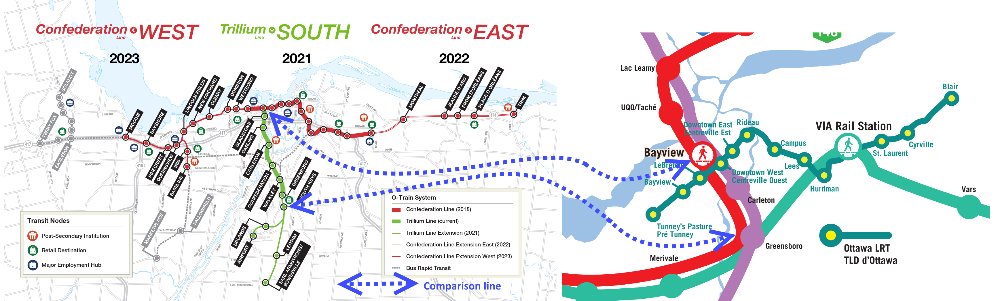
Sorry one more image. Joseph, I just want to make sure I'm correctly understanding what you're proposing for your "Greenboro Station" where the green line, purple line, and red line intersect. Would it be at the existing Greenboro O-Train Station (just south of Presswood Junction)? Or would you move it slightly to the north so that it intersects with the green line that continues northeast to the VIA Station at Ellwood Junction? I can adjust the dotted blue line on the comparison map I did.
[I have attached a historic Ottawa rail map that notes the names of the rail junctions - Presswood and Ellwood]


 Prev
Prev


 Linear Mode
