HomeDiagramsDatabaseMapsForum About
     

Go Back   SkyscraperPage Forum > Regional Sections > Canada > Alberta & British Columbia > Vancouver > Downtown & City of Vancouver


    One Burrard Place in the SkyscraperPage Database

Building Data Page   • Comparison Diagram   • Vancouver Skyscraper Diagram

Map Location


Thread Tools Display Modes
     
     
Prev Previous Post   Next Post Next
     
     
  #11  
Old Posted Aug 21, 2015, 6:09 PM
mcminsen's Avatar
mcminsen mcminsen is offline
Registered User
 
Join Date: Sep 2007
Location: Downtown Vancouver
Posts: 9,950
Quote:
Originally Posted by officedweller View Post
Another misleading rendering:
Where is Anchor Point?


http://eedition.vancouver.24hrs.ca/epaper/viewer.aspx

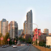
I think the residential part of Anchor Point is hiding behind the Burrard Bridge towers (mid-span structure) in that image. The residential part is about the same height as the office part of the complex (on Pacific) which you can see to the right. Check out this Googlestreetview image:

https://www.google.ca/maps/place/Anchor+...!1s0x548673d36fb44731:0x59c43bd887711cc2

What I was wondering about in that rendering was the alignment of the tower looking like it's right at the other end of the bridge. So, I got a Google map up and put a straight edge over it and sure enough, it does line up like that with a bit of Nelson Place and Scotiabank Tower visible on the left.
Reply With Quote
     
     
End


Go Back   SkyscraperPage Forum > Regional Sections > Canada > Alberta & British Columbia > Vancouver > Downtown & City of Vancouver
Forum Jump


Forum Jump


All times are GMT. The time now is 7:13 PM.

     
SkyscraperPage.com - Privacy Statement - Top

Powered by vBulletin® Version 3.8.7
Copyright ©2000 - 2026, vBulletin Solutions, Inc.