HomeDiagramsDatabaseMapsForum About
     

Go Back   SkyscraperPage Forum > Regional Sections > Canada > Alberta & British Columbia > Calgary > Transportation & Infrastructure


Closed Thread

 
Thread Tools Display Modes
     
     
  #3281  
Old Posted Jun 30, 2011, 9:05 PM
UofC.engineer's Avatar
UofC.engineer UofC.engineer is offline
Laura Palmer
 
Join Date: Nov 2010
Location: Twin Peaks, Calgary, AB
Posts: 1,033
Quote:
Originally Posted by Radley77 View Post
WHat is Canyon Meadows station like for bike parking (location, availability and security) and accessibility?
It's not too bad.

On the east side there are lots of bike racks and a few bike lockers, there is also a crosswalk which connects to Bonavista. On the west side there are a few bike racks a direct access to Canyon Meadows.

The station has an elevator, but it's slow so I just pick up my bike and use the stairs to save time when boarding the platform.

I wish there were more direct bike paths from Deer Run/Queensland and Woodlands/Woodbine that would go the station without having to use the Fish Creek pathways.
     
     
  #3282  
Old Posted Jul 2, 2011, 3:23 AM
srperrycgy's Avatar
srperrycgy srperrycgy is offline
I'm the bear on the right
 
Join Date: Jun 2004
Location: Calgary (Killarney)
Posts: 1,670
NE Extension Construction

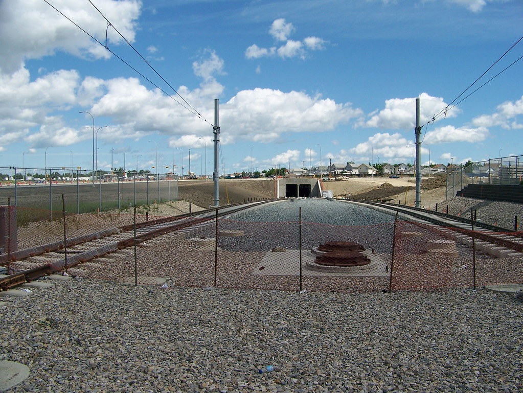
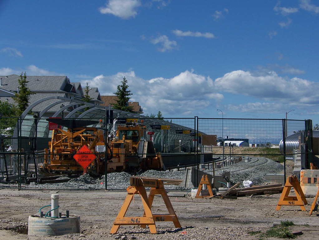
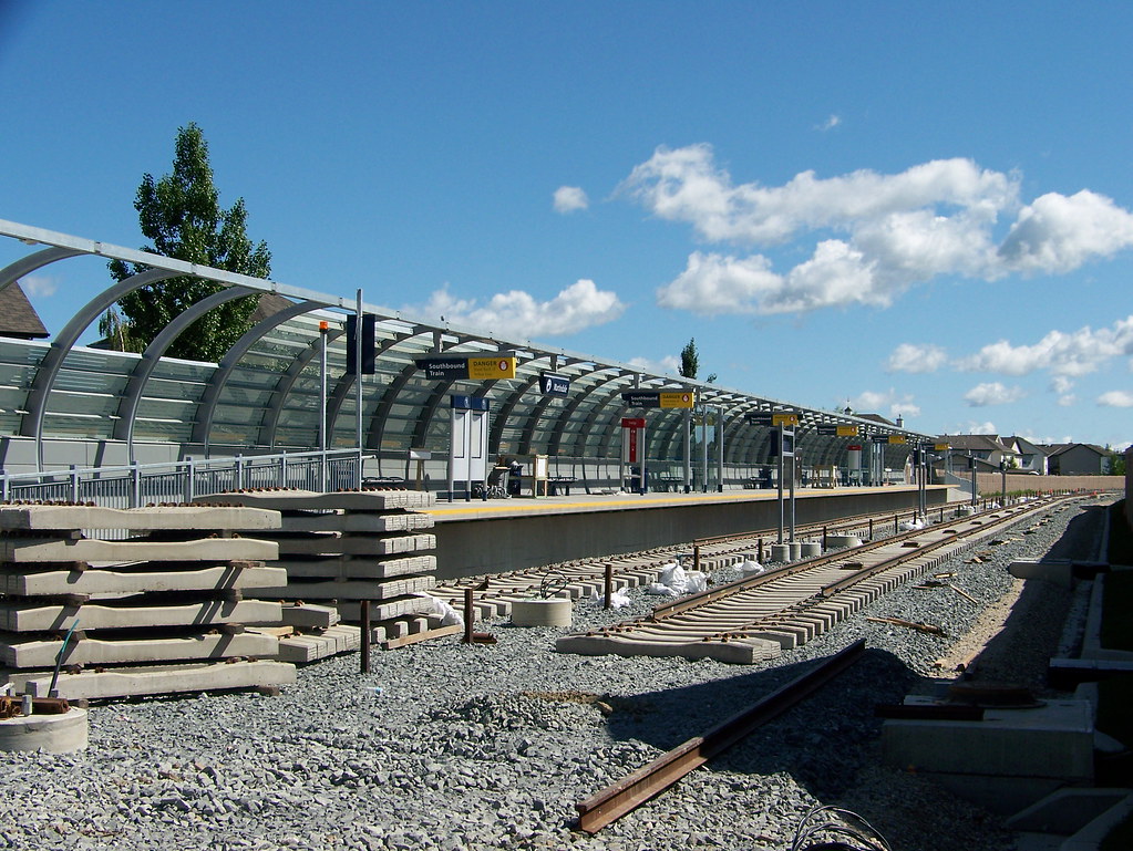
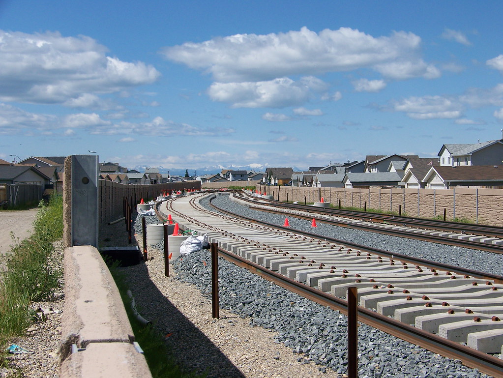
Took a very long overdue trip to the NE to grab a few shots of the construction work on the NE Extension to Saddletowne.

64th Avenue Tunnel taken from McKnight-Westwinds:


NEC2-07012011-17 by srp775, on Flickr

Northbound Martindale Platform:


NEC2-07012011-3 by srp775, on Flickr

Southbound Martindale Platform:


NEC2-07012011-2 by srp775, on Flickr

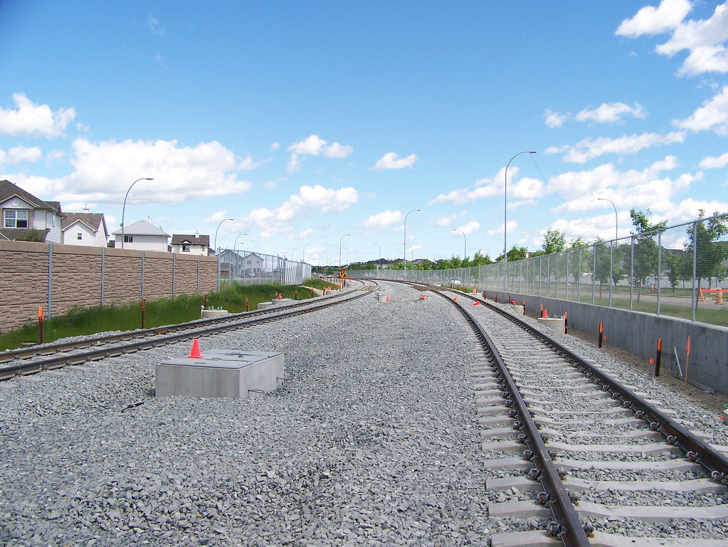
Track Construction South of Saddletowne:


NEC2-07012011-5 by srp775, on Flickr

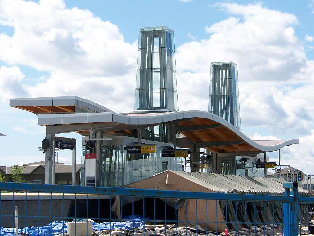
Saddletowne Station:


NEC2-07012011-12 by srp775, on Flickr

Tail Track north of Saddletowne Station:


NEC2-07012011-15 by srp775, on Flickr

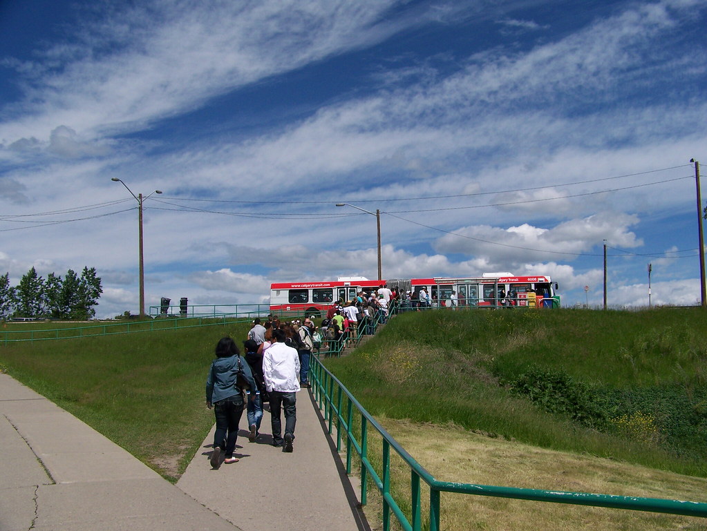
Getting there was fun with the CTrain construction closure downtown and up to Barlow.


CTrain Shuttle at Barlow by srp775, on Flickr
__________________
Stevinder.
* * * * * *
     
     
  #3283  
Old Posted Jul 2, 2011, 6:06 AM
tmjr tmjr is offline
Registered User
 
Join Date: May 2009
Location: Calgary
Posts: 122
Quote:
Originally Posted by srperrycgy View Post
Saddletowne Station:


NEC2-07012011-12 by srp775, on Flickr
Wait - is this the NE?? I thought there was some rule in place that the NE was required to have dull, boring LRT infrastructure...
     
     
  #3284  
Old Posted Jul 3, 2011, 5:12 PM
DarkKeyo DarkKeyo is offline
Transit/Cartography Geek
 
Join Date: May 2008
Location: Burnaby
Posts: 332
The ticket machines that accept debit/credit have been installed. I may get to try one today as I haven't been able to buy a transit pass yet.

Update: The electronic payment wouldn't work for me. Is it set up yet?

As well... There was a big discussion about fares, and my opinion was that they're ok the way they are, but there's a few things that could use some work:

Sell the low income pass at more than 4 places in the city, two of which (the leisure centers) are awkward to get to by transit, especially from anywhere not in the NE or SSW of the city, and two of which are only open during normal work hours.

Many pass holders use the train, and many low income pass holders don't have cars/don't work downtown. It's great that they are affordable, but if you can't get to where you buy them...

Last edited by DarkKeyo; Jul 4, 2011 at 4:35 AM. Reason: Update
     
     
  #3285  
Old Posted Jul 5, 2011, 8:14 PM
Radley77's Avatar
Radley77 Radley77 is offline
The City That Moves
 
Join Date: Sep 2008
Location: Bridgeland, Calgary
Posts: 1,450
Is there any chance that some sort of tram or LRT train could be envisioned as the East LRT to be completed after SE LRT, but before the North-Central LRT? i.e. Route from downtown, thru Inglewood, International Avenue and out to Chestermere. Total distance is about 16 km.

I understand that the value would be less than NC LRT, but the cost would probably be a lot less as well.

Also, considering City of Calgary will be approaching it's maximum debt levels over the course of the next couple years. And NC LRT, especially the subway route, is going to require a lot of capital I can't see this happening in a very long time... Calgary also seems to have a lot of wants... I'm worried about the risk that a capital fund that was developed for this purpose ends up being ransacked.
     
     
  #3286  
Old Posted Jul 5, 2011, 8:19 PM
mersar's Avatar
mersar mersar is offline
Registered User
 
Join Date: May 2006
Location: Calgary, AB
Posts: 10,083
Theres now TVM's with credit card capability at Brentwood also, though reportedly only 1 of the 4 there have it. Sounds like from reports at cptdb that they've recycled old TVM's with really old software in them for it, as it still shows 10th Street/Whitehorn and the map has Crowfoot as not opened yet. So lets hope they do update them soon.
__________________

Live or work in the Beltline? Check out the Official Beltline web site here
     
     
  #3287  
Old Posted Jul 5, 2011, 9:26 PM
fusili's Avatar
fusili fusili is offline
Retrofit Urbanist
 
Join Date: Sep 2007
Posts: 6,692
Quote:
Originally Posted by Radley77 View Post
Is there any chance that some sort of tram or LRT train could be envisioned as the East LRT to be completed after SE LRT, but before the North-Central LRT? i.e. Route from downtown, thru Inglewood, International Avenue and out to Chestermere. Total distance is about 16 km.

I understand that the value would be less than NC LRT, but the cost would probably be a lot less as well.

Also, considering City of Calgary will be approaching it's maximum debt levels over the course of the next couple years. And NC LRT, especially the subway route, is going to require a lot of capital I can't see this happening in a very long time... Calgary also seems to have a lot of wants... I'm worried about the risk that a capital fund that was developed for this purpose ends up being ransacked.
It would be interesting to examine the idea of interlining the SELRT with an international avenue LRT. Not sure I am convinced, but it an idea to throw around. It would make better use of an expensive piece of infrastructure (the 2nd street subway), but that depends on how much of the capacity the SELRT will need. This has been discussed a bit here. A single transfer at Inglewood has been suggested and that wouldn't be a bad idea. My only issue would be whether the SELRT would have capacity at that point, or whether it would be full already. Having people transfer at Inglewood only to wait for 3 trains before getting on isn't the best solution in my opinion.

I do think that going with a low-floor vehicle model for the SELRT is a good option though, because it opens up more options for spur lines and interlining. I think 17th avenue SE would be better served as a low floor LRT, which would require the SELRT to be low-floor as well if interlined. Maintenance facilities could be shared as well.

I, however am not convinced at all for extending rail out to Chestermere. Too far and not enough ridership IMO.
__________________
Not everything that can be counted counts, and not everything that counts can be counted.
     
     
  #3288  
Old Posted Jul 5, 2011, 9:31 PM
freeweed's Avatar
freeweed freeweed is offline
Home of Hyperchange
 
Join Date: Sep 2006
Location: Dynamic City, Alberta
Posts: 17,568
Quote:
Originally Posted by fusili View Post
I, however am not convinced at all for extending rail out to Chestermere. Too far and not enough ridership IMO.
Ugh. As bad as suburban sprawl is, ex-urban sprawl is 10x worse. One thing that kept me solidly in the city (if on the edge) was the LRT. If Chestermere or Airdrie or Okotoks had it, we may well have moved there instead. Adding hundreds of driving trips into the city each year (basically everything non work related).
     
     
  #3289  
Old Posted Jul 5, 2011, 9:32 PM
suburb suburb is offline
BANNED
 
Join Date: Jun 2010
Posts: 945
Quote:
Originally Posted by Radley77 View Post
Route from downtown <> out to Chestermere.
Did you forget your meds??
     
     
  #3290  
Old Posted Jul 6, 2011, 1:56 AM
Bassic Lab Bassic Lab is offline
Registered User
 
Join Date: Oct 2005
Location: Calgary
Posts: 1,934
Quote:
Originally Posted by fusili View Post
It would be interesting to examine the idea of interlining the SELRT with an international avenue LRT. Not sure I am convinced, but it an idea to throw around. It would make better use of an expensive piece of infrastructure (the 2nd street subway), but that depends on how much of the capacity the SELRT will need. This has been discussed a bit here. A single transfer at Inglewood has been suggested and that wouldn't be a bad idea. My only issue would be whether the SELRT would have capacity at that point, or whether it would be full already. Having people transfer at Inglewood only to wait for 3 trains before getting on isn't the best solution in my opinion.

I do think that going with a low-floor vehicle model for the SELRT is a good option though, because it opens up more options for spur lines and interlining. I think 17th avenue SE would be better served as a low floor LRT, which would require the SELRT to be low-floor as well if interlined. Maintenance facilities could be shared as well.

I, however am not convinced at all for extending rail out to Chestermere. Too far and not enough ridership IMO.
I definitely don't see an LRT to Chestermere being viable today but in the near future it might make sense. There is no point in putting a train through three miles of farms and cemeteries to reach a town of, what is it these days, 15 000 people? That said the corridor is quite different from other suburbs. The edge of the city there is only six miles from downtown and the current gap is, again, only three miles. All of that gap is also incorporated in either Calgary or Chestermere This differs from Airdrie, where the edge of town is nine miles north and the gap is another six miles, or Okotoks, where the edge of town is 11 miles south and the gap is nine miles.

So if those three miles are planned with rapid transit in mind, that is relatively densely and in a way that they could be easily served by north-south buses that intersect with future stations surrounded by TODs, and Chestermere is found to be willing to contribute, then it could be a very viable route with high ridership. It would also depend on what kind of redevelopment International Avenue can attract but if it can match some of the visions then a lot of potential riders could end up living in Forest Lawn. For those reasons I would prefer that any rail transit to the east be built to be capable of high capacity, rapid transit. The first phase would only go from Erlton Station to just east of 68 St and, yes, that could work as a tram for the current area but if the line needs to be extended and the area develops then it could prove to be less than what is needed.

So I'd have it start with an underground station below Erlton Station on the SLRT then, moving roughly due east, have it rise up to elevated for a station above the Crossroads Station on the SELRT. It would then continue east, cross over Blackfoot Trail and then follow its ROW on the east/south side with a station over 9 Ave. It would then keep going alongside Blackfoot, cross over Deerfoot, and then assume a position elevated over 17 Ave's median. It would stay elevated until just past 52 St, where it would sink to run in the median until just east of 68 St. Along the way there would be the following stations: the first would be elevated between 26 St and 28 St; the next would be elevated over 36 St; the next would be elevated over 44 St; the next would be elevated over 52 St; the next would be in the median just east of 60 St; the last would be in the median, either just east of 68 St or possibly under it if an interchange is called for. There would be plenty of land for a maintenance/storage facility on the hill between 26 Ave, Blackfoot Trail, and Highfield Rd. The whole route would be just over 9 kilometres long, 400 meters underground, just under 7 kilometres elevated, and about 2 kilometres on the surface.

I would imagine the cost, including track, stations, the maintenance/storage facility, and LRVs, would be roughly comparable with the West LRT at about a billion dollars. It could later be extended east to serve Chestermere and any planned TODs along the way or west to serve Marda Loop, Garrison Woods, and Mount Royal University.

     
     
  #3291  
Old Posted Jul 6, 2011, 4:50 AM
Radley77's Avatar
Radley77 Radley77 is offline
The City That Moves
 
Join Date: Sep 2008
Location: Bridgeland, Calgary
Posts: 1,450
A couple of points I was thinking about Chestermere. It's the closest in proximity to Centre City Calgary as compared to Okotoks, Cochrane or Airdrie. It already has a large share of citizens who are driving into Calgary and burdening City of Calgary infrastructure. Differentiated fares, and capital costsharing may create a better relationship between capturing these externalized costs that municipalities are placing on one another. Lastly, I think that East LRT and some sort of regional transit network is inevitable.

Anyways, I don't see the East LRT happening in the near future. Reading through some of the points made by Bassic Lab and fusili. I like the idea of the lowfloor LRT, and was thinking it would require substantially less capital to other proposed LRT routes, but definitely less important than SE LRT.

Ultimately, I share a lot of concerns about sprawl, but I think if there was the right agreement in place, and there was a regional plan in place that looked at things from a holistic point of view, then maybe, just maybe, Chestermere would be the lowest hanging fruit for starting a regional transit system.
     
     
  #3292  
Old Posted Jul 6, 2011, 5:30 AM
UofC.engineer's Avatar
UofC.engineer UofC.engineer is offline
Laura Palmer
 
Join Date: Nov 2010
Location: Twin Peaks, Calgary, AB
Posts: 1,033
East LRT

Build the east LRT/Tram when the gap between Calgary and Chestermere gets filled in:

1. Densify Forest Lawn.

2. Develop the area in between Calgary and Chestermere with a medium dense urban form. This is a blank canvas, so developers and planners can get creative.

3. Create a complete street from 26th street to Range Rd 283
http://www.calgary.ca/portal/server.pt/g...e+S.E.+Transportation+Planning+Study.htm
4. Have the tram separated from the SE line yet share the Inglewood/Ramsay station. Tie in the the tram line to the 11th ave streetcar line!
     
     
  #3293  
Old Posted Jul 6, 2011, 3:25 PM
suburb suburb is offline
BANNED
 
Join Date: Jun 2010
Posts: 945
Quote:
Originally Posted by UofC.engineer View Post
Build the east LRT/Tram when the gap between Calgary and Chestermere gets filled in:
And maybe *AFTER* Calgary's 1M people are serviced better. Chestermere represents an absolutely minute number of commuters to DT relative to the SE or Northern Hills. Additionally, 3 miles (or 5 km) is a huge distance when you're talking increasing the perimeter of the city by that much. Additionally, there is a lot of land on that side of the city that is not too appetizing - particularly on the north portion of the East end - that is why it will grow out East more on the south end. Lastly, let us not try to compete with the Leduc Airport. We have enough comedy already!
     
     
  #3294  
Old Posted Jul 6, 2011, 3:48 PM
You Need A Thneed's Avatar
You Need A Thneed You Need A Thneed is offline
Construction Enthusiast
 
Join Date: Feb 2007
Location: Castleridge, NE Calgary
Posts: 5,892
Three finalists for the CT smart card are:

Connect
Range
Energy
     
     
  #3295  
Old Posted Jul 6, 2011, 3:51 PM
freeweed's Avatar
freeweed freeweed is offline
Home of Hyperchange
 
Join Date: Sep 2006
Location: Dynamic City, Alberta
Posts: 17,568
Ugh. Out of those, Connect is the only one remotely palatable.
     
     
  #3296  
Old Posted Jul 6, 2011, 3:58 PM
fusili's Avatar
fusili fusili is offline
Retrofit Urbanist
 
Join Date: Sep 2007
Posts: 6,692
Quote:
Originally Posted by suburb View Post
And maybe *AFTER* Calgary's 1M people are serviced better. Chestermere represents an absolutely minute number of commuters to DT relative to the SE or Northern Hills. Additionally, 3 miles (or 5 km) is a huge distance when you're talking increasing the perimeter of the city by that much. Additionally, there is a lot of land on that side of the city that is not too appetizing - particularly on the north portion of the East end - that is why it will grow out East more on the south end. Lastly, let us not try to compete with the Leduc Airport. We have enough comedy already!
Based on the 2010 census, I calculated the population of Northern Hills to be 47K. The remainder of the NCLRT would be around another 108K.

The SELRT, by comparison, would have 24K people north of Deerfoot (Inglewood, Ramsay, Ogden and Riverbend) and 67K south of Deerfoot (basically all of Ward 12). So in terms of total population, the NCLRT would actually have more of a potential catchment base (~150K to ~90K). So in terms of ridership and need for capacity, it is totally reasonable to expect the NCLRT to actually be greater than the SELRT. Although the SELRT has the hospital and Foothills Industrial, this would generate counter flow, or at least ridership that is not destined for downtown.

With this, maybe it actually does make sense to interline the SELRT with an international avenue LRT, whose catchment would be the Greater Forest Lawn area (population ~55K). That balances out the populations between the NCLRT and the combined SELRT and Greater Forest Lawn LRT (I am going to call it the GFL LRT for now).

Just throwing out ideas again, but perhaps this makes sense. We build a single tunnel through downtown, and get three lines out of it. Plus it makes transfers a lot easier.

Thoughts?
__________________
Not everything that can be counted counts, and not everything that counts can be counted.
     
     
  #3297  
Old Posted Jul 6, 2011, 3:58 PM
srperrycgy's Avatar
srperrycgy srperrycgy is offline
I'm the bear on the right
 
Join Date: Jun 2004
Location: Calgary (Killarney)
Posts: 1,670
I'm not crazy about these three choices either. But there was a suggestion that this Smart Card could be extended to other City of Calgary services. With that information, "Connect" might be a suitable name.
__________________
Stevinder.
* * * * * *
     
     
  #3298  
Old Posted Jul 6, 2011, 4:00 PM
5seconds 5seconds is offline
Closed account
 
Join Date: Mar 2011
Posts: 935
Those are just terrible. Connect is OK, but too generic.

I assume they liked the dual meaning of Range, relating both to transportation and Calgary (being both 'distance' and 'homestead')

And I can only assume that Energy is just a not to the oil sector... weird.

I may not vote at all.
     
     
  #3299  
Old Posted Jul 6, 2011, 4:06 PM
MalcolmTucker MalcolmTucker is offline
Registered User
 
Join Date: May 2007
Posts: 11,627
First one has to decide what 17th SE should become. Do we want 'transit city' (for lack of a better term) style LRT on it, short trains, reasonably frequent, small frequent stations, no grade seperation. Or do we want mass rapid transit like the LRT lines we have built so far.

I don't think interlining a transit city style system with a mass rapid system would be very smart, and I am not sure you would generate enough ridership if mass rapid given the proximety of the SE and NE LRT lines which limit the catchment area, and ensure many of the 'new' riders on such a line will just be displaced from existing LRT.

All that being said in 40 years when we might be in a position to build a service such as this, things may have changed a great deal.
     
     
  #3300  
Old Posted Jul 6, 2011, 4:26 PM
DizzyEdge's Avatar
DizzyEdge DizzyEdge is offline
My Spoon Is Too Big
 
Join Date: Oct 2006
Location: Calgary
Posts: 9,162
Quote:
Originally Posted by You Need A Thneed View Post
Three finalists for the CT smart card are:

Connect
Range
Energy
It's like they picked the 3 most forgettable.
__________________
Concerned about protecting Calgary's built heritage?
www.CalgaryHeritage.org
News - Heritage Watch - Forums
     
     
This discussion thread continues

Use the page links to the lower-right to go to the next page for additional posts
 
 
Closed Thread

Go Back   SkyscraperPage Forum > Regional Sections > Canada > Alberta & British Columbia > Calgary > Transportation & Infrastructure
Forum Jump


Forum Jump


All times are GMT. The time now is 10:50 AM.


Powered by vBulletin® Version 3.8.7
Copyright ©2000 - 2026, vBulletin Solutions, Inc.