HomeDiagramsDatabaseMapsForum About
     

Go Back   SkyscraperPage Forum > Regional Sections > Canada > Alberta & British Columbia > Vancouver > Transportation & Infrastructure


Closed Thread

 
Thread Tools Display Modes
     
     
  #1681  
Old Posted Oct 26, 2009, 12:20 AM
hollywoodnorth's Avatar
hollywoodnorth hollywoodnorth is offline
Registered User
 
Join Date: Oct 2001
Location: Downtown Vancouver
Posts: 6,394
Go Gordo Go!
__________________
Quote of the Decade on SSP: "what happens would it be?" - argon007

"orange vested guy" - towerguy3
     
     
  #1682  
Old Posted Oct 26, 2009, 12:43 AM
Stingray2004's Avatar
Stingray2004 Stingray2004 is offline
Registered User
 
Join Date: Jan 2004
Location: White Rock, BC (Metro Vancouver)
Posts: 3,145
Quote:
Originally Posted by officedweller View Post
For the past ~15 years, BC MoT finally 'got' into the groove and has been installing proper highway signage in accordance with the Manual on Uniform Traffic Control Devices (MUTCD) guidelines.

However, recently they have diverted from ther own guidelines and have been installing inferior signage just south of the Oak St. Bridge, along the Hwy 91A Queensborough Bridge/new Queensborough interchange and now this. (Golden Ears also has similar signage)

What's wrong with the above signage? These skimpy overhead signs should be nearly double the width to make them readable for high speed traffic and the arrows show be both 'short' and be pointing downward in accordance to MUTCD.

I have no idea what has gotten into BC MoT.

The proper signage for the new Hwy 7/MHB split should have followed similar signage at the Hwy 91/91A split:

Prior to the split:


At the split:


Source: bcpl8s
     
     
  #1683  
Old Posted Oct 26, 2009, 3:07 AM
Zassk Zassk is offline
Registered User
 
Join Date: Sep 2009
Posts: 2,303
Those 91/91A signs pre-date the switchover to these new, annoying, arrows. I agree with everything you said about how annoying the upward arrows are. The fundamental problem is that you cannot easily tell which lane is referred to by which arrow.

The BC Ministry is simply following the lead of Ontario in this, I would guess.

When I lived in Ottawa in 1993, I was appalled to watch all of the downward-pointing arrows gradually replaced with upward-pointing arrows along the 417 throughout that summer. I believe Ontario has switched their entire freeway network to upward-pointing arrows in the years since then.

I don't know why Ontario is considered worthy of following. I think they made a huge mistake in changing away from the American standard.
     
     
  #1684  
Old Posted Oct 26, 2009, 3:19 AM
amor de cosmos amor de cosmos is offline
BANNED
 
Join Date: Jun 2005
Location: lodged against an abutment
Posts: 6,750
from the official announcement:
Quote:
Features of the new Pitt River Bridge:
  • The project is on time and on budget.
  • The new cable-stayed bridge is constructed between the existing bridges and has three lanes of westbound traffic and four lanes of eastbound traffic. The bridge has been built to accommodate eight lanes in the future.
  • The design for the bridge and interchange incorporates pedestrian and cycling features, including bicycle lanes across the bridge. In addition, the bridge is engineered to accept light rail transit at a later date.
  • Peter Kiewit and Sons Co. won the competitive bidding process for this design-business project. Construction started in February 2007.
  • Seismic improvements were extensive, with the interchange built to accommodate a 1-in-500-year earthquake. The new bridge is deemed a lifeline structure and is built to accommodate a 1-in-2,475-year quake.
  • The original (southern) span of the bridge was built in 1956. The second (northern) span was built in 1978. Following construction, these existing swing bridges will be removed in 2010.
  • The $198-million project is being cost-shared between the provincial and federal governments. The federal Asia-Pacific Gateway and Corridor Initiative is providing up to $90 million. The Province is providing $108 million.
Pitt River Bridge by the numbers:
  • 190 metres – Length of the main span of the bridge (cable tower to cable tower).
  • 380 metres – Length of the cable-stayed span of the bridge (end to end of cable sections).
  • 500 metres – The entire length of the bridge including the bridge approach spans. The width will be 45 metres.
  • 16 metres – Height above the water (marine clearance).
  • 60 metres – Height of the six main bridge towers.
  • 100 metres – Depth of the piles (metal posts used to provide a foundation for the structure), which are some of the largest and deepest ever driven in British Columbia.
  • 1,200 - Approximate number of jobs created over the life of the project.
http://www2.news.gov.bc.ca/news_releases_2009-2013/2009PREM0056-000533.htm
     
     
  #1685  
Old Posted Oct 26, 2009, 5:51 AM
SpongeG's Avatar
SpongeG SpongeG is offline
Registered User
 
Join Date: Jun 2006
Location: Coquitlam
Posts: 40,106
i prefer the downward arrows a little more obious when you are driving
__________________
belowitall
     
     
  #1686  
Old Posted Oct 26, 2009, 6:12 AM
wrenegade's Avatar
wrenegade wrenegade is offline
ON3P Skis
 
Join Date: Sep 2008
Location: Lower Lonsdale, North Vancouver, BC
Posts: 2,594
Was today opening day? Yesterday? Either way, I was actually out there this afternoon and drove over it. It is fantastic. Although on my way back I was taking the 7B Mary Hill Bypass exit (which is two lanes) and the minivan in front of me slammed on the brakes and swerved across both lanes to get back on the Lougheed Hwy portion. I guess some people haven't gotten the hang of it yet. Glad I had my brakes replaced a couple weeks ago.
     
     
  #1687  
Old Posted Oct 26, 2009, 6:29 AM
Pennywise604 Pennywise604 is offline
Registered User
 
Join Date: Oct 2009
Posts: 150
Are there any plans to make Dewdney Trunk @ Hwy 7 an interchange? Since the new bridge will allow free flowing traffic now at Mary Hill @ Lougheed, to me it just seems like a bad idea if Dewndey is kept as a light. I only ask though since it's 4 lanes EB, traffic will not be stopped at the 7 @ 7B light anymore, way more cars will be allowed to travel EB at the same time than the old bridge. I don't travel to Maple Ridge very often at all, but that light can back up EB during rush hour, so now to me it seems like it will. WB backs up to 203rd/Harris every morning, so it'd make sense to convert Dewdney to a full interchange.
     
     
  #1688  
Old Posted Oct 26, 2009, 6:38 AM
Metro-One's Avatar
Metro-One Metro-One is offline
Registered User
 
Join Date: Sep 2008
Location: Japan
Posts: 18,019
That is the long term plan in the "North Perimeter Road Project." Essentially they will be making Lougheed Highway from the Golden Ears Interchange a freeway to the Pitt River Bridge, and from there they plan to make the Mary Hill Bypass a freeway to the #1. If it happens, we will have to wait and see. I have a bad feeling it will be the one piece of the Gateway Project not to go through because of a change in government.

Quote:
Was today opening day? Yesterday? Either way, I was actually out there this afternoon and drove over it. It is fantastic. Although on my way back I was taking the 7B Mary Hill Bypass exit (which is two lanes) and the minivan in front of me slammed on the brakes and swerved across both lanes to get back on the Lougheed Hwy portion. I guess some people haven't gotten the hang of it yet. Glad I had my brakes replaced a couple weeks ago.
Exact same thing happened to me today, the truck in front slammed on their brakes and swerved over to the lanes going to Poco. It is amazing how despite this project being under construction for years and the painfully obvious westbound off ramp being built on the north side of the westbound bridge lanes and several new signs that display which lanes go where, people are still able to screw it up!
__________________
Bridging the Gap
Check out my Flickr: https://www.flickr.com/photos/30634635@N03/with/29495547810/ and Youtube channel https://www.youtube.com/channel/UCV0_0h9qKlhxXFxuAey_q6Q
     
     
  #1689  
Old Posted Oct 26, 2009, 6:26 PM
go_leafs_go02 go_leafs_go02 is offline
Registered User
 
Join Date: Dec 2007
Location: London, ON
Posts: 2,406
Ontario does it this way:

In Advance before any lane splits or re-configurations:


Right where the lanes split off:
     
     
  #1690  
Old Posted Oct 26, 2009, 6:52 PM
Mininari Mininari is offline
Registered User
 
Join Date: Jul 2004
Location: Victoria (formerly Port Moody, then Winnipeg)
Posts: 2,447
How is the Kingsway / MHB intersection holding up now that the interchange ramp is open?

Also, your assessment on the future NFPR freeway upgrade is probably true. The liberals are really cooking in some hot HST oil now (and also as all governments running a deficit usually are). Furthermore, this could turn into one another highway 91, where one or two at-grade intersections are left forever and ever and ever...
     
     
  #1691  
Old Posted Oct 26, 2009, 8:25 PM
DKaz DKaz is offline
Registered User
 
Join Date: Nov 2008
Location: Kelowna BC & Edmonton AB
Posts: 4,299
I went to work later than the West Coast Express ran today so I had to drive to work... gave me a great excuse to try out the new flyover. They obviously still have to finish the approach to the bridge and the end of the flyover and most importantly dismantle the bridge and build the new ramp from MHB to Lougheed WB but overall it's pretty cool so far. I'll be taking the bus tomorrow morning at rush hour to see what traffic is like during rush hour.
     
     
  #1692  
Old Posted Nov 2, 2009, 10:25 PM
Pennywise604 Pennywise604 is offline
Registered User
 
Join Date: Oct 2009
Posts: 150
I had a hockey game in Maple Ridge last night. Hwy 7 @ 105th ave. Way down there... My route took me from Hwy 91 @ 64th, down Scott Rd, Pattulo, Columbia, Brunette, Hwy 1, Mary Hill, PRB, Haney BP. I got my first look of the new PRB and it's really quite amazing if your headed Eastbound. It was a very quick drive over with hardly any traffic, eventhough it was 7:30pm on a Sunday. I like that they are widening the highway Eastbound, to what almost looked like 4 lanes until Harris... It's already 3 lanes but they were widening it even more. It looked like it was being widened to 3 lanes until Maple Meadows Way (That's what it looked like). Westbound though was untouched, but with the HOV I guess there's no need right now. I took the GEB home like normal from Maple Ridge, saves over 20 minutes...

What really pissed me off though... I was running a bit late so I had to speed quite a bit. WHY THE HELL IS THE SPEED LIMIT 60 KM/H FROM 207TH UNTIL THE HANEY BYPASS. What idiot decided to do that? Seriously. I knew it was a dark/long stretch of road with absolutely no traffic in either direction, and the speed limits 60? I'm doing 90 having to worry about police since it's so dark... That is the stupidest thing I have ever seen, I know in rush hour it's a busy stretch, but they should think of having variable speed limits on that stretch of road. There is no one travelling at 60 on that portion of Hwy 7 at 7:30pm on a Sunday night. Now I know anything over 100 would be dangerous since there are a few intersections (not traffic light) but at least 80, so everyone can travel at 90 or 100 and not have to worry. The slowest I saw anyone driving when I actually saw another car in either direction was 80...
I-5/I-90 in Seattle are very good with variable speed limits, if there's rain on the road it's 55, if not it's 65. Hwy 7 from 207th to Haney needs one, and Hwy 1 east of Abby needs one.

     
     
  #1693  
Old Posted Nov 3, 2009, 12:20 AM
Metro-One's Avatar
Metro-One Metro-One is offline
Registered User
 
Join Date: Sep 2008
Location: Japan
Posts: 18,019
Maple Ridge is full of retarded speed limits. There is a 1km section of the Lougheed that runs up the hill just north of Kanaka Way, here it is a 4 lane highway with no driveways and a median running along the middle with a 50kmh speed limit!
__________________
Bridging the Gap
Check out my Flickr: https://www.flickr.com/photos/30634635@N03/with/29495547810/ and Youtube channel https://www.youtube.com/channel/UCV0_0h9qKlhxXFxuAey_q6Q
     
     
  #1694  
Old Posted Nov 3, 2009, 12:31 AM
WarrenC12's Avatar
WarrenC12 WarrenC12 is online now
Registered User
 
Join Date: May 2007
Location: East OV!
Posts: 24,690
Don't forget the GEB! Lots of 60 km/h stretches.
     
     
  #1695  
Old Posted Nov 3, 2009, 6:45 AM
Pennywise604 Pennywise604 is offline
Registered User
 
Join Date: Oct 2009
Posts: 150
lol, I've driven that stretch from Kanaka Way to wherever the McDonalds is WB. I don't remember caring about it though since I was in no rush. I would admit that 50 is stupid, but if it is never changed that makes sense too. The Haney Bypass saves an incredible amount of time, and the speed limit was 60, but at the times I was driving last night, 60 was a mere suggestion to everybody.

The one thing I did love when I took the Mary Hill Bypass, people know how to drive on it (at least when I took it). If you don't want to drive at 120 along the whole stretch, than you get the hell out of the way and stick to the right. That's the first highway stretch I can honestly say that not one driver held anybody up. I had 6 cars in front of me cruise at 120, no need to tailgate since the speed limits 80. It's the biggest miracle I have ever seen while driving in Metro Vancouver... I think we all drove it in under 5 minutes.
     
     
  #1696  
Old Posted Nov 4, 2009, 1:12 AM
Metro-One's Avatar
Metro-One Metro-One is offline
Registered User
 
Join Date: Sep 2008
Location: Japan
Posts: 18,019
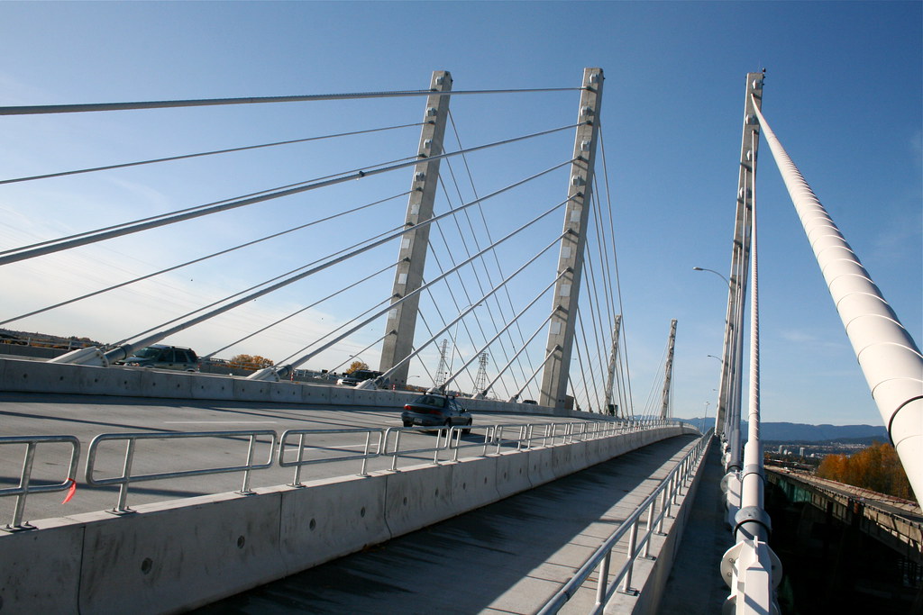
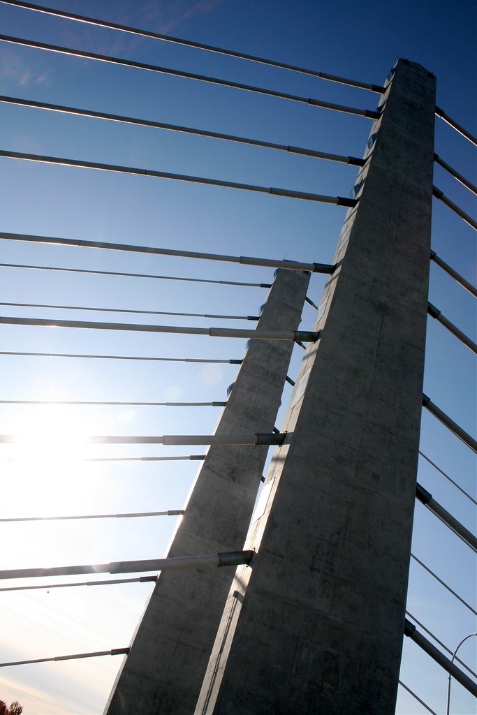
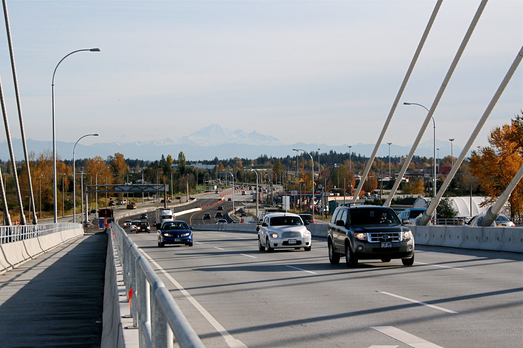
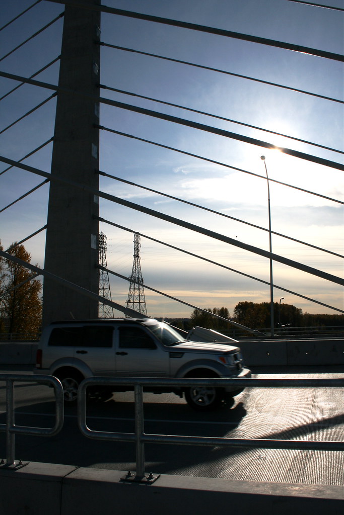
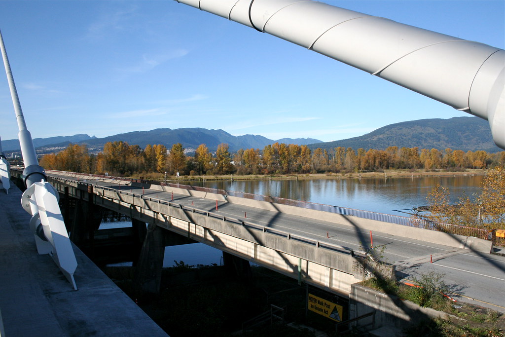
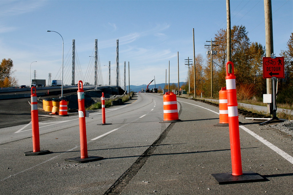
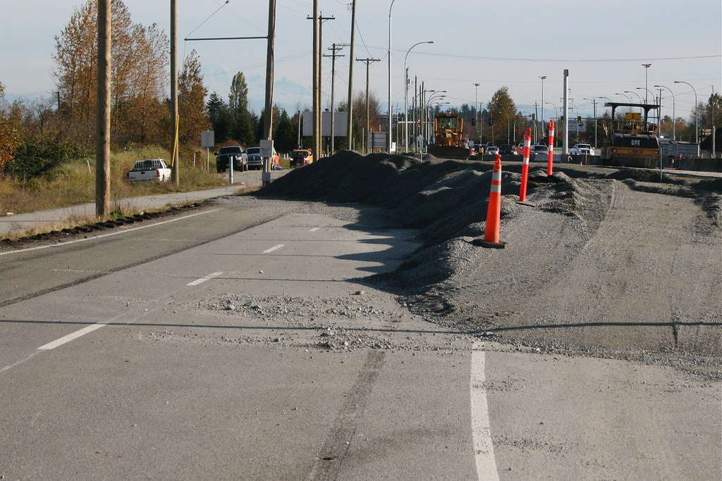
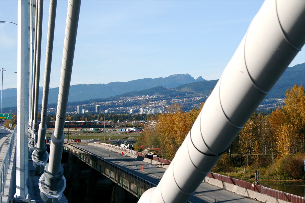
Here are some Pitt River Bridge shots I took today


And here are some pics of the old North side Pitt River Bridge, soon to be no more.


And here is the growing Coquitlam Skyline from the Bridge


A beautiful bridge on a beautiful day! All pics are my own

Cheers
__________________
Bridging the Gap
Check out my Flickr: https://www.flickr.com/photos/30634635@N03/with/29495547810/ and Youtube channel https://www.youtube.com/channel/UCV0_0h9qKlhxXFxuAey_q6Q
     
     
  #1697  
Old Posted Nov 4, 2009, 1:42 AM
metroXpress's Avatar
metroXpress metroXpress is offline
(||||||-||||-||||||)
 
Join Date: Jan 2009
Location: Vancouver B.C.
Posts: 2,220
^ impressive shots! Thanks
__________________
"Think simple…reduce the whole
of its parts into the simplest terms,
Getting back to first principles"


~ FRANK LLOYD WRIGHT
     
     
  #1698  
Old Posted Nov 4, 2009, 6:12 AM
Metro-One's Avatar
Metro-One Metro-One is offline
Registered User
 
Join Date: Sep 2008
Location: Japan
Posts: 18,019
Here is another something i made today, a video time lapse of the new Pitt River bridge.

All images and shots are my own.

• Video Link


Cheers!
__________________
Bridging the Gap
Check out my Flickr: https://www.flickr.com/photos/30634635@N03/with/29495547810/ and Youtube channel https://www.youtube.com/channel/UCV0_0h9qKlhxXFxuAey_q6Q
     
     
  #1699  
Old Posted Nov 14, 2009, 1:40 AM
Pennywise604 Pennywise604 is offline
Registered User
 
Join Date: Oct 2009
Posts: 150
hmmm.. Global News Traffic just showed what stated what I thought would happen at the new PRB. Traffic EB flows fine up to and over the bridge but after, jammed from Maple Meadows Way until Dewdney. It wouldn't take a highly intelligent person to figure out that an interchange should of been constructed at Dedney at the same time. It is at least in planning though.

Since I live right at Hwy 91 @ 64th and can see the mess at 72nd from my house, I realized something. The reason why the light at 72nd jams up so much in rush hour, is beacuse those big semi trucks occupy BOTH lanes to get through the light... I see it all the time, in fact I've learned to stay in the right lane when it's jammed to 64th, it moves a minute or so faster... Once the SFPR is finished, trucks should be prohobited on Hwy 91 until Nordel Way NB. I know it sounds stupid but Delta won't allow an interchange to be built, so at least increase traffic flow through the light. Semi trucks are so slow off the light, and since the light is timed to be short due to heavy traffic heading EB on 72nd from SB Hwy 91, it jams up very quickly, and moves very slowly in the afternoon. Would that even be a consideration? It's not that much of an inconvenience to truckers. I know about Annacis Island, but Nordel Way is a truck route, Scott Rd is a truck route, and the SFPR is obviously a truck route too. They can still get on the AFB very easily since the SFPR is a full Highway with no lights from Hwy 17 through to Nordel.
     
     
  #1700  
Old Posted Nov 14, 2009, 4:28 AM
Zassk Zassk is offline
Registered User
 
Join Date: Sep 2009
Posts: 2,303
^ I'm confused by the 72nd situation. What say does Delta have in a provincial highway upgrade?
     
     
This discussion thread continues

Use the page links to the lower-right to go to the next page for additional posts
 
 
Closed Thread

Go Back   SkyscraperPage Forum > Regional Sections > Canada > Alberta & British Columbia > Vancouver > Transportation & Infrastructure
Forum Jump


Forum Jump


All times are GMT. The time now is 8:00 PM.


Powered by vBulletin® Version 3.8.7
Copyright ©2000 - 2026, vBulletin Solutions, Inc.