HomeDiagramsDatabaseMapsForum About
     

Go Back   SkyscraperPage Forum > Regional Sections > Canada > Alberta & British Columbia > Vancouver > Transportation & Infrastructure


Closed Thread

 
Thread Tools Display Modes
     
     
  #6501  
Old Posted Jun 27, 2009, 9:06 PM
lightrail lightrail is offline
Registered User
 
Join Date: Oct 2007
Posts: 809
Quote:
Originally Posted by kylemacmac View Post
The Transit Connections map is the first easy-to-understand regional transit map I've ever seen Translink produce. Only major lines shown. Fast and easy to figure out. Perfect. Make more like this. If people want more info, they can consult a more detailed map. Who cares if areas of the map aren't exactly to scale. Transit user's aren't orienteering or piloting an airplane, they're figuring out how a system works. If it's clear to see the system as a schematic diagram, with some basic water boundaries and park for reference, perfect. The not-at-all-to-scale London Underground Map is regarded as one of the most innovative cartographic improvements of all time, for good reason.
I quite like it as a first attempt. It could be improved from a design point of view. oOr example, Burrard Station would look better if centred on the curve; better balancing of line and station spacing; and straightening of the lines showing the water features would work better as a schematic diagram. I'd like to see this map improved a little and then published in pocket map size and given out for free or a nominal fee - similar to London Underground's Journey Planner.

I'm really happy to see the "no smoking on skytrain platforms" in the Canada Line stations - as it should be the system should be all branded skytrain.
     
     
  #6502  
Old Posted Jun 27, 2009, 11:09 PM
Bureaucromancer Bureaucromancer is offline
Registered User
 
Join Date: Mar 2008
Posts: 106
I agree, the map is great. Disporporitonate sure, but its trying to show the full region, and it does a great job at that. It's also the first time I've seen a realy Lower Mainland map that shows all regional service rather than just rail and (maybe) B-Lines or a full local bus map.
     
     
  #6503  
Old Posted Jun 28, 2009, 12:22 AM
CLC CLC is offline
Registered User
 
Join Date: Apr 2008
Posts: 877
Quote:
Originally Posted by deasine View Post
Overall Impressions:
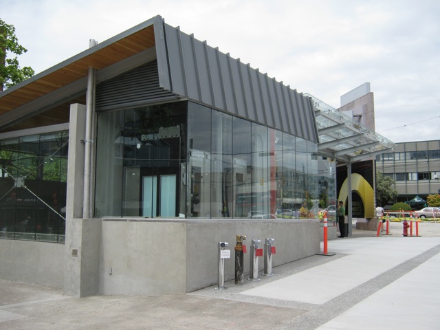
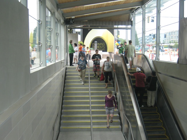
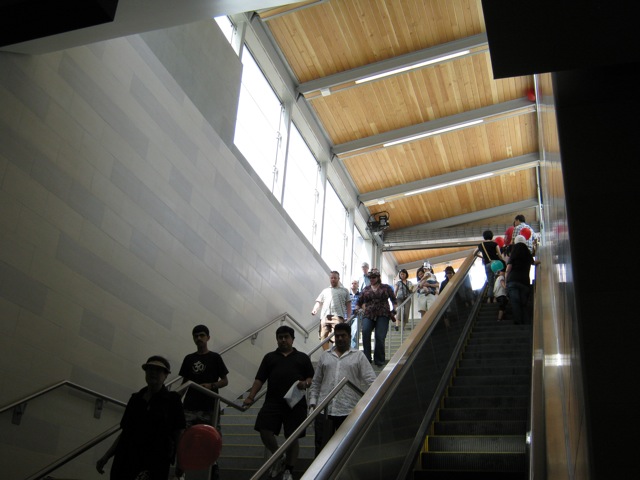
I love the openness... it's great that they were able to continue that feeling from the elevated stations (Lansdowne) to the underground stations now.

The TransLink map just killed me. Hate it. See post below.

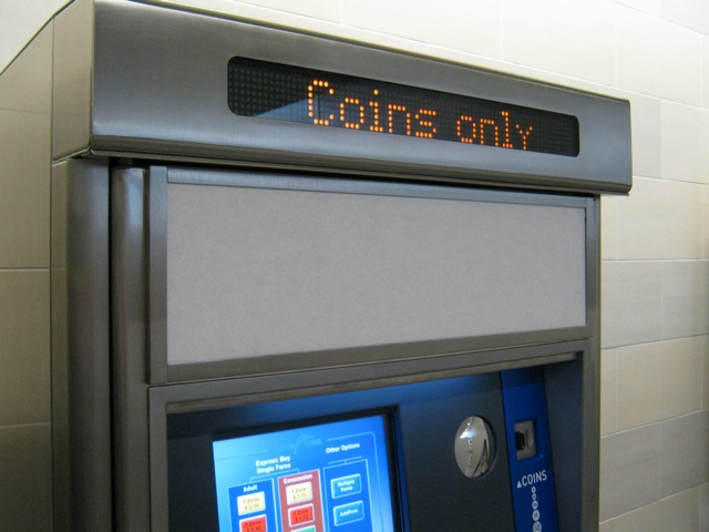
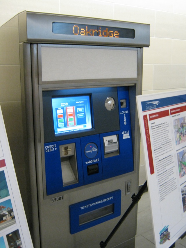
The new TVMs look great and actually look more usable than before, like I said, with the better controls.

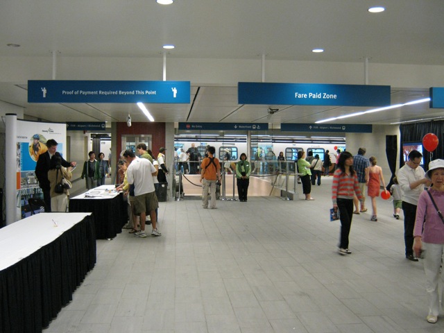
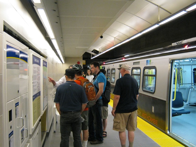
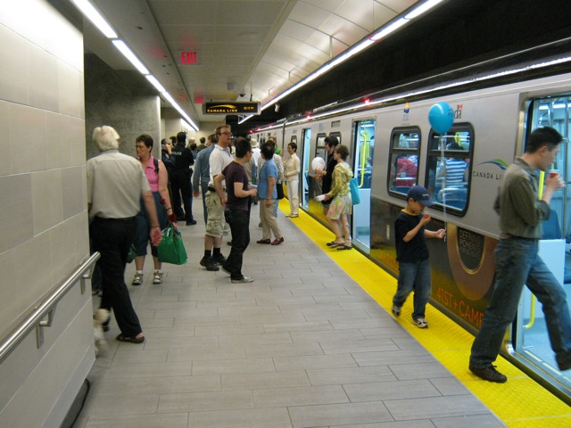
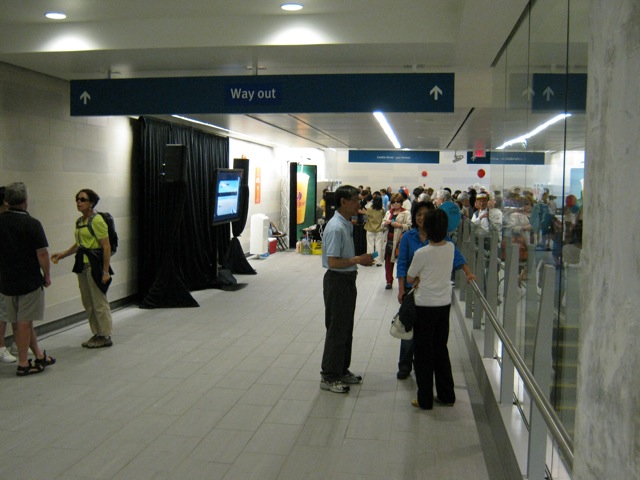
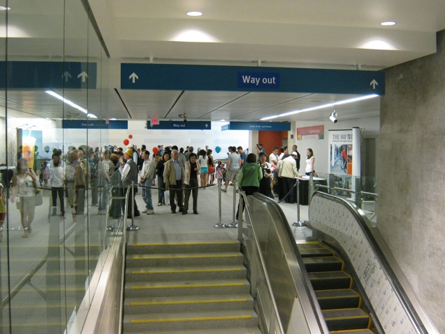
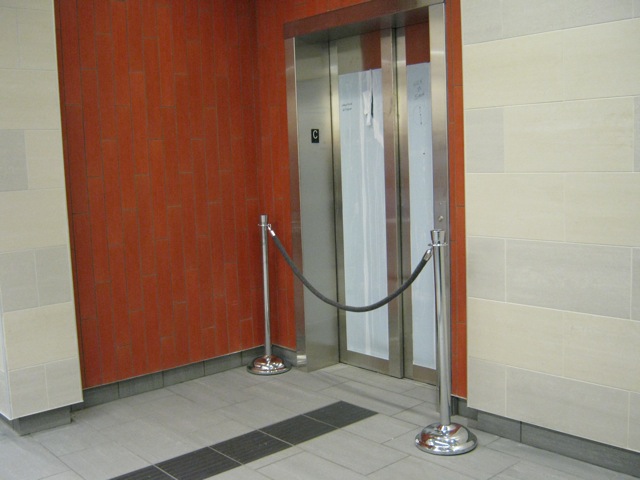
I also went to the event. I arrived at 2:30pm and there were more people then shown in your photos. I personally think that oakridge station is spacious enough and won't expect crowded situation in this particular station if intransitbc can keep train running every 3 minutes. However the person whose goes with me have the impression that the station is too small and not beautiful.

Another related issue is the traffic light for pedestrian to cross either cambie or 41st is still too long. I would foresee people frustrated for missing bus connection.

btw, is Oakridge a 50-meters platform?

Last edited by CLC; Jun 28, 2009 at 1:47 AM.
     
     
  #6504  
Old Posted Jun 28, 2009, 1:47 AM
CBeats CBeats is offline
Registered User
 
Join Date: Mar 2009
Posts: 422
That map is good, but defs has a few mistakes. For example, the horseshoe bay express is shown to start at Burrard station, when it actually begins farther East than Vancouver City Centre station. The map makes it seem that to get to the horseshoe bay express from the canada line, one must transfer at VCC to the Expo/Millenium line, then skytrain to burrard, then get on the bus; the reality is that the horseshoe bay express bus stops directly across the street from the VCC station entrance.

Stupid mistake that should be fixed...
     
     
  #6505  
Old Posted Jun 28, 2009, 2:13 AM
The_Henry_Man The_Henry_Man is offline
HA
 
Join Date: Mar 2006
Location: St. Cloud, MN/Richmond, BC
Posts: 873
Quote:
Originally Posted by CLC View Post
I also went to the event. I arrived at 2:30pm and there were more people then shown in your photos. I personally think that oakridge station is spacious enough and won't expect crowded situation in this particular station if intransitbc can keep train running every 3 minutes. However the person whose goes with me have the impression that the station is too small and not beautiful.

Another related issue is the traffic light for pedestrian to cross either cambie or 41st is still too long. I would foresee people frustrated for missing bus connection.

btw, is Oakridge a 50-meters platform?
No, unfortunately, it's 40m. But yeah, I initially thought it's 50m, at least according to the initial illustrations.

BTW, one of the ProTransitBC's operating managers told me that the entire system testing for formal safety certification will start tomorrow!! So basically, the trains will undergo full service testing, with frequencies like it will be once it is in operation, minus the passengers. I really hope this formal service testing goes smooth and opens during the BC Day weekend, because I'll be moving to the US for grad school around Aug 10th. Otherwise I won't be able to take it until either this Christmas or even Summer of 2010!!

Anyways, Oakridge Station is nicely done overall. When I first saw the platform, I was a bit surprised by its length, but the length should be ok for now for the next few years. But judging by the turnout for this open-house event, it looks like this station will be extremely popular, and perhaps one of the most crowded stations on the C-Line, besides Waterfront, Vancouver City Centre, Bridgeport and Richmond-Brighouse.

I think the Transit Connection map is not bad at all. It really ties the C-Line into the Skytrain system and it does what it should be done, unifying and branding our rapid transit system as one. Even on that map, all the C-Line stations are included within the list of "Skytrain Stations" in the bottom of that info board, along with E/M-Line stations. So it looks like Translink is branding C-Line as part of the Skytrain network, but not for the employees of ProTransBC. What I really hope to see is a schematic map of the entire Skytrain rapid transit system, with all C/E/M-Lines inside the C-Line cars.


Last edited by The_Henry_Man; Jun 28, 2009 at 2:23 AM.
     
     
  #6506  
Old Posted Jun 28, 2009, 2:18 AM
igeneer igeneer is offline
Registered User
 
Join Date: Nov 2008
Location: Vancouver BC
Posts: 55
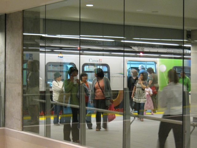
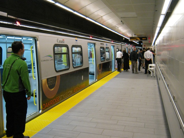
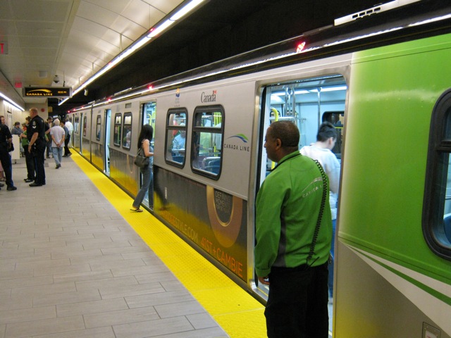
advertisement on side of train

was it just me or did the trains have an ad decal on the lower half...? If that was an example of what the trains may look like, I'm impressed at how they look.
     
     
  #6507  
Old Posted Jun 28, 2009, 2:23 AM
GeeCee's Avatar
GeeCee GeeCee is offline
Registered User
 
Join Date: Jan 2009
Location: Port Coquitlam, BC
Posts: 2,816
I wasn't there, but there is an ad on the train in this picture: http://news1130.com/news/local/more.jsp?content=20090627_183154_6316
     
     
  #6508  
Old Posted Jun 28, 2009, 2:25 AM
The_Henry_Man The_Henry_Man is offline
HA
 
Join Date: Mar 2006
Location: St. Cloud, MN/Richmond, BC
Posts: 873
The Rotem trains now look really nice, with the Oakridge Mall ad wrapped in the bottom half of the train.
     
     
  #6509  
Old Posted Jun 28, 2009, 2:28 AM
Gordon Gordon is offline
Registered User
 
Join Date: Jul 2008
Posts: 1,065
The closest Expo line connection to the 257 Horseshoe Bay express is probably the Stadium \Chinatown Stations 1 1\2 blocks to the east.
     
     
  #6510  
Old Posted Jun 28, 2009, 3:44 AM
mr.A mr.A is offline
Registered User
 
Join Date: Apr 2009
Posts: 134
I liked it! simple but nice. If you look at it a bit closer you will see that the platform is 10 meters extended! to the south but covered with the brick wall!
So if needed in the future easy to open it up.
     
     
  #6511  
Old Posted Jun 28, 2009, 5:22 AM
mr.x's Avatar
mr.x mr.x is offline
Registered User
 
Join Date: Dec 2003
Location: Stockholm
Posts: 12,805
Quote:
Originally Posted by The_Henry_Man View Post
No, unfortunately, it's 40m. But yeah, I initially thought it's 50m, at least according to the initial illustrations.

BTW, one of the ProTransitBC's operating managers told me that the entire system testing for formal safety certification will start tomorrow!! So basically, the trains will undergo full service testing, with frequencies like it will be once it is in operation, minus the passengers. I really hope this formal service testing goes smooth and opens during the BC Day weekend, because I'll be moving to the US for grad school around Aug 10th. Otherwise I won't be able to take it until either this Christmas or even Summer of 2010!!

Anyways, Oakridge Station is nicely done overall. When I first saw the platform, I was a bit surprised by its length, but the length should be ok for now for the next few years. But judging by the turnout for this open-house event, it looks like this station will be extremely popular, and perhaps one of the most crowded stations on the C-Line, besides Waterfront, Vancouver City Centre, Bridgeport and Richmond-Brighouse.

I think the Transit Connection map is not bad at all. It really ties the C-Line into the Skytrain system and it does what it should be done, unifying and branding our rapid transit system as one. Even on that map, all the C-Line stations are included within the list of "Skytrain Stations" in the bottom of that info board, along with E/M-Line stations. So it looks like Translink is branding C-Line as part of the Skytrain network, but not for the employees of ProTransBC. What I really hope to see is a schematic map of the entire Skytrain rapid transit system, with all C/E/M-Lines inside the C-Line cars.
I was surprised that it wasn't a 50-metre platform either.

I went there with a few friends, along our way to see Transformers 2 on IMAX (jawdropping awesome) at Riverport, and they were quite impressed with the escalator entrance and the concourse but one they reached the platform they were quite shocked at how small/short it was.

Oakridge will definitely be one of the most popular stations outside of downtwon.

And I like the transit map too....sure it is disproportionate, but so are a lot of transit maps in other systems.
     
     
  #6512  
Old Posted Jun 28, 2009, 6:17 AM
DKaz DKaz is offline
Registered User
 
Join Date: Nov 2008
Location: Kelowna BC & Edmonton AB
Posts: 4,299
I had the pleasure of having a train pass by on the northbound track while at Oakridge-41st, this was about 4pm.

http://www.youtube.com/watch?v=8cGcncz1pXc
     
     
  #6513  
Old Posted Jun 28, 2009, 6:44 AM
The_Henry_Man The_Henry_Man is offline
HA
 
Join Date: Mar 2006
Location: St. Cloud, MN/Richmond, BC
Posts: 873
^Damn, I think I left just before that train passing by.
     
     
  #6514  
Old Posted Jun 28, 2009, 1:48 PM
metroXpress's Avatar
metroXpress metroXpress is offline
(||||||-||||-||||||)
 
Join Date: Jan 2009
Location: Vancouver B.C.
Posts: 2,220
Quote:
Originally Posted by igeneer View Post
was it just me or did the trains have an ad decal on the lower half...? If that was an example of what the trains may look like, I'm impressed at how they look.
Yes, there was the Oakridge Mall ad on the lower half of the train. Oakridge mall is celebrating it's 50th b-day! (the ad did look really good on the train!)
__________________
"Think simple…reduce the whole
of its parts into the simplest terms,
Getting back to first principles"


~ FRANK LLOYD WRIGHT
     
     
  #6515  
Old Posted Jun 28, 2009, 1:52 PM
metroXpress's Avatar
metroXpress metroXpress is offline
(||||||-||||-||||||)
 
Join Date: Jan 2009
Location: Vancouver B.C.
Posts: 2,220
__________________
"Think simple…reduce the whole
of its parts into the simplest terms,
Getting back to first principles"


~ FRANK LLOYD WRIGHT
     
     
  #6516  
Old Posted Jun 28, 2009, 2:51 PM
metroXpress's Avatar
metroXpress metroXpress is offline
(||||||-||||-||||||)
 
Join Date: Jan 2009
Location: Vancouver B.C.
Posts: 2,220
Just in case someone needs the info for the bus route changes:


__________________
"Think simple…reduce the whole
of its parts into the simplest terms,
Getting back to first principles"


~ FRANK LLOYD WRIGHT
     
     
  #6517  
Old Posted Jun 28, 2009, 3:56 PM
mr.x's Avatar
mr.x mr.x is offline
Registered User
 
Join Date: Dec 2003
Location: Stockholm
Posts: 12,805
From Tafryn's collection, taken yesterday:
http://canadalinephotos.blogspot.com/


  #6518  
Old Posted Jun 28, 2009, 4:03 PM
The_Henry_Man The_Henry_Man is offline
HA
 
Join Date: Mar 2006
Location: St. Cloud, MN/Richmond, BC
Posts: 873
Quote:
Originally Posted by Allen View Post
Just in case someone needs the info for the bus route changes:


Wow, it looks like Translink is seriously contemplating the C-Line opening earlier than Labour Day weekend, so early Aug? Also, more evidence that the C-line will be part of Skytrain: its logo on the bottom of the brochure

And what the hell happened to the Richmond-Brighouse bus loop at the back of the station? When is Translink going to be build it? To this day, I have still yet to see any construction on that piece of land. And when is Richmond Area Plan going to be implemented?
     
     
  #6519  
Old Posted Jun 28, 2009, 4:05 PM
The_Henry_Man The_Henry_Man is offline
HA
 
Join Date: Mar 2006
Location: St. Cloud, MN/Richmond, BC
Posts: 873
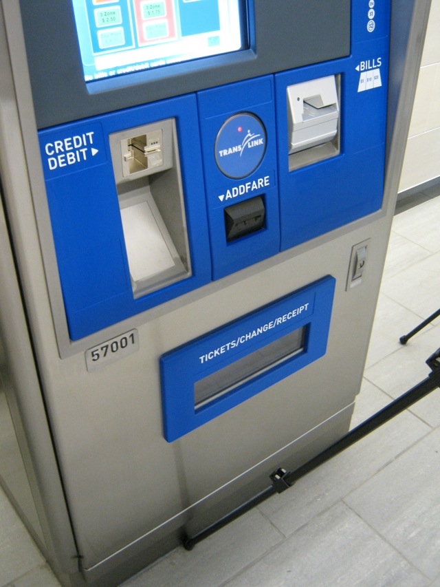
For the ticketing machines at Oakridge, there's the slot which says "Add Fare". Is it possible that is for people who have smart cards in the future to add more money into their accounts (they don't have this at the existing machines)?
     
     
  #6520  
Old Posted Jun 28, 2009, 4:08 PM
mr.x's Avatar
mr.x mr.x is offline
Registered User
 
Join Date: Dec 2003
Location: Stockholm
Posts: 12,805
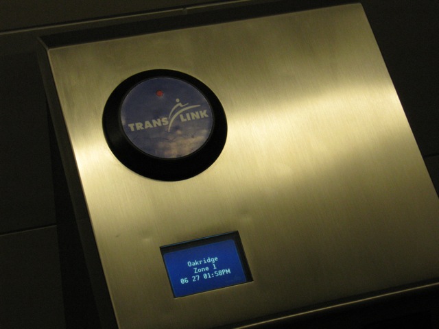
^ probably, considering smart cards are coming next year (and with the high likelihood of fare gates being part of the package too). The circle thing with the red light is the smart card scanner that you wave your smart card over, for some reason they decided to have that way down on the bottom on the old machines:
     
     
This discussion thread continues

Use the page links to the lower-right to go to the next page for additional posts
 
 
Closed Thread

Go Back   SkyscraperPage Forum > Regional Sections > Canada > Alberta & British Columbia > Vancouver > Transportation & Infrastructure
Forum Jump


Forum Jump


All times are GMT. The time now is 8:12 PM.

     
SkyscraperPage.com - Privacy Statement - Top

Powered by vBulletin® Version 3.8.7
Copyright ©2000 - 2026, vBulletin Solutions, Inc.