Looking at the Phase 1 plan for the Baseline BRT again. Recall that Phase 1 involves reallocating the existing east-bound third lane between St. John the Apostle Church and Constellation into a Bus-only lane and rebuilding the Baseline-Greenbank intersection.
Here is an image of what is planned for Phase 1 of that intersection:
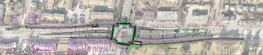
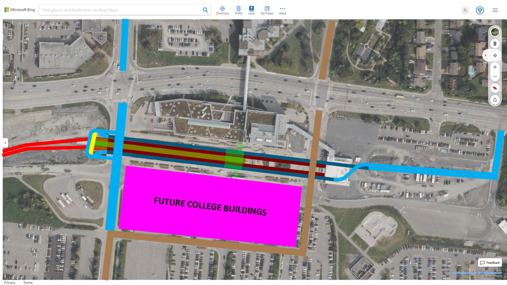
I found it a bit difficult to identify where the extra space was coming from, so I made this rough sketch of the Baseline-Greenbank component of Phase 1:
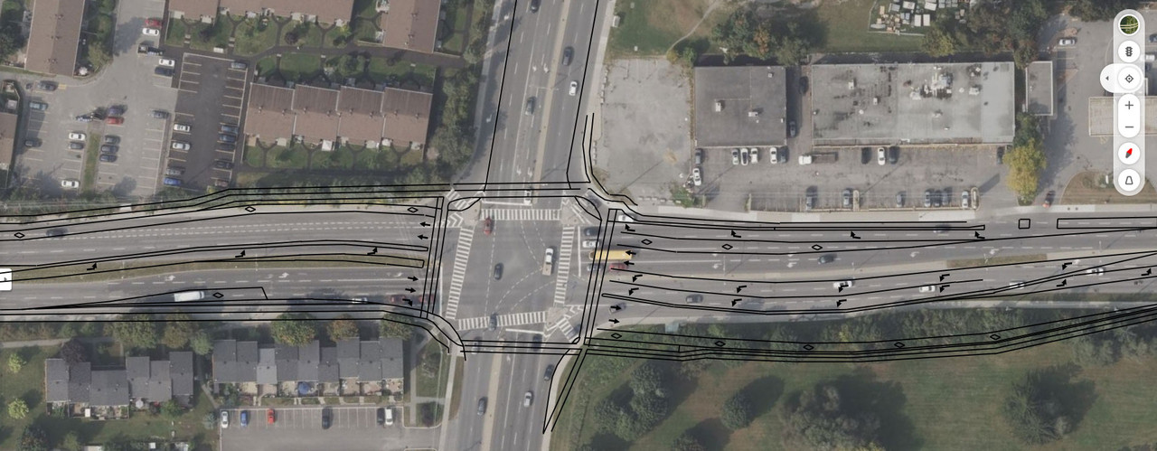
Looking at that, I wondered if enough property had been taken, or if there would need to be more expropriations and a lot of re-working to do later.
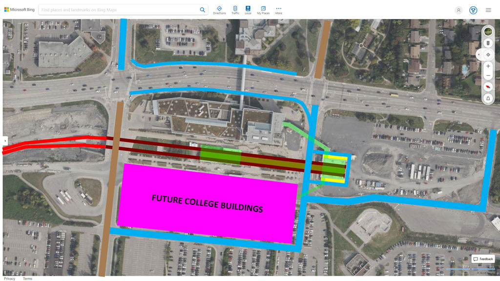
I have not seen the ULTIMATE PLAN for this intersection – the one post-Phase 3, where central bus lanes of the full BRT have been implemented. Therefore, I have had to do a bit of guesswork. Using cut & paste, here is what I imagine the ULTIMATE configuration will look like:
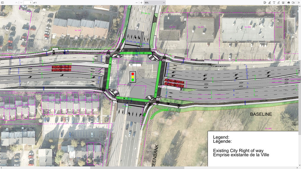
There is room for two general traffic lanes, central bus lanes, bus platforms, cycle tracks, and sidewalks within the new Right of Way (RoW) – but the right-turn lanes along Baseline will need to disappear. The reconfiguration will require a LOT of disruptive construction at the intersection, but, likely no further land purchases.
I find it disappointing that the 800 metres, or so, of Baseline between McWatters and the wider section, east of St. John the Apostle Church, could not be widened at the same time. Obviously, this would have added to the cost of Phase 1, but it would have prevented one of the bottle-necks where buses (and cyclists) need to move from their dedicated lanes into mixed traffic.
Alas, that would have meant actual road construction along Baseline. And we know that, according to City policy, if any reconstruction of a roadway happens, it MUST be reconstructed as a ‘Complete Street’ – inflating the price greatly.
Honestly, I think that the City could have added BUS & BIKE-only lanes – with half-depth bus bays at stops so that bikes could pass without weaving into mixed traffic – within the existing RoW between McWatters and Constellation quite easily, for the most part. It would have provided greater safety for cyclists (over what will be there until Phase 3 is completed) and faster transit – all at a more reasonable price.
But, in Ottawa, if a transit improvement can’t be accomplished with paint alone, then it MUST become a very expensive ‘Complete Street’ project. The Regional Municipality of Ottawa-Carleton (RMOC) believed in relatively inexpensive projects that would benefit transit – but the City of Ottawa does not.





 Prev
Prev


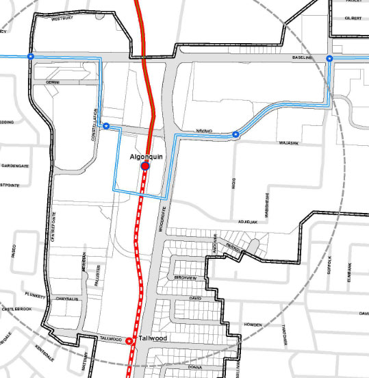



 The station could have serviced College Square equally as well.

 Linear Mode
