On to day 2! This post is going to be huge. Since I went to the Grand Canyon, and spent the entire day exploring the West, I ended up taking almost 700 pictures that day.
Let me premise this by explaining how Las Vegas figured into my trip with my friend for the Eagles game in Glendale. My friend was going to be moving to Phoenix the next week; he had just accepted a job there. He wasn't sure if it was worth it to go out for a weekend when he would be there the next week. Also, 15,000-30,000 Eagles fans were going to be at the game, which meant that airfare from BWI, Philadelphia, Dulles, Newark, Lehigh Valley, Atlantic City, Harrisburg, etc were all very high. He couldn't find airfare under $600 when the game was a month away. Eventually, he decided to go, but he found cheap airfare from LaGuardia to Las Vegas, with a return flight from Phoenix Sunday night to LaGuardia. He asked if I could pick him up in Las Vegas Saturday morning. It was perfect for me, since I would be in northern Arizona anyway. Eventually, it changed to picking him up Friday night, and then we would go out in Las Vegas. So, that ended up being how I made a big triangle between Phoexnix, Flagstaff/the Grand Canyon, and Las Vegas.
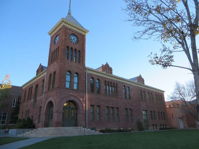
I woke up at around 6 AM in order to get in as much in one day as possible. This was the view from my hotel room when I woke up. Mount Elden is on the left.

Mount Elden is pretty big for a little mountain. You might think it's far away, but it was less than 3 miles from my hotel. Its elevation is 9,301 feet high (2,835 m), with a topographic prominence of 1,219 feet (372 m) above the surrounding area. Of course, Google Earth puts my hotel at 6,853 feet (2089 m) in elevation, for a topographic prominence of 2,448 feet (746 m).

Some of the mountains in the Appalachians have much smaller topographic prominences. For instance, Blue Mountain in Pennsylvania has a topographic prominence of about 944 feet (288 m) where I used to cross over it to visit my grandparents.
Here's a picture of that spot on Blue Mountain, as PA Route 501 gets ready to ascend from Berks County into Schuylkill County. This is about 1.1 miles from the local summit. I'm showing this to show how your eyes can deceive you, and bigger mountains can look the same as smaller mountains in your memory.


The Catholic Church of San Francisco de Asís sits on the top of McMillan Mesa. The church was built in 2013. I actually had a hard time figuring out what this place was, because satellite imagery showed the top of the hill with nothing on it!

As I pulled out of my hotel, I saw a Burlington Northern Santa Fe Railroad train going over a little historic bridge. It seemed an appropriate start to my morning in the railroad town of Flagstaff.

I passed this Route 66 roadside architecture/sign on my way into Downtown Flagstaff.

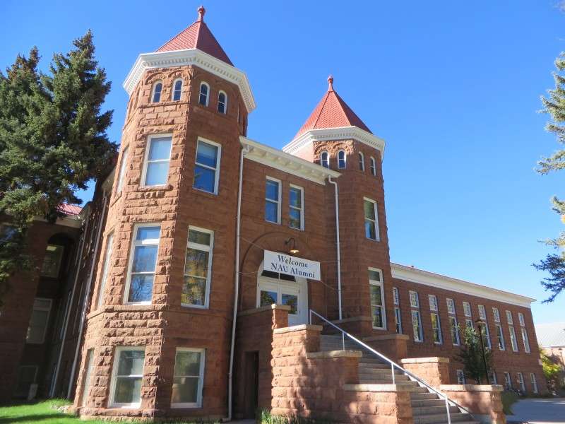
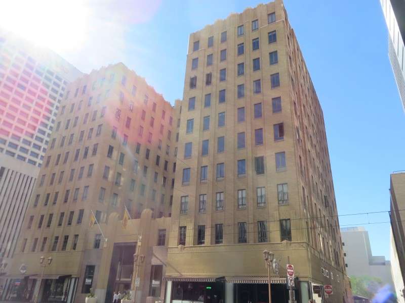
I spent a couple hours walking around Flagstaff. As much as I wanted to get to the Grand Canyon, I needed to eat breakfast, and I made sure I woke up early enough to explore in town. There will be a Flagstaff photothread shortly.


Finally, it was time to head to the Grand Canyon. I took US Route 180 out of Flagstaff and towards the national park.
Agassiz Peak, at 12,356 feet (3,766 m), is Arizona's second-highest mountain. It is prominent from most places in and around Flagstaff, including off of Shultz Pass Road, where I pulled off in case I wouldn't see these mountains any more. It's featured here on the left, along with Fremont Peak at 11,929 feet (3,636 m) to the right-of-center, and then Doyle Peak at 11,460 feet (3,493 m) to the very right.


But, I couldn't stay there forever and look at the mountains. I had to get to the Grand Canyon!


Alright, I had to stop one more time to see Agassiz Peak. There was a roadside rest stop for Coconino National Forest, and I went to the bathroom (who knows when my next chance would be, in such a desolate area), and I read up on the mountains from a roadside information board. Surprisingly, these mountains are very susceptible to avalanches, which you don't really think about in Arizona.

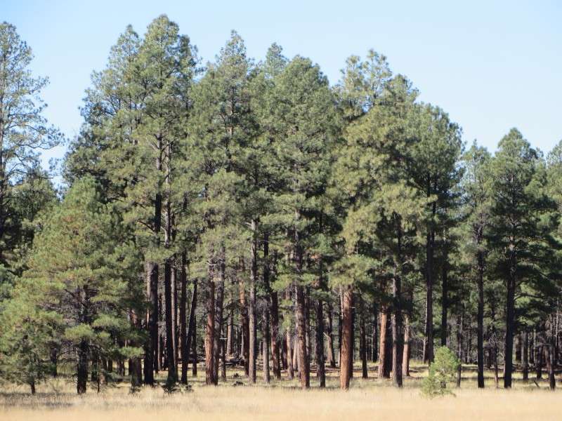
Since I was stopped, I took a few minutes to walk around the forest.


About 7 miles out from Downtown Flagstaff is a neighborhood, spread out across hundreds of acres, in a ranch-y area. I think it's called Fort Valley. The road to the Arizona Snow Bowl, the ski resort on Humphrey's Peak, is at the edge of this area.


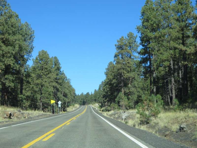
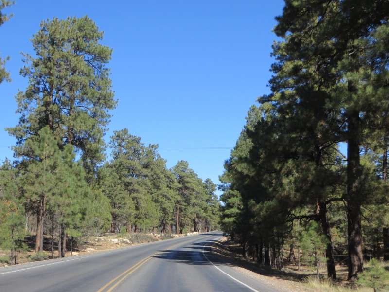
The drive through Coconino National Forest is spectacular! I stopped countless times in my rental car to take pictures of the road. This is the kind of drive that you romanticize about when you think about exploring the West.


In the distance, you can see Saddle Mountain. This is about 18 miles out from Downtown Flagstaff. The highest elevation on the roaad, at 8,046 feet (2,452 m), is just before this spot.

Kendrick Peak, at 10,418 feet (3,175 m) can be seen to the east of US 180. Elevation on the road is around 7,850 feet (2,393 m).

Some people live out in the wilderness, about 30 minutes northwest of Flagstaff. There's a bed & breakfast, A Shooting Star Inn, that is just out of view, and gets good reviews.

After driving through the meadow past Kendrick Peak, you go up a small rise, and then get an amazing view to the north-northwest as you begin to descend the plateau.


During the descent, you pass by the aftermath of a forest fire, which started
around HERE, and spread to the northeast. (Coordinates for Google Earth are 35°25'33.19" N, 111°47'24.16" W .) I figured it was the aftermath of a wildfire, but I wasn't too sure because we don't get them in Delaware. It appears that the forest fire happened in 2000.


We continue down the plateau even more.


One thing that is cool in Arizona is that each rise or drop in elevation of 1,000 feet is labeled. I saw it on the drive from Scottsdale to Flagstaff the night before; I must have been driving up a plateau, because the elevations pretty much just kept going up! I managed to stop at one of these signs, where the elevation is 7,000 feet (2,133 m).


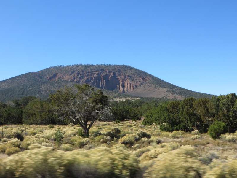
A very distinctive landmark on the drive is Red Mountain. This mountain, a volcanic cinder cone, has an amphitheater that was likely created through a steam eruption or steam blast, when rainfall was superheated by hot cinders. The mountain has a topographic prominence of over 1,000 feet (304 m), but seems smaller. (This picture is a little over a mile away, so mountain height and distance from the mountain are similar to the Blue Mountain picture linked further up.)
At the bottom of the plateau, you exit Coconino National Forest, with its ponderosa pines, and enter Kaibab National Forest.

I'm not sure what type of "trees" are in this forest, since everything is much shorter. This part doesn't seem to really be a forest, more than it is scrubland. The real forests are elsewhere in Kaibab. Maybe someone can elaborate on this?


It's hard for me to believe that some people live so far away from civilization, just out in the desert like this. It's things like this that make it apparent why the skeptical and laissez faire attitude towards government, and the self-reliance that we Americans tend to prefer, and that we inherited from our Founding Fathers, is still strong today. I could feel the same thing myself. In a wide open state like Arizona, where I was the only one on the road for most of my drive, I was happy that there were no cops hounding on people about speeding or anything like that.

US Route 180 connects with Arizona Route 64 in the community of Valle. The community really isn't much more than a collection of buildings where a couple roads meet up. It's the only community between I-40 and the Grand Canyon. As such, Valle has some of the highest gas prices in the continental US; in October, when I passed through, prices were $3.99/gallon, whereas whereas I got gas in Delaware for the $2.30s a couple days before my trip. Right now, according to gasbuddy.com, gas prices in the Wilmington/Newark area in Delaware are in the $1.90s to $2.00s, in the $1.70s in Phoenix, in the $1.90s to $2.00s in Flagstaff, and $2.79 in Valle.

Continuing north on US 180, it now runs north concurrently with AZ 64. Red Butte, with an elevation of 7,329 feet (2,234 m) and a topographic prominence of 956 feet (291 m), is on the right.

Even though this is in a National Forest, these "lower elevations" closer to 6,000 feet are more like scrubland.

At the intersection with Willaha County Road, a dip in the landscape lets you see that the scrubland is turning into forest.

Back into the ponderosa pines as I get near the entrance!

A traffic circle indicates that you're entering the community of Tusayan, before the entrance to the National Park.

There's a few businesses in this little community, like this steakhouse that had some nice neon signage that I saw in the evening.

Almost there!

I made it!

Every once in a while, you would hear a helicopter coming in fast and loud. These things would fly just over the tree line and were loud enough to make you poop your pants if you didn't hear it coming sooner.

The park entrance, which kind of uses the rustic architectural style. For the record, admission is $25 per car, but the attendant told me that if I kept the receipt and taped it to my front windshield, it was valid for entry for 7 days.

Driving through the forest in Grand Canyon National Park.
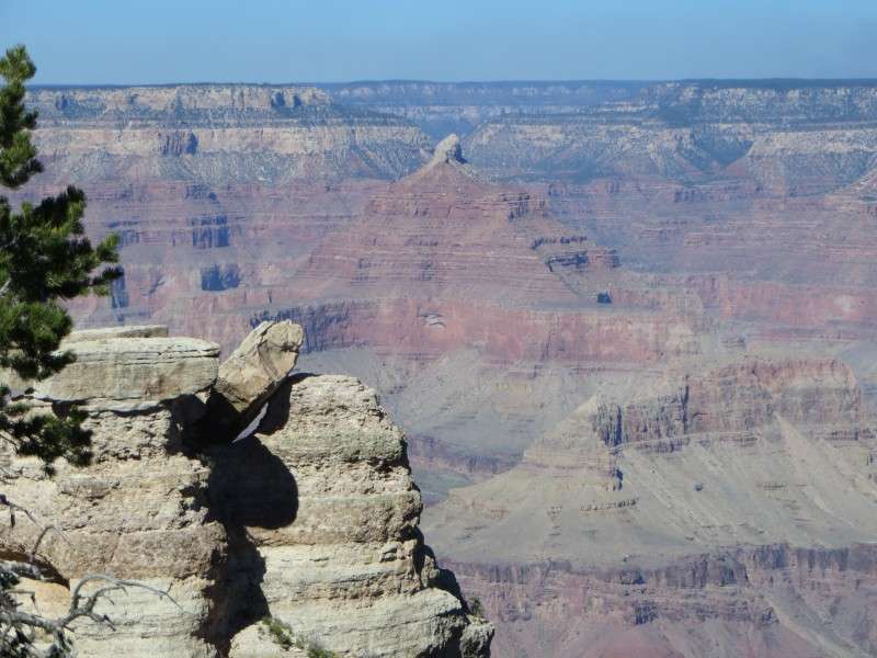
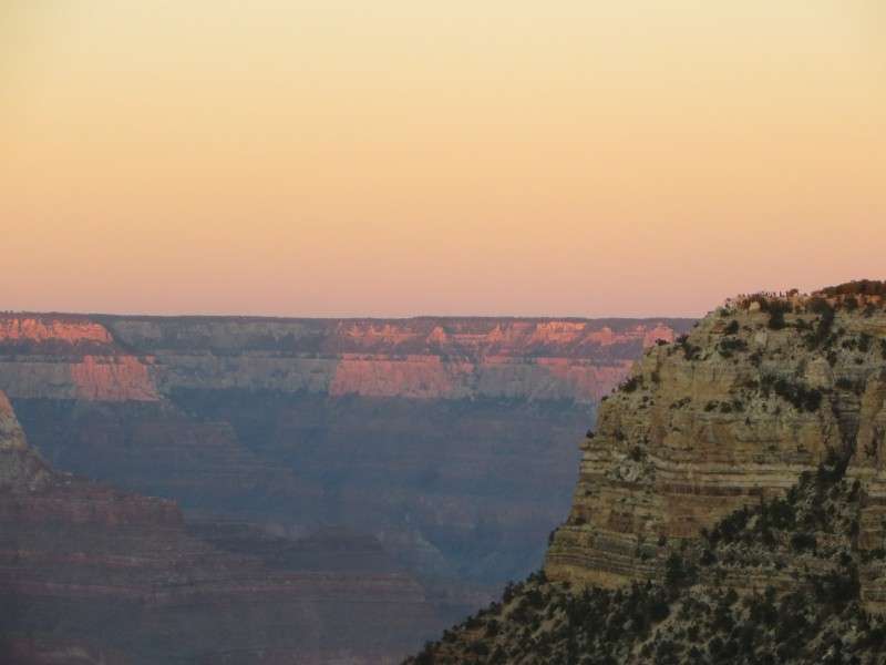
This was my very first view of the Grand Canyon. How amazing!!!

The first place that I walked to see the Grand Canyon was a spot about 150 yards east of Mather Point. Everything that I did that day was on the South Rim.

It's not often you look down on a bird soaring high above the ground.

Using the 20x optical and 80x digital zoom on my point-and-click, I zoomed in on the Colorado River, and a little weather station.


There's a little oasis along a creekbed down there!

There's a lot to digest when taking in the view!!


Looking down at a trail, or at a creek bed, or maybe both.


I couldn't figure out what this thing was. There were pock-marks dotted all around the canyon. Maybe it was wind erosion, like the famous stone arches in Arches National Park? Maybe it was massive chunks of rock that had fallen off?

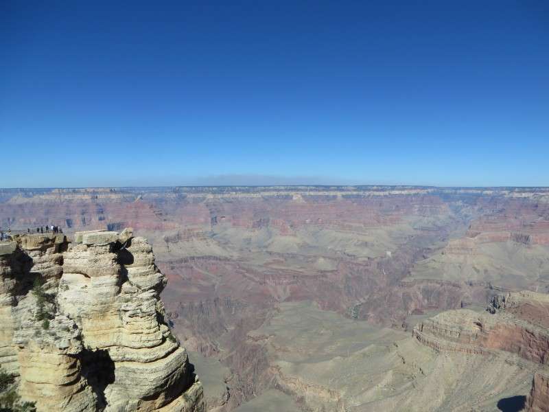
A view of Mather Point.


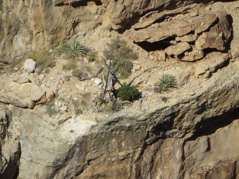
I noticed something strange on one of the ledges as I looked at Mather Point. Time to use the megazoom!

Do you see it in the middle there?

It looked like tree branches were set up like a tripod, to be used for a campfire. Maybe my eyes were playing tricks on me at the time, because it looks like one of the branches is just something that fell down there. Not sure about the others, though. Any suggestions on this? Can you imagine if it was set up there by someone? How would they get down there?


Back to the canyon. I tried my hand at a few pictures showcasing depth.


The view was literally breath-taking. As evidence, let me share a story. So I had practically run up to the edge of the canyon after parking in the Mather Point parking lot, as if the canyon would disappear like a sunset if I didn't get there soon enough. After looking out for a few minutes, I heard an old woman on a bench panting and having a hard time breathing. I asked her if she needed help, and she said no. She said that she was 87 years old, and it was her first time at the Grand Canyon. Seeing the canyon literally took her breath away and left her speechless. She just sat there and drank it all in.


After a while, I walked the short distance over to Mather Point. There are historic markers commemorating people and events that helped shape the park. There's actually a decent amount of history on the formation of the park sprinkled around the park, if you like that kind of stuff. This plaque commemorating Stephen Tyng Mather was dedicated in 1930.

Mather Point sticks way out into the canyon, and is popular with tourists, and is therefore lined with guardrails. Some other promontories are smaller, and have no guardrails, so you can just walk out and sit o the canyon rim. Technically, you aren't allowed to go off of the trails and walkways, but that didn't stop hundreds of people. While I didn't sit right on the edge of the canyon, I went out on a couple spots.


The Plateau Point Trail is a prominent manmade feature in the Grand Canyon. The Plateau Trail is an extension of the Bright Angel Trail, which goes from Grand Canyon Village down to the river, then crosses and goes up to the North Rim. Plateau Trail branches off and goes to the rim of the Inner Canyon. You'll see quite a few more pictures of this plateau and the trail later (but not from on it, unfortunately).


The vistas are one thing to photograph, but to help me remember the place more comprehensively, in case I never make it back (I really hope that's not the case!), I took some pictures of other things. Here's what some of the Outer Canyon walls look like with vegetation on them. I took these from an unrailed section of a precipice.


While walking along a walkway west of Mather Point, I saw a bird almost right in front of my face. I tried my hand at some fauna pictures.


I then tried a couple pictures where I changed the focus.


Back to the canyon!

I found a couple spots to really go out on a ledge, and not test my jitters. I'm not afraid of heights, but I am afraid of falling from them! I stayed a couple feet away from the edge in all of these places.


Off in the distance is Mount Trumbull, which has an elevation of 8,029 feet (2,447 m). Mount Trumbull is about 62 miles (100 km) away from the area around Mather Point.


The next place that I went to was Yavapai Point, which I reached by taking the bus system available.


There's the Plateau Point Trail again.

You get a good view of Maricopa Point from Yavapai Point.

At Yavapai Point is the old Yavapai Observation Station, now the Geology Museum. The station was built in 1928 and was just the third formal interpretive center in any of the national parks. The observation station, built of native Kaibab limestone and ponderosa pine, wass located here because it would give geologists a place to see all of the major features of the Grand Canyon.

I took the bus back to Mather Point, and then walked to my car. I had time to stay until the evening, but I didn't want to have to take the bus everywhere, and I wasn't sure if it would run at night anyway. I had to take the bus in other parts of the park, since the roads were off-limits to other cars. So, I had a lunch that I packed, and then got in my car and drove into Grand Canyon Village.
Here's something for the license plate geeks. In the parking lot by Mather Point was a Baja California plate. I had seen 6 or 7 of these plates in San Diego when I was there in 2009, and I've seen Mexican plates at home in Delaware: Chihuahua, Guanajuato twice, and something else that I can't remember or find too similar of on the Internet, and Estado de Mexico just into New Jersey on the Turnpike. This is the new Baja California plate. Most of the plates that I saw, besides Arizona, were Californias and New Mexicos. Of course, people from farther away likely rented cars like me.

The views were amazing from the rim by Grand Canyon Village, as you would expect anywhere.


From Grand Canyon Village, I went over to this area and farther west.

From Trailview Overlook, you get a nice view of the historic area of Grand Canyon Village. National Park workers that live in Grand Canyon Village live in the woods off to the right.

The views are a little different from Maricopa Point.


There's some of those pock-marks again.


Let's autocorrect those colors form the last picture and see what happens.

Let's negative the original and see what happens.

To the east of was some mining equipment. The Orphan Mine, which operated from 1891 to 1961, was nearby, so this equipment might be from that mine.


I went over to that place, Powell Point, a little later.

Can you spot the mining equipment from the above pictures? Highlight here for the answer:

On to Powell Point. The Orphan Mine was located on this spot seen here, but it is being reclaimed and turned back to its natural state as much as possible. By the way, you can see Red Butte in the background, with the San Francisco Mountains beyond that.


Below where the mine was, it looks like rubble is spilled over the rim. But I have an untrained eye as to what to look for to see if this section is in a natural state or not.

There's a monument at Powell Point.

Great views from here too!


There's that pock-mark from Mather Point again.


Here's the close up of the Major John Wesley Powell Monument, built in 1916.

Back to Grand Canyon Village.

These people are walking the Bright Angel Trail, which, as mentioned earlier, goes down to the Colorado River and up to the North Rim. This hole in the precipice was popular for pictures. I think very few people hiked beyond that.

I wanted to hike a little bit of the Bright Angel Trail myself. I had to be able to say that I went into the Grand Canyon.

There's that hole in the rock.

Here's proof that I walked over the rim and into the canyon.

Walking back up. Unfortunately, I only walked a little past the hole in the rock. Walking farther down the Bright Angel Trail to or near the Inner Canyon is now on the bucket list!

There was some renovations going on for some of the historic art studios. The Kolb Studio, built in 1904, was being restored.

The Lookout Studio, built in 1914, was also under renovation.

The El Tovar Hotel, built in 1905, is the centerpiece of Grand Canyon Village.

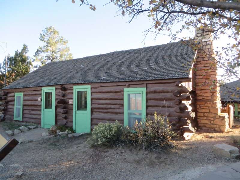
Buckey's Cabin, along the South Rim. The cabin was built by William "Buckey" O'Neill in 1890. It is the last remaining building from the early pioneer settlement era of Grand Canyon Village.
At this point, the battery in my camera had died. Oh no! Makes sense, since I took over 500 pictures for the day so far, most of them high-resolution. I was now missing the sunset! Thankfully, I went into the National Park gift shop and bought some little items as Christmas presents, and when the place was empty, I asked the store clerk if I could charge my battery. I had the common sense to have the charger in my pocket in case the battery died, which I knew would surely happen. The guy was an old man with saggy skin and a ponytail, but he was very nice. His look and demeanor made him seem kind of like a nice old grandfather with a subtle, gentle hippie streak in him. It took us some time to find an electrical outlet, but we foudn one behind a blanket that was hiding wiring. I let the battery charge a little bit and took some pictures with my phone.
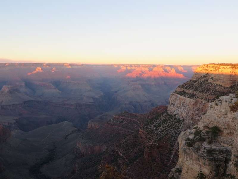
Finally, I had some juice! Here's my first Grand Canyon sunset picture. Anyone that plans on going here has to be around for a sunrise, or a sunset, or both!


This is the Park gift shop, where I charged my camera battery. It's Verkamp's Curios Store, and was built in 1906. It was originally a private building until 2008, when the Park bought the concession license. The Park has had it continued on as a store/gift shop, and now is also a visitor's center. Above the ground floor is a little apartment. Some family was up there watching the sunset for a while before I took this picture. I asked the guy that helped me charge my battery about who had the wonderful priviledge of living up there, and he said it's not a permanent residence. Rather, the Park offers the apartment to an artist to live there for a week at a time. I don't know if there's a list or not. The artist there at the time was a wood sculptor. Some of you photographers that are able to sell your pictures should look into being able to stay there. You would love it!

The El Tovar Hotel was built in 1905 by the Santa Fe Railway, and is one of the hotels that set the precedent of railway hotels in National Parks. The hotel borrowed elements from Swiss chalets and Norwegian villas to use the rustic architectural style. In its early years, the El Tovar was considered the nicest hotel west of the Mississippi River by many.


The rustic architecture is continued in the interior, with exposed logs and beams, and is decorated with animal heads.

Enough about buildings. My battery had a charge, so I needed sunset pictures!


This stand likely had a telescope on it, where you could set it in the grooves and look at the features labeled.


I put some lines in to try and show where these grooves and divots would make a telescope point. I'm not sure how well it works. The tree is in the way, which makes it tough to see anything. The five lines, going left to right, point to: the Hopi Fire Tower, a Figure 7, Cheops Pyramid, the Colorado River Gorge, and Grandeur Point


The sun was setting fast. I don't know why I thought this, but I assumed that I would also have a view of the sun going over the horizon. It was really flat, other than the canyon, because the entire area is a plateau.


Let's enhance that last picture so you can see the foreground a little better.

One last chance to enjoy the colors of the sunset!


El Tovar was a really nice hotel. I like Rustic style architecture. The El Tovar was built by Hopi Indians using local limestone and logs from Oregon. There will be a Grand Canyon Village thread coming up some time in the future.

The sunset was over, and now we entered twilight. Remember Plateau Point? You can see the Plateau Point Trail to the left of the litle lush creekbed down in the canyon.

Look at the Plateau Point Trail again. See the little white dots? Those were mules with lights, coming up the trail to the village.


If we lighten the previous picture a little bit, you can see a little more of the canyon, and you can also see the mules with the lights a little better.

At this point, it was too dark to take any more pictures. I made the long walk back to my car through Grand Canyon Village. It actually got kind of cold once the sun went down. A t-shirt wasn't cutting it at such a high elevation.
It was now time to get to Las Vegas! I was sure I would be late to pick up my friend, after staying so long in Grand Canyon National Park. I had to really fly to Las Vegas, otherwise my friend would be waiting an hour for me. His flight was delayed a little bit, or he lied on when he was leaving, and it ended up going well. I got to the airport 10 minutes after he landed, and 5 minutes after he got outside waiting for me.
On Arizona Route 64, between Valle and Williams, I stopped to take a picture of the night sky. I didn't wait too long for my eyes to adjust, since I had to get to McCarran Airport, so even though I saw more stars than I maybe have ever before, I still didn't see as many as I wanted. My point-and-click camera didn't do the sky much justice, either. This is an enhanced photo.

I stopped at this gas station in Kingman, Arizona. Not only did it have the lowest price along the drive from the Grand Canyon to Las Vegas, it had distinctive architecture. The place was called Terrible Herbst's. I thought it might be some old Route 66 architecture, but I found out on the Internet that it was built in the 1970s. It's still an interesting gas station.

While at the gas station, I was surrounded by a swarm of locusts.

I tried to take some pictures of the Las Vegas metro from my rental car as I drove down the mountain past Henderson.


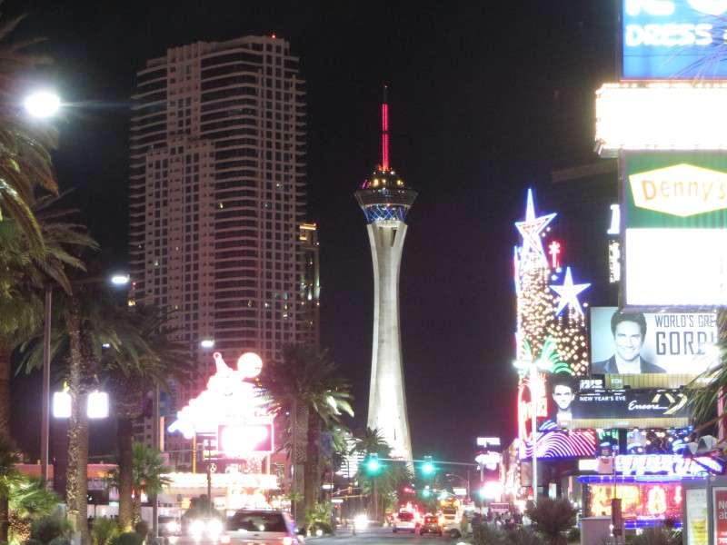
I made it to Las Vegas! After picking up my friend, we took the back way to our hotel, which was on the north end of the Strip.

There's a little bit of historic (relatively speaking) neon signs on the Strip. Circus Circus and the Riviera are some of the older casinos on Las Vegas Boulevard.

That's the last picture from that night, other than the ones of me and my friend drinking! We went out to XS at Wynn. Some famous DJ was there, but I'm not into that kind of stuff. My friend is, however. It was a good time at XS, anyway. As proof that all roads lead to Delaware, one of the girls that we talked to lifeguarded in Bethany Beach a few years ago. Anyway, the next set of pictures, not taken with my phone, were the next morning.
Day 3 and more are still to come! Keep coming back!


 Prev
Prev


 Linear Mode
