As explained in
Part 1, I was in Pittsburgh last weekend. Being a transportation planner I am always very interested to see a city's transit network, and Pittsburgh has an incredibly interesting one, which made it an incredibly interesting trip.
Note that I said
interesting, which isn't the same as
good. Pittsburgh's system could be good, but appears to be mired by mad management and underfunding. One litmus test for whether or not a transit agency knows what it's doing is how easy it is to find a system map, or at least some close approximation of a system map. Pittsburgh doesn't publish one; such a thing doesn't exist. They publish a reasonably good
light rail map, but there is no overall system map and no map that shows how the city's three impressive busways integrate into the larger system.
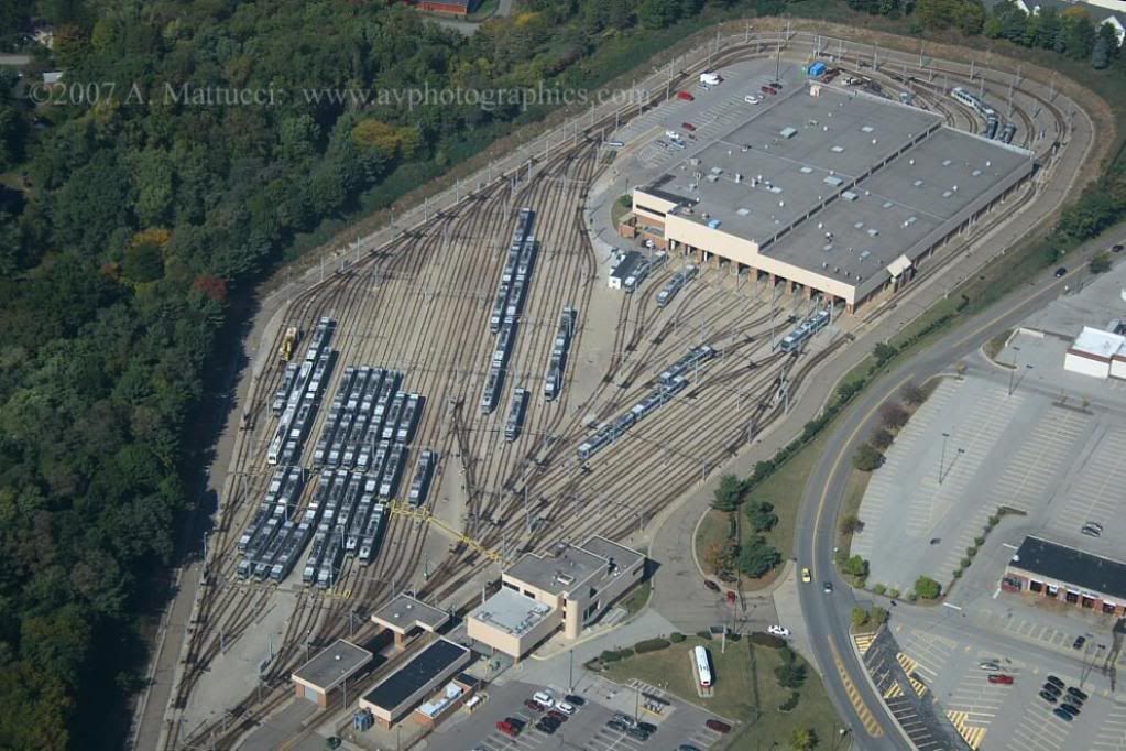
Yes, Pittsburgh has three busways. I had heard that there was something like a busway there, but had no idea the system was so extensive. It is probably fair to say that Pittsburgh has the most extensive and mature BRT system in the United States. Which would be great, except that the already under-funded service was
dramatically cut back last month due to budget constraints.
The light rail appears to be the same. I waited 1/2 hour for a train at one of the main downtown subway stations. Granted it was Sunday, but still. That's crazy.
It's all very unfortunate, because the infrastructure is there for Pittsburgh to have a great network. If only they had enough money to run decent service, and enough brain power to advertise it correctly.
Since an official map doesn't exist, here is an unofficial one produced by
Father Pitt:

I also produced
a google map showing the light rail and busways according to real geography.
Now on to pictures. Let's start with the light rail. Pittsburgh's light rail is vintage from the streetcar era, and as you can infer from the number of street-level stops on that map along the southern end of the red and blue lines, it still functions very much like an old streetcar for parts of its route.
I didn't ride it all the way down there. I got on at Station Square, which is a full-on high-platform station, and rode into downtown.
Station Square
appears to be a multi-modal transfer point. Note what looks like a busway to the right. However I can't actually find any service that uses that lane or that stop. Perhaps it was discontinued?


Here's a good look at the train livery, which is pretty plain.

Just west of Station Square there's a transit tunnel under Mount Washington for use by light rail and buses only. I didn't go through.


From Station Square the train went over this bridge to cross into downtown.

Looks like this, as seen from Mount Washington:


Downtown the stations are in a subway. The last time I was in Pittsburgh I was nearly arrested for taking a picture of a subway station. This time no one bothered me.
This is Wood Street Station, which is temporarily the end of the line, while an extension across the Allegheny River into Northshore is under construction.


The inside of a train:

Further indication that the light rail functions like a bus in the suburbs: A stop request strip.

The entrance to Wood Street subway station occupies the ground floor of this building.

A few blocks down, Gateway Center subway station, which used to be the end-line downtown station but is currently closed, to be completely rebuilt as part of the northern extension.

There's a light rail spur to Penn Station, one of Pittsburgh's two grand old intercity rail depots. I'm not sure if the light rail service to Penn Station is still active or if it was cut, but you can see the contemporary multi-modal local station on the right side of this picture:

The historic depot is gorgeous, and features a carriage turn-around / pick-up-drop-off area that's very unique:

Unfortunately, the historic depot isn't used for trains anymore. It's been converted to apartments, and they keep the doors locked. I stuck my camera up against the window and took this teaser of the station's old main hall:

I searched flickr to find a picture of the main hall and found this. THIS IS NOT MY PICTURE. It's from
flickr user PMcC in WashDC:

The small number of Amtrak trains a day that come through use an Amshack off to the side

Here's the light rail station off to the side that you first saw in the Penn Station overview picture a few shots up. I'm not sure whether this is still served by trains or if service here was cut. It's only a little spur from the main line.

Between the light rail station and the historic depot building, the West MLK busway has its first station.


The busways are pretty simple. They're dedicated highways for buses only. No cars, whatsoever (except transit agency police, apparently). They're one lane in each direction, except at stops where there are extra pull-off lanes. Maybe there's express service? I don't know.
Stations vary from those that look like fairly basic bus stops, like Herron Avenue stop:


... To the more extensive East Liberty station:


They use a mix of regular and articulated buses.

The busways are very much like light rail in other cities in many ways (for a discussion of ways light rail and buses are inherently different,
click here). This shows the East Busway, which follows the right-of-way of freight rail tracks. It would be so simple to convert these to rail.

In addition to the busways there are some surface bus lanes around. I thought this one on 5th Avenue in Oakland near the Cathedral of Learning was particularly interesting, since it's counterflow to the main direction of traffic:


Downtown it looks like the buses just mix with traffic. That's too bad.


Bus with an ad for a bus. It's meta:

Oh, right:

Pretty darn nice-looking Greyhound station. I didn't go in, but should have.

Now let's go back across the Monongahela River and check out the inclines, the two unique diagonal railroads carrying passengers to and from the top and bottom of Mount Washington.
This is the Duquesne Incline, as seen from downtown Pittsburgh.

I didn't ride this one, but have zoomed-in pictures of the stations at the top and bottom of the mountain:


I
did ride the Monongahela Incline, the one that starts right at Station Square (where our tour began).


Looks like this from the outside:

Back in:


Head back down the incline and we're right where we started, at Station Square.
Station square is so named because it's the location of Pittsburgh's other large historic intercity rail depot, the Pittsburgh & Lake Erie Station:

The main hall for P&LE Station is now a restaurant called the Grand Concourse. Check it out in the next post, which is the end of this photo set.


 Prev
Prev


 Linear Mode
