A couple of weeks ago I flew from BWI to Charlotte. The plane did a giant loop around the western half of DC, so I took what pictures I could. Here they are.
Washington, DC from almost directly north. This is zoomed in quite a bit. We'll get much closer down the thread.

Looping around the western suburbs. Now you can see both sides of the river.

Ahha.

Even better.
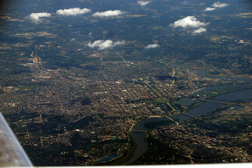
There it is.

I tried several zoomed-in shots, but generally they didn't turn out. This is the best they got. You can very clearly see the Capitol and Washington Monument.

OK. Now let's look at some suburbs.
This ribbon of orange is a new interstate highway under construction in Montgomery County. It is the ICC (InterCounty Connector), which when complete will run from Gaithersburg to Laurel.

Speaking of Gaithersburg, here it is.

And a very quick, very blurry picture of downtown Rockville and its Metro station. Almost missed it.

Oh hai, Arlington. Several interesting things in this picture. Prominent at center-left along the river is Reagan National Airport. Immediately below the airport you can see the Pentagon and Crystal City. Below that, running in a line beginning across from that island in the river and running straight right across the screen you can see a series of TODs along the Metrorail Orange line.

Another view of central Arlington. You can see the airport, Crystal City, the Pentagon, and the first three Orange line TODs, along with Arlington National Cemetery (the green space at center) and two of DC's most famous monuments. The Jefferson Memorial is the white building immediately on the DC side (left) of that cluster of three bridges that begin near the Pentagon. The Lincoln Memorial is the building in the middle of the circle that's immediately on the DC side of the darker-colored bridge near center-left.

A similar view, zoomed in. You can more clearly make out the Lincoln Memorial at upper left (inside the circle road) and the Kennedy Center (the large squarish building at upper left), as well as Rosslyn and part of Courthouse (the first two Orange line TODs)

The plane is flying almost due south now, so we have wrapped around Arlington and how have a more clear view of National Airport, Pentagon, and Crystal City. The highway running through the image is I-395. Across the river is Bolling Air Force Base, in DC. The left side of this image also clearly shows the confluence of the Anacostia and Potomac Rivers.

Continuing south, here is an overview of Alexandria. Old Town is at center, along the river. The cluster of tall buildings near center is the TOD around King Street Metro station. The bridge is the Wilson Bridge and the highway is the Beltway (I-495). The cluster of buildings you see on the eastern bank of the river at top-right is National Harbor, a big "new downtown" development in Prince George's County, Maryland.

All the same things, but closer. At this scale you can also more clearly make out the Braddock Road Metro TOD, the cluster of tallish buildings near center-left (it's quite a bit smaller than the King Street TOD closer, which is closer to the center of Alexandria).

Zoomed in on Old Town Alexandria and the King Street TOD. The TOD is the big cluster of tall buildings at lower and center-right. Old Town extends from there up to the Potomac River.

That's it for the DC area, but here are a couple of bonus shots from further south on the same flight:
Downtown Greensboro, NC.

High Point, NC.

And finally, for all you NASCAR fans, the Charlotte race track.

I'll post pictures from Charlotte and Greenville, SC later.


 Prev
Prev


 Great shots.


 Linear Mode
