Quote:
Originally Posted by q12

|
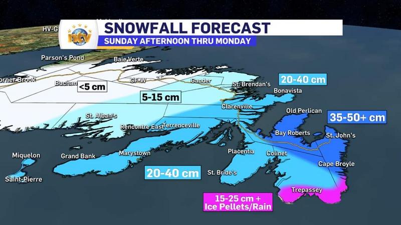
Yes, well, the image below clearly demonstrates this to be an ocean storm, with the majority of effects being to coastal NS, and, as the storm moves NE, to Cape Breton and then to the Burin and Avalon peninsulas.

The centre of low pressure is currently due south of Halifax. The colour scale is for total precipitable water. There is a large band of precipitation just offshore. If the storm had deviated even 30-40 km to the west, Halifax could have been in trouble.
As for Moncton, you can see that the prevailing circulation for us is NNE off of the Gulf of St Lawrence, and, what little precipitation we are currently getting is "sea effect" rather than systemic. This has been pretty light so far.


 Prev
Prev


 Linear Mode
