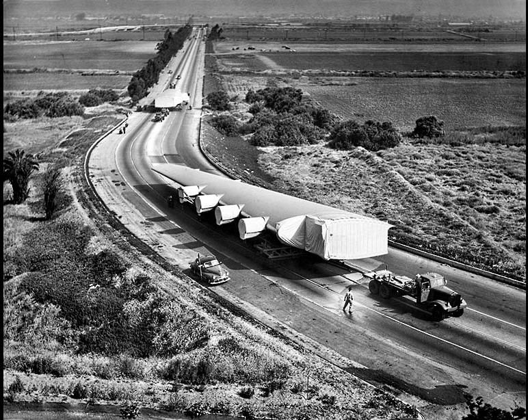
On June 11-12, 1946, the two wings of the Spruce Goose were towed 28 miles at 2 mph from the Hughes Airport in Culver City to Long Beach, where the plane was assembled. Along the way, 2,100 power and telephone lines were moved.
Here in this LA Times photo are the two wings on June 11, just after they've been towed from the west end of the airstrip, across a dirt ramp, and onto southbound Lincoln Blvd:

In the distance you can just barely see the Culver Blvd bridges over Lincoln Blvd and, to the left, over Ballona Creek. A little closer in is Jefferson Blvd, marked by the line of power poles. Left to right across the picture just north of the trailing wing appears to be a creek, or at least a ditch of some sort. (I remember seeing a culvert under Lincoln in about that spot with 1930 stamped in the concrete.) I'm guessing that's a remnant of Centinela Creek, which historically flowed along the base of the Westchester bluffs and was eventually put in a concrete channel and diverted into Ballona Creek further upstream.
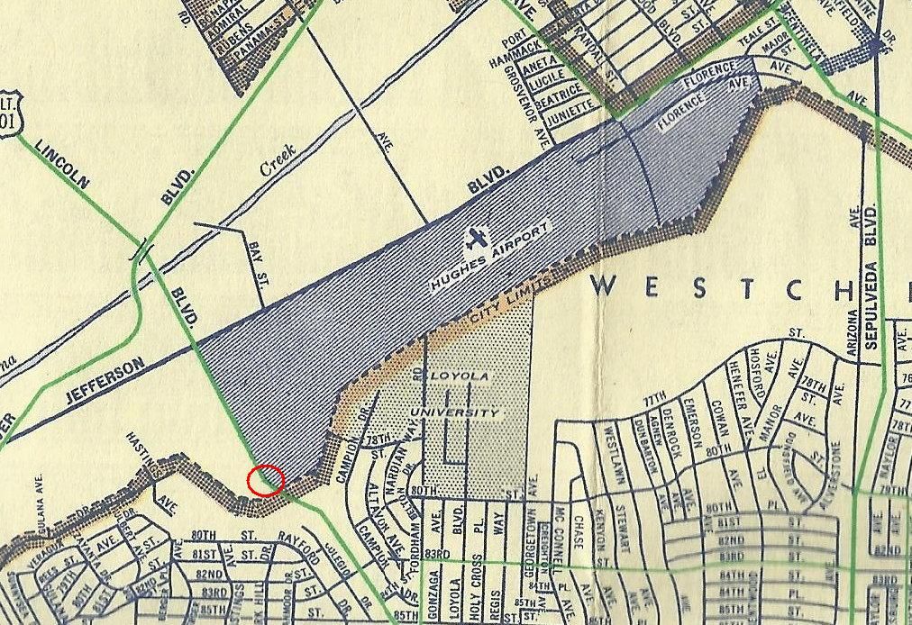
Let's use
ER's 1947 map to show where this happened. In the b/w photo the wings are about where the red circle is:

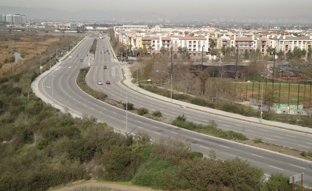
And the same view today:

The highrises at upper left are Marina del Rey; the ballfield and sea of condos at right are part of Playa Vista, the development at the old Hughes Airport site. The water west of Lincoln (opposite the T intersection) is part of a manmade freshwater marsh:
http://www.ballonafriends.org/restor...ter_marsh.html
More info and old pics at:
http://framework.latimes.com/2012/10...ruce-goose/#/5
Color photo by me


