HomeDiagramsDatabaseMapsForum About
     

Go Back   SkyscraperPage Forum > Regional Sections > Canada


Closed Thread

 
Thread Tools Display Modes
     
     
  #6161  
Old Posted Apr 7, 2015, 6:25 AM
Chadillaccc's Avatar
Chadillaccc Chadillaccc is offline
ARTchitecture
 
Join Date: Feb 2011
Location: Cala Ghearraidh
Posts: 22,842
Quote:
Originally Posted by advance62 View Post
I believe track will be down on King and Charles. A large percentage of the work is going to be done this summer, project wide.
Oh great news! We'll have to check it out! Will be there mid September.


Speaking of LRT construction, here are some great aerials I found of Calgary's West Line.


http://www.peakaerials.com/project-sheet/west-lrt/#

http://www.peakaerials.com/project-sheet/west-lrt/#

http://www.peakaerials.com/project-sheet/west-lrt/#

http://www.peakaerials.com/project-sheet/west-lrt/#

http://www.peakaerials.com/project-sheet/west-lrt/#
__________________
Strong & Free

Mohkínstsis — 1.6 million people at the Foothills of the Rocky Mountains, 400 high-rises, a 300-metre SE to NW climb, over 1000 kilometres of pathways, with 20% of the urban area as parkland.
     
     
  #6162  
Old Posted Apr 7, 2015, 2:27 PM
kwoldtimer kwoldtimer is online now
Registered User
 
Join Date: Jan 2008
Location: La vraie capitale
Posts: 26,103
The stations for the Calgary system are lightyears beyond what is planned for the K-W ion.
     
     
  #6163  
Old Posted Apr 7, 2015, 2:35 PM
Chadillaccc's Avatar
Chadillaccc Chadillaccc is offline
ARTchitecture
 
Join Date: Feb 2011
Location: Cala Ghearraidh
Posts: 22,842
Have they released station designs for the Ion yet? are there going to be any "heftier" sort of ones? Even the original stations from 1981 (our south line) are quite hefty. Though our older downtown stations were basically just platforms.
__________________
Strong & Free

Mohkínstsis — 1.6 million people at the Foothills of the Rocky Mountains, 400 high-rises, a 300-metre SE to NW climb, over 1000 kilometres of pathways, with 20% of the urban area as parkland.
     
     
  #6164  
Old Posted Apr 7, 2015, 6:21 PM
SFUVancouver's Avatar
SFUVancouver SFUVancouver is offline
Registered User
 
Join Date: Dec 2006
Location: Hamilton
Posts: 6,631
Great photos!

It is clear that a high level of architecture and urban design went into the stations and their immediate vicinity. This will pay back long-term dividends in terms of public appreciation for the stations and the likelihood of quality redevelopment occurring nearby.

With that said, has Calgary pursued comprehensive station area redevelopment plans? I look at this station and scratch my head, because that appears to be one of the poorest locations for a station. There is a golf course on one side and single family homes on the other. The green space won't change, and unless there is a comprehensive redevelopment plan for the single family home area, that won't change either. That largely forfeits the potential for TOD in the immediate vicinity of the station. I do note a large low-density parcel of land to the northeast of the station (https://www.google.ca/maps/@51.0424323,-114.1217687,269m/data=!3m1!1e3?hl=en) and wonder whether this is slated for redevelopment at higher densities and with a mixture of uses.
__________________
VANCOUVER | Beautiful, Multicultural | Canada's Pacific Metropolis

Last edited by SFUVancouver; Apr 7, 2015 at 6:32 PM.
     
     
  #6165  
Old Posted Apr 7, 2015, 6:50 PM
MalcolmTucker MalcolmTucker is offline
Registered User
 
Join Date: May 2007
Posts: 11,578
Quote:
Originally Posted by SFUVancouver View Post
Great photos!

It is clear that a high level of architecture and urban design went into the stations and their immediate vicinity. This will pay back long-term dividends in terms of public appreciation for the stations and the likelihood of quality redevelopment occurring nearby.

With that said, has Calgary pursued comprehensive station area redevelopment plans? I look at this station and scratch my head, because that appears to be one of the poorest locations for a station. There is a golf course on one side and single family homes on the other. The green space won't change, and unless there is a comprehensive redevelopment plan for the single family home area, that won't change either. That largely forfeits the potential for TOD in the immediate vicinity of the station. I do note a large low-density parcel of land to the northeast of the station (https://www.google.ca/maps/@51.0424323,-114.1217687,269m/data=!3m1!1e3?hl=en) and wonder whether this is slated for redevelopment at higher densities and with a mixture of uses.
Yup. And yup.

First the parcel:
http://www.silvera.ca/about-us/future-developments/jacques-site/jacques-project-udates/


Now the plans:

Westbrook Village Area Redevelopment Plan (Underground station)

Sunalta Area Redevelopment Plan & West Village Area Redevelopment Plan (Elevated Station)

West LRT Land Use Study (golf course adjacent station)

From: EVERYDAY TOURIST

Last edited by MalcolmTucker; Apr 7, 2015 at 7:01 PM.
     
     
  #6166  
Old Posted Apr 7, 2015, 9:25 PM
SFUVancouver's Avatar
SFUVancouver SFUVancouver is offline
Registered User
 
Join Date: Dec 2006
Location: Hamilton
Posts: 6,631
^ What an awesomely thorough response. Thank you! Looks like Calgary's on the ball with a sensitive intensification plan that leverages the TOD opportunities created by the line without scraping the earth clean and starting over, which is a non-starter in an established residential area.
__________________
VANCOUVER | Beautiful, Multicultural | Canada's Pacific Metropolis
     
     
  #6167  
Old Posted Apr 8, 2015, 3:23 AM
Chadillaccc's Avatar
Chadillaccc Chadillaccc is offline
ARTchitecture
 
Join Date: Feb 2011
Location: Cala Ghearraidh
Posts: 22,842
A few of our older stations also have TOD plans underway (UC), and many more with ARP's in place with proposals pending.
__________________
Strong & Free

Mohkínstsis — 1.6 million people at the Foothills of the Rocky Mountains, 400 high-rises, a 300-metre SE to NW climb, over 1000 kilometres of pathways, with 20% of the urban area as parkland.
     
     
  #6168  
Old Posted Apr 9, 2015, 2:59 PM
The_Architect's Avatar
The_Architect The_Architect is offline
Registered User
 
Join Date: Oct 2010
Location: Toronto, ON
Posts: 3,385
The current state of Spadina and College with the replacement of the streetcar tracks at the intersection:


http://www.blogto.com/city/2015/04/this_is_what_college_and_spadina_looks_like_right_now/

Don't read the comments unless you like being infuriated by idiocy.
__________________
Hope is the quintessential human delusion, simultaneously the source of our greatest strength, and our greatest weakness.
     
     
  #6169  
Old Posted Apr 9, 2015, 3:45 PM
MalcolmTucker MalcolmTucker is offline
Registered User
 
Join Date: May 2007
Posts: 11,578
Why didn't they do this back when Queen's Quay was closed? Open a route to just shut it down again.
     
     
  #6170  
Old Posted Apr 9, 2015, 3:50 PM
niwell's Avatar
niwell niwell is offline
sick transit, gloria
 
Join Date: Nov 2004
Location: Roncesvalles, Toronto
Posts: 11,593
^The north part of Spadina was still open at the time. I'm guessing they waited until weather was warmer so construction could be expedited as much as possible. The TTC has actually gotten quite good at replacing these intersections quickly.
     
     
  #6171  
Old Posted Apr 9, 2015, 4:00 PM
1overcosc's Avatar
1overcosc 1overcosc is offline
Registered User
 
Join Date: Jun 2013
Location: Eastern Ontario
Posts: 12,377
Spadina was the route that got the big fancy new streetcars first right? Where have they been redeployed?
     
     
  #6172  
Old Posted Apr 9, 2015, 4:03 PM
caltrane74's Avatar
caltrane74 caltrane74 is offline
gettin' rich!
 
Join Date: Aug 2002
Location: Toronto
Posts: 34,204
Quote:
Originally Posted by 1overcosc View Post
Spadina was the route that got the big fancy new streetcars first right? Where have they been redeployed?
They are on the scenic Harbourfront Route now.. (Route 509)
     
     
  #6173  
Old Posted Apr 10, 2015, 9:51 PM
Coldrsx's Avatar
Coldrsx Coldrsx is offline
Community Guy
 
Join Date: Dec 2003
Location: Edmonton, AB
Posts: 68,958
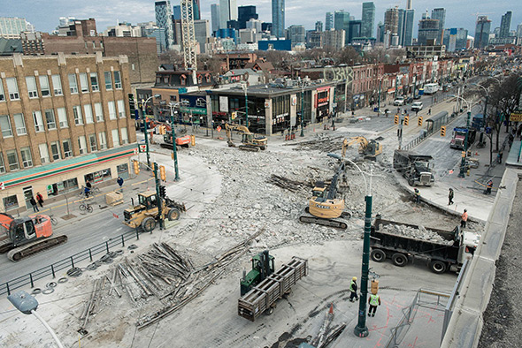
Edmonton's Valley-Line starting up.


UTILITY PREPARATIONS IN RIVER VALLEY

Between Monday, April 13, 2015 and Wednesday, April 15, 2015, City contractors will be operating hydrovacs at sites in the river valley to pinpoint utilities for relocation prior to construction of the Valley Line.

Between Monday, April 13, 2015 and Wednesday, April 15, 2015, City contractors will be using hydrovacs to probe locations in the river valley near the Valley Line alignment.
Probing is being conducted to locate utilities in preparation for relocations.
These utilities must be moved out of the Valley Line right-of-way before construction begins in 2016.
The work will produce some noise, but hydrovac crews will only be at each location for a few hours.
Work will take place between 8:00 a.m. and 6:00 p.m.
Each site will be restored to its original condition after the work is completed.
Some locations may require short-term detours for trail users.
The information in this bulletin is current to April 10, 2015. For more information please check www.edmonton.ca/valleyline, email [email protected] or leave a voicemail at the LRT Projects Message Centre: 780.496.4874.


(http://transformingedmonton.ca/wp-content/uploads/2014/08/Se_stage-1-HQ.jpg)
__________________
"The destructive effects of automobiles are much less a cause than a symptom of our incompetence at city building" - Jane Jacobs 1961ish

Wake me up when I can see skyscrapers
     
     
  #6174  
Old Posted Apr 11, 2015, 3:08 AM
thmx
Guest
 
Posts: n/a
Content removed
     
     
  #6175  
Old Posted Apr 11, 2015, 3:41 AM
TorontoDrew's Avatar
TorontoDrew TorontoDrew is offline
Registered User
 
Join Date: Nov 2014
Posts: 10,633
Quote:
Originally Posted by MalcolmTucker View Post
Why didn't they do this back when Queen's Quay was closed? Open a route to just shut it down again.

It has more to do with how many east west connections they can close down each year. The last two years they closed off Queen and Dundas on Spadina. If they did it all at the same time it would be a traffic nightmare for east west travel. Not that this doesn't make it bad. They work 24/7 though and should have all the work done in 3 weeks. What's more annoying as a cyclist Queens Quay has been a headache for 3 years now and they seem so far from completion and it's supposed to be a model boulevard in time for the Pan Am games. Parts of the rec trail from Queen Quay to the Don have been closed now for 3 years and haven't been touched. They only have 3 months to get them open again and some sections of the closed off trail have trees growing through the paved trail now. Good luck with that!!!!
     
     
  #6176  
Old Posted Apr 11, 2015, 3:43 AM
TorontoDrew's Avatar
TorontoDrew TorontoDrew is offline
Registered User
 
Join Date: Nov 2014
Posts: 10,633
Quote:
Originally Posted by MeIsThomas View Post

Hamilton is going through a renaissance right now and it's fun to watch.
     
     
  #6177  
Old Posted Apr 11, 2015, 3:53 AM
Metro-One's Avatar
Metro-One Metro-One is online now
Registered User
 
Join Date: Sep 2008
Location: Japan
Posts: 17,869
It is great to see so many train projects being undertaken across Canada. Although I do wish Edmonton was going in the direction of more grade separation rather than less.

Here is an update (about 2 or 3 weeks old) of the Evergreen Line.

Quote:
Quote:
Originally Posted by adrianroam95 View Post
An update for Moody Centre Station, taken by me on Thursday:


Quote:
Originally Posted by adrianroam95 View Post
There's also a goldmine of photos (that I think haven't been posted here yet) from the Ministry of Transportation's flickr account:

https://www.flickr.com/photos/tranbc/sets/72157632226282626/

Check out that LIM rail!


Inside the tunnel:


Burquitlam (northbound platform):


More tunnel goodness:


Ring segments. The site is located on the block of Barnet Hwy, Clarke Ave, and Douglas St.


Northbound view from Burquitlam:


North of Lincoln Station:
__________________
Bridging the Gap
Check out my Flickr: https://www.flickr.com/photos/30634635@N03/with/29495547810/ and Youtube channel https://www.youtube.com/channel/UCV0_0h9qKlhxXFxuAey_q6Q
     
     
  #6178  
Old Posted Apr 11, 2015, 4:06 AM
TorontoDrew's Avatar
TorontoDrew TorontoDrew is offline
Registered User
 
Join Date: Nov 2014
Posts: 10,633
Canada's abandoned Monorail.
2 trains collided in the 80's and the zoo was sued so they closed the Monorail for good. Too bad as well becuase for anybody who has been to the Toronto Zoo knows it's a huge sprawling complex that takes you up and down valleys. The Mono-Rail made it easy to get around.

Posted: on blogto.co


Posted on: http://www.fslocal.com/


Posted on: wikimedia.org


Posted on: http://www.retrontario.com/


Posted by: jamica1 on flickr.com


Posted on: http://www.uerev.com/


Posted on: http://transit.toronto.on.ca/


Posted on: http://transit.toronto.on.ca/


Posted on: http://www.pentaxforums.com/


the zoo should turn it into an x-x\ski trail though it does traverse some deep valleys perhaps they don't want to be sued again.
     
     
  #6179  
Old Posted Apr 11, 2015, 3:49 PM
thmx
Guest
 
Posts: n/a
Content removed
     
     
  #6180  
Old Posted Apr 11, 2015, 7:57 PM
miketoronto miketoronto is offline
Registered User
 
Join Date: Jul 2001
Location: Toronto, Ontario, Canada
Posts: 9,932
The Toronto Zoo Monorail was so cool. I remember taking it as a kid, when it was the Metro Zoo .
__________________
Miketoronto
     
     
This discussion thread continues

Use the page links to the lower-right to go to the next page for additional posts
 
 
Closed Thread

Go Back   SkyscraperPage Forum > Regional Sections > Canada
Forum Jump


Forum Jump


All times are GMT. The time now is 3:00 AM.

     
SkyscraperPage.com - Privacy Statement - Top

Powered by vBulletin® Version 3.8.7
Copyright ©2000 - 2026, vBulletin Solutions, Inc.