HomeDiagramsDatabaseMapsForum About
     

Go Back   SkyscraperPage Forum > Regional Sections > Canada > Ontario > Hamilton > Transportation & Infrastructure


Reply

 
Thread Tools Display Modes
     
     
  #2801  
Old Posted Aug 2, 2021, 3:05 PM
TheRitsman TheRitsman is offline
Registered User
 
Join Date: Sep 2017
Location: Hamilton
Posts: 3,055
Quote:
Originally Posted by ShavedParmesanCheese View Post
Everybody likes trolley buses, nobody likes the cables. Even though nowadays they're not as spiderwebby as the vintage photos or TTC might have you believe.

The issue with the poles coming loose was a regular problem for the HSR way back when, particularly at the Queenston traffic circle. But, there are alternatives...


Alternatively: imagine a bus that alternates between using overhead wiring while in service and charging a battery, to just using the battery. Depends on the tech of course, though that could solve the mountain problem...
The only downside of these kinds of catenary is that the old trolley buses could change lanes and the catenary would follow the overhead line, I don't know how the new type would do that.

In Amsterdam they have trams everywhere and I honestly don't find the overhead lines that ugly. In Amsterdam they sometimes attach them to the buildings instead of poles meaning there are far less things littering the street. They also don't have overhead electric lines anywhere like we do, so there are less overhead lines as a result of that too. Something we really should be working on doing when a road is reconstructed.
__________________
Hamilton Downtown. Huge tabletop skyline fan. Typically viewing the city from the street, not a helicopter. Cycling, transit and active transportation advocate 🚲🚍🚋

Follow me on Twitter: https://x.com/ham_bicycleguy?t=T_fx3kIXnr9MISIZNGfD4A&s=09
Reply With Quote
     
     
  #2802  
Old Posted Aug 2, 2021, 3:15 PM
Northern Light Northern Light is offline
Registered User
 
Join Date: Jul 2009
Location: Toronto
Posts: 2,159
Quote:
Originally Posted by Innsertnamehere View Post
What grade is the Claremont access? Anyone know what the max for a standard LRT train is?
The maximum grade capability of any known LRT in North America is 9%. (at at 2009) (for distances greater than 1km)

Access to the mountain at James is 10.8%

Discussed in this report: (for Hamilton)

http://www2.hamilton.ca/NR/rdonlyres/A5E6E5F1-C6AD-4745-A733-166A3EDF079F/0/TechnologyAnalysis.pdf

Refer to p. 34

That particular report discounted the notion of using Claremont as adding too much trip time.

I couldn't find an official source for the Claremont Access road grade, but looking at estimates, and at the grade for the bike trail where it abuts the road; it appears to be in the 5% range.
__________________
An environmentally conscientious, libertarian inclined, fiscally conservative, socialist.
Reply With Quote
     
     
  #2803  
Old Posted Aug 2, 2021, 8:28 PM
swimmer_spe swimmer_spe is offline
BANNED
 
Join Date: Apr 2014
Posts: 10,743
Why not have a rack system installed? It would allow the trains to get up the grade.
Reply With Quote
     
     
  #2804  
Old Posted Aug 2, 2021, 8:44 PM
Beedok Beedok is offline
Exiled Hamiltonian Gal
 
Join Date: Jun 2012
Posts: 6,795
Lisbon seems to hit 13% grades on their system?
Reply With Quote
     
     
  #2805  
Old Posted Aug 2, 2021, 10:21 PM
ScreamingViking's Avatar
ScreamingViking ScreamingViking is offline
Ham-burgher
 
Join Date: Jun 2013
Location: Hamilton
Posts: 7,476
Quote:
Originally Posted by Northern Light View Post
I couldn't find an official source for the Claremont Access road grade, but looking at estimates, and at the grade for the bike trail where it abuts the road; it appears to be in the 5% range.
Based on Google Earth's data, the top of the Claremont (where it splits off between U. James and West 5th) is 183m, and the bottom (where the Wellington and Victoria lanes combine) is 99m. So let's round off and say 85m. Distance between those points is almost 1,500m.

Rise over run = 0.05666, so almost a 5.7% grade.

Between Hunter/Wellington (93m) and the top of the Claremont at Inverness (191m) it's almost 2km distance (1,950m) = 0.05025 so just over 5%
Reply With Quote
     
     
  #2806  
Old Posted Aug 2, 2021, 11:17 PM
Northern Light Northern Light is offline
Registered User
 
Join Date: Jul 2009
Location: Toronto
Posts: 2,159
Quote:
Originally Posted by ScreamingViking View Post
Based on Google Earth's data, the top of the Claremont (where it splits off between U. James and West 5th) is 183m, and the bottom (where the Wellington and Victoria lanes combine) is 99m. So let's round off and say 85m. Distance between those points is almost 1,500m.

Rise over run = 0.05666, so almost a 5.7% grade.

Between Hunter/Wellington (93m) and the top of the Claremont at Inverness (191m) it's almost 2km distance (1,950m) = 0.05025 so just over 5%
In this order:

Thanks! Good work......

And

Hey I didn't make a bad guess....
__________________
An environmentally conscientious, libertarian inclined, fiscally conservative, socialist.
Reply With Quote
     
     
  #2807  
Old Posted Aug 3, 2021, 12:48 AM
Dr Awesomesauce's Avatar
Dr Awesomesauce Dr Awesomesauce is offline
Registered User
 
Join Date: Jan 2010
Location: BEYOND THE OUTER RIM
Posts: 5,889
Quote:
Originally Posted by Beedok View Post
Would running up the Claremont like this be able to work for the same technology as the B-Line? Maybe something like this, with a very short downtown tunnel for turning on to Hunter?
Cool. Not sure a tunnel is necessary, though.

I've also considered running it down Hunter and having a transit hub at the GO Centre. Might not be worth it, however, as it would probably be cheaper to just run it along the existing tracks on King.

How about St Joe's and Mohawk? Shouldn't this line run up W5th to serve those two locations then have it cut back to Upper James at either Fennel or Mohawk?

Lime Ridge seems a reasonable terminus, although it would be even better if there were more housing on site. Running it all the way up to the airport does seem kinda silly for a city the size of Hamilton.
Reply With Quote
     
     
  #2808  
Old Posted Aug 3, 2021, 11:11 AM
Beedok Beedok is offline
Exiled Hamiltonian Gal
 
Join Date: Jun 2012
Posts: 6,795
Quote:
Originally Posted by Dr Awesomesauce View Post
Cool. Not sure a tunnel is necessary, though.

I've also considered running it down Hunter and having a transit hub at the GO Centre. Might not be worth it, however, as it would probably be cheaper to just run it along the existing tracks on King.

How about St Joe's and Mohawk? Shouldn't this line run up W5th to serve those two locations then have it cut back to Upper James at either Fennel or Mohawk?

Lime Ridge seems a reasonable terminus, although it would be even better if there were more housing on site. Running it all the way up to the airport does seem kinda silly for a city the size of Hamilton.
I feel like Metrolinx would insist on serving both GO stations, and the James-King corner would probably be pretty tight. Especially when part of the station is going to be to the west of James, so the A-line wouldn't connect to that at all.

I was debating switching it to West Fifth, but it's only about 250-300m either way, so either route serves the other fairly well.

Lime Ridge could probably turn some parking into condos pretty quickly if it had an LRT station serving it. I do think LRT service out to the airport would probably make sense in the medium term (especially with all the employment planned out there), but GO bus service to bring in customers from across the region first probably makes more sense. Especially a Mount Hope to Niagara Falls bus route. That should already exist, since it's the nearest major Canadian airport to one of the country's most famous travel destinations...
Reply With Quote
     
     
  #2809  
Old Posted Aug 4, 2021, 1:33 AM
Dr Awesomesauce's Avatar
Dr Awesomesauce Dr Awesomesauce is offline
Registered User
 
Join Date: Jan 2010
Location: BEYOND THE OUTER RIM
Posts: 5,889
Quote:
Originally Posted by Beedok View Post
I feel like Metrolinx would insist on serving both GO stations, and the James-King corner would probably be pretty tight. Especially when part of the station is going to be to the west of James, so the A-line wouldn't connect to that at all.

I was debating switching it to West Fifth, but it's only about 250-300m either way, so either route serves the other fairly well.

Lime Ridge could probably turn some parking into condos pretty quickly if it had an LRT station serving it. I do think LRT service out to the airport would probably make sense in the medium term (especially with all the employment planned out there), but GO bus service to bring in customers from across the region first probably makes more sense. Especially a Mount Hope to Niagara Falls bus route. That should already exist, since it's the nearest major Canadian airport to one of the country's most famous travel destinations...
Reply With Quote
     
     
  #2810  
Old Posted Aug 6, 2021, 12:20 PM
thistleclub thistleclub is offline
Registered User
 
Join Date: Mar 2008
Posts: 3,729
Quote:
Originally Posted by Beedok View Post
Would running up the Claremont like this be able to work for the same technology as the B-Line? Maybe something like this, with a very short downtown tunnel for turning on to Hunter?
Technology is only part of the challenge.

The B-Line LRT recommended itself because of population and employment density alongside proven ridership levels (~40% of the system's fares derive from five key routes that substantially overlap).

Ridership on A-Line routes amounts to around a third of the B-Line. Two-thirds of that ridership has historically accrued between the Waterfront and Mohawk College, and most of that core ridership is realistically found between King and Fennell.

So around half of this route might be vestigial from a ridership perspective.

Looking forward to the north-south sequel to the bus lane pilot, though!
__________________
"Where architectural imagination is absent, the case is hopeless." - Louis Sullivan

Last edited by thistleclub; Aug 6, 2021 at 12:34 PM.
Reply With Quote
     
     
  #2811  
Old Posted Oct 3, 2021, 6:41 AM
mikevbar1 mikevbar1 is offline
Registered User
 
Join Date: Dec 2017
Posts: 216
Not sure if anyone's suggested something like this before, but I was looking at the city on google Earth (as one does) and began wondering about all that industrial-era track we have laid. Before the LRT, were there ever investigations into using the existing railways in the city as a form of transit? Knowing that the GO network is mostly built on track bought/leased from CN/other carriers, I began wondering if the same tracks around our city centre could have ben turned into some sort of metro- one so cheap, we wouldn't even need to lay a lot of track. Furthermore, the current Government has actively been making it EASIER to run trains along such existing track already, so if we ever wanted to do it, it would only get easier from here.

Obviously, not all this track is available for free use, which is probably a large part of why were' building the LRT. However, GO has proven that running alongside inconsistent trains is an acceptable reality and that leasing is more than viable for just getting people from point A to B. Now, I am no train expert so I can't say if there are trains that could run on such track safely, quickly, or consistently. What I picture is LRT/metro-like capacity vehicles running on existing track, carrying people to and from the two downtown GO stations. GO trains might be the model here, but their obviously too big for this, hence the need for a smaller train-perhaps a modified GO train with a few fewer cars. I'll try to attempt a rough map of what I am describing.

This kind of rail-reuse seems viable mostly because Metrolinx is already doing it on a larger scale. Now the question of demand is obviously the most important factor here, and with a future LRT we have our transit bases covered. However this could offer a potential low-cost 'metro' for Hamilton that involves laying minimal track to supplement a future Hamilton experiencing rapid growth. Naturally, upgrades/connections will only be made if an initial run has any success, so maybe something like this already has existed, in which case I'd love to hear about it.

Hypothetically, what's the harm in having the city operate a few shortened GO trains between West Harbour and Confederation, or Centre GO and some future station(s) anywhere along that long stretch of track? Both of these sections might need additional track/regrades over road, but the cost of that is likely minimal compared to clearing land and laying brand-new tracks altogether. A more interesting discussion might be how, when or why we might ever need such retrofitted lines for just Hamilton, but the prospect is definitely appealing. pardon my photoshop skills, but I threw this together to illustrate what I think such a system could look like on existing tracks and a few (hopefully low-cost) stations. [IMG][/IMG]

Obviously this is all vision, not based on any actual plans. Thats especially true for all the stations I drew and rail extensions (dotted lines); just fantasy for where I figured a reasonable distance apart might be.

Last edited by mikevbar1; Oct 3, 2021 at 6:45 AM. Reason: clarity
Reply With Quote
     
     
  #2812  
Old Posted Oct 3, 2021, 1:07 PM
Beedok Beedok is offline
Exiled Hamiltonian Gal
 
Join Date: Jun 2012
Posts: 6,795
I think GO is pushing those rail lines to the maximum amount they can use them for passenger traffic already? You could probably sneak a smidge more commuter grade transit out to Stoney Creek along the downtown line, with a bit of negotiation, but Hamilton’s rail network is very heavily used for freight. Getting the hourly service to West Harbour took GO building significant extra rail infrastructure for freight usage.
Reply With Quote
     
     
  #2813  
Old Posted Oct 3, 2021, 2:51 PM
ShavedParmesanCheese's Avatar
ShavedParmesanCheese ShavedParmesanCheese is offline
Registered User
 
Join Date: Oct 2020
Location: Ontario
Posts: 370
For a long time, the tracks you've highlighted did have passenger services, starting all the way back when the Great Western and TH&B were the 2 railways in town.

70 years ago you could take the blue route from Hunter St. all the way to Grand Central in New York, if you changed in Buffalo. The red and orange routes have always had passenger services, be it from the GWR, GTR, CN, GO, VIA, or Amtrak. though only in the past 30 years did they avoid stopping in Hamilton.

The route that's since been torn up - the one along Ferguson and up the mountain - also used to have passenger services south to Port Dover, back when CN was in the passenger buisness.

That cyan route too used to have passenger services. The length from Toronto - Dundas used to have Amtrak services from Toronto - Chicago / Detroit, but cutbacks 30~ years ago ended that service, and I think arsonists burnt the station down?

The only route here that's never seen a passenger train is the pink one. That siding has always existed so that TH&B (eventually CP) could get from their mainline on the foot of the mountain to the mills at the harbour. The line snakes around houses, over level crossings, and goes right from the Kinnear Yard on Gage Ave. to the mills on Beach Rd. It doesn't even connect to the CN mainline - https://maps.app.goo.gl/qSLP5aRsFnF5vxAD6

If you had the political willpower, most of these routes could realistically return to passenger services. With Amtrak doing... something... about reinstating Toronto - Detroit - Chicago services... eventually... it'll take its original route through London, Brantford, and use the CN mainline through Dundas. Though there aren't any plans to build another station, it wouldn't be impossible to add one in the future.

The red and orange routes are the easiest in that the process to bringing them up to snuff is already in the works, though with fewer stops. All these tracks are best suited for Intercity travel, since it's very difficult to reliably stop and start something as huge as a GO train, and share the tracks with the freight railways. I do remember seeing a fantasy GO map with stops at Dundurn and Gage, which would be good stopping points for people who need to get into the East / West ends, although with the LRT the convenience might not be worth the investment to the powers that be...

To get reliable passenger services back to the blue route, you'd have to twin the line. Past the Kinnear Yard or so that's just a single track. It wouldn't be impossible, however, because the planners of old had the foresight to design the crossings in the east end with increased trackage in mind. There's space for a second track that's never been used where it passes over Kenilworth, and that's been there since the 50s. Had that not been there it would've added a huge cost to this plan.

We're very fortunate in Hamilton to still have most of our old railways in use, and the tracks still there. Intercity trains to Stoney Creek, Dundas, and the East End are possible, all they need is the political willpower and something to win over the freight railways to share their tracks. That's what prevented us from having reliable GO service for so long. Most of these routes were originally built for both freight and passenger, and with a little bit of investment and a whole lot of steel, they can be that way again. Except for part of that pink route, that's always been for freight and you already know any investment would get some ire from the neighbours.

(Actually this map somewhat reminds me of the B.L.A.S.T network, with routes downtown that extend off to the periphery. Some of these tracks won't be able to reliably handle frequent passenger trains (curse you Bayview Jct) so the tracks from Hamilton to Dundas or Waterdown aren't best suited for the services. An extended B-Line and the L-Line portions of the B.L.A.S.T network, though? Could do the job easier and with more direct routing.)
__________________
Ask me about my radioactive materials
Reply With Quote
     
     
  #2814  
Old Posted Oct 3, 2021, 7:47 PM
mikevbar1 mikevbar1 is offline
Registered User
 
Join Date: Dec 2017
Posts: 216
Quote:
Originally Posted by ShavedParmesanCheese View Post
For a long time, the tracks you've highlighted did have passenger services, starting all the way back when the Great Western and TH&B were the 2 railways in town.

70 years ago you could take the blue route from Hunter St. all the way to Grand Central in New York, if you changed in Buffalo. The red and orange routes have always had passenger services, be it from the GWR, GTR, CN, GO, VIA, or Amtrak. though only in the past 30 years did they avoid stopping in Hamilton.

The route that's since been torn up - the one along Ferguson and up the mountain - also used to have passenger services south to Port Dover, back when CN was in the passenger buisness.

That cyan route too used to have passenger services. The length from Toronto - Dundas used to have Amtrak services from Toronto - Chicago / Detroit, but cutbacks 30~ years ago ended that service, and I think arsonists burnt the station down?

The only route here that's never seen a passenger train is the pink one. That siding has always existed so that TH&B (eventually CP) could get from their mainline on the foot of the mountain to the mills at the harbour. The line snakes around houses, over level crossings, and goes right from the Kinnear Yard on Gage Ave. to the mills on Beach Rd. It doesn't even connect to the CN mainline - https://maps.app.goo.gl/qSLP5aRsFnF5vxAD6
This is fantastic feedback and exactly what I was looking for, so thanks a ton. This brings alot of clarity into what is admittedly an urban facet I haven't really explored (trains and train hobbyism in general). The best thing I heard here was that while not particularly easy, such transportation is possible given the assets at hand, which is perhaps more influential in the decision-making for this than anything else. I did have a hunch that in our city's storied railroad history that these railroads had been used for transit, perhaps more along track that simply doesn't exist anymore. I was aware of the many 'old' connections Hamilton used to have as a critical junction in the Great Lakes region, but I was not aware these are still in use/could be easily retrofitted . Thats the beauty of rail I suppose!


Quote:
Originally Posted by ShavedParmesanCheese View Post
If you had the political willpower, most of these routes could realistically return to passenger services. With Amtrak doing... something... about reinstating Toronto - Detroit - Chicago services... eventually... it'll take its original route through London, Brantford, and use the CN mainline through Dundas. Though there aren't any plans to build another station, it wouldn't be impossible to add one in the future.

The red and orange routes are the easiest in that the process to bringing them up to snuff is already in the works, though with fewer stops. All these tracks are best suited for Intercity travel, since it's very difficult to reliably stop and start something as huge as a GO train, and share the tracks with the freight railways. I do remember seeing a fantasy GO map with stops at Dundurn and Gage, which would be good stopping points for people who need to get into the East / West ends, although with the LRT the convenience might not be worth the investment to the powers that be...

To get reliable passenger services back to the blue route, you'd have to twin the line. Past the Kinnear Yard or so that's just a single track. It wouldn't be impossible, however, because the planners of old had the foresight to design the crossings in the east end with increased trackage in mind. There's space for a second track that's never been used where it passes over Kenilworth, and that's been there since the 50s. Had that not been there it would've added a huge cost to this plan.

We're very fortunate in Hamilton to still have most of our old railways in use, and the tracks still there. Intercity trains to Stoney Creek, Dundas, and the East End are possible, all they need is the political willpower and something to win over the freight railways to share their tracks. That's what prevented us from having reliable GO service for so long. Most of these routes were originally built for both freight and passenger, and with a little bit of investment and a whole lot of steel, they can be that way again. Except for part of that pink route, that's always been for freight and you already know any investment would get some ire from the neighbours.
As you examined my 'lines' more critically, I had never really assumed much traffic was present beyond my orange and blue tracks, and they are definitely where I would want to start if anything like this were ever considered based on their existing viability. Now, becoming a regional rail hub for the lakes again would be fantastic, but that might be out of the scope of this for the time being, since that would require coordination on a scale I doubt we would see for a long time. Because of the headstart on the red/orange track by GO, the best track to begin building/improving would likely be the blue track. It's unfortunate the track reaching the mountain is almost entirely gone, as that would be perfect for LRT/metro scale trains to bring residents downtown. While I did create another fantasy map showing where the future track could be laid, I haven't shared it because its frankly too idealistic without anything concrete to the plan at hand. Knowing that the Kinnear section and onward is one track only, I would argue the first step in the Hamilton 'metro' would be to buy out/run along that section of track alone. It's perhaps the ripest railyard for redevelopment in the lower city besides CN's waterfront, which as discussed here/some other thread is probably not going to be available for some time (of course there is a GO station there as well, so no need to build a new station anyway).

I'll quickly address the pink and cyan lines since I am more interested in discussing the blue line. Pink is obviously fantasy but is the closest Hamilton could get to a downtown loop of transit. I heavily debated including it, but decided to simply because it would be the most expensive, but also most useful line if built. The risk-reward is highest here, but was simply worth considering for the sheer connectivity it could offer. Thinking larger for a moment, many cities would kill for a metro loop like seen in chicago, even though this would be nothing close in terms of quality or service (early on at least...).

The blue line offers the most potential IMO because it has a much more feasible cost-reward ratio. I dont know how much it would cost to do what you have suggested, ie adding a second track and perhaps regrading elevating sections, but it would certainly cost less than doing the same to the pink line. The blue track runs along the escarpment, which can bring back the age-old discussions about transit along and for the mountain. While trying to remain cost-effective, I would say adding a mountain pedestrian access to a mid-escarpment station would perhaps be out of the question cost-wise depending on the track elevation and geography of the area. However, given enough time that should become the model for stations along that track specifically. Feeding commuters to the mountain brow towards mid-escarpment stations is far easier than building new transit between the two elevations; see the 'other' LRT line for Upper James and the long-canceled Monorail with an underground station on Fennel. If the Blue line were to be extended West and merged with the red or cyan lines, that is certainly viable as well; every line in the original image exists to mostly highlight track options, passenger-used today or not.

Admittedly I have ignored the political aspect of this kind of project, primarily because It's so beyond what our city is capable of producing that even trying to suggest it would require firsthand intervention. I am a planning undergrad so that is certainly in my scopes, but I don't want to even think about working for our city without acquiring credentials to cut through the Hamilton BS first. For the purposes of this discussion, I'd love to keep it to the engineering/feasibility, since we obviously must know whether or not we can add commuter transit before deciding whether or not we should. With that being said, I have two small points regarding cost/viability Im still curious about and will hopefully act as discussion points going forward ontop of what's already been mentioned.

1. Cost-effective stations and platforms
After watching the many recent videos about the GO system's viability/rationale, it seems obvious that a big hurdle to building stations (especially for a cash-strapped Hamilton) is the parking and auto-centric amenities required. Not Just Bike's video on GO highlighted Bloomington GO as an ultra-expensive station that despite It's amenities has only 2(?) platforms. Learning from such sunk costs, it would be both cost-effective and better for the city to perhaps exclusively build stations with platforms and little else- not a GO station, but maybe closer to some TTC stations (Haven't been on the TTC so I can't say if their surface stations are a worthy reference).

2. The Trains
What trains are right for this kind of project? I know almost nothing about trains themselves; track grade/width, fuel/engine type, min/max lengths, etc. I assume these tracks are all non-electrified except for maybe the red/orange sections. This brings up a few questions, primarily what locomotives should be used, and what (if any) modifications need to be made to the track they run on. This is less about adding track since that's already a given; rather, what can be run on Hamilton's existing track in this case. Starting/stopping a GO train as mentioned is hard, but an LRT/subway-sized vehicle is much different from that. A brief google search on diesel metros didn't reveal too much to me and is probably outdated tech anyway, but there has to be some model worth following and replicating to fill the niche. hence I am calling upon other posters to help me fill in this gap if anyone has the knowledge.

Now obviously this is alot of thought and effort being put into something that is currently redundant, but I want to examine the angles by which we might assess commuter transit implementation for the city of Hamilton. This fantasy holds water IMO because it could be an uber-cost effective method of transit; if the costs begin to exceed that of just building new LRT lines (in the case of the Blue line, cyan, pink, etc) then it Isn't worth discussing. Instead, I wonder if this is a hidden asset we could easily use to greatly improve the QoL in Hamilton with added transit connectivity previously reserved for very large cities. This opportunity is also rare, so it is no wonder we haven't seen anyone else do it besides for true regional railways like the GO network. With that being said, Toronto doesn't have the same frequency of track crisscrossing the inner city that Hamilton does. There's union station and the subways yes, but the track from Union extends much farther out from downtown than ours do. I picture it like the same tracks GO has been using, but made snack-sized for Hamilton. Other cities could experiment with this as well, but the prerequisite is inner-city track being frequent enough and in good enough condition to feasibly do it. Hamilton is also lucky to be the only rustbelt city that comes to mind that could see demand for such transit, being denser and overall more prosperous than Buffalo, Cleveland, Gary, hell pretty much any rustbelt city short of Pittsburgh.

Last edited by mikevbar1; Oct 3, 2021 at 8:03 PM.
Reply With Quote
     
     
  #2815  
Old Posted Oct 3, 2021, 10:46 PM
ShavedParmesanCheese's Avatar
ShavedParmesanCheese ShavedParmesanCheese is offline
Registered User
 
Join Date: Oct 2020
Location: Ontario
Posts: 370
Quote:
Originally Posted by mikevbar1 View Post
This is fantastic feedback and exactly what I was looking for, so thanks a ton. This brings alot of clarity into what is admittedly an urban facet I haven't really explored (trains and train hobbyism in general). The best thing I heard here was that while not particularly easy, such transportation is possible given the assets at hand, which is perhaps more influential in the decision-making for this than anything else. I did have a hunch that in our city's storied railroad history that these railroads had been used for transit, perhaps more along track that simply doesn't exist anymore. I was aware of the many 'old' connections Hamilton used to have as a critical junction in the Great Lakes region, but I was not aware these are still in use/could be easily retrofitted . Thats the beauty of rail I suppose!
I often tell my friends how happy I am that certain periods of Hamilton's history happened when they did, because of what we were left with as a result. Things like exploding as a manufacturing centre before WWII, leaving us with a wealth of railway connections, even after losing so much of that network. Imagine a maze of sidings and spurs like at the Harbour, but downtown, for example.

Quote:
As you examined my 'lines' more critically, I had never really assumed much traffic was present beyond my orange and blue tracks, and they are definitely where I would want to start if anything like this were ever considered based on their existing viability. Now, becoming a regional rail hub for the lakes again would be fantastic, but that might be out of the scope of this for the time being, since that would require coordination on a scale I doubt we would see for a long time. Because of the headstart on the red/orange track by GO, the best track to begin building/improving would likely be the blue track. It's unfortunate the track reaching the mountain is almost entirely gone, as that would be perfect for LRT/metro scale trains to bring residents downtown. While I did create another fantasy map showing where the future track could be laid, I haven't shared it because its frankly too idealistic without anything concrete to the plan at hand. Knowing that the Kinnear section and onward is one track only, I would argue the first step in the Hamilton 'metro' would be to buy out/run along that section of track alone. It's perhaps the ripest railyard for redevelopment in the lower city besides CN's waterfront, which as discussed here/some other thread is probably not going to be available for some time (of course there is a GO station there as well, so no need to build a new station anyway).
Back when places like Hamilton Pressed Brick and Lawson Lumber actually had active operations, it made sense to have a freight yard at this junction, same as CN's yard by Dundurn Castle. Of course, neither are in the best place nowadays, and both companies are in no short supply of other real estate for a replacement. Problem with the Blue Line is it's still CP's mainline, and their only route into Niagara and Buffalo. It can't be the same scenario as Ottawa's O-train, where the city bought out a disused freight line, we'd sadly have to share.

Quote:
The blue line offers the most potential IMO because it has a much more feasible cost-reward ratio. I dont know how much it would cost to do what you have suggested, ie adding a second track and perhaps regrading elevating sections, but it would certainly cost less than doing the same to the pink line. The blue track runs along the escarpment, which can bring back the age-old discussions about transit along and for the mountain. While trying to remain cost-effective, I would say adding a mountain pedestrian access to a mid-escarpment station would perhaps be out of the question cost-wise depending on the track elevation and geography of the area. However, given enough time that should become the model for stations along that track specifically. Feeding commuters to the mountain brow towards mid-escarpment stations is far easier than building new transit between the two elevations; see the 'other' LRT line for Upper James and the long-canceled Monorail with an underground station on Fennel. If the Blue line were to be extended West and merged with the red or cyan lines, that is certainly viable as well; every line in the original image exists to mostly highlight track options, passenger-used today or not.
I confess I'm not entirely sure which route you're talking about, I assume you meant the old H&LE/CN line up the mountain, that's now a trail? It would be a very valuable connection for the upper & lower cities and beyond, but oh man would that be an impossible sell. Apart from geological concerns, complaints from the mansions at the top of the mountain, and everybody else who adores the trail, it's awfully narrow, only wide enough for one track. Restoring passenger service to that route is something I've thought about before, and it would be a mammoth undertaking. Really, any new access for the east mountain is incredibly difficult, there's a reason the only way up (the Kenilworth Access) is 90 years old, and the line out to Port Dover took 40 years and bankrupted 3 companies in the process. Connecting the East End and East Mountain is a tricky topic and certainly worth it's own discussion.

Quote:
Admittedly I have ignored the political aspect of this kind of project, primarily because It's so beyond what our city is capable of producing that even trying to suggest it would require firsthand intervention. I am a planning undergrad so that is certainly in my scopes, but I don't want to even think about working for our city without acquiring credentials to cut through the Hamilton BS first. For the purposes of this discussion, I'd love to keep it to the engineering/feasibility, since we obviously must know whether or not we can add commuter transit before deciding whether or not we should. With that being said, I have two small points regarding cost/viability Im still curious about and will hopefully act as discussion points going forward ontop of what's already been mentioned.
I swear it's like I'm talking to myself. If COVID never happened I would be in University right now, also in for planning. I'm still going to, of course, just taking a gap year right now. Which university are you at? I have my prospects lined up and I'm curious to see how they compare.

I too want to make a difference with the city & it's transportation, so I'm also aiming to eventually run for office within the council eventually. Though I agree it's important to get some credentials and familiarize yourself with the process first, so I plan to get into the city's planning department beforehand. I honestly think I'd prefer the department to the city council, though one has more influence over the other, unfortunately.

I'd also appreciate to keep the politics out of this, since we both know all that would amount to is some sort of reiteration of the phrase "With this council? Yeah that'll never happen", and what fun is that?

Quote:
1. Cost-effective stations and platforms
After watching the many recent videos about the GO system's viability/rationale, it seems obvious that a big hurdle to building stations (especially for a cash-strapped Hamilton) is the parking and auto-centric amenities required. Not Just Bike's video on GO highlighted Bloomington GO as an ultra-expensive station that despite It's amenities has only 2(?) platforms. Learning from such sunk costs, it would be both cost-effective and better for the city to perhaps exclusively build stations with platforms and little else- not a GO station, but maybe closer to some TTC stations (Haven't been on the TTC so I can't say if their surface stations are a worthy reference).
I saw that NJB video too, it's a great take on an aspect of the system that we in Hamilton don't see much of. That Bloomington GO though... oy vey. It only has one platform and track

There's no way the city will be able to finance this without help from above, and a utilitarian design for the stations will certainly help sell the project, and bring costs down. Have you seen the stations the regional services they have in the NE in the states, like NJ transit or the regional services in Philly? They have a lot of very simple stations, usually nothing more than a waiting shelter, platforms, and a big sign to tell you where you are. Of course, being the states, you're at no shortage for parking either, but that's not as integral to station design as with some of the GO stations.

Another place for inspiration are some of the very rural stations in the UK and France. For example, the least-used station in all of the UK is a delightfully dower and derelict-looking place called Redcar British Steel - here's a photo:


The bones don't get much barer than that, eh? These will be small, local stations, so they don't need much in the way of amenities. Give the people a space to lock their bikes, somewhere to stick a service map, and a place to get out of the rain, and that's all you need.

Quote:
2. The Trains
What trains are right for this kind of project? I know almost nothing about trains themselves; track grade/width, fuel/engine type, min/max lengths, etc. I assume these tracks are all non-electrified except for maybe the red/orange sections. This brings up a few questions, primarily what locomotives should be used, and what (if any) modifications need to be made to the track they run on. This is less about adding track since that's already a given; rather, what can be run on Hamilton's existing track in this case. Starting/stopping a GO train as mentioned is hard, but an LRT/subway-sized vehicle is much different from that. A brief google search on diesel metros didn't reveal too much to me and is probably outdated tech anyway, but there has to be some model worth following and replicating to fill the niche. hence I am calling upon other posters to help me fill in this gap if anyone has the knowledge.
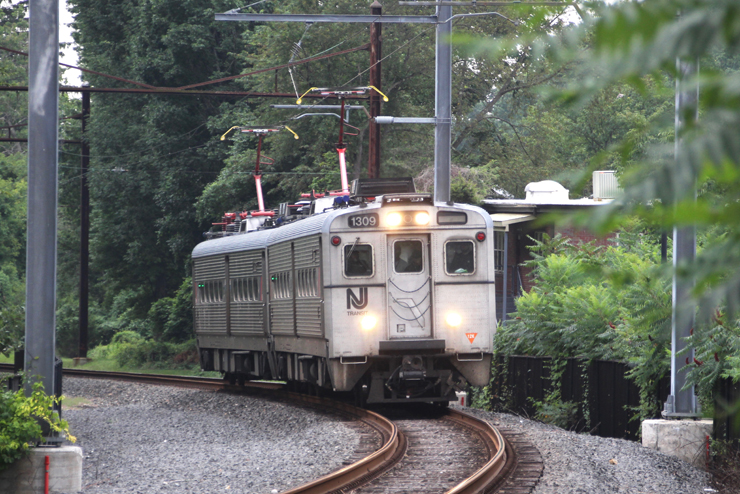
Way back when, TH&B ran a daytripper service from Hunter St. to Toronto. They used self-propelled DMU (diesel multiple units) railbusses, called Budd cars, after the manufacturer in Philly. They were usually 2 carriages that moved under their own power, and were best suited for the lower passenger levels, which otherwise wouldn't make best usage of the typical diesel intercity train used by GO or VIA. In fact, if you want an example still in use today, I can think of two lines that actively use similar tech in NA -

Sudbury - White River, which uses the very same rolling stock as the aforementioned service;


Princeton - Princeton Junction, nicknamed the Princeton Dinky;


As you can see, they're able to be electrified as well.

These sorts of rolling stock are the best choice when conventional intercity trains aren't suitable. It wouldn't be necessary to have an entire diesel engine pull a service so small (Sudbury-White River) or for such a small distance (Princeton Dinky) so these would be the go-to for a network of this size, and one that stops so frequently. If demand increases or decreases, reflect that in how many carriages you couple/de-couple.

Quote:
Now obviously this is alot of thought and effort being put into something that is currently redundant, but I want to examine the angles by which we might assess commuter transit implementation for the city of Hamilton. This fantasy holds water IMO because it could be an uber-cost effective method of transit; if the costs begin to exceed that of just building new LRT lines (in the case of the Blue line, cyan, pink, etc) then it Isn't worth discussing. Instead, I wonder if this is a hidden asset we could easily use to greatly improve the QoL in Hamilton with added transit connectivity previously reserved for very large cities. This opportunity is also rare, so it is no wonder we haven't seen anyone else do it besides for true regional railways like the GO network. With that being said, Toronto doesn't have the same frequency of track crisscrossing the inner city that Hamilton does. There's union station and the subways yes, but the track from Union extends much farther out from downtown than ours do. I picture it like the same tracks GO has been using, but made snack-sized for Hamilton. Other cities could experiment with this as well, but the prerequisite is inner-city track being frequent enough and in good enough condition to feasibly do it. Hamilton is also lucky to be the only rustbelt city that comes to mind that could see demand for such transit, being denser and overall more prosperous than Buffalo, Cleveland, Gary, hell pretty much any rustbelt city short of Pittsburgh.
This sort of fantasy project is one that really interests me because of how possible it is. Really, the biggest hurdle is human, rather than monetary. If you can get complete and total support from the city and province, you won't even need to beg the Feds for contribution. That's not to say this sort of project would be cheap, something I totally forgot to mention is in order to introduce meaningful passenger services on CP's track, you'd need to widen the 3 block Hunter Street Tunnel. At present it's only wide enough for a single track, and despite being only 3 block long, it's in such a high populated area and it's over a century old, so that undertaking in of itself is incredibly tricky. It's a part of the reason why they built West Harbour GO and used that as the station to introduce all-day GO service.

Hamilton truly is blessed and cursed by it's geography It's truly unique and I haven't yet seen another city like it. It's blessed in the gorgeous and interesting landscape in which to build a city in the first place, allowing for things like a thriving industrial harbour and quiet (before the Skyway at least) beach community, almost cottage country, to exist at the same time, and not interfere with each other. Funny enough, the trail along the beach also used to be a freight line.

These blessings are also curses, but not something impossible to work around. If they could build a complex freight & passenger network 120 years ago, we can do the very same with some investment and political willpower. This sort of topic is really, really complex, so to properly do all parts of it justice we'd have to go one thing at a time. Though from my signature I'm sure you can tell I wouldn't mind that.
__________________
Ask me about my radioactive materials
Reply With Quote
     
     
  #2816  
Old Posted Oct 4, 2021, 7:05 PM
mikevbar1 mikevbar1 is offline
Registered User
 
Join Date: Dec 2017
Posts: 216
Quote:
Originally Posted by ShavedParmesanCheese View Post
I often tell my friends how happy I am that certain periods of Hamilton's history happened when they did, because of what we were left with as a result. Things like exploding as a manufacturing centre before WWII, leaving us with a wealth of railway connections, even after losing so much of that network. Imagine a maze of sidings and spurs like at the Harbour, but downtown, for example.

Back when places like Hamilton Pressed Brick and Lawson Lumber actually had active operations, it made sense to have a freight yard at this junction, same as CN's yard by Dundurn Castle. Of course, neither are in the best place nowadays, and both companies are in no short supply of other real estate for a replacement. Problem with the Blue Line is it's still CP's mainline, and their only route into Niagara and Buffalo. It can't be the same scenario as Ottawa's O-train, where the city bought out a disused freight line, we'd sadly have to share.
A unique history indeed! In many ways that rail history could be turned around into a model for transit and connectivity in post-manufacturing cities, and your showing new facets of that with every post. By the time the line and yard is available for purchase, the LRT should be complete and the merits of additional E/W connections will be a lot stronger. I completely agree with your first point about our unique history and conditions, as Its part of what makes Hamilton so great. I think there's something about Hamilton worth loving, even if a bit rough around the edges. I'd say Hamilton is the 'good ending' of many rustbelt cities, where manufacturing remains present and the working-class neighborhoods retain their charm.

Quote:
Originally Posted by ShavedParmesanCheese View Post
I confess I'm not entirely sure which route you're talking about, I assume you meant the old H&LE/CN line up the mountain, that's now a trail? It would be a very valuable connection for the upper & lower cities and beyond, but oh man would that be an impossible sell. Apart from geological concerns, complaints from the mansions at the top of the mountain, and everybody else who adores the trail, it's awfully narrow, only wide enough for one track. Restoring passenger service to that route is something I've thought about before, and it would be a mammoth undertaking. Really, any new access for the east mountain is incredibly difficult, there's a reason the only way up (the Kenilworth Access) is 90 years old, and the line out to Port Dover took 40 years and bankrupted 3 companies in the process. Connecting the East End and East Mountain is a tricky topic and certainly worth it's own discussion.
This is where I figured I would lose you and anyone else reading my post haha. While that H&LE/CN line is certainly useful and I don't understand why such a challenging feat would be removed, I actually am referring to canceled plans for a monorail in Hamilton from the 1970s. It was never even close to being built mind you, but I got the info from the fantastic Unbuilt Hamilton book. I'll try to find some images online and post them later, or just take pictures from the book directly if I can't find any. In essence, the federal govt was experimenting with monorail tech or something like that as a cheaper, less intensive form of urban transit. We were going to have mostly elevated stations across the lower city and presumably the mountain as well, and Fennell would have had the only submerged station. Now, for why we don't have the monorail...

Typical Hamilton sob story. I like telling people this one because it gets people in a very YIMBY mindset, but basically, the tech behind the monorail was mostly seen as experimental, unproven or at least questionable already- so once Hamiton was chosen/won the contract (not sure which), the city erred on the side of caution to avoid a white elephant. Vancouver alternatively saw no such qualms with the system, and that is how they got their monorail system.

...Yup. Vancouver's monorail, the robust and effective people moving network that everyone associates with them, was rejected by Hamilton.

Anyhow...

I brought the monorail up partially to illustrate how mountain-downtown connections could be possible by manipulating access to the station rather than modifying the track/platforms. That being said, after looking at these sections of track (my blue line) you couldn't create any meaningful connections to the mountain in the present day. I was alluding to pedestrian elevators/stairs/escalators under the pretense that the track runs somewhere along the middle of the escarpment, with say ~20m to the bottom and probably ~40m to the mountain. Obviously, this track (in most spots, but especially at this railyard) does not actually go that far up at all, especially without the actual mountain track. I am curious about why that is no longer present though; I'm sure there was a good reason it fell into disuse, but being such a crucial and costly connection surely didn't merit abandoning.

Quote:
Originally Posted by ShavedParmesanCheese View Post
I swear it's like I'm talking to myself. If COVID never happened I would be in University right now, also in for planning. I'm still going to, of course, just taking a gap year right now. Which university are you at? I have my prospects lined up and I'm curious to see how they compare.

I too want to make a difference with the city & it's transportation, so I'm also aiming to eventually run for office within the council eventually. Though I agree it's important to get some credentials and familiarize yourself with the process first, so I plan to get into the city's planning department beforehand. I honestly think I'd prefer the department to the city council, though one has more influence over the other, unfortunately.
I'm currently at the University of Waterloo in the School of Planning. It's unique as a planning undergrad degree, whereas most are postgrad/graduate degrees afaik. The good news is the curriculums should be the same at a University level regardless of which level you choose to start since University-level planning is actually a relatively new phenomenon for Canadian schools. Overall Its a good program; they made it difficult for me to transfer, but direct application is much easier. I can't speak to all the classes yet of course, but it mostly seeks to touch on the various aspects of planning and the fields that accompany planning decisions. So, you will end up learning a lot about Ecology, Economics, and the history of planning, and some popular urban philosophies for the first while. One thing I have been able to tell, not just from myself but from professors and various academic sources, is that Planning as a true Discipline is very much in its infancy. Its academic 'base' is very broad, but it is mostly a field concerned with synthesizing knowledge from other fields and applying it effectively- and that's with more abstract definitions. We are still very much transitioning away from the very policy-first fill-in-the-blank type planners of the past, and so there's little innovation happening as much as we just look at what works and what does not. The good thing about this is that every time you think "I wonder if someone has thought of this?" the answer is that they probably haven't, or at least not for a long time. Using true academic resources and expertise is also a bit of a rarity; sure I learn economics, but I am not adapting economics for planning (yet). I personally want to see planning flesh out its academic side, creating concrete, empirical and quantifiable measures, and analysis along with access to academic research to create a rigorous science of human habitat and systems.

Because this hasn't happened yet, I encourage you to pursue planning as best you can. People who actually care about urban planning, believe it or not, are rare; most people don't even understand what it is or are not in tune with planning trends for lack of a better term. The vast majority of students in my program seem to have a more general interest in its facets rather than the goals of planning. Think 'I like economics and the environment; planning offers students that while also producing something bigger than just those two things. What this means though is that a sizable portion of planning students will end up fitting a mold whether we mean to put them in one or not. That DOES however leave a lot of room for people who actually care, like you or me. In many ways, the best way to do anything in urban planning might be to just get directly involved like you said, perhaps with an academic basis being secondary or not required at all. Call it a knack of mine, but anyone who is at least somewhat understanding of modern planning principles and what works/does not work can easily criticize a city's practices or even their Master Plan with obvious oversights coming from a lack of rigorous inquiry. This doesn't mean we are geniuses; rather it further illustrates the lack of care and bureaucracy of the field, which screams opportunity for those who want real change in their communities. Politics will slow down our ability to perform proper planning across all of its concerns, but nothing is stopping a planning-conscious person from running for a position in the city. Hell, a lot of our problems stem from the fact that a lot of our elected officials don't know much of anything; they were elected by the people based on campaigns and political motivations, not by a team of academic evaluators, after all.

This is a bit of an unrelated tangent so I will cut it off there, but the main takeaway is that entering planning has a lot of superficial barriers that are quite easy to see through. Planning as a true discipline, at least in NA, is in its infancy, and that means there are a lot fewer barriers to entry for passionate individuals.


Quote:
Originally Posted by ShavedParmesanCheese View Post
I saw that NJB video too, it's a great take on an aspect of the system that we in Hamilton don't see much of. That Bloomington GO though... oy vey. It only has one platform and track

There's no way the city will be able to finance this without help from above, and a utilitarian design for the stations will certainly help sell the project, and bring costs down. Have you seen the stations the regional services they have in the NE in the states, like NJ transit or the regional services in Philly? They have a lot of very simple stations, usually nothing more than a waiting shelter, platforms, and a big sign to tell you where you are. Of course, being the states, you're at no shortage for parking either, but that's not as integral to station design as with some of the GO stations.

Another place for inspiration are some of the very rural stations in the UK and France. For example, the least-used station in all of the UK is a delightfully dower and derelict-looking place called Redcar British Steel - here's a photo:


The bones don't get much barer than that, eh? These will be small, local stations, so they don't need much in the way of amenities. Give the people a space to lock their bikes, somewhere to stick a service map, and a place to get out of the rain, and that's all you need.
NJB's video is nice as it's a reminder that GO Isn't a miracle system. However, his videos have started to bug me as there is a little too much pretentious Europe pandering and too little empirical assessment of the network as a whole. Before getting too off-topic again, NJB is just pretentiously comparing Toronto/GTA/GTHA to the pinnacles of urban planning (him and his dutch cities ) when he should be empirically assessing system effectiveness, perhaps compared to other systems of similar scope and scale. Think of all the economic planning that has taken place around the GO network; urban designated growth zones, rapid densification, cars off the road (even if they're parked, they didn't drive to Toronto; only to their GO station), and more. Like, he's not even remotely aware of how dramatically the GO system has already improved, and how monumental some other changes are. This leads to a disingenuous portrayal that makes GO feel like the same as other American heavy rail systems, which is untrue because like so much else, Toronto/GTA is actually quite innovative on the planning front. GO sees consistently high ridership, and it makes money. Sure lateral connections could too, but that is a recent change in demand. It's just a pointless thing to focus on when such a large urban region is connected by rail and continues to improve the economies across it. There were perhaps many years when Hamilton's GO trains were all that kept our population from leaving for somewhere better and sending us past the point of no return.

Now about those stations. They're perfect! In fact, we could probably 'splurge' a little more considering how inflated transit costs become when your typical GO station has an ocean of parking. Stations like those (a platform, shelter, maybe some occupiable space above/below) are space and cost-efficient, and I am glad you knew what is needed. A lot of the costs in such projects are artificially raised by regulations and requirements that are often arbitrary (parking mins of course come to mind). For that reason, European stations (and networks as a whole) are a great model to follow going forward. There must be cities comparable in size to Hamilton that have multiple rail lines. Searching for such systems is also easy because reference cities don't even have to be the same size; just the same density and a similarly sized area of focus.

While we probably can't cut costs to ludicrously cheap levels, there is a case to be made that if stations run a certain % over budget, it is because of institution XYZ and they should take on some of that cost as a result. There's a lot to be said for the economic/financial aspect of planning; I want to believe that at least one reason it is so expensive to build new rail systems is that tracks must be laid on land already owned, which is a ridiculous requirement in urban areas with high land costs. Now I am absolutely not suggesting market intervention or abandoning the market system; quite the opposite. For one reason or another, there has been no foray into innovative economic/financial policy around land use to make infrastructure building easier, at least not on a large and easily replicable scale. IF such a solution is ever found, then ideally the cost of building new systems would be 90% materials and construction/labour, and only a small remainder being land-related. I do not know what such a system could look like so I'll keep it on the shelf for now.


Quote:
Originally Posted by ShavedParmesanCheese View Post
Way back when, TH&B ran a daytripper service from Hunter St. to Toronto. They used self-propelled DMU (diesel multiple units) railbusses, called Budd cars, after the manufacturer in Philly. They were usually 2 carriages that moved under their own power, and were best suited for the lower passenger levels, which otherwise wouldn't make best usage of the typical diesel intercity train used by GO or VIA. In fact, if you want an example still in use today, I can think of two lines that actively use similar tech in NA -

Sudbury - White River, which uses the very same rolling stock as the aforementioned service;


Princeton - Princeton Junction, nicknamed the Princeton Dinky;


As you can see, they're able to be electrified as well.

These sorts of rolling stock are the best choice when conventional intercity trains aren't suitable. It wouldn't be necessary to have an entire diesel engine pull a service so small (Sudbury-White River) or for such a small distance (Princeton Dinky) so these would be the go-to for a network of this size, and one that stops so frequently. If demand increases or decreases, reflect that in how many carriages you couple/de-couple.

This sort of fantasy project is one that really interests me because of how possible it is. Really, the biggest hurdle is human, rather than monetary. If you can get complete and total support from the city and province, you won't even need to beg the Feds for contribution. That's not to say this sort of project would be cheap, something I totally forgot to mention is in order to introduce meaningful passenger services on CP's track, you'd need to widen the 3 block Hunter Street Tunnel. At present it's only wide enough for a single track, and despite being only 3 block long, it's in such a high populated area and it's over a century old, so that undertaking in of itself is incredibly tricky. It's a part of the reason why they built West Harbour GO and used that as the station to introduce all-day GO service.


Hamilton truly is blessed and cursed by it's geography It's truly unique and I haven't yet seen another city like it. It's blessed in the gorgeous and interesting landscape in which to build a city in the first place, allowing for things like a thriving industrial harbour and quiet (before the Skyway at least) beach community, almost cottage country, to exist at the same time, and not interfere with each other. Funny enough, the trail along the beach also used to be a freight line.

These blessings are also curses, but not something impossible to work around. If they could build a complex freight & passenger network 120 years ago, we can do the very same with some investment and political willpower. This sort of topic is really, really complex, so to properly do all parts of it justice we'd have to go one thing at a time. Though from my signature I'm sure you can tell I wouldn't mind that.
I now know its only a matter of time before I become a train geek. Not only is this interesting, but it is also directly applicable and relevant to our goals and the goals of the fantasy network. I was initially worried we would have to find some way to adapt true heavy rail for metro use, which is probably as terrible as it sounds. If that was where we were at, then it would be no surprise Hamilton doesn't have this metro. However, you posted some really fantastic-sized rolling stock that occupies the niche perfectly. Keeping individual trains small also presumably helps with fuel/track demands as well; smaller trains mean less energy expenditure, less track manipulation, and shorter platforms. Purely on a visual level, I love the Sudbury train and the Princeton Dicky, and while I'd personally modify them for a modern context, they have the 'bones' and the visual proportions I'd associate with this scale.

This project does seem more than doable now. Not all transit is to be built to demand; sometimes you have to induce it. There are two ways I see that working.

First, you can shift even more HSR ridership off busses and onto these trains (perhaps more so my orange/pink/cyan lines than Blue) primarily because they serve different corridors than the LRT. I was thinking about the demand-side of this alot in the last day, and I think we underestimate how dense and 'big city'-like Hamilton is. As we mentioned, the railroads crisscross our downtown, and the lower city as a whole extends quite far East. To me, that indicates lots of historical growth, which translates to 'good bones'. A good baseline of density is thus already established in Hamilton, and we are already familiar with that. Remember, the reason Hamilton isn't such a sprawling mess is that we are bisected by a f*cking cliff. We are in a ridiculously good geographic position for trade and industry, and the lower city very rapidly expanded about as far as it could in either direction before looking to the mountain. Therefore, the idea of densifying the lower city as a whole more should be logical for any urban planner in Hamilton. Everything short of the airport is down there, and the mountain is hard to get to anyway. While some might argue that this is over intensification for the lower city while neglecting the mountain, we don't necessarily have the financial means to just build rail wherever we want. It is simply easiest to build new infrastructure where land is flat, and (unique to Hamilton) that means both points A and B need to be flat.

Second is the 'induced' demand component, which is in some ways a crux of the Orange/Blue lines if they are ever built. because the most obvious corridor will have an LRT, the other two trains should serve specific regions of the lower city. The orange line is better for East end and Stoney Creek Waterfront residents seeking to get to West harbour or just the industrial zones for work. This line is still quite industrial, so a mix of encouraging nearby neighborhoods and upzoning would help in fleshing out demand for the areas between West Harbour and Confederation GO. I certainly think it is present, but the neglect of the area will just require some work. Now for the Blue line, ignoring any N/S modifications it would mostly serve residents near the escarpment. This is actually mostly low-rise housing, but is closer to Hamilton's population median line per se, if such a line exists. The Blue line would also go right to center GO, so it features better access to people employed in downtown Hamilton than West harbour. I imagine some properties in the Stinson/St. Clair area is quite desirable already, and so I will concede temporarily to NIMBYs here (not to get preferential, I do think that these more desirable neighborhoods would put up more a fight in upzoning though and that is not something we need on top of the other challenges of the fantasy line). The real benefits would come towards Blakely/Delta West, where people would now be able to easily commute downtown from places like Gage Park or King st E. I am not terribly well versed in the demographics of this area, but using transit as a vessel to improve the local economics/circumstances would help integrate normally NIMBY residents and share the economic benefits with them for generations to come. Of course, this also means densification and the questions of gentrification, but since this is all theoretical I won't get caught up in that now. The line continues eastward into Stoney Creek, and while I don't end up there very often I do know that driving from the West side of downtown to say King/centennial isn't particularly easy or enjoyable. Making it a transit corridor instead might not be improving commutes as much as it will encourage people to commute at all; now, one could turn a 20-minute drive into a 10-minute train ride.

Because Hamilton is relatively compact, the line does quite quickly run into new-ish suburbs ripe for intensification. Inner-city neighborhoods are one thing, but I have little qualms about upzoning empty lots amidst sprawling suburbia. We are particularly lucky for that, and we are also lucky to have a pristine urban model like the GTA to steal notes from. While 20 years of intensification has rendered the corridors and centers approach outdated (and almost dystopic) in the GTA, Hamilton still has plenty of room to use that philosophy before heights begin to get squeezed by the zoning limits. Toronto is proof that we can densify while preserving existing communities at least in the short-medium term, but it is not a long-term solution.

My favorite part about this is that I can get the stamp of approval from others like yourself! It's one thing for me to come and suggest an off-kilter idea, but we have proved, at least in a forum space, that transit planning can get alot more creative than we are led to believe. We aren't approaching this with hubris or ignorance; like most forum members here, it is a plan grounded in reality to a reasonable extent. That to me illustrates the status of planning best; good ideas are far from exhausted, and the people in charge don't even have them most of the time. This post I mostly got into the surrounding factors about such a system and deviated a bit from rail and trains in some spots, but I chalk that up to moving on from the 'engineering of the project to the utility and demand of it. I personally believe that Hamilton should be trying to invest in fringe infrastructure as much as possible, mostly because of all the unique factors you and I have discussed that separate it from alot of cities. We have lost ground to make up for, and I am quite confident our housing market is about to see a ridiculous squeeze and a subsequent skyscraper boom in the coming decades due to Toronto's zoning being pushed to its absolute limits. That is a topic for another time, but it affirms that when our leaders won't plan for the future, we will have to take up the mantle.

Also, pardon the long response times- I am still in school and unfortunately, they haven't given me a grant to research this project's viability, so I can't get paid to post-Yet. LOL. I'll try to find some pictures/drawings of what our monorail was supposed to be and post them as a separate entry here sometime soon.
Reply With Quote
     
     
  #2817  
Old Posted Oct 5, 2021, 6:05 AM
ShavedParmesanCheese's Avatar
ShavedParmesanCheese ShavedParmesanCheese is offline
Registered User
 
Join Date: Oct 2020
Location: Ontario
Posts: 370
Quote:
Originally Posted by mikevbar1 View Post
A unique history indeed! In many ways that rail history could be turned around into a model for transit and connectivity in post-manufacturing cities, and your showing new facets of that with every post. By the time the line and yard is available for purchase, the LRT should be complete and the merits of additional E/W connections will be a lot stronger. I completely agree with your first point about our unique history and conditions, as Its part of what makes Hamilton so great. I think there's something about Hamilton worth loving, even if a bit rough around the edges. I'd say Hamilton is the 'good ending' of many rustbelt cities, where manufacturing remains present and the working-class neighborhoods retain their charm.
There's an alternate universe where I'm going to school to work at the HPL, somewhere I could properly use for research to get all that I know about the city onto print. I like to tell my friends that I can give a history, usually brief but not always, on any area of the city that they show me. Though I do hate to brag, so I'll just say that of any city in the province, Hamilton is incredibly underrated, it's truly weathered the effects of the Rust Belt better than any of it's industrial peers, excepting Toronto and Chicago, though they were hardly the industrial centres they once were by the time the 90s rolled around. We're much better off than Cleveland, Gary, Detroit, Toledo, Akron, one could even make the argument for places like Buffalo.

Quote:
This is where I figured I would lose you and anyone else reading my post haha. While that H&LE/CN line is certainly useful and I don't understand why such a challenging feat would be removed, I actually am referring to canceled plans for a monorail in Hamilton from the 1970s. It was never even close to being built mind you, but I got the info from the fantastic Unbuilt Hamilton book. I'll try to find some images online and post them later, or just take pictures from the book directly if I can't find any. In essence, the federal govt was experimenting with monorail tech or something like that as a cheaper, less intensive form of urban transit. We were going to have mostly elevated stations across the lower city and presumably the mountain as well, and Fennell would have had the only submerged station. Now, for why we don't have the monorail...
Ah yes, the old ICTS proposal, I know all about that. I have Unbuilt Hamilton as well, though I heard about the proposal before I bought it. A crown corp for the province (the same people who had the CLRV's built for the TTC) came up with a new experimental transport alternative, but like you said only Vancouver wanted it... and Scarborough.

Quote:
Typical Hamilton sob story. I like telling people this one because it gets people in a very YIMBY mindset, but basically, the tech behind the monorail was mostly seen as experimental, unproven or at least questionable already- so once Hamiton was chosen/won the contract (not sure which), the city erred on the side of caution to avoid a white elephant. Vancouver alternatively saw no such qualms with the system, and that is how they got their monorail system.

...Yup. Vancouver's monorail, the robust and effective people moving network that everyone associates with them, was rejected by Hamilton.
I don't know how to feel about the ICTS, honestly. I've seen pictures of what the tracks would look like as they looped downtown, and they just don't have the same... appeal as L's in say, Chicago or Brooklyn or The Bronx. If nothing else, would've utterly ruined King William St., though it certainly wasn't the hip destination back then. I don't think we as a city would've ended up with something like the Skytrain, that system had the budget to build something worth celebrating. Rather, I think we would've ended up with the technology most specifically used in the TTC's line 4 in Scarborough, a technology that's due to be entirely replaced by the end of the decade. To me it illustrates the urban planning ideals of the mid century, which in a word was segregation. There's a reason why contemporary depictions of the future showed different separated avenues for people/cars/trucks/transportation, why Jackson Square is so horrible for the streetscape, and why Montreal has the underground city. That's a whole other story, though

Quote:
Anyhow...

I brought the monorail up partially to illustrate how mountain-downtown connections could be possible by manipulating access to the station rather than modifying the track/platforms. That being said, after looking at these sections of track (my blue line) you couldn't create any meaningful connections to the mountain in the present day. I was alluding to pedestrian elevators/stairs/escalators under the pretense that the track runs somewhere along the middle of the escarpment, with say ~20m to the bottom and probably ~40m to the mountain. Obviously, this track (in most spots, but especially at this railyard) does not actually go that far up at all, especially without the actual mountain track. I am curious about why that is no longer present though; I'm sure there was a good reason it fell into disuse, but being such a crucial and costly connection surely didn't merit abandoning.
The reason the tracks up the mountain were removed is because of Nanticoke, actually. Something to do with decreased traffic between Stelco's Hamilton and Lake Erie works, plus the lack of passenger services for decades at that point, not to mention CN's privatization around the same time. It's a cocktail of misfortune.

Getting up and down the mountain has always been a challenge, though I think looking again to the past might help with the out-of-the-box thinking this problem would need to solve. Two words - Incline Railways.

I'm sure you've heard of these. There were two, the Hamilton & Barton Incline Railway (on James St.) and the Hamilton East End Incline Railway (on Wentworth - show's how long ago this is) and a 3rd planned for Ottawa St. which, despite sounding like a funicular, was really just a platform that went up and down the mountain 120 years ago. This is a tricky subject, because really no matter what tech you choose, it risks falling into the niche of novelty. Though, I think a modern funicular with the right capacity could prove to be a valuable alternative to shoving more busses up the access roads, or even digging a tunnel up at Ottawa St, like mentioned in Unbuilt Hamilton. The busiest funicular in the world is in Naples, and despite being 93 years old, can work as inspiration for our issue:
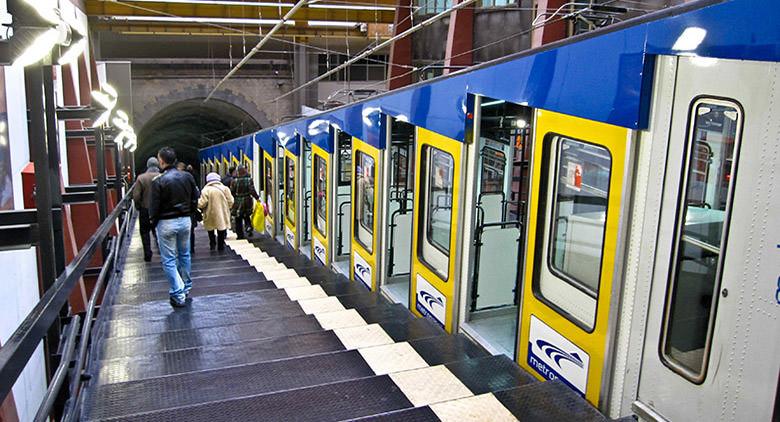


Though to have any high-capacity system that isn't just for novelty, I think we'd truly have to design a system unique on Earth. Where else is there a city our size bisected by a 30 storey cliff? Of course, we can't forget about disabled accessibility as well, like there weren't enough problems...

Quote:
I'm currently at the University of Waterloo in the School of Planning. It's unique as a planning undergrad degree, whereas most are postgrad/graduate degrees afaik. The good news is the curriculums should be the same at a University level regardless of which level you choose to start since University-level planning is actually a relatively new phenomenon for Canadian schools. Overall Its a good program; they made it difficult for me to transfer, but direct application is much easier. I can't speak to all the classes yet of course, but it mostly seeks to touch on the various aspects of planning and the fields that accompany planning decisions. So, you will end up learning a lot about Ecology, Economics, and the history of planning, and some popular urban philosophies for the first while.
I don't believe it. Waterloo is my top school! all according to plan, I'll be in the same classes next September. Good to know I'm not the only one who's interested in the classes they offer. If you don't mind, how long have you been at Waterloo? I might have some questions you could answer later on.

Quote:
One thing I have been able to tell, not just from myself but from professors and various academic sources, is that Planning as a true Discipline is very much in its infancy. Its academic 'base' is very broad, but it is mostly a field concerned with synthesizing knowledge from other fields and applying it effectively- and that's with more abstract definitions. We are still very much transitioning away from the very policy-first fill-in-the-blank type planners of the past, and so there's little innovation happening as much as we just look at what works and what does not. The good thing about this is that every time you think "I wonder if someone has thought of this?" the answer is that they probably haven't, or at least not for a long time.
The scale in which we build and regulate our cities has never been as high in history as it is now. It's interesting to see the extent in which planned communities have changed in the past centuries. Savannah, GA was a planned community, here's the original design called the Oglethorpe Plan circa 1730 -


...this is what counted as a planned community 300 years ago it was a cellular system, centred on a public square, surrounded by houses and shops. No mention of what the streets would look like, be it how wide or narrow, the sizes of the sidewalks, which vehicles are allowed, nothing of the sort. This plan is successful and would create Savannah's town centre, probably the only part of the city worth visiting. It's interesting how our best parts of cities are the ones that weren't planned at all - Places like old Quebec City come to mind - things that in the post-industrial age sadly can't be replicated naturally, as it now needs quite the opposite - careful, meticulous intervention. Something that, like you said, isn't common for a discipline only now coming out of it's infancy of importance, as well as popularity.

Quote:
Using true academic resources and expertise is also a bit of a rarity; sure I learn economics, but I am not adapting economics for planning (yet). I personally want to see planning flesh out its academic side, creating concrete, empirical and quantifiable measures, and analysis along with access to academic research to create a rigorous science of human habitat and systems.
Imagine a time when town planners and experts in the field are almost as respected as their medicinal counterparts town planning is a profusely complex study, since it incorporates all facets of our lives and society. It concerns economics, history, botany, zoology, and even psychology - there's a reason we find Norilsk depressing after all.

Quote:
Because this hasn't happened yet, I encourage you to pursue planning as best you can. People who actually care about urban planning, believe it or not, are rare; most people don't even understand what it is or are not in tune with planning trends for lack of a better term.
Can I get this on a mug? I swear, the amount of Armchair Urban Planners out there probably outnumber the real planners by a startling margin. Its incredible just how much people out in the suburbs appear to know about something that, in truth, they really really don't. I'm sure you've seen this on perfect display with the utterly asinine things people who live south of the Linc have to say against the LRT.

Quote:
The vast majority of students in my program seem to have a more general interest in its facets rather than the goals of planning. Think 'I like economics and the environment; planning offers students that while also producing something bigger than just those two things. What this means though is that a sizable portion of planning students will end up fitting a mold whether we mean to put them in one or not. That DOES however leave a lot of room for people who actually care, like you or me. In many ways, the best way to do anything in urban planning might be to just get directly involved like you said, perhaps with an academic basis being secondary or not required at all. Call it a knack of mine, but anyone who is at least somewhat understanding of modern planning principles and what works/does not work can easily criticize a city's practices or even their Master Plan with obvious oversights coming from a lack of rigorous inquiry. This doesn't mean we are geniuses; rather it further illustrates the lack of care and bureaucracy of the field, which screams opportunity for those who want real change in their communities.
There it is. That's why I'm so firmly committed to this career path - the opportunity and potential at our disposal to create simple, enjoyable living spaces, both in general and living in a city so rich to the town planner as Hamilton. In a strange sort of way, I can almost appreciate how asinine some of the city's planning decisions have been, because they can act as a beginning point for study. It's very easy to look at what doesn't work in a city. It's a different thing to figure out the why. We know Main being 5 lanes one-way is a horrible idea. But the reasons why might begin at the simple answers of it being horribly dangerous to the pedestrian, and eventually extend to complex notions of inviting streetscapes and noise pollution. These sorts of analyses fascinate me.

Quote:
Politics will slow down our ability to perform proper planning across all of its concerns, but nothing is stopping a planning-conscious person from running for a position in the city. Hell, a lot of our problems stem from the fact that a lot of our elected officials don't know much of anything; they were elected by the people based on campaigns and political motivations, not by a team of academic evaluators, after all.
This is the hell in which the town planner lives every day. The people who make the decisions aren't qualified to do them, and their priorities are never on the right side. It feels like a medical professional during times of COVID

Despite having dreams of bringing a wrecking ball to a few of his legacy projects, I deeply admire Victor Copps. Without him, downtown Hamilton would not be the beast it is today, for better or (usually) for worse. I can't dislike his ideas in a contemporary sense, because what he and his council built 50 years ago were in line with the segregatory ideals of the time. What I admire about both him and Lloyd Jackson was their ability to not only dream, but do. For Christ's sake, in order to alleviate congestion on Burlington St., they just built a second street on top of the original! That would be an unthinkable idea today, but the Burlington St. overpass is one of the more minor of the public works projects of the time!! Imagine instead of a council ripping itself apart over something as (to the city's coffers) trivial as the Aviary's 50,000$ budget, there was one who actually wanted to get the flock out of it's temporary home in Westdale of 26 years.

Though, I already know this would end in me red in the face at our incompetent politicians, so I better bite my tongue.

Quote:
This is a bit of an unrelated tangent so I will cut it off there, but the main takeaway is that entering planning has a lot of superficial barriers that are quite easy to see through. Planning as a true discipline, at least in NA, is in its infancy, and that means there are a lot fewer barriers to entry for passionate individuals.
Good idea. It's already taking me an hour to type these replies. Not that I don't want to, I very much enjoy being able to go into this much detail over something I'm so very interested in - I'm putting the rest of my life into this discipline after all Urban planning in NA might not have as many academic requirements or precedents as in Europe, but it's problems stem from handling of the public - people just don't seem to know what they should want.

Quote:
NJB's video is nice as it's a reminder that GO Isn't a miracle system. However, his videos have started to bug me as there is a little too much pretentious Europe pandering and too little empirical assessment of the network as a whole. Before getting too off-topic again, NJB is just pretentiously comparing Toronto/GTA/GTHA to the pinnacles of urban planning (him and his dutch cities ) when he should be empirically assessing system effectiveness, perhaps compared to other systems of similar scope and scale. Think of all the economic planning that has taken place around the GO network; urban designated growth zones, rapid densification, cars off the road (even if they're parked, they didn't drive to Toronto; only to their GO station), and more. Like, he's not even remotely aware of how dramatically the GO system has already improved, and how monumental some other changes are. This leads to a disingenuous portrayal that makes GO feel like the same as other American heavy rail systems, which is untrue because like so much else, Toronto/GTA is actually quite innovative on the planning front. GO sees consistently high ridership, and it makes money. Sure lateral connections could too, but that is a recent change in demand. It's just a pointless thing to focus on when such a large urban region is connected by rail and continues to improve the economies across it. There were perhaps many years when Hamilton's GO trains were all that kept our population from leaving for somewhere better and sending us past the point of no return.
NJB makes some quality content, but for somebody born in London and so enthusiastic about this field of study, you're so right in that he doesn't properly weigh the good and the bad of the system. Each suburban GO station, in a vacuum, sucks. That's plain to see. But when out of the vacuum and back to the real world does it turn out to not be so horrible - every summer for nearly 20 years my family has gone to the CNE. Without the GO trains we would have to drive all the way to the exhibition grounds, clogging up the Gardiner, and likely having to fight for a spot in the hypothetical massive parkade that would have to exist on the grounds. In the past, all we've had to do is drive to Burlington and take the train straight to the action. Now, with GO trains reliably to West Harbour, when the CNE is (hopefully) on again in 2022, we won't even need to drive to reliably get to the station. NJB also didn't go into the future of the system, apart from the Garage-Mahal in Bloomington, which would serve as a nice change to the otherwise constant flow of apparent distaste for the system.

Think about the stations that in the future will have just as frequent of service as the suburban seas of parking - namely Hunter St, West Harbour, Guelph, and Kitchener. These stations are all in urban centres, minimal (or none at all) parking facilities, and once electrified (eventually) will be just as good as any mid-sized town's station on the Deutsche Bahn.

Quote:
Now about those stations. They're perfect! In fact, we could probably 'splurge' a little more considering how inflated transit costs become when your typical GO station has an ocean of parking. Stations like those (a platform, shelter, maybe some occupiable space above/below) are space and cost-efficient, and I am glad you knew what is needed. A lot of the costs in such projects are artificially raised by regulations and requirements that are often arbitrary (parking mins of course come to mind). For that reason, European stations (and networks as a whole) are a great model to follow going forward. There must be cities comparable in size to Hamilton that have multiple rail lines. Searching for such systems is also easy because reference cities don't even have to be the same size; just the same density and a similarly sized area of focus.
There is something to be said about the arbitrary inflation of costs for higher-order transportation on the continent. Remember when the province tried to feed us the utter crock that the LRT would cost 5,500,000,000$ to build? or that the 2nd Ave. Subway in New York costs about 3,800,000,000$ per mile. Arbitrary hoops and utterly unnecessary regulations like parking mins and setback rules only jack up the cost of construction, not to mention the price of all that red tape. Cutting all of that away, we would actually be able to build more enjoyable stations with greater amenities, likely a little station building for buying tickets and keeping out of the rain. Perhaps something not unlike the size and scale Port Hope's VIA station, though with amenities befitting this century


Quote:
While we probably can't cut costs to ludicrously cheap levels, there is a case to be made that if stations run a certain % over budget, it is because of institution XYZ and they should take on some of that cost as a result. There's a lot to be said for the economic/financial aspect of planning; I want to believe that at least one reason it is so expensive to build new rail systems is that tracks must be laid on land already owned, which is a ridiculous requirement in urban areas with high land costs. Now I am absolutely not suggesting market intervention or abandoning the market system; quite the opposite. For one reason or another, there has been no foray into innovative economic/financial policy around land use to make infrastructure building easier, at least not on a large and easily replicable scale. IF such a solution is ever found, then ideally the cost of building new systems would be 90% materials and construction/labour, and only a small remainder being land-related. I do not know what such a system could look like so I'll keep it on the shelf for now.
I won't pretend to be an economist or land-speculator, so forgive my ideas if they end up wrong - I think part of the reason why costs are so impossibly high is due to how much land you're required to own, and how little you're required to alter in order to build anything. Perhaps this is just anecdotal, but one of the most pertinent examples of this phenomenon is how many properties Metrolinx was required to purchase entirely, when a lot of which they could have just bought a portion. Take the dearly departed Atlantic Subs, on King St. and Sherman Ave. - https://goo.gl/maps/MGM6CcgAJkpgVukVA - There is absolutely no way this building would interfere in construction. But, because buying portions of land cannot be done, the business had to go. I'm convinced this sort of land management in regards to public works projects is a recent thing, because of how storefronts along Queenston Rd. have been build suspiciously 1 car-width away from the sidewalk, as if to accommodate a hypothetical widened road. Though, I don't have anything concrete to back those up, so just theories they remain.

Quote:
I now know its only a matter of time before I become a train geek. Not only is this interesting, but it is also directly applicable and relevant to our goals and the goals of the fantasy network.
Welcome to the heart-wrenching world of North American train enthusiasm, where the 90's were worse than the depression. In fact, I'm in a depression whenever I see the before and after of the VIA network from the '95/'98 service cuts.

Quote:
I was initially worried we would have to find some way to adapt true heavy rail for metro use, which is probably as terrible as it sounds. If that was where we were at, then it would be no surprise Hamilton doesn't have this metro. However, you posted some really fantastic-sized rolling stock that occupies the niche perfectly. Keeping individual trains small also presumably helps with fuel/track demands as well; smaller trains mean less energy expenditure, less track manipulation, and shorter platforms. Purely on a visual level, I love the Sudbury train and the Princeton Dinky, and while I'd personally modify them for a modern context, they have the 'bones' and the visual proportions I'd associate with this scale.
I'm sure if I ventured over to a railway enthusiast's forum in France or Germany, they'd point me towards some modern versions of the examples I sent. Alas, our railways haven't been good since the 60's, so they're the first that come to mind. I'm sure if you just type in Railbus and scroll through the photos, there's bound to be the perfect rolling stock out there, probably in Japan. A great benefit to using these shorter trains primarily is you can still run enormous intercity trains on the shorter platforms on occasion, you just have to tell passengers that they're only boarding from XY&Z carriages.

Quote:
This project does seem more than doable now. Not all transit is to be built to demand; sometimes you have to induce it. There are two ways I see that working.
At this point I should just have "if you build it, they will come" bound to a hotkey somehow for the amount of times I've had to repeat something to that effect to others online who dismiss transport projects for everything not on systems bursting at the seams.

Quote:
First, you can shift even more HSR ridership off busses and onto these trains (perhaps more so my orange/pink/cyan lines than Blue) primarily because they serve different corridors than the LRT. I was thinking about the demand-side of this alot in the last day, and I think we underestimate how dense and 'big city'-like Hamilton is. As we mentioned, the railroads crisscross our downtown, and the lower city as a whole extends quite far East. To me, that indicates lots of historical growth, which translates to 'good bones'. A good baseline of density is thus already established in Hamilton, and we are already familiar with that. Remember, the reason Hamilton isn't such a sprawling mess is that we are bisected by a f*cking cliff. We are in a ridiculously good geographic position for trade and industry, and the lower city very rapidly expanded about as far as it could in either direction before looking to the mountain. Therefore, the idea of densifying the lower city as a whole more should be logical for any urban planner in Hamilton. Everything short of the airport is down there, and the mountain is hard to get to anyway. While some might argue that this is over intensification for the lower city while neglecting the mountain, we don't necessarily have the financial means to just build rail wherever we want. It is simply easiest to build new infrastructure where land is flat, and (unique to Hamilton) that means both points A and B need to be flat.
One of the beauties of Hamilton's geography is how constricting it is to sprawl. On the one side you have the big damn cliff, and on the other side is one of the largest lakes on Earth Despite what the opposition might bemoan, everything there is to do in Hamilton is down the mountain, so like you said it's only logical to intensify this area first. Additionally, it provides easier access to the surrounding towns as well - somebody from Dundas or lower Stoney Creek is in for a long ride if they want to go to Lime Ridge. We can increase ridership on this hypothetical metro by stealing part of what the BLAST network aims to do - to connect the communities on the periphery with the city centre. Through significant investment, this network if built tomorrow would offer the greatest connectivity between downtown Hamilton and Stoney Creek... well, ever, and with downtown Dundas, something not enjoyed since the interurban went out of business 95 years ago - and in a fraction of the time.

Quote:
Second is the 'induced' demand component, which is in some ways a crux of the Orange/Blue lines if they are ever built. because the most obvious corridor will have an LRT, the other two trains should serve specific regions of the lower city. The orange line is better for East end and Stoney Creek Waterfront residents seeking to get to West harbour or just the industrial zones for work. This line is still quite industrial, so a mix of encouraging nearby neighborhoods and upzoning would help in fleshing out demand for the areas between West Harbour and Confederation GO. I certainly think it is present, but the neglect of the area will just require some work. Now for the Blue line, ignoring any N/S modifications it would mostly serve residents near the escarpment. This is actually mostly low-rise housing, but is closer to Hamilton's population median line per se, if such a line exists. The Blue line would also go right to center GO, so it features better access to people employed in downtown Hamilton than West harbour. I imagine some properties in the Stinson/St. Clair area is quite desirable already, and so I will concede temporarily to NIMBYs here (not to get preferential, I do think that these more desirable neighborhoods would put up more a fight in upzoning though and that is not something we need on top of the other challenges of the fantasy line). The real benefits would come towards Blakely/Delta West, where people would now be able to easily commute downtown from places like Gage Park or King st E. I am not terribly well versed in the demographics of this area, but using transit as a vessel to improve the local economics/circumstances would help integrate normally NIMBY residents and share the economic benefits with them for generations to come. Of course, this also means densification and the questions of gentrification, but since this is all theoretical I won't get caught up in that now. The line continues eastward into Stoney Creek, and while I don't end up there very often I do know that driving from the West side of downtown to say King/centennial isn't particularly easy or enjoyable. Making it a transit corridor instead might not be improving commutes as much as it will encourage people to commute at all; now, one could turn a 20-minute drive into a 10-minute train ride.
Downtown or indeed cross-city access from the areas surrounding the blue line are difficult. I have a friend who lives in Rosedale, and he has to take a half hour walk from his house to mine, and that's before we even set out to our actual destination. With the blue line, meeting downtown or indeed any of the other areas of the city that are now easily accessible is incredibly different for us two, as well as getting home at the end of the day as well. What for him was once a long ride on the length of the 5A/B/C/D/E is now a quick train ride, that doesn't have to make so many turns through residential streets. The area surrounding the blue line at present is desirable for upzoning and intensification, and that's by sheer proximity to the LRT. Add this metro network, and King St south of the delta could turn out to be it's own commercial destination, not unlike the size and scale of James or Ottawa. Think of the potential!

Quote:
Because Hamilton is relatively compact, the line does quite quickly run into new-ish suburbs ripe for intensification. Inner-city neighborhoods are one thing, but I have little qualms about upzoning empty lots amidst sprawling suburbia. We are particularly lucky for that, and we are also lucky to have a pristine urban model like the GTA to steal notes from. While 20 years of intensification has rendered the corridors and centers approach outdated (and almost dystopic) in the GTA, Hamilton still has plenty of room to use that philosophy before heights begin to get squeezed by the zoning limits. Toronto is proof that we can densify while preserving existing communities at least in the short-medium term, but it is not a long-term solution.
What we are most fortunate for, especially living in the lower city, is having the foundation for intensification already built and sitting there for the better part of 120 years Commercial avenues like Ottawa and Kenilworth don't need significant changes in the zoning map to triple the heights of their buildings and increase foot traffic. To accommodate the increased demand for living space, one need only to increase the density of residential lots adjacent to the Kenilworth or Ottawa corridors. imagine side-streets like Grosvenor or or Croswaithe with low-rise apartment blocks, not unlike those you see in surplus in Montreal or even Shawinigan. In fact, this sort of planning works throughout the lower city, because in part to the existing infrastructure, as well as the uniform grid. It would be a much taller order to do this in Stoney Creek or along Upper Wentworth, though not impossible...

Quote:
My favorite part about this is that I can get the stamp of approval from others like yourself! It's one thing for me to come and suggest an off-kilter idea, but we have proved, at least in a forum space, that transit planning can get alot more creative than we are led to believe. We aren't approaching this with hubris or ignorance; like most forum members here, it is a plan grounded in reality to a reasonable extent. That to me illustrates the status of planning best; good ideas are far from exhausted, and the people in charge don't even have them most of the time. This post I mostly got into the surrounding factors about such a system and deviated a bit from rail and trains in some spots, but I chalk that up to moving on from the 'engineering of the project to the utility and demand of it. I personally believe that Hamilton should be trying to invest in fringe infrastructure as much as possible, mostly because of all the unique factors you and I have discussed that separate it from alot of cities. We have lost ground to make up for, and I am quite confident our housing market is about to see a ridiculous squeeze and a subsequent skyscraper boom in the coming decades due to Toronto's zoning being pushed to its absolute limits. That is a topic for another time, but it affirms that when our leaders won't plan for the future, we will have to take up the mantle.
I can't tell you how many times I've complained about something of this nature and ended it with "just give me 30 years, I'll fix it." I'm sure somebody would find it admirable how perspicacious you or I are into this topic, something most people don't give frequent thought about. We're living in the beginning of a construction boom in the city not seen since the 1970's, and this time we have the opportunity to use that to create a city for it's people, rather than their cars.

The ideas you've put forth are possible. They have a lot of potential for something so cheap to build and with pre-existing infrastructure, I'm somewhat embarrassed that I've never looked at it this way myself The only thing somebody can reasonably say is in the way are those who make these decisions in the first place.

Just give me 30 years

Quote:
Also, pardon the long response times- I am still in school and unfortunately, they haven't given me a grant to research this project's viability, so I can't get paid to post-Yet. LOL. I'll try to find some pictures/drawings of what our monorail was supposed to be and post them as a separate entry here sometime soon.
Oh don't worry about it at all, It takes me literally hours to write these replies, and I don't mind the infrequency if it means we can go this in-depth. Besides, there's a lot of time between now and next September, so I've got work to go to as well. I must say, I am thoroughly enjoying this
__________________
Ask me about my radioactive materials
Reply With Quote
     
     
  #2818  
Old Posted Oct 7, 2021, 7:21 AM
mikevbar1 mikevbar1 is offline
Registered User
 
Join Date: Dec 2017
Posts: 216
Smile

In my attempt to shorten these responses for the forum's sake, I'll try to address as much as I can here without jumping around too much.

Quote:
Originally Posted by ShavedParmesanCheese View Post
There's an alternate universe where I'm going to school to work at the HPL, somewhere I could properly use for research to get all that I know about the city onto print. I like to tell my friends that I can give a history, usually brief but not always, on any area of the city that they show me. Though I do hate to brag, so I'll just say that of any city in the province, Hamilton is incredibly underrated, it's truly weathered the effects of the Rust Belt better than any of it's industrial peers, excepting Toronto and Chicago, though they were hardly the industrial centres they once were by the time the 90s rolled around. We're much better off than Cleveland, Gary, Detroit, Toledo, Akron, one could even make the argument for places like Buffalo.

Ah yes, the old ICTS proposal, I know all about that. I have Unbuilt Hamilton as well, though I heard about the proposal before I bought it. A crown corp for the province (the same people who had the CLRV's built for the TTC) came up with a new experimental transport alternative, but like you said only Vancouver wanted it... and Scarborough.
I always thought of the ICTS as a missed opportunity, but that's partially the framing of the book. Its definetly better to have something of more permanence and conventional effectiveness, and the project probably just couldnt' work for somewhere like Hamilton. Something we've gotten at through these examples and debate is that Hamilton is very clearly not a regular city and cannot be planned as such. A monorail certainly sounds nice, but in practice I don't really know who would even be using it, if Im entirely honest. Hamilton has always been at least somewhat utilitarian, and something THAT flashy just sounds like a recipe for disaster in the 70s, exactly like Jackson square or any other downtown institution. Actually, it somewhat reminds of the monorail/train to nowhere in Detroit, that monorail they did downtown without the spoke networks to actually provide riders.

Quote:
Originally Posted by ShavedParmesanCheese View Post
The reason the tracks up the mountain were removed is because of Nanticoke, actually. Something to do with decreased traffic between Stelco's Hamilton and Lake Erie works, plus the lack of passenger services for decades at that point, not to mention CN's privatization around the same time. It's a cocktail of misfortune.

Getting up and down the mountain has always been a challenge, though I think looking again to the past might help with the out-of-the-box thinking this problem would need to solve. Two words - Incline Railways.

Though to have any high-capacity system that isn't just for novelty, I think we'd truly have to design a system unique on Earth. Where else is there a city our size bisected by a 30 storey cliff? Of course, we can't forget about disabled accessibility as well, like there weren't enough problems...
I actually only saw the odd picture on Google and wasn't sure what I was even looking at. It's hard to even fathom this kind of infrastructure existing, and it being so robust. This only reinforces the idea that the bones of a good Hamilton already exist; trying to reform the city for cars has disproportionately damaged Hamilton and is clearly a failed experiment. You bring up the zoning and scale of streets like Ottawa and Wentworth, and sometimes I forget that the 'downtown' really extends that far east, at least in feel. And I mean, of course it does- the entire economic engine of the city lies right to the north. Trying to reform the city to become 'normal' that commutes down the mountain and works downtown is not something we are built for. It can exist, and it should be the center of the city no doubt. But the case to make the entire lower city dense is far stronger. Hamilton HAS overbuilt rail and roads and inner city real eastate for miles. Discussing some of these incline rails and monorails and adapted light metro tracks illustrates just how strong the infrastructure of this city is for a population of 530,000. Sure there weren't cars in the early 20th century, but rail infrastructure was clearly tailored to the city in a way that we should be striving to return to. Its a miracle we don't have to reinvent the wheel (or in this case, a mountain rail access), because our industrial forefathers already figured it out. It was a mistake to remove alot of them, but now we can learn and incorporate innovative solutions better than before.

Quote:
Originally Posted by ShavedParmesanCheese View Post
I don't believe it. Waterloo is my top school! all according to plan, I'll be in the same classes next September. Good to know I'm not the only one who's interested in the classes they offer. If you don't mind, how long have you been at Waterloo? I might have some questions you could answer later on.
I'll have to pm ya tomorrow! Its getting late for me, but I have mostly good things to say.

Quote:
Originally Posted by ShavedParmesanCheese View Post
The scale in which we build and regulate our cities has never been as high in history as it is now. It's interesting to see the extent in which planned communities have changed in the past centuries. Savannah, GA was a planned community, here's the original design called the Oglethorpe Plan circa 1730 -


...this is what counted as a planned community 300 years ago it was a cellular system, centred on a public square, surrounded by houses and shops. No mention of what the streets would look like, be it how wide or narrow, the sizes of the sidewalks, which vehicles are allowed, nothing of the sort. This plan is successful and would create Savannah's town centre, probably the only part of the city worth visiting. It's interesting how our best parts of cities are the ones that weren't planned at all - Places like old Quebec City come to mind - things that in the post-industrial age sadly can't be replicated naturally, as it now needs quite the opposite - careful, meticulous intervention. Something that, as you said, isn't common for a discipline only now coming out of it's infancy of importance, as well as popularity.

Imagine a time when town planners and experts in the field are almost as respected as their medicinal counterparts town planning is a profusely complex study, since it incorporates all facets of our lives and society. It concerns economics, history, botany, zoology, and even psychology - there's a reason we find Norilsk depressing after all.
I always loved that plan from Savannah. Funny enough, Hamilton's neighbourhoods have a certain pattern and form to them reminiscent of the golden age of industry and rail we speak of. Its actually quite uniform and not disjointed; when I look at Toronto's inner city, it lacks that cohesiveness. If anything, our downtown feels like it gets in the way once you spend enough time appreciating the Hamilton industrial engine. It offers alot of insight into how our city is planned, and alot of oversights begin to make sense.

Quote:
Originally Posted by ShavedParmesanCheese View Post
Can I get this on a mug? I swear, the amount of Armchair Urban Planners out there probably outnumber the real planners by a startling margin. Its incredible just how much people out in the suburbs appear to know about something that, in truth, they really really don't. I'm sure you've seen this on perfect display with the utterly asinine things people who live south of the Linc have to say against the LRT.
It's not even urbanism, unfortunately. Urbanism in many ways clashes with what people in the suburbs, particularly here in Hamilton, think a city is and how it should work. Anyone who's not 80 years old now has no idea what a good, walkable community is, what is needed to get there, and most importantly why we should ever bother. It's a tragedy. That mentality in a lot of ways permeates our entire city and stems from a lack of education on planning at all. This is everywhere, but particularly bad in Hamilton because of that trademark incompetence and also its conveniently divisive geography. It isn't unique to here, and is very prevalent in American suburbs which feature a ridiculous detachment from the city on average too, no escarpment needed. Starting in the lower city is important because its all been done already, it's easiest there, and the people will benefit. No one on the mountain gives a shit about desirable communities, and the effort to bring density/transit up there isn't worth it. That's a strong statement sure, but the whole reason people moved up there was to get away from the downtown pollution; from HAMILTON.

Quote:
Originally Posted by ShavedParmesanCheese View Post
I won't pretend to be an economist or land-speculator, so forgive my ideas if they end up wrong - I think part of the reason why costs are so impossibly high is due to how much land you're required to own, and how little you're required to alter in order to build anything. Perhaps this is just anecdotal, but one of the most pertinent examples of this phenomenon is how many properties Metrolinx was required to purchase entirely, when a lot of which they could have just bought a portion. Take the dearly departed Atlantic Subs, on King St. and Sherman Ave. - https://goo.gl/maps/MGM6CcgAJkpgVukVA - There is absolutely no way this building would interfere in construction. But, because buying portions of land cannot be done, the business had to go. I'm convinced this sort of land management in regards to public works projects is a recent thing, because of how storefronts along Queenston Rd. have been build suspiciously 1 car-width away from the sidewalk, as if to accommodate a hypothetical widened road. Though, I don't have anything concrete to back those up, so just theories they remain.
I think you are completely right about this, although it might not be a universal truth in every city. I believe I read something from Metrolinx (research for the forums, research for class-it all comes together alot of the time nowadays!) breaking down price costs across modes. It measured acquired land in metres squared, which implies they subdivide lots- but only to certain degree. For single family housing or urban lots in general they probably just buy the whole thing. Something I always thought about was the nature of finance and land. Acquiring land should in theory become collateral just like cash; buying land is viable for investment, developing it is just further profit. Now this is a discussion moreso related to cost breakdowns and not really related to the cost of projects, but what I am getting at is a potential skewing of surface rail because of properties acquired- we are discussing these as if they are a loss, but I am not entirely certain they are if the corporation building track gets a nice piece of TOD. A study from University of Victoria explores this in a cost breakdown, but not quite as directly. Theres always the possibility of radical zoning reform where you can subdivide lots super easily for stuff like this, but the barriers to transit cost have to be deeper than property acquisitions. It cant be this simple. There is the cynical perspective though that this is how infrastructure got built, and Europe is only ahead because they never tore their stuff down. Ie, NA cities are just set super far back because we intentionally removed all the good connections, rails, etc that made it easy to expand upon.

Quote:
Originally Posted by ShavedParmesanCheese View Post
Welcome to the heart-wrenching world of North American train enthusiasm, where the 90's were worse than the depression. In fact, I'm in a depression whenever I see the before and after of the VIA network from the '95/'98 service cuts.
I saw a high speed rail map the other day that bypassed Hamilton, choosing to pass through KW-Guelph instead. Couldn't believe it. You'd think Hamilton would be the junction of a network like that.

Quote:
Originally Posted by ShavedParmesanCheese View Post
I'm sure if I ventured over to a railway enthusiast's forum in France or Germany, they'd point me towards some modern versions of the examples I sent. Alas, our railways haven't been good since the 60's, so they're the first that come to mind. I'm sure if you just type in Railbus and scroll through the photos, there's bound to be the perfect rolling stock out there, probably in Japan. A great benefit to using these shorter trains primarily is you can still run enormous intercity trains on the shorter platforms on occasion, you just have to tell passengers that they're only boarding from XY&Z carriages.
We absolutely need to look outward for ideal references. I'm not so sure following American or GTA/Toronto initiatives are a good idea for a few reasons. From city initiative to the sheer demand and growth, we just aren't the same. Geography is a huge inhibitor in Hamilton for better or worse, but it makes infrastructure ludicrously complicated when discussing something that isnt there/hasnt been done before. Besides, European models for planning and transit do work better; I'm sure a masterplan that posits Hamilton as a mid-rise city would be quite appealing, especially considering your height limit could stay 30 floors That requires alot more research however. This conversation has moved so far beyond the feasibility on track now, which is actually fantastic. Most of what's being discussed is the use cases and demand, but as you say...
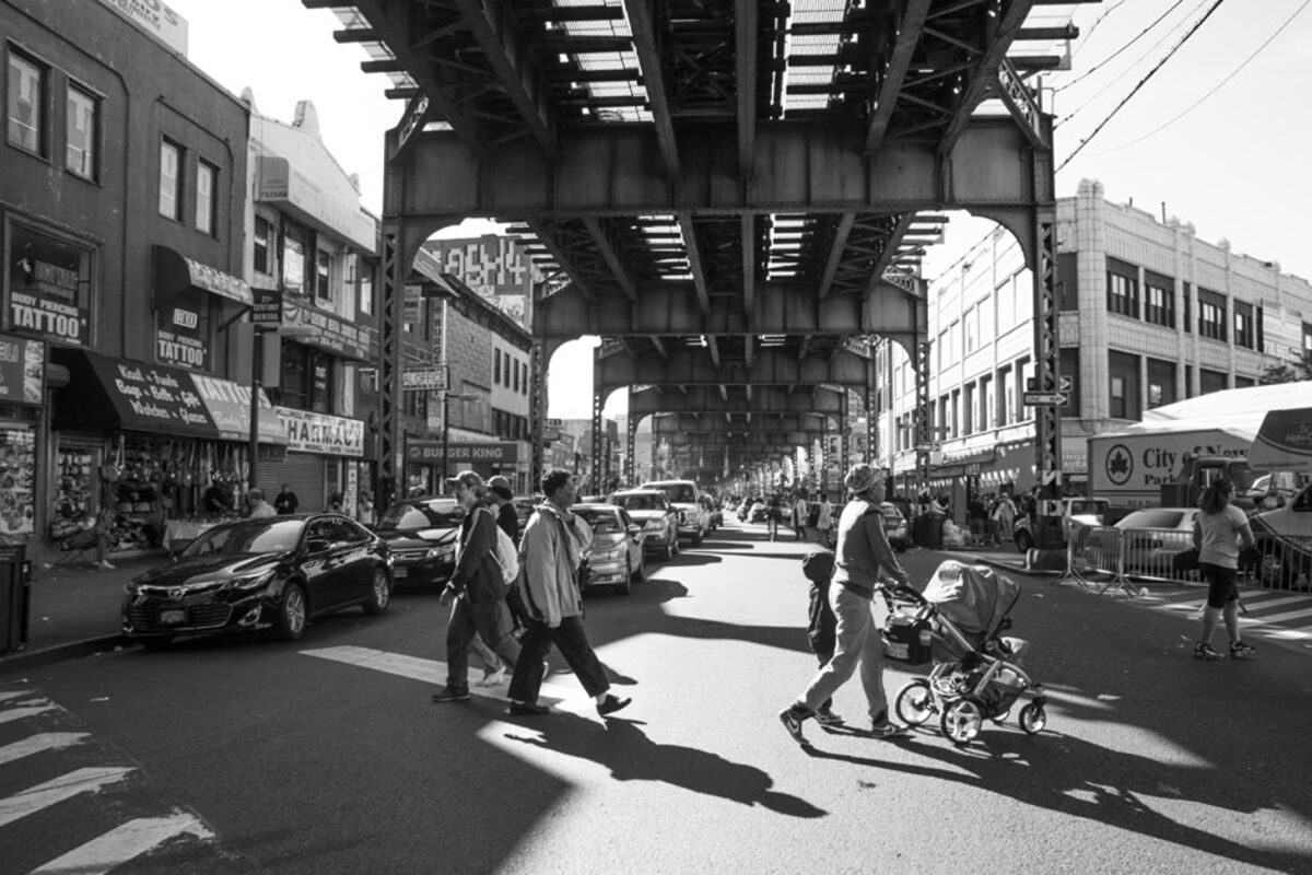
I'll answer everything else in pm and here with something more substantial soon, I'm eeking out the last bits of work before my reading week, so I'll be able to provide something more concrete/a synthesis we can work from afterwards as well. Maybe an updated map/rolling stock selection or something of the like. For now, I'll leave you with these thoughts mostly on land use and alternative transit
Reply With Quote
     
     
  #2819  
Old Posted Oct 7, 2021, 2:46 PM
jonny24 jonny24 is offline
Registered User
 
Join Date: Aug 2017
Location: Caledonia, often in Hamilton and Norfolk
Posts: 1,734
This back and forth has been super interesting to read, don't feel you have to take it all to PM guys
Reply With Quote
     
     
  #2820  
Old Posted Oct 7, 2021, 5:21 PM
ShavedParmesanCheese's Avatar
ShavedParmesanCheese ShavedParmesanCheese is offline
Registered User
 
Join Date: Oct 2020
Location: Ontario
Posts: 370
Quote:
Originally Posted by mikevbar1 View Post
In my attempt to shorten these responses for the forum's sake, I'll try to address as much as I can here without jumping around too much.
Good idea. Holy moly are these posts getting long

Quote:
I always thought of the ICTS as a missed opportunity, but that's partially the framing of the book. Its definetly better to have something of more permanence and conventional effectiveness, and the project probably just couldnt' work for somewhere like Hamilton. Something we've gotten at through these examples and debate is that Hamilton is very clearly not a regular city and cannot be planned as such. A monorail certainly sounds nice, but in practice I don't really know who would even be using it, if Im entirely honest. Hamilton has always been at least somewhat utilitarian, and something THAT flashy just sounds like a recipe for disaster in the 70s, exactly like Jackson square or any other downtown institution. Actually, it somewhat reminds of the monorail/train to nowhere in Detroit, that monorail they did downtown without the spoke networks to actually provide riders.
Ah yes, the People-Mover. A one-way system I dislike even more than our streets An elevated system wouldn't work, at least not as much as something on the ground and by modern standards, because of how it interacts with the streetscape, and how it doesn't do anything with taking cars off the road. If anything, it'd increase it. L's don't seem to have the same rejuvenating effect on an area like a tramway. If I had to say why It's probably because of the image they present. It may be a bit of an extreme example, but as much as you or I or others on this forum might find a street like this in the Bronx to be interesting and fun to at least explore, other people wouldn't agree, not to mention noise concerns and real-estate depreciation, things you don't have to contend with for things on the ground.


(Bloomberg)

Quote:
I actually only saw the odd picture on Google and wasn't sure what I was even looking at. It's hard to even fathom this kind of infrastructure existing, and it being so robust. This only reinforces the idea that the bones of a good Hamilton already exist; trying to reform the city for cars has disproportionately damaged Hamilton and is clearly a failed experiment. You bring up the zoning and scale of streets like Ottawa and Wentworth, and sometimes I forget that the 'downtown' really extends that far east, at least in feel.
I want to go back to when this was considered suburbia I take it you've seen NJB's video on the streetcar suburb, which while not exactly abundant in the lower city, had influence on how it was built. Indeed, there's a parallel between how the surveys in the lower city were built 120 years ago, and how surveys up the mountain are being built - a large rectangular parcel of land with housing in the centre, usually a couple schools & the odd church, surrounded by a perimeter of commercial lots. Of course, what in the 20's resulted in attractive urban strips like Ottawa St. today and Barton/Kenilworth yesterday has since been warped to end up with little more than a strip mall at the principal intersections.

Quote:
And I mean, of course it does- the entire economic engine of the city lies right to the north. Trying to reform the city to become 'normal' that commutes down the mountain and works downtown is not something we are built for. It can exist, and it should be the center of the city no doubt. But the case to make the entire lower city dense is far stronger. Hamilton HAS overbuilt rail and roads and inner city real eastate for miles. Discussing some of these incline rails and monorails and adapted light metro tracks illustrates just how strong the infrastructure of this city is for a population of 530,000. Sure there weren't cars in the early 20th century, but rail infrastructure was clearly tailored to the city in a way that we should be striving to return to. Its a miracle we don't have to reinvent the wheel (or in this case, a mountain rail access), because our industrial forefathers already figured it out. It was a mistake to remove alot of them, but now we can learn and incorporate innovative solutions better than before.
Our definition of how a normal city moves and behaves really only came about in the past 70 years or so. Sparing the history for the sake of not going on and on and on, if this is what we consider normal, I'm very ready to embrace the abnormal. Commuting only detracts from the urban fabric of a city, and the shorter they are, the better. You're quite right in the very strong case for furthering the density of the lower city, in part because it's really the only place in the entire county to do it without some very drastic zoning changes.

Quote:
I'll have to pm ya tomorrow! Its getting late for me, but I have mostly good things to say.
Sounds good, PM me any time

Quote:
I always loved that plan from Savannah. Funny enough, Hamilton's neighbourhoods have a certain pattern and form to them reminiscent of the golden age of industry and rail we speak of. Its actually quite uniform and not disjointed; when I look at Toronto's inner city, it lacks that cohesiveness. If anything, our downtown feels like it gets in the way once you spend enough time appreciating the Hamilton industrial engine. It offers alot of insight into how our city is planned, and alot of oversights begin to make sense.
While Toronto is about 20 years older than Hamilton, when and how each city exploded in population is highly reflective in how they look today, in more ways than one. That's something for another time, though, otherwise I'd have to summarize 80 years of commerce and industry

Quote:
It's not even urbanism, unfortunately. Urbanism in many ways clashes with what people in the suburbs, particularly here in Hamilton, think a city is and how it should work. Anyone who's not 80 years old now has no idea what a good, walkable community is, what is needed to get there, and most importantly why we should ever bother. It's a tragedy. That mentality in a lot of ways permeates our entire city and stems from a lack of education on planning at all. This is everywhere, but particularly bad in Hamilton because of that trademark incompetence and also its conveniently divisive geography. It isn't unique to here, and is very prevalent in American suburbs which feature a ridiculous detachment from the city on average too, no escarpment needed. Starting in the lower city is important because its all been done already, it's easiest there, and the people will benefit. No one on the mountain gives a shit about desirable communities, and the effort to bring density/transit up there isn't worth it. That's a strong statement sure, but the whole reason people moved up there was to get away from the downtown pollution; from HAMILTON.
You keep hitting the nail on the head when boomers reminisce of the downtown that once was, they don't look at why the place was so vibrant and enjoyable in the first place. It was built for the pedestrian, and gradually that was eroded until it left us with an urban centre that couldn't survive the economic hardships of the 90s, and left us as a city in the slump we're only now being pulled out of. They don't look at it through the same lens that we do, they just look at it as something that happened. Indeed, most people don't look at the why for things like this.

People disconnected but with every equal a voice like the suburban populations will always piss and moan about how the lower city is treated. They might complain about the so called 'special treatment' it might receive, ignoring that the only thing the mountain has going for it is Suburban Fringe. You're quite right in how true this is across the continent, and It's awfully poetic that the high and mighty suburban armchair planners find themselves literally high up atop that 30 storey cliff.

Quote:
I think you are completely right about this, although it might not be a universal truth in every city. I believe I read something from Metrolinx (research for the forums, research for class-it all comes together alot of the time nowadays!) breaking down price costs across modes. It measured acquired land in metres squared, which implies they subdivide lots- but only to certain degree. For single family housing or urban lots in general they probably just buy the whole thing. Something I always thought about was the nature of finance and land. Acquiring land should in theory become collateral just like cash; buying land is viable for investment, developing it is just further profit. Now this is a discussion moreso related to cost breakdowns and not really related to the cost of projects, but what I am getting at is a potential skewing of surface rail because of properties acquired- we are discussing these as if they are a loss, but I am not entirely certain they are if the corporation building track gets a nice piece of TOD. A study from University of Victoria explores this in a cost breakdown, but not quite as directly. Theres always the possibility of radical zoning reform where you can subdivide lots super easily for stuff like this, but the barriers to transit cost have to be deeper than property acquisitions. It cant be this simple. There is the cynical perspective though that this is how infrastructure got built, and Europe is only ahead because they never tore their stuff down. Ie, NA cities are just set super far back because we intentionally removed all the good connections, rails, etc that made it easy to expand upon.
The truth behind why our transport is so radically expensive to build is definitely a complicated beast. It's in part land acquisition, I suspect, but it also has to do with how the pre-existing infrastructure is handled as well. I think a good place to start could be comparing similar projects across the pond - two tramway projects that also make use of pre-existing trackage that I can think of off the top of my head is the ION in Waterloo and the Croydon Tramways. This is certainly a topic for more economically-inclined experts than I.

Quote:
I saw a high speed rail map the other day that bypassed Hamilton, choosing to pass through KW-Guelph instead. Couldn't believe it. You'd think Hamilton would be the junction of a network like that.
I've been saying for a long time that a Niagara Falls -> Hamilton -> KWC line would be a success. But, alas, the only line out that way is very old and snakes up the mountain and through Waterdown, hardly the best route for passenger services. Of course, being out in the Greenbelt, there's plenty of space to build a dedicated track and R.O.W, but apparently that has been out of the question for decades. I feel like it could work, though, with the right investment and dedication from the powers-that-be...

Quote:
We absolutely need to look outward for ideal references. I'm not so sure following American or GTA/Toronto initiatives are a good idea for a few reasons. From city initiative to the sheer demand and growth, we just aren't the same.
Good point. It's clear that what's... I suppose you'd call ""traditional"" over here isn't what works best. We could find useful inspirations for what could work and what couldn't in European beltline examples like the Circle Line on the Londerground, Le Petit Ceinture in Paris, even something like the Glasgow Subway. Whichever inspiration we borrow most from, it would have to be tweaked heavily to meet our needs as a city.

Quote:
Geography is a huge inhibitor in Hamilton for better or worse, but it makes infrastructure ludicrously complicated when discussing something that isnt there/hasnt been done before. Besides, European models for planning and transit do work better; I'm sure a masterplan that posits Hamilton as a mid-rise city would be quite appealing, especially considering your height limit could stay 30 floors That requires alot more research however. This conversation has moved so far beyond the feasibility on track now, which is actually fantastic. Most of what's being discussed is the use cases and demand, but as you say...
The city's zoning map is a curious thing. It mostly just takes what's already been there and zones that lot for that one thing. So, a corner store on a lot in a residential survey from the 40's that would have no hopes of being built today is still zoned as commercial. Excepting some areas that need to be re-zoned to facilitate commercial growth (King St. past the Delta, for example) most of what's there just needs 3 or 5 more storeys thrown on top of what's already legislated. We and the rest of this forum could easily spend hours going over what the best course of action for zoning in the lower city is, and even longer for the periphery, so I'll just say for now that mandatory minimums are far more effective than any mandatory maximum.

Quote:
I'll answer everything else in pm and here with something more substantial soon, I'm eeking out the last bits of work before my reading week, so I'll be able to provide something more concrete/a synthesis we can work from afterwards as well. Maybe an updated map/rolling stock selection or something of the like. For now, I'll leave you with these thoughts mostly on land use and alternative transit
I must say, as much as I'm very much enjoying this back-and-forth, these take me ages to write I think we would both benefit from smaller, more frequent posts than this.

I feel like we could actually develop that initial map into a network with a strong business case for being once we figure out what'll work and what won't. Plus what everything will have to look like, such as rolling stock + station design & placements. Very interested to see what that looks like. Who knows? Maybe it'll result in something one day
__________________
Ask me about my radioactive materials
Reply With Quote
     
     
This discussion thread continues

Use the page links to the lower-right to go to the next page for additional posts
 
 
Reply

Go Back   SkyscraperPage Forum > Regional Sections > Canada > Ontario > Hamilton > Transportation & Infrastructure
Forum Jump


Forum Jump


All times are GMT. The time now is 10:55 PM.


Powered by vBulletin® Version 3.8.7
Copyright ©2000 - 2026, vBulletin Solutions, Inc.