HomeDiagramsDatabaseMapsForum About
     

Go Back   SkyscraperPage Forum > Discussion Forums > City Discussions


Reply

 
Thread Tools Display Modes
     
     
  #181  
Old Posted Aug 29, 2021, 11:22 PM
badrunner badrunner is offline
Registered User
 
Join Date: Oct 2016
Posts: 3,138
Quote:
Originally Posted by dktshb View Post
That is probably the most accurate boundary for Downtown Los Angeles. I may even take out skid row. These numbers are much more a true representation.
I wouldn't include all of Westlake east of Hoover, just some of the downtown adjacent census tracts that were considered a part of downtown before the freeways carved up those neighborhoods. Westlake itself is too big and residential to be considered a part of downtown imo. It actually has more people at a higher density than DTLA.

But since we're also tallying numbers for downtown adjacent districts in this thread, we can estimate that Koreatown-Westlake-DTLA has now surpassed 300k population in ~7.7 square miles for a density upwards of 40k ppsm.

Koreatown - 124,281 (2008 estimate) - 2.7 sqm - 46,030 ppsm
Westlake - 117,756 (2008 estimate) - 2.72 sqm - 43,292 ppsm
DTLA - 52,691 (2020 census, unofficial borders) in 2.3 sqm - 22,909 ppsm

http://maps.latimes.com/neighborhoods/population/density/neighborhood/list/
Reply With Quote
     
     
  #182  
Old Posted Aug 30, 2021, 12:41 AM
Yuri's Avatar
Yuri Yuri is offline
Registered User
 
Join Date: Sep 2008
Posts: 6,404
Downtown Milwaukee


--------------------------------- 2020 ------ 2010 ------ 2000 ------ 1990 ------ Growth ------ Density

Downtown ---------------------- 13,556 ----- 10,518 ------ 7,557 ------ 5,736 ---- 28.9% ---- 39.2% --- 31.7% ------- 3.6 km² --- 3,784.5 inh./km²

Milwaukee --------------------- 577,222 ---- 594,503 ---- 596,783 ---- 628,568 ---- -2,9% ---- -0,4% --- -5,1% ----- 249.1 km² --- 2,317.2 inh./km²

Milwaukee Metro Area ------ 1,772,458 -- 1,751,316 -- 1,689,572 -- 1,607,183 ----- 1.2% ----- 3.7% ---- 5.1% --- 4,629 km²


Downtown Milwaukee seems to be a very charming place and apparently it's regarded highly for its inhabitants way before "flight back to city" to become a trend. It's in a better shape and more populated than the ones of cities much bigger (Cleveland or Detroit).
Reply With Quote
     
     
  #183  
Old Posted Aug 30, 2021, 3:18 AM
Steely Dan's Avatar
Steely Dan Steely Dan is online now
devout Pizzatarian
 
Join Date: Jul 2001
Location: Lincoln Square, Chicago
Posts: 30,527
Quote:
Originally Posted by yuriandrade View Post

--------------------------------- 2020

Milwaukee Metro Area ------ 1,772,458
where are you getting that metro population figure from?

The MSA is at 1,574,731

the CSA is at 2,049,805
Reply With Quote
     
     
  #184  
Old Posted Aug 30, 2021, 10:14 AM
Yuri's Avatar
Yuri Yuri is offline
Registered User
 
Join Date: Sep 2008
Posts: 6,404
Quote:
Originally Posted by Steely Dan View Post
where are you getting that metro population figure from?

The MSA is at 1,574,731

the CSA is at 2,049,805
If I write "Metro Area" instead of "CSA" or "MSA", it means definition is mine, the same I posted on the census thread.

In Milwaukee's case, it's Milwaukee MSA plus Racine MSA. I usually exclude rural counties (rural, not exurbs) that are losing population, showing no signs of getting the metro spill over.

I also work with the list of the Census Bureau historical definitions opened and favour the ones that lasted long and finally go to Wikipedia's page for each metro area to see if the regional planing offices definitions are more sensible.

In any case, I prefer to go with either MSA or CSA and only other definition if one is too strict and the other too broad. That's Milwaukee's case. Others are San Francisco and Boston. I also did this with New York and Washington excluding far flung and often declining counties.
Reply With Quote
     
     
  #185  
Old Posted Aug 30, 2021, 10:25 AM
Yuri's Avatar
Yuri Yuri is offline
Registered User
 
Join Date: Sep 2008
Posts: 6,404
Downtown Washington


-------------------------------- 2020 ------ 2010 ------ 2000 ------ 1990 ------ Growth ------ Density

Downtown --------------------- 30,279 ----- 27,025 ----- 18,704 ----- 17,457 ---- 12.0% ---- 44.5% ---- 7.1% ------ 11.0 km² --- 2,743.7 inh./km²

Georgetown -------------------- 13,603 ----- 14,231 ----- 12,991 ----- 12,181 ---- -4.4% ----- 9.5% ---- 6.6% ------- 3.2 km² --- 4,268.3 inh./km²

Washington DC --------------- 689,545 ---- 601,723 ---- 572,059 ---- 606,900 ---- 14.6% ----- 5.2% --- -5.7% ----- 158.3 km² --- 4,355.9 inh./km²

Arlington-Alexandria-F.C. ---- 412,768 ---- 359,925 ---- 328,113 ---- 291,697 ---- 14.7% ----- 9.7% --- 12.5% ----- 111.3 km² --- 3,708.3 inh./km²

Washington Metro Area ----- 6,105,431 -- 5,388,326 -- 4,635,194 -- 3,997,373 ---- 13.3% ---- 16.2% --- 16.0% -- 12,403 km²


Washington Downtown is very different from everything. Firstly, the Mall and Potomac Park takes half of it (1 census tract). The other 10 census tracts comprise Foggy Bottom and everything between the Massachusetts Avenue and the Mall. As this region is full of big government offices, embassies, hotels, it's hard to make any assumption about its residential population trends.

As bonus, I brought Georgetown, formed by 4 census tracts.
Reply With Quote
     
     
  #186  
Old Posted Aug 30, 2021, 1:54 PM
DCReid DCReid is offline
Registered User
 
Join Date: Jun 2012
Posts: 1,559
Quote:
Originally Posted by badrunner View Post
I wouldn't include all of Westlake east of Hoover, just some of the downtown adjacent census tracts that were considered a part of downtown before the freeways carved up those neighborhoods. Westlake itself is too big and residential to be considered a part of downtown imo. It actually has more people at a higher density than DTLA.

But since we're also tallying numbers for downtown adjacent districts in this thread, we can estimate that Koreatown-Westlake-DTLA has now surpassed 300k population in ~7.7 square miles for a density upwards of 40k ppsm.

Koreatown - 124,281 (2008 estimate) - 2.7 sqm - 46,030 ppsm
Westlake - 117,756 (2008 estimate) - 2.72 sqm - 43,292 ppsm
DTLA - 52,691 (2020 census, unofficial borders) in 2.3 sqm - 22,909 ppsm

http://maps.latimes.com/neighborhoods/population/density/neighborhood/list/
This article says 80K live in downtown LA, up from 28K in 2000. It says that LA is planning for 125K more residents downtown by 2040.
https://www.bisnow.com/los-angeles/news/multifamily/tbd-110017
Reply With Quote
     
     
  #187  
Old Posted Aug 30, 2021, 1:59 PM
the urban politician the urban politician is offline
The City
 
Join Date: Jul 2004
Location: Chicago region
Posts: 21,329
Quote:
Originally Posted by yuriandrade View Post
Downtown Washington


-------------------------------- 2020 ------ 2010 ------ 2000 ------ 1990 ------ Growth ------ Density

Downtown --------------------- 30,279 ----- 27,025 ----- 18,704 ----- 17,457 ---- 12.0% ---- 44.5% ---- 7.1% ------ 11.0 km² --- 2,743.7 inh./km²

Georgetown -------------------- 13,603 ----- 14,231 ----- 12,991 ----- 12,181 ---- -4.4% ----- 9.5% ---- 6.6% ------- 3.2 km² --- 4,268.3 inh./km²

Washington DC --------------- 689,545 ---- 601,723 ---- 572,059 ---- 606,900 ---- 14.6% ----- 5.2% --- -5.7% ----- 158.3 km² --- 4,355.9 inh./km²

Arlington-Alexandria-F.C. ---- 412,768 ---- 359,925 ---- 328,113 ---- 291,697 ---- 14.7% ----- 9.7% --- 12.5% ----- 111.3 km² --- 3,708.3 inh./km²

Washington Metro Area ----- 6,105,431 -- 5,388,326 -- 4,635,194 -- 3,997,373 ---- 13.3% ---- 16.2% --- 16.0% -- 12,403 km²


Washington Downtown is very different from everything. Firstly, the Mall and Potomac Park takes half of it (1 census tract). The other 10 census tracts comprise Foggy Bottom and everything between the Massachusetts Avenue and the Mall. As this region is full of big government offices, embassies, hotels, it's hard to make any assumption about its residential population trends.

As bonus, I brought Georgetown, formed by 4 census tracts.
I remember when I lived in DC, reading in about 2004 an article where the Mayor of DC had a goal of turning around population loss and trying to get the city to grow again. Looks like that goal was realized!
Reply With Quote
     
     
  #188  
Old Posted Aug 30, 2021, 2:48 PM
Steely Dan's Avatar
Steely Dan Steely Dan is online now
devout Pizzatarian
 
Join Date: Jul 2001
Location: Lincoln Square, Chicago
Posts: 30,527
Quote:
Originally Posted by yuriandrade View Post
If I write "Metro Area" instead of "CSA" or "MSA", it means definition is mine, the same I posted on the census thread. In Milwaukee's case, it's Milwaukee MSA plus Racine MSA.
oh, gotcha.

and adding racine to milwaukee makes a lot of sense if washington and ozaukee counties are included. racine gets pinched a little bit, with its "out of county" commuters getting split between milwaukee's MSA to the north, and chicago's MSA to the south, such that it doesn't meet the threshold to be added to either MSA.

as you said, racine county is in milwaukee's CSA, but the CSA adds some truly — rural counties that have no business being included in a "metropolitan area", so the CSA is far too bloated.

sometimes, it really does make the most sense to just make up your own rules because the CB's rigid commuter thresholds don't always align with the other less quantifiable realities on the ground.


Quote:
Originally Posted by yuriandrade View Post
I usually exclude rural counties (rural, not exurbs) that are losing population, showing no signs of getting the metro spill over.
in that case, we should delete dekalb, newton, and jasper counties from chicago's MSA too. all of them are extremely rural and declining in population.

i would also argue in favor of getting rid of grundy county as well, but it's growing modestly (+4.9%)
Reply With Quote
     
     
  #189  
Old Posted Aug 30, 2021, 3:25 PM
Yuri's Avatar
Yuri Yuri is offline
Registered User
 
Join Date: Sep 2008
Posts: 6,404
Quote:
Originally Posted by Steely Dan View Post
oh, gotcha.

and adding racine to milwaukee makes a lot of sense if washington and ozaukee counties are included. racine gets pinched a little bit, with its "out of county" commuters getting split between milwaukee's MSA to the north, and chicago's MSA to the south, such that it doesn't meet the threshold to be added to either MSA.

as you said, racine county is in milwaukee's CSA, but the CSA adds some truly — rural counties that have no business being included in a "metropolitan area", so the CSA is far too bloated.

sometimes, it really does make the most sense to just make up your own rules because the CB's rigid commuter thresholds don't always align with the other less quantifiable realities on the ground.
As US population growth eases and exurb explosive growth is no longer nowhere near what we've seen till the early 2000's, I started to see an interesting phenomenon while adding up counties to make the metro areas: more and more very small and declining counties are being added. I guess as their population and economy declines, a higher share of their population ends up looking for a job on the suburbs of the next big metro area.

Up to the 2000's, far away small counties used to be added, but they usually getting all the impact of the neighbouring metro areas (e.g. counties west of Chicago or Livingstone County, MI, etc. etc.


Quote:
Originally Posted by Steely Dan View Post
in that case, we should delete dekalb, newton, and jasper counties from chicago's MSA too. all of them are extremely rural and declining in population.

i would also argue in favor of getting rid of grundy county as well, but it's growing modestly (+4.9%)
Indeed. I decided to keep Chicago intact because the present definition is around for quite a while, if I'm not mistaken since 1999 or 2003 revisions. It seemed very consolidated by now, so I decided to keep it that way.

I work with several definitions for each metro area, usually using several historical ones: 1950, 1961, 1963, 1973 etc. in case I want to make a historical list or work with a more strict one.

Interestingly, up to 2000 or 2010, the broader definition, the fast the growth. Now, it's opposite: the majority of more strict ones get the fastest growth.


Quote:
Originally Posted by the urban politician View Post
I remember when I lived in DC, reading in about 2004 an article where the Mayor of DC had a goal of turning around population loss and trying to get the city to grow again. Looks like that goal was realized!
Yes, I didn't mention it because it happened in the last decade, but I remember it was a big thing on 2010 Census that reversal. Some expected Baltimore could come flat, but that didn't materialized.

Washington DC came below 2019 Estimates, so results seemed a bit underwhelming, but it's still a 14% growth, and higher than the metro area as a whole.
Reply With Quote
     
     
  #190  
Old Posted Aug 30, 2021, 5:52 PM
wwmiv wwmiv is offline
Registered User
 
Join Date: Sep 2009
Location: Austin -> San Antonio -> Columbia -> San Antonio -> Chicago -> Austin -> Denver -> Austin
Posts: 5,846
Quote:
Originally Posted by yuriandrade View Post
As US population growth eases and exurb explosive growth is no longer nowhere near what we've seen till the early 2000's, I started to see an interesting phenomenon while adding up counties to make the metro areas: more and more very small and declining counties are being added. I guess as their population and economy declines, a higher share of their population ends up looking for a job on the suburbs of the next big metro area.

Up to the 2000's, far away small counties used to be added, but they usually getting all the impact of the neighbouring metro areas (e.g. counties west of Chicago or Livingstone County, MI, etc. etc.
This is a very common effect. As economic activity hypercongregates into urban areas, the immediately surrounding rural areas lose some of their economic vitality and their residents opt to join the labor market of the nearby economic powerhouse urban area.

Metropolitan areas are most properly understood as a measure of the size of a labor market, which can include both urban and rural settings. Stripping away certain counties in an ad hoc basis from "metro areas" because those places are rural begets a certain misunderstanding of what a metropolitan areas is in the first place (it suggests a misunderstanding that metropolitan areas should be urban). If anything, you should be adding some rural counties around certain metropolitan areas. For instance, Houston's metropolitan area will add Montgomery County to its list of core counties, which also has the effect of changing the math for outlying counties (and more outlying rural counties may now be included because of this simple change).

If you want to strip out the more rural counties of a metropolitan area and still rely on official census designations, my suggestion is to simply add up the populations of "Core Counties" and leave off all "Outlying Counties." That way you're consistent in the way you apply.
Reply With Quote
     
     
  #191  
Old Posted Aug 30, 2021, 6:27 PM
Yuri's Avatar
Yuri Yuri is offline
Registered User
 
Join Date: Sep 2008
Posts: 6,404
Quote:
Originally Posted by wwmiv View Post
This is a very common effect. As economic activity hypercongregates into urban areas, the immediately surrounding rural areas lose some of their economic vitality and their residents opt to join the labor market of the nearby economic powerhouse urban area.

Metropolitan areas are most properly understood as a measure of the size of a labor market, which can include both urban and rural settings. Stripping away certain counties in an ad hoc basis from "metro areas" because those places are rural begets a certain misunderstanding of what a metropolitan areas is in the first place (it suggests a misunderstanding that metropolitan areas should be urban). If anything, you should be adding some rural counties around certain metropolitan areas. For instance, Houston's metropolitan area will add Montgomery County to its list of core counties, which also has the effect of changing the math for outlying counties (and more outlying rural counties may now be included because of this simple change).

If you want to strip out the more rural counties of a metropolitan area and still rely on official census designations, my suggestion is to simply add up the populations of "Core Counties" and leave off all "Outlying Counties." That way you're consistent in the way you apply.
wwmiv, even though I love those stats, I don't access US Census Bureau site anymore, preferring secondary references such as City Population or Wikipedia. It's easier to navigate there. Hence I don't know where I can find their definition/description of "Core Counties". That would be interesting.

I agree with you about the labour market and I don't have much problem with wider metropolitan definitions. However, I'm not US-based and I tend to compare US with other countries, and many of them have different threshold for commute rates and many of them have no official definition whatsoever. And as the US metro areas expand much further, sometimes I prefer to work with a more strict definition available in order to try making things more comparable internationally (or work with wider definitions elsewhere to make them more comparable with the US).

As this thread is basically about a very vague concept (Downtowns), where we hardly find any official definition for it, I don't see much problem calling, let's say, the five inner counties of Boston + Worcester + the two bordering NH counties "Boston Metro Area". It's just a generic and unpretentious label as much as calling that peninsula in central Boston "Downtown", even though formed by distinct and traditional neighbourhoods.
Reply With Quote
     
     
  #192  
Old Posted Aug 30, 2021, 6:28 PM
wwmiv wwmiv is offline
Registered User
 
Join Date: Sep 2009
Location: Austin -> San Antonio -> Columbia -> San Antonio -> Chicago -> Austin -> Denver -> Austin
Posts: 5,846
Quote:
Originally Posted by yuriandrade View Post
wwmiv, even though I love those stats, I don't access US Census Bureau site anymore, preferring secondary references such as City Population or Wikipedia. It's easier to navigate there. Hence I don't know where I can find their definition/description of "Core Counties". That would be interesting.

I agree with you about the labour market and I don't have much problem with wider metropolitan definitions. However, I'm not US-based and I tend to compare US with other countries, and many of them have different threshold for commute rates and many of them have no official definition whatsoever. And as the US metro areas expand much further, sometimes I prefer to work with a more strict definition available in order to try making things more comparable internationally (or work with wider definitions elsewhere to make them more comparable with the US).

As this thread is basically about a very vague concept (Downtowns), where we hardly find any official definition for it, I don't see much problem calling, let's say, the five inner counties of Boston + Worcester + the two bordering NH counties "Boston Metro Area". It's just a generic and unpretentious label as much as calling that peninsula in central Boston "Downtown", even though formed by distinct and traditional neighbourhoods.
https://www.whitehouse.gov/wp-content/uploads/2020/03/Bulletin-20-01.pdf

Starting on page 41, any county listed in italics.

As for your last paragraph, you may not see an issue with it, sure, but the issue with it is that by using the term metro area you are inviting your audience to misunderstand your numbers, because we use the term metro area very specifically precisely because the census bureau had claimed that label already. Why not a label that hasn’t been claimed, like “region” or just simply “area”?
Reply With Quote
     
     
  #193  
Old Posted Aug 30, 2021, 7:13 PM
Yuri's Avatar
Yuri Yuri is offline
Registered User
 
Join Date: Sep 2008
Posts: 6,404
Quote:
Originally Posted by wwmiv View Post
https://www.whitehouse.gov/wp-content/uploads/2020/03/Bulletin-20-01.pdf

Starting on page 41, any county listed in italics.

As for your last paragraph, you may not see an issue with it, sure, but the issue with it is that by using the term metro area you are inviting your audience to misunderstand your numbers, because we use the term metro area very specifically precisely because the census bureau had claimed that label already. Why not a label that hasn’t been claimed, like “region” or just simply “area”?
Thank you for the link! It's really informative. Some things I didn't understand (Lorain don't be a core county of Cleveland MSA), but overall it's interesting nonetheless.

About last paragraph, I don't quite agree. Firstly, that's an informal internet forum, not a paper. And I was careful enough to call them "metro area" when using my definition, while on others I wrote MSA (Chicago, Tampa, Pittsburgh, San Diego) or CSA (Los Angeles, Denver). And I specifically mention this fact on my metro area series of posts starting on Page 124 of the Census thread. Moreover, there are several local governmental and non-governmental agencies in the US that uses the term "metro area" independently of the census definition.

And the same apply for "Downtown". Many cities don't even use the term (like Boston) and others might defined it differently or not defining at all, and we're still here talking about "downtowns" all over the country and around the globe.
Reply With Quote
     
     
  #194  
Old Posted Aug 30, 2021, 8:56 PM
dktshb's Avatar
dktshb dktshb is offline
Environmental Sabotage
 
Join Date: Jun 2005
Location: San Francisco/ Los Angeles/ Tahoe
Posts: 5,145
Quote:
Originally Posted by DCReid View Post
This article says 80K live in downtown LA, up from 28K in 2000. It says that LA is planning for 125K more residents downtown by 2040.
https://www.bisnow.com/los-angeles/news/multifamily/tbd-110017
I am pretty sure that it will meet that mark too but the definition of downtown is too broad. Badrunner's definition of Downtown more fits the actual area IMO and is where all 90% growth is occurring, regardless.

When I was downtown a couple weeks ago I was amazed at all the new residential towers (and big ones too) that are still going up. San Francisco it appears all but dried up in comparison. Lots of residential just finished but I don't see much at all in the way of visible new construction.
Reply With Quote
     
     
  #195  
Old Posted Aug 30, 2021, 9:29 PM
Steely Dan's Avatar
Steely Dan Steely Dan is online now
devout Pizzatarian
 
Join Date: Jul 2001
Location: Lincoln Square, Chicago
Posts: 30,527
Quote:
Originally Posted by wwmiv View Post

the issue with it is that by using the term metro area you are inviting your audience to misunderstand your numbers, because we use the term metro area very specifically precisely because the census bureau had claimed that label already.
The US Census Bureau may own "MSA" and "CSA", but it does not own "metropolitan area", which is a generic term used by thousands of bodies around the world and defined in an uncountable number of ways.
Reply With Quote
     
     
  #196  
Old Posted Aug 30, 2021, 10:25 PM
Yuri's Avatar
Yuri Yuri is offline
Registered User
 
Join Date: Sep 2008
Posts: 6,404
Downtown Portland


--------------------------------- 2020 ------ 2010 ------ 2000 ------ 1990 ------ Growth ------ Density

Downtown --------------------- 12,568 ----- 11,585 ------ 8,939 ------ 8,298 -------- 8.5% ---- 29.6% ----- 7.7% ------- 2.1 km² --- 6,004.8 inh./km²

Portland MSA -------------- 2,512,859 -- 2,226,009 -- 1,927,881 -- 1,523,741 ----- 12.9% ---- 15.5% ---- 26.5% -- 17,321 km²


Downtown Portland hasn't followed the national trend, posting a rather modest growth and slower than its own metro area. It's an already dense area, but Downtown Seattle haven't stopped by it. Density is twice higher and growth was insane up there.
Reply With Quote
     
     
  #197  
Old Posted Aug 31, 2021, 2:00 AM
mhays mhays is offline
Never Dell
 
Join Date: Jul 2001
Posts: 21,284
DT. Portland has boomed if you include the Pearl District, and to a lesser extent Goose Hollow. Some would add the South Waterfront which is basically new.
Reply With Quote
     
     
  #198  
Old Posted Aug 31, 2021, 10:33 AM
Yuri's Avatar
Yuri Yuri is offline
Registered User
 
Join Date: Sep 2008
Posts: 6,404
Quote:
Originally Posted by yuriandrade View Post
Downtown Los Angeles


As the US 2020 Census numbers are available, I decided to bring some actual figures. For Los Angeles, I used a 25 census tract area, that matches with the most usual definitions for Downtown LA.


-- 2020 ---- 2010 ---- 2000 ---- 1990

74,349 ---- 52,538 ---- 40,836 ---- 32,786 ---- 41.5% ---- 28.7% ---- 24.5%


It's a 14.86 km² area, for a density of 5,003 inh./km². Lots of room to densify. The growth is nothing but impressive. Almost doubled in the past 20 years.

One interesting thing I noticed while put the numbers together is the only area dropping was the census tract where Union Station is located. And dropped big: from 10,800 in 2000 to 5,500 in 2020. It represented over 1/4 of total population back then and now it's mere 7.5%.

As LA forumers requested, bringing the main neighbourhoods bordering Downtown LA, north and westwards:


------------------------------ 2020 ------ 2010 ------ 2000 ------ 1990 ------ Growth ------ Density

Downtown ---------------------- 74,349 ----- 52,538 ----- 40,836 ----- 32,786 ----- 41.5% ---- 28.7% ---- 24.6% ------ 14.8 km² --- 5,008.0 inh./km²

Chinatown ----------------------- 5,434 ------ 5,204 ------ 5,602 ------ 5,516 ------ 4.4% ---- -7.1% ----- 1.6% ------- 1.7 km² --- 3,119.4 inh./km²

Echo Park ---------------------- 29,830 ----- 31,847 ----- 36,951 ----- 38,486 ----- -6.3% --- -13.8% ---- -4.0% ------ 10.0 km² --- 2,969.9 inh./km²

Westlake --------------------- 106,160 ---- 107,043 ---- 102,144 ---- 104,269 ----- -0.8% ----- 4.8% ---- -2.0% ------- 7.7 km² -- 13,699.8 inh./km²

Los Angeles CSA ---------- 18,644,680 - 17,877,006 - 16,373,645 - 14,531,529 ------ 4.3% ----- 9.2% ---- 12.7% -- 87,982 km²


Chinatown had its southern section counted inside Downtown LA due census tracts shapes. It also contains low density area near the freeways, railways and the river.

Echo Park has the park inside its borders, formed by a big census tract 3.8 km² with only 144 people inside, therefore its actual density would be somewhat higher, around 4,600 inh./km².

Westlake with a very high density but population is flat. By the numbers of censos tracts, it was the biggest area I made so far, with 33.

And here we can see clearly how Downtown LA stands out, growing at insane rates, surrounded by dense residential neighbourhoods with flat/declining growth though.

Reply With Quote
     
     
  #199  
Old Posted Aug 31, 2021, 5:17 PM
Twin Citian Twin Citian is offline
Registered User
 
Join Date: Jul 2018
Posts: 5
Quote:
Originally Posted by yuriandrade View Post
Downtown Minneapolis-St. Paul


------------------------------ 2020 ------ 2010 ------ 2000 ------ 1990 ------ Growth ------ Density

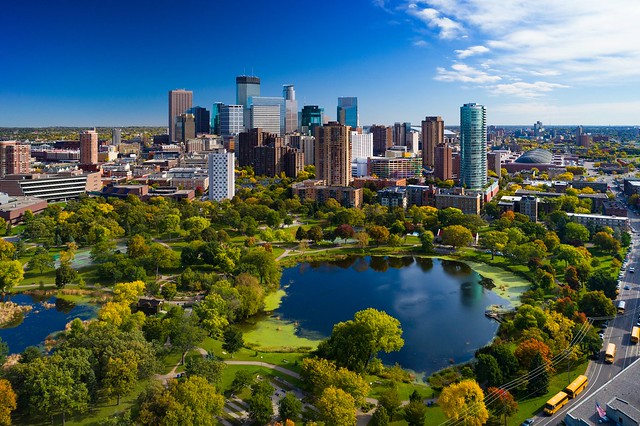
Downtown Minneapolis --------- 41,093 ----- 29,725 ----- 24,149 ----- 21,157 ---- 38.2% ---- 23.1% --- 14.1% ------- 7.5 km² --- 5,471.0 inh./km²

Downtown St. Paul ------------- 11,808 ------ 9,050 ------ 7,999 ------ 6,711 ---- 30.5% ---- 13.1% --- 19.2% ------- 3.2 km² --- 3,663.7 inh./km²

Minneapolis ------------------- 429,954 ---- 382,603 ---- 382,824 ---- 368,397 ---- 12.4% ---- -0.1% ---- 3.9% ----- 139.9 km² --- 3,073.3 inh./km²

St. Paul ----------------------- 311,527 ---- 285,103 ---- 287,029 ---- 272,065 ----- 9.3% ---- -0.7% ---- 5.5% ----- 134.6 km² --- 2,314.5 inh./km²

Minneapolis Metro Area ---- 3,635,128 -- 3,279,833 -- 2,968,806 -- 2,538,834 ---- 10.8% ---- 10.5% --- 16.9% -- 15,609 km²


Both Downtowns are doing quite well, growing much faster this decade than the previous ones. Minneapolis is one of the most populated in the country, with 41,000 people. St. Paul's, that is completely overlooked by Minneapolis', it's in fact more populated than St. Louis', for instance.

Regarding the metro area, it's one of the very few in the country that grew faster this decade than the past one.
This is great info. Thanks for posting.

I assumed both downtown Minneapolis and downtown St. Paul would have large populations. What neighborhoods or boundaries did you use for each downtown area?
Reply With Quote
     
     
  #200  
Old Posted Aug 31, 2021, 7:12 PM
Yuri's Avatar
Yuri Yuri is offline
Registered User
 
Join Date: Sep 2008
Posts: 6,404
Quote:
Originally Posted by Twin Citian View Post
This is great info. Thanks for posting.

I assumed both downtown Minneapolis and downtown St. Paul would have large populations. What neighborhoods or boundaries did you use for each downtown area?
Thank you!

I used the traditional definitions, the ones that come up in Google Maps. For Minneapolis census tracts match perfectly with this definition, which is the freeway loop plus a few blocks south of it, a place called Stevens Square. For St. Paul, census tracts also include an area north of capitol, so it's basically what Google Maps bring as Downtown, Capitol and Mt. Airy.
Reply With Quote
     
     
This discussion thread continues

Use the page links to the lower-right to go to the next page for additional posts
 
 
Reply

Go Back   SkyscraperPage Forum > Discussion Forums > City Discussions
Forum Jump


Forum Jump


All times are GMT. The time now is 3:10 PM.


Powered by vBulletin® Version 3.8.7
Copyright ©2000 - 2026, vBulletin Solutions, Inc.