I suspect that the designation of 400-series highways is not a hard and fast rule, but a general guideline.
I would speculate that the routes are selected and designated as such because they are designed to be freeways in their entirety and serve as connection routes between major provincial cities.
So, something like Highway 7/8/85 in Kitchener-Waterloo is not considered a 400-series highway because it is merely an upgraded portion of a larger existing route. The EC Row Expressway serves a local purpose in Windsor, thus its omission. The 417, despite being connected to highway 17 at the eastern end, paralleled 17 through Ottawa until the province decommissioned it, so it was a completely independent route.
The designation is mostly academic, I suppose. Highway 8 between Kitchener and the 401 is wider than much of the 400-series network and built to similar design standards.
I suspect that the designation of 400-series highways is not a hard and fast rule, but a general guideline.
I would speculate that the routes are selected and designated as such because they are designed to be freeways in their entirety and serve as connection routes between major provincial cities.
So, something like Highway 7/8/85 in Kitchener-Waterloo is not considered a 400-series highway because it is merely an upgraded portion of a larger existing route. The EC Row Expressway serves a local purpose in Windsor, thus its omission. The 417, despite being connected to highway 17 at the eastern end, paralleled 17 through Ottawa until the province decommissioned it, so it was a completely independent route.
The designation is mostly academic, I suppose. Highway 8 between Kitchener and the 401 is wider than much of the 400-series network and built to similar design standards.
Wasn't there a super-2 400-series highway at one point in Niagara region? I am thinking of the Welland-Thorold area for some reason.
Or was the 410 up through Brampton partly a super-2 at one point?
Wasn't there a super-2 400-series highway at one point in Niagara region? I am thinking of the Welland-Thorold area for some reason.
Or was the 410 up through Brampton partly a super-2 at one point?
Exception happens. But you see? They’re all 4-lane divided freeways now.
Edit: It may have been a time when 10 still ran down Hurontario Street so signing the super-2 as 10 didn’t make sense. As for 406, there was probably no good numbers around. 58 would have been absolutely confusing, though 140 would have worked I guess.
^ Both the 406 and the 410 opened as either as two-lane highways or with two lane segments.
The 400 and 401 had two lane segments many decades ago as well.
The MTO wrote an internal policy over the past few years that forbade designating a highway that didn't meet 400-series standards with a 400-series number. I believe this policy was in response to pressure from governments within the Region of Niagara to extend the 406 designation along Highway 140 to Port Colborne.
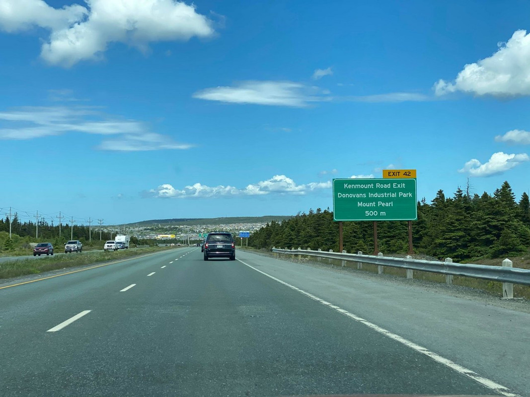
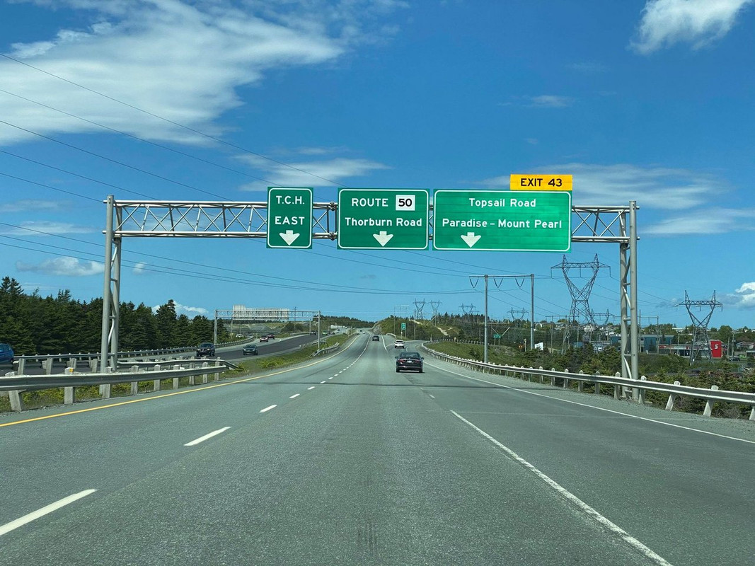
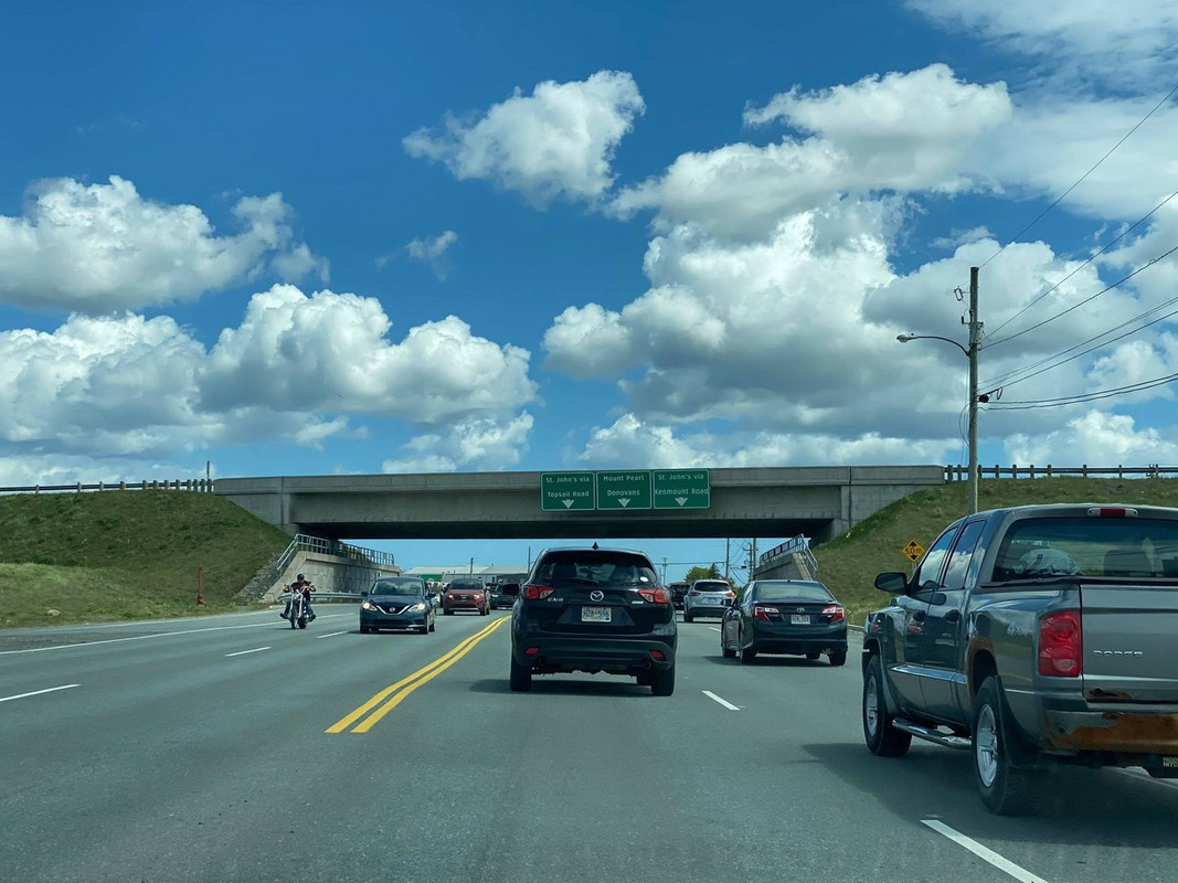
Heading back into the city, now that I'm temporarily living in the suburbs, I got to take a whole new exit - as far as I can recall, for the first time.
Skipping my usual exit...
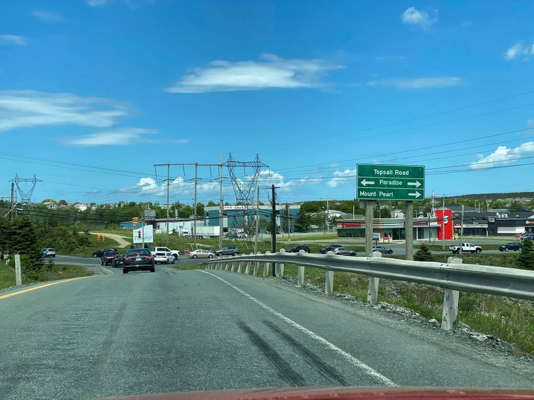
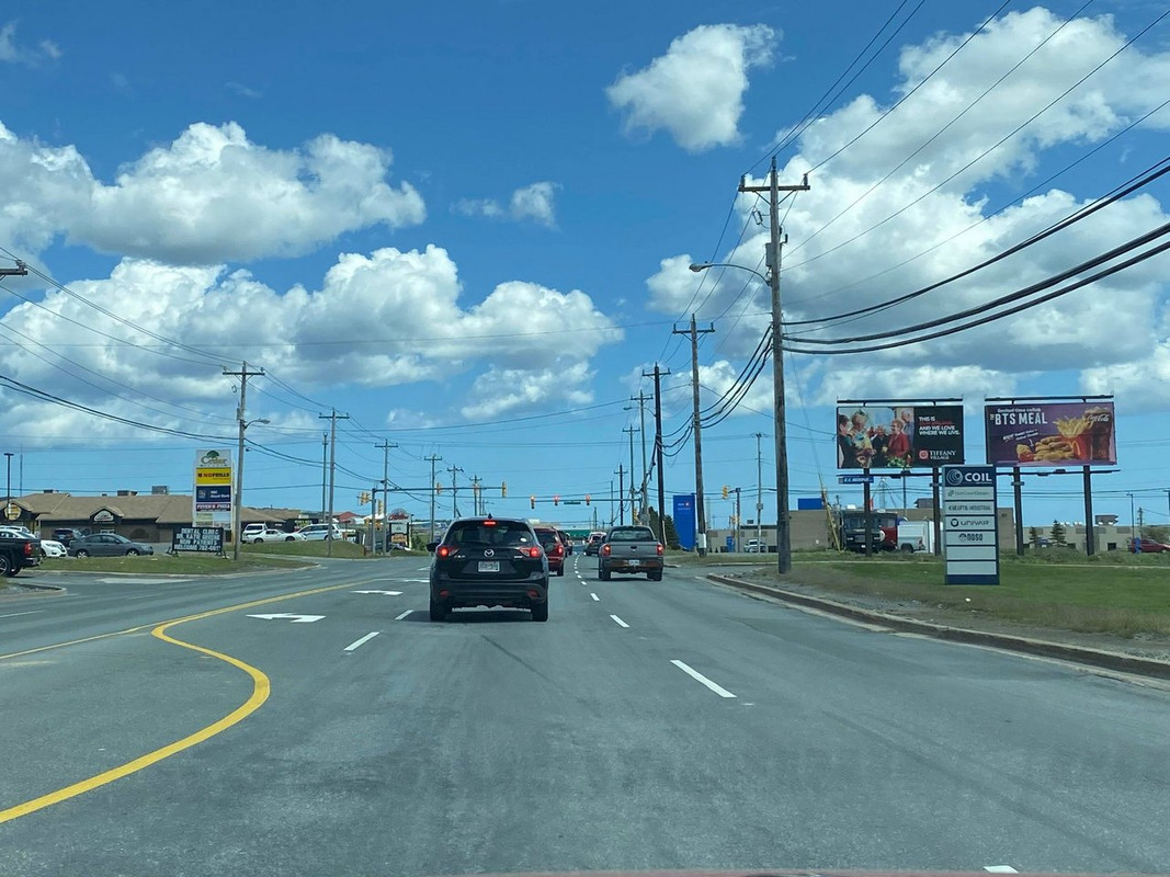
Topsail is the main road in the part of Mount Pearl I'm living in...
The exit is right on the border between the Town of Paradise and the City of Mount Pearl...
This is as urban as they get...
The Kenmount Road overpass above Topsail Road is traditionally considered the border between Townies and Baymen (I'm on the baymen side, facing toward town)... you'll hear it used most commonly here in the phrase "inside/outside the overpass" - for example, "The government doesn't give a shit about anything outside the overpass", "She's dating a guy from inside the overpass but he's not that bad", etc.
__________________ Note to self: "The plural of anecdote is not evidence."
Certainly cheaper, and appropriate too. There is a northbound section of the 118 exiting Halifax which is on a steep grade that has an auxiliary lane for slow truck traffic too. It works well.
I'm not 100% sure about the 118 lane but most of the three lane sections on twinned freeways in Nova Scotia are leftover from the untwinned highways and are left in place due to grades.
There's one on Highway 101 heading west climbing Avonport Mountain. It's my favourite because on the downhill side you get this stunning view entering the Annapolis Valley.
What does annoy me about Highway 118 is it is the best built freeway in Nova Scotia. The entire length is twinned and either has a depressed median or a C/E system. Despite how great the freeway is the speed limit is limited to 100km/h even though the design from 102 to 107 is clearly made for 120km/h. Coming off of 102 the speed reduction sign should be for the right lanes only. The left lane should be marked as a suggested ramp speed of 90km/h followed by a 110km/h sign until the depressed median ends near 107.
St. John's appears to have many more miles of freeway than London (Ont.).
__________________
The whole problem with the world is that fools and fanatics are always so certain of themselves, and wiser people so full of doubts. (Bertrand Russell). Sweet Loretta fart thought she was a cleaner, but she was a frying pan. (John Lennon)
No one ever says freeway here so I’m not even sure what they are or if our highways would qualify Either way what we have extends only 45 minutes outside the city. There’s a similar amount of it on the West Coast either side of Corner Brook.
__________________ Note to self: "The plural of anecdote is not evidence."
I really feel that the TCH should end at Signal Hill. A route using local roads from where the ring road ends would be fine.
I like how in Victoria BC it ends at Beacon Hill in a park with a scenic view of the ocean. It should be a Parks Canada national historic site like Signal Hill is.
It would make more sense than where it is - even Cape Spear would be better. Currently it's right beside City Hall and I've no idea which roads are designated TCH to get you there.
But the TCH could follow Pitts Memorial Drive along the southside, then take Blackhead Road all the way to Cape Spear.
__________________ Note to self: "The plural of anecdote is not evidence."
St. John's appears to have many more miles of freeway than London (Ont.).
IMO, St. John's has a fairly decent highway system for it's size. Two highways that form a horseshoe around the edges of the city, and a third unfinished one that suppose to connect the two in the middle.
St. John's has a ridiculously massive freeway system for a city it's size. Possibly the largest in Canada.
Cities in Ontario that have a population of 200k are lucky to have a regional freeway run through them with 3-4 interchanges. Winnipeg is literally 4x St. John's size and has 0 freeways.
Even by American standards St. John's is well served.
Heading back into the city, now that I'm temporarily living in the suburbs, I got to take a whole new exit - as far as I can recall, for the first time.
Skipping my usual exit...
Topsail is the main road in the part of Mount Pearl I'm living in...
The exit is right on the border between the Town of Paradise and the City of Mount Pearl...
This is as urban as they get...
The Kenmount Road overpass above Topsail Road is traditionally considered the border between Townies and Baymen (I'm on the baymen side, facing toward town)... you'll hear it used most commonly here in the phrase "inside/outside the overpass" - for example, "The government doesn't give a shit about anything outside the overpass", "She's dating a guy from inside the overpass but he's not that bad", etc.
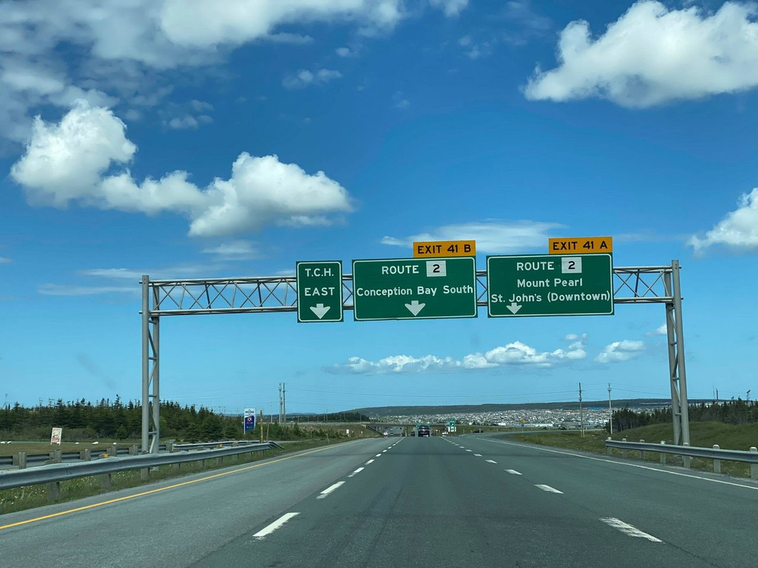
I've always found Newfoundland highway signage (wording) to be very... interesting.
It's like there is very little standardization, as if some guy in the sign shop just decided what should go on the sign.
It's very different from what you see anywhere else in North America.
Very few symbols compared to most places.
__________________
Loin des yeux, loin du coeur.
Last edited by JHikka; Jun 14, 2021 at 3:34 PM.
Reason: photo redundancy
In the book 'A Road For Canada' (TCH History) it says the Trans Canada Highway begins/ends at Signal Hill in St. John's and Beacon Hill Park in Victoria. But looking at this old Newfoundland Provincial Highway map it shows the TCH beginning/ending at the Confederation Building (Provincial Legislature) on Prince Phillip Drive...then following Kenmount Road.
Now the TCH appears to end at Logy Bay Road...north and east of the city:
Here's the end of most easterly Freeway in North America where the 4-lane TCH tapers down to 2 lanes at Exit 50: Logy Bay Road:
At Exit 45 on the TCH.....note the Curling Rock on the overhead sign for the 'Team Gushue Highway'....Cool!!
Now lets head 650 km west to another section of divided TCH between Deer Lake and Corner Brook. This section through the Humber River Gorge is built on a portion of the old CN narrow gauge railbed abandoned in 1989.
It would make more sense than where it is - even Cape Spear would be better. Currently it's right beside City Hall and I've no idea which roads are designated TCH to get you there.
But the TCH could follow Pitts Memorial Drive along the southside, then take Blackhead Road all the way to Cape Spear.
Here's the end of the most easterly road in North America** where it enters the parking lot at Cape Spear National Historic Site
(** I guess there's roads in Greenland but wouldn't consider them easily driveable to!!)
Some friends and I were playing the Canadian map of geoguessing yesterday. Everyone was impressed that I was able to immediately identify ON-11 in Northern Ontario when all that was shown was a highway in the middle of nowhere with a track next to it and km marker 794 (though we also scrolled a bit and saw the sign for Strickland).
The 2nd street view after, at first I thought it was the Prairies until I saw the sign Route 430. I was shouting (with a mask on), “Zoom in on the Island of Newfoundland! NOT LABRADOR! THE ISLAND OF NEWFOUNDLAND. BEYOND DEER LAKE!”
One of the street view was a divided highway with a median barrier. Immediately I recognized it as somewhere in B.C. At first I thought it was Saanich though until we saw the sign for Highway 19. We also saw the sign for Exit 28 Aulds Road. I was like, “MOVE THE POINTER NANAIMO!” Eventually we found it too.
We totally bombed the first one though. At first we thought it was somewhere in York Region but it was actually in the City of Hamilton. Then I thought it was near 403 & the Linc when it was actually somewhere in Waterdown…
Oh ghYHZ, you posting where the "freeway" ends before Logy Bay Road reminded me I actually have in my post above a picture of where it ends in the other direction:
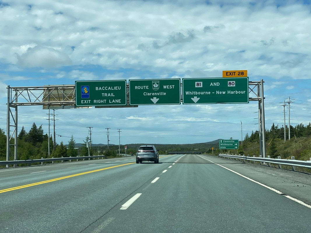
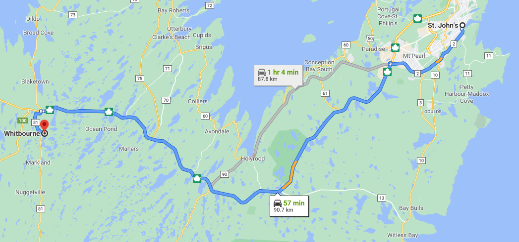
This is just before Whitbourne:
So, a few metres behind me the highway is fully divided, it's already merged into a single four-lane road.
Just over this hill, the right lane becomes the exit, and the left lane begins on the opposite side of the bridge over the highway. Then it continues as two lanes through the town of Whitbourne (former railroad town, now just an assortment of gas stations). After that it's 2-3 lanes the rest of the way across the island, with a couple of four-lane-divided exceptions around larger interchanges/industrial sites.
__________________ Note to self: "The plural of anecdote is not evidence."
I've always found Newfoundland highway signage (wording) to be very... interesting.
It's like there is very little standardization, as if some guy in the sign shop just decided what should go on the sign.
It's very different from what you see anywhere else in North America.
Very few symbols compared to most places.
As far as I know, outside things like colour, there is no standard for signs in NL. They are designed on an adhoc basis by whatever engineer is working on the road.
NL road signs also place less emphasis on route numbers and focus more place names. I often wonder how many locals are even aware of the route numbers.
As far as I know, outside things like colour, there is no standard for signs in NL. They are designed on an adhoc basis by whatever engineer is working on the road.
NL road signs also place less emphasis on route numbers and focus more place names. I often wonder how many locals are even aware of the route numbers.
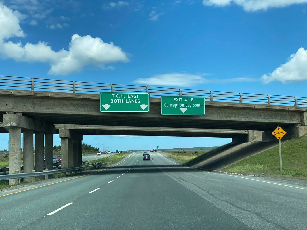
Yeah, it's jarring to me to have "ROUTE (highway number in shield)". Normally you'd just have the shield and that would be enough for people to know that's the highway number.
Then you also have overhead signs on the same road that just have the shield.
And you have signs on the same highway but that say TCH or T.C.H. with no shield or no number at all.





 Prev
Prev





 But you see? They’re all 4-lane divided freeways now.




 Source: Saltwire






 Linear Mode
