HomeDiagramsDatabaseMapsForum About
     

Go Back   SkyscraperPage Forum > Regional Sections > Canada > Ontario > Ottawa-Gatineau > Transportation


Reply

 
Thread Tools Display Modes
     
     
  #2381  
Old Posted Mar 22, 2021, 4:55 PM
J.OT13's Avatar
J.OT13 J.OT13 is offline
Moderator
 
Join Date: Mar 2012
Location: Ottawa
Posts: 29,131
Reply With Quote
     
     
  #2382  
Old Posted Mar 25, 2021, 2:30 PM
J.OT13's Avatar
J.OT13 J.OT13 is offline
Moderator
 
Join Date: Mar 2012
Location: Ottawa
Posts: 29,131
From Leiper's newsletter:

Roosevelt bridge demolition mid-May

The pedestrian/cycling bridge across the Transitway will be demolished in mid-May as part of the LRT construction. A signed detour will be in place directing people to cross the Transitway either at Churchill or the crossing at the SJAM parkway. Workman and the path on the south side will remain open. A few months ago I communicated my expectation to the City that Workman (while extremely low traffic it doesn't have sidewalks) will be made safe, and hope to be able to pass on details of that in the coming weeks.
Reply With Quote
     
     
  #2383  
Old Posted Mar 30, 2021, 8:09 PM
J.OT13's Avatar
J.OT13 J.OT13 is offline
Moderator
 
Join Date: Mar 2012
Location: Ottawa
Posts: 29,131
From Hubley's Twitter. Holly Acres rail bridge.


https://twitter.com/AllanHubley_23/status/1376908265670516742
Reply With Quote
     
     
  #2384  
Old Posted Mar 31, 2021, 2:31 AM
Har13 Har13 is offline
Registered User
 
Join Date: Nov 2020
Posts: 184
Quote:
Originally Posted by J.OT13 View Post
From Hubley's Twitter. Holly Acres rail bridge.


https://twitter.com/AllanHubley_23/status/1376908265670516742
They were up all night doing that Friday night. I drove past on Richmond at 2am and holly acres northbound was closed to traffic.
Reply With Quote
     
     
  #2385  
Old Posted Apr 2, 2021, 11:56 AM
J.OT13's Avatar
J.OT13 J.OT13 is offline
Moderator
 
Join Date: Mar 2012
Location: Ottawa
Posts: 29,131
Pinecrest Creek stormwater pond.


https://twitter.com/AllanHubley_23/status/1377246802181713922

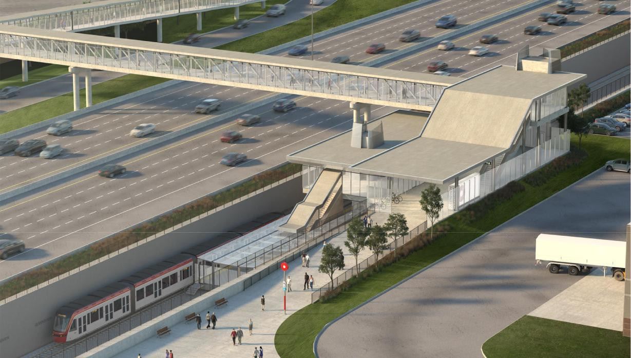
And a new Queensview Station rendering. The platforms are now side (as per GeoOttawa and O-Train Fans for a while now) and the trench is not as deep. The vertical circulation tower seems quite tall.

So it looks like the north elevator tower from the west side, so presumably the station might have another entrance on the other side, as per the original rendering. Maybe not. Maybe they just turned it around.


The old Queensview rendering.


https://otrain.railfans.ca/line-3-stations/queensview
Reply With Quote
     
     
  #2386  
Old Posted Apr 6, 2021, 1:48 PM
J.OT13's Avatar
J.OT13 J.OT13 is offline
Moderator
 
Join Date: Mar 2012
Location: Ottawa
Posts: 29,131
Reply With Quote
     
     
  #2387  
Old Posted Apr 9, 2021, 8:01 PM
J.OT13's Avatar
J.OT13 J.OT13 is offline
Moderator
 
Join Date: Mar 2012
Location: Ottawa
Posts: 29,131
Reply With Quote
     
     
  #2388  
Old Posted Apr 9, 2021, 8:09 PM
J.OT13's Avatar
J.OT13 J.OT13 is offline
Moderator
 
Join Date: Mar 2012
Location: Ottawa
Posts: 29,131
Also, a newly released site plan for the Lincoln Fields area available on O-Train Fans (PDF). It shows the layout of the concourse, vertical circulation, bus loop, MUPs and pedestrian bridge (suggesting re-aligned Parkway and connection to the LF Shopping Centre redevelopment).

https://otrain.railfans.ca/transfer-station/lincoln-fields
Reply With Quote
     
     
  #2389  
Old Posted Apr 9, 2021, 8:53 PM
TransitZilla TransitZilla is offline
Registered User
 
Join Date: Dec 2006
Posts: 2,801
Quote:
Originally Posted by J.OT13 View Post
Also, a newly released site plan for the Lincoln Fields area available on O-Train Fans (PDF). It shows the layout of the concourse, vertical circulation, bus loop, MUPs and pedestrian bridge (suggesting re-aligned Parkway and connection to the LF Shopping Centre redevelopment).

https://otrain.railfans.ca/transfer-station/lincoln-fields
I wonder if that "pedestrian bridge" label is a mistake since they are removing the Transitway and the path leads to a location where there is currently an at-grade crossing of the SJAM. Even if there was a pedestrian bridge there, the Lincoln Fields property is not on the opposite side of the parkway at that location.

https://www.google.com/maps/@45.3671816,...vzWhkzMYhs_5Z1CM0vs2Q!2e0!7i16384!8i8192

EDIT: Also, WHY does the SJAM even need an underpass at Carling?? The amount of land that could be freed up if the SJAM intersected Carling as an at-grade, T intersection is staggering.

Last edited by TransitZilla; Apr 9, 2021 at 9:07 PM.
Reply With Quote
     
     
  #2390  
Old Posted Apr 9, 2021, 9:42 PM
roger1818's Avatar
roger1818 roger1818 is offline
Registered User
 
Join Date: Feb 2016
Location: Stittsville, ON
Posts: 6,610
Quote:
Originally Posted by bradnixon View Post
I wonder if that "pedestrian bridge" label is a mistake since they are removing the Transitway and the path leads to a location where there is currently an at-grade crossing of the SJAM.
I was puzzled by the same thing. The only thing I can think of is that they are re-aligning the SJAM parkway to follow the former transitway to bring the pedestrian overpass closer to the new station. Don't forget the grey lines are existing infrastructure and not necessarily what will be.

Quote:
EDIT: Also, WHY does the SJAM even need an underpass at Carling?? The amount of land that could be freed up if the SJAM intersected Carling as an at-grade, T intersection is staggering.
Likely because the underpass is already there. I do agree that this is an opportunity for improvement. With the LRT line further east, they could probably do something much better.
Reply With Quote
     
     
  #2391  
Old Posted Apr 10, 2021, 2:05 PM
J.OT13's Avatar
J.OT13 J.OT13 is offline
Moderator
 
Join Date: Mar 2012
Location: Ottawa
Posts: 29,131
Here's an overview of that Lincoln Fields plan. A zoomable PDF available on the O-Train Fans link I provided earlier, or for download on Bay Ward Bulletin: https://www.baywardbulletin.ca/lrt-stage-2-lincoln-fields-connectivity-map/

Reply With Quote
     
     
  #2392  
Old Posted Apr 10, 2021, 7:01 PM
Williamoforange's Avatar
Williamoforange Williamoforange is offline
Registered User
 
Join Date: Sep 2020
Location: Ottawa
Posts: 880
Quote:
Originally Posted by bradnixon View Post
I wonder if that "pedestrian bridge" label is a mistake since they are removing the Transitway and the path leads to a location where there is currently an at-grade crossing of the SJAM. Even if there was a pedestrian bridge there, the Lincoln Fields property is not on the opposite side of the parkway at that location.

https://www.google.com/maps/@45.3671816,...vzWhkzMYhs_5Z1CM0vs2Q!2e0!7i16384!8i8192

EDIT: Also, WHY does the SJAM even need an underpass at Carling?? The amount of land that could be freed up if the SJAM intersected Carling as an at-grade, T intersection is staggering.
I think it's just the bridge over Pinecrest Creek, which is getting unburied in that area
Reply With Quote
     
     
  #2393  
Old Posted Apr 11, 2021, 10:45 AM
eltodesukane eltodesukane is offline
Registered User
 
Join Date: Dec 2011
Posts: 1,146
Reply With Quote
     
     
  #2394  
Old Posted Apr 12, 2021, 4:33 PM
Sauvanto Sauvanto is offline
Registered User
 
Join Date: Jan 2021
Posts: 54
Is there a plan or document available on the re-alignment of the SJAM near Carling, and the connectivity to the old Lincoln Fields mall? The above diagram just seems like it provides no proper connection...
Reply With Quote
     
     
  #2395  
Old Posted Apr 12, 2021, 5:01 PM
J.OT13's Avatar
J.OT13 J.OT13 is offline
Moderator
 
Join Date: Mar 2012
Location: Ottawa
Posts: 29,131
Quote:
Originally Posted by Williamoforange View Post
I think it's just the bridge over Pinecrest Creek, which is getting unburied in that area
That makes sense. Too bad.
Reply With Quote
     
     
  #2396  
Old Posted Apr 12, 2021, 5:10 PM
J.OT13's Avatar
J.OT13 J.OT13 is offline
Moderator
 
Join Date: Mar 2012
Location: Ottawa
Posts: 29,131
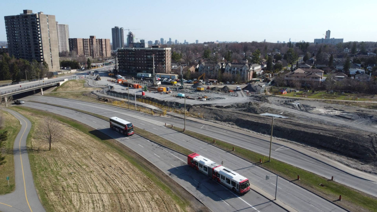
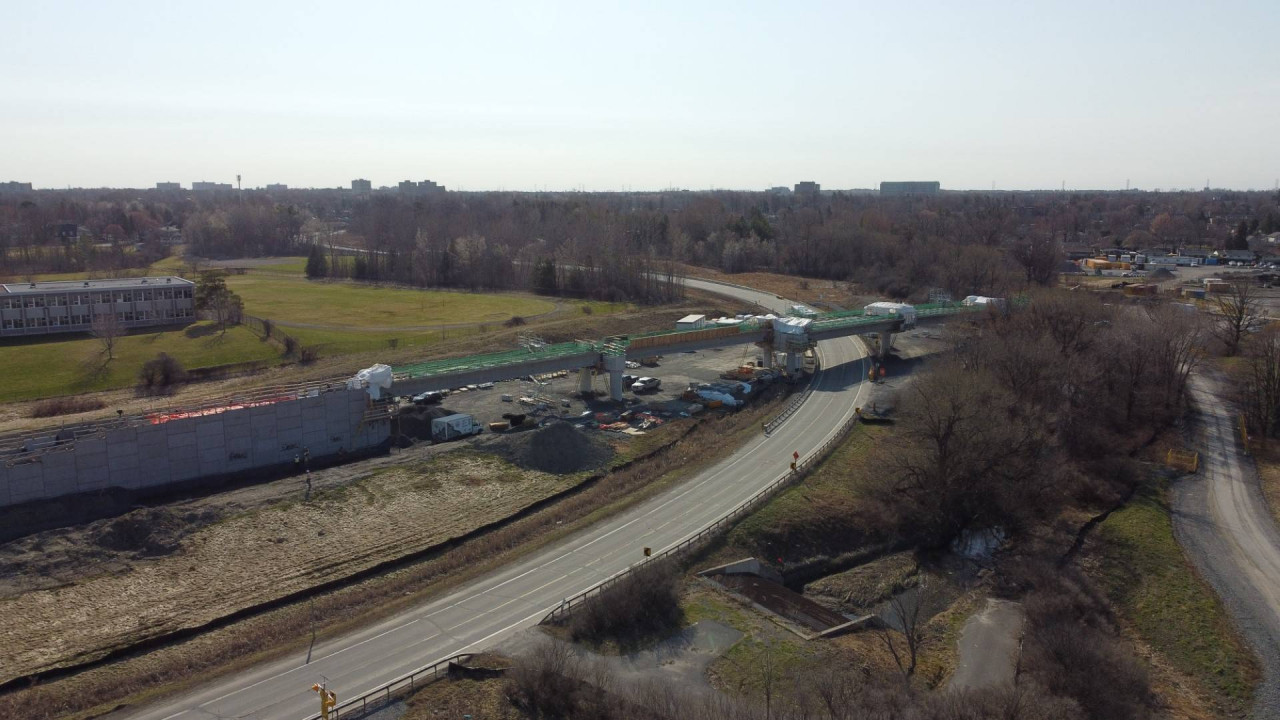
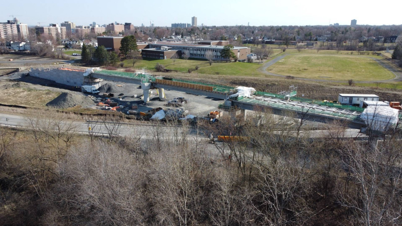
Snapshots from O-Train Fans.

Queensview


Bayshore and Holly Acres rail overpass


Westboro (no progress expected for a while still)


Tunney's Goldenrod Bridge.


Kitchi Sibi (Dominion)


More images of each available on O-Train Fans: https://otrain.railfans.ca/snapshot
Reply With Quote
     
     
  #2397  
Old Posted Apr 13, 2021, 9:01 PM
J.OT13's Avatar
J.OT13 J.OT13 is offline
Moderator
 
Join Date: Mar 2012
Location: Ottawa
Posts: 29,131
According to this, tunnel (or I guess trench, by that point) excavation should be completed by April 2022.

Quote:
Your Guide to Stage 2 O-Train West Extension’s Slurry Plant

Over the last few months, many Ottawa residents driving along the Sir John A. Macdonald Parkway (SJAM) may have seen what looks like an indoor golf driving range by the sight of a large white tent and two white silos (6m high) in the Kitchissippi Ward, near Cleary Avenue. The structure has nothing to do with sports. In fact, the site is called a slurry plant.

This plant is crucial to building two tunnels, key features of the O-Train’s west extension.

The three-kilometre Parkway tunnel will travel between Kichi Sibi and Lincoln Fields stations travelling underneath the SJAM and Byron Linear Park.

Construction of the tunnels has started, using a cut and cover technique, which in non-construction terms, is a top-down technique rather than a drilling method. Cut and cover construction involves using excavation equipment to dig a large trench or rectangular hole in the ground which is then covered by a concrete deck. Once the deck is in place, surface activity can largely resume as construction crews continue to work below.

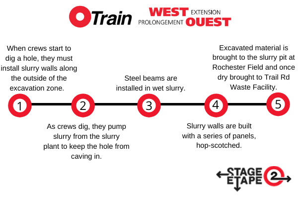
What makes the tunnels unique is the use of slurry walls to support the excavation while digging proceeds. If crews just started digging, water and sand in the area would cause the new excavation to cave-in. These special walls made of mixture of bentonite (a type of clay), water, and cement with steel beams placed inside for strength are waterproof and strong enough to keep the hole from caving in when the crews dig the remaining area of the tunnel between the slurry walls.

As the dirt is dug out, it is replaced by slurry which is pumped from the slurry plant to where the digging is occurring through a series of pipes. The weight of the slurry keeps the hole from caving in. The wall is built with a series of panels, hop-scotched, at about one to two panels per day. When a panel is excavated and filled with slurry, steel beams are installed in the wet slurry. In a couple of days, the slurry dries and hardens (just like concrete) and then a portion of the slurry wall is complete. The process then repeats itself to continue to construct more walls.

When the crane continues to dig through the hole, it puts the excavated material (which contains a mixture of soil, bentonite, cement, dirt, water) into a dump truck which then hauls it to a storage and drying area called slurry pits at Rochester Field near the plant location. The slurry waste is left to dry before being trucked to the Trail Road landfill site.


The slurry wall technique was first introduced during the excavation of the underground rapid transit system in Milan, Italy just after the end of World War II. This new technology became an important component of the top-down tunneling method also known as Metodo Milano ("Milan method"). It made its first rail construction appearance in North America in the 1980s when the Boston subway’s Red Line Northwest Extension project used the modern form of the technology.

Slurry will be mixed in this dedicated plant onsite and the slurry plant will be operational until approximately Spring 2022 when it’s anticipated slurry walls for the tunnels will be fully built.


The current slurry plant visible with two white cement silos and a large white tent. The large tent covers tanks, pumps, and other equipment used to produce slurry.


Aerial westbound view of the slurry plant. It will be operational until approximately April 2022.
https://ottawa.ca/en/planning-developmen...xtension-spring-2021-information-session
Reply With Quote
     
     
  #2398  
Old Posted Apr 13, 2021, 11:34 PM
LRTeverywhere LRTeverywhere is offline
Registered User
 
Join Date: Oct 2018
Posts: 326
Quote:
Originally Posted by Williamoforange View Post
I think it's just the bridge over Pinecrest Creek, which is getting unburied in that area
You are correct, got a response from Connie Defalco at Bay ward.

Quote:
"The pedestrian bridge at Lincoln Fields is a dry creek crossing. In general, in a 100 year storm event, the Pinecrest Creek may overflow its banks, and as a result, will flow towards the Ottawa River. This bridge is designed to accommodate these infrequent storm events to ensure that there is continuous, dry access from the residents on the west side of the SJAM to the station entry, without having to use Carling Avenue.


The pedestrians will cross this bridge and connect to the east side of the signalized intersection and cross the SJAM using the signals.

Sincerely,

Connie Defalco

Councillor Assistant"
Reply With Quote
     
     
  #2399  
Old Posted Apr 20, 2021, 12:04 AM
Kitchissippi's Avatar
Kitchissippi Kitchissippi is offline
Busy Beaver
 
Join Date: Nov 2005
Location: Ottawa
Posts: 4,697
New Orchard, taken today. Looks to be as deep as the Transitway trench

Reply With Quote
     
     
  #2400  
Old Posted Apr 20, 2021, 5:00 PM
J.OT13's Avatar
J.OT13 J.OT13 is offline
Moderator
 
Join Date: Mar 2012
Location: Ottawa
Posts: 29,131
Quote:
Jim Watson
@JimWatsonOttawa

The #Stage2 #OttLRT crews met a major milestone by starting station construction at Lincoln Fields, the first station to start across the East-West Extension! This will be a key transfer connecting to Algonquin & Moodie Stations #Stage2MajorProgress 1/2

In the next few weeks, you will see lots of site prep activity as crews lay down the ground work to build the future Lincoln Fields Station. Stay up to date on the #Stage2WestExtension by signing up for the e-newsletter at http://Ottawa.ca/Stage2Connect 2/2


11:08 AM · Apr 20, 2021·Twitter Web App
https://twitter.com/JimWatsonOttawa/status/1384524452881391619
Reply With Quote
     
     
This discussion thread continues

Use the page links to the lower-right to go to the next page for additional posts
 
 
Reply

Go Back   SkyscraperPage Forum > Regional Sections > Canada > Ontario > Ottawa-Gatineau > Transportation
Forum Jump


Forum Jump


All times are GMT. The time now is 10:58 AM.


Powered by vBulletin® Version 3.8.7
Copyright ©2000 - 2026, vBulletin Solutions, Inc.