Fine I’ll look up the actual distance between Deacon’s Corners and Falcon Lake and put in a specific number. When I first wrote this, I was doing it in a hurry so I didn’t think much about the actual number.
Ps: At this rate, I’m afraid both of us are gonna get suspended...
Edit: Wow, with the shorter distance, it actually serves my narrative better.
Wait, you are not talking about the 2 lanes, but the 4 lanes?
This is with me having driven to Halifax twice and out to Yorkton (SK) once too. (Insert cry face.) I actually wanna go as far as Sydney, N.S. or even St John’s, N.L. whenever the Argentia run is running.
I hope you mean you're just taking the Argentia Ferry one-way......then returning on the other ferry . If not.....you'll be missing a lot of Newfoundland: it's 900 km between St. John's and Port aux Basques
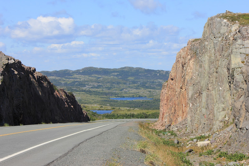
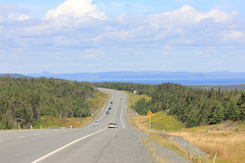
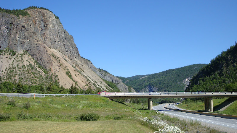
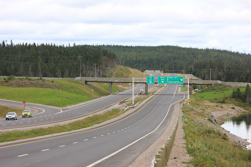
Here’s the Trans Canada Highway through the narrow Humber River gorge near Corner Brook and another section of twinned TCH. And in case you haven’t noticed.....there’s hardly any traffic. Other than the surge of 400 cars and trucks when a ferry docks.....you have a wide, straight highway nearly to yourself. Just watch out for moose (which I didn’t see on this trip)
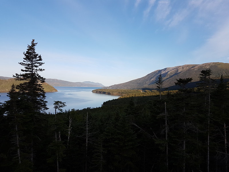
And you really have to get of the Trans Canada to see Newfoundland:
I really love the last picture.
My time and budget may not say yes to going back via Port-aux-Basque though......
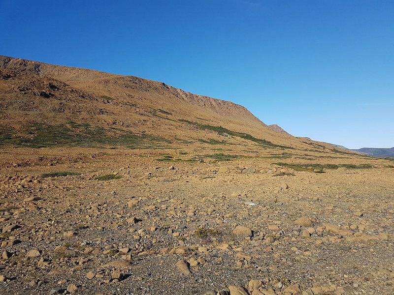
Those look like the tablelands in Gros Morne National Park. They are actually geologically very unique. What you are looking at is exposed mantle. It may be the only such place on the planet where this phenomenon exists. Nothing grows on it.
"Do what you gotta do" to make a cross-Newfoundland trip happen. If nothing else, use the savings on the shorter ferry trip to fund at least a night in the Corner Brook/Deer Lake area.
I found that taking the midnight ferry from Sydney to Port aux Basques worked out perfectly, at least in the summer, as you arrive just after dawn. Port aux Basques and the surrounding low mountains are starkly beautiful. The drive to Corner Brook and Gros Morne is really nice and the Tablelands pictured above are definitely worth a day hike.
Those look like the tablelands in Gros Morne National Park. They are actually geologically very unique. What you are looking at is exposed mantle. It may be the only such place on the planet where this phenomenon exists. Nothing grows on it.
Yes that is the Tablelands in Gros Morne along the Highway to Trout River.
I've been there a few times. I'll have to post some of the photos I took while there sometime.
Hiking in the Tablelands.....in a lunar type landscape:
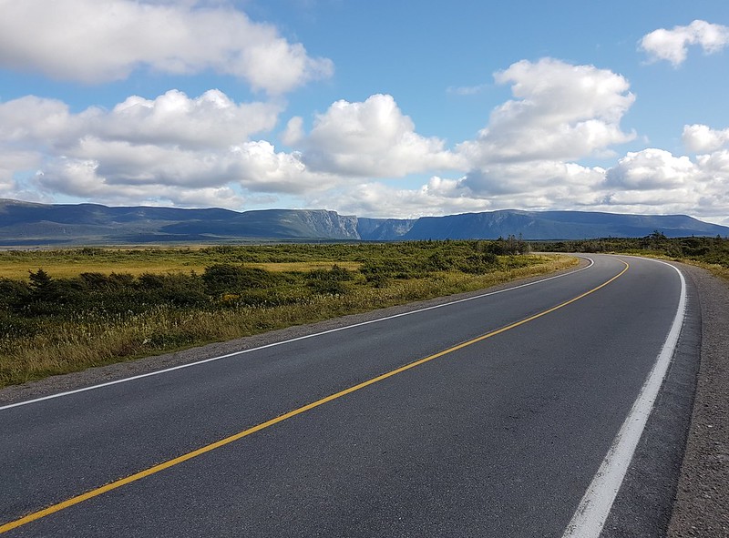
Then hop on NL430 up the west coast of Newfoundland.....long straight stretches of highway with little traffic and a pleasure to drive.
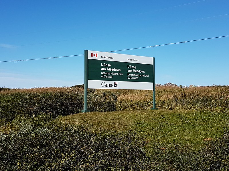
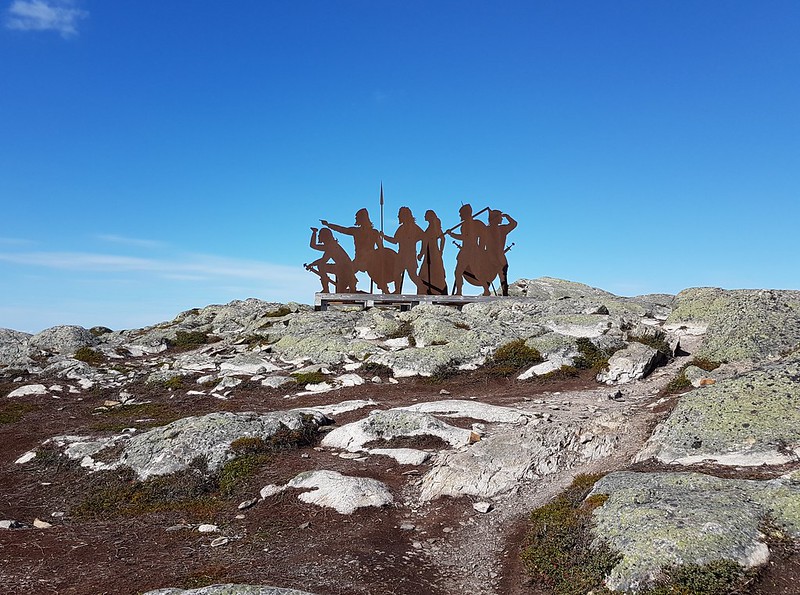
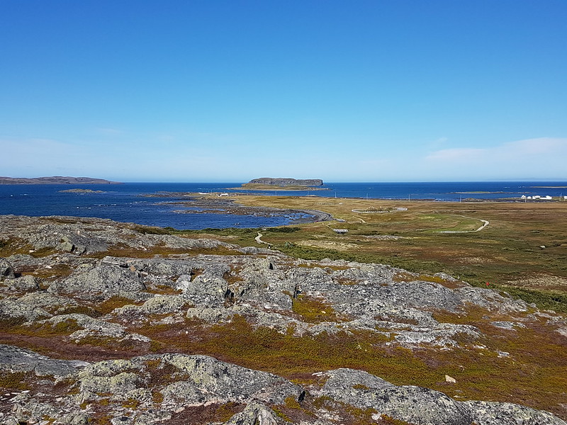
700km north of the Ferry at Port-aux-Basques......you reach the Viking Settlement at L’Anse aux Meadows.....a Parks Canada/UNESCO World Heritage Site and the only authenticated Norse Settlement in North America. It's 1000 years old and established 500 years before Columbus. You think of this as being way up north....but it's at the same latitude as London, England
The remains (footprint) of the sod buildings is quite evident around the site and Parks Canada has replicated how one of those buildings might have looked.
Yes that is the Tablelands in Gros Morne along the Highway to Trout River.
I've been there a few times. I'll have to post some of the photos I took while there sometime.
Are table rocks different from table lands? I know that the Neebing - Nipigon Corridor is famous for the former. There’s even a gorge in Ouimet. (Unfortunately I was driving on TCH through Ouimet at 11 pm so I missed all that. I was preoccupied with the thought of getting to Marathon - Heron Bay so I could check out Pukawaska NP the next day.)
The Tablelands are a (relatively) flat elevated plateau. That's how they got their name. I doubt there is any geological similarity between the Tablelands and the table rocks in northern ON.
Again, the Tablelands are a geological oddity - exposed mantle on the surface of the Earth, which is unique on the planet. The Tablelands are a UNESCO World Heritage Site. The land is extremely mineral poor, which is why nothing grows on it.
I just learned that BC has 50 highway border crossings with Alaska, Washington State, Idaho, Montana, Alberta, the Yukon, and the Northwest Territories.
__________________
Peak SSP:
28C is hotter than 42C
Vancouver is not on the ocean but Quebec City is.
I just did a count for Ontario, I counted roughly 48 crossings, 34 are with Quebec mostly south of Ottawa on small side roads only 1 in the west with Manitoba, the rest are with Minnesota, Michigan, and New York.
Also funny enough, if an Ontario driver gets busted for traffic infraction in MN, even upon conviction, the demerit points don’t transfer over as Ontario doesn’t have an agreement with Minnesota on that. In N.Y. and MI though...
I just did a count for Ontario, I counted roughly 48 crossings, 34 are with Quebec mostly south of Ottawa on small side roads only 1 in the west with Manitoba, the rest are with Minnesota, Michigan, and New York.
Ah interesting I was hoping other provinces would chime in with their counts.
__________________
Peak SSP:
28C is hotter than 42C
Vancouver is not on the ocean but Quebec City is.
Why? Do you think there should be more? Glancing at a map really quickly seems to indicate not.
NS and NB only have two crossings, three if you include the Saint John-Digby ferry.
It's not as if interprovincial crossings are all that important...much less so than international crossing, obviously.
2 crossings in 15 miles, compared to 1 in 600 miles. I get that there is a lot of empty space in northern Ontario and Manitoba, but you'd still think there would be a couple roads up there. I'm not saying that border is crossing-deprived or anything, but a first impression of looking at the globe is there would be some type of roads.
Why? Do you think there should be more? Glancing at a map really quickly seems to indicate not.
NS and NB only have two crossings, three if you include the Saint John-Digby ferry.
It's not as if interprovincial crossings are all that important...much less so than international crossing, obviously.
Actually, there is a third land crossing on the Chignecto isthmus - Mount Whatley Road, about 3-4 km north of the TCH off of Fort Lawrence Road. Interestingly, It connects to Eddy Road on the NB side of the border, which, given the proximity to Fort Beausejour/Fort Cumberland, may have been named after the rebel Jonathon Eddy, who led the Eddy Rebellion during the American War of Independence, and who tried to capture Fort Cumberland for the rebel cause.
Actually, there is a third land crossing on the Chignecto isthmus - Mount Whatley Road, about 3-4 km north of the TCH off of Fort Lawrence Road. Interestingly, It connects to Eddy Road on the NB side of the border, which, given the proximity to Fort Beausejour/Fort Cumberland, may have been named after the rebel Jonathon Eddy, who led the Eddy Rebellion during the American War of Independence, and who tried to capture Fort Cumberland for the rebel cause.
2 crossings in 15 miles, compared to 1 in 600 miles. I get that there is a lot of empty space in northern Ontario and Manitoba, but you'd still think there would be a couple roads up there. I'm not saying that border is crossing-deprived or anything, but a first impression of looking at the globe is there would be some type of roads.
About 30-35 years ago, a road was planned that would have linked the Red Lake area to Manitoba but Ontario nixed it, supposedly because they thought it was mostly for Manitoba's economic benefit.
There really aren't any other places where a road from Manitoba to Ontario would be practical or needed. The entire border area in Manitoba is rugged Canadian Shield and taken up by provincial parks.
__________________
crispy crunchy light and snappy
I just did a count for Ontario, I counted roughly 48 crossings, 34 are with Quebec mostly south of Ottawa on small side roads only 1 in the west with Manitoba, the rest are with Minnesota, Michigan, and New York.
There are at least three crossings between Manitoba and Northern Ontario that go unnoticed by most people. Both Werner Lake and Ingolf in Ontario have road access only from Manitoba. On the Manitoba side, Hwy 312 goes almost to Ingolf which sits on the Ontario side of the border and Hwy 315 becomes Werner Lake Road after it crosses into Ontario towards Werner Lake.
And there's also a road in Shoal Lake First Nation that crosses the border. I'm not sure if it connects to other roads in Manitoba but I think it's supposed to eventually. It was in the news recently about how the Winnipeg River flows through there and supplies Winnipeg with drinking water yet the First Nation didn't have safe drinking water until recently because of whatever diversion that was done in the past.





 Prev
Prev









 Linear Mode
