Quote:
Originally Posted by roger1818

I suspect that the power car isn’t designed to power more than a 59m train. Few cities need (or could even use) LRT vehicles longer than that.
On the bright side, should we switch to driverless trains, it gives us a way of increasing capacity when the trains need to be replaced.
|
There's that. With evolving technology, we might one day be able to produce either a 120 meter train with no cabs, or at the very least, two 60 meter cars with no cabs.
jchilds also brings up good points, with shorter work areas and more flexibility if certain cars are out of service for maintenance or repairs. I would hope that, at the very minimum, they built the maintenance bays 60 meters to accommodate the longer fleet in a couple years.
Quote:
Originally Posted by Kitchissippi
We could have gone for a stubbier front end, it's not like these things need to be aerodynamic. It would have looked nicer coupled instead of the sharp nose-to-nose that results in a large visual gap.
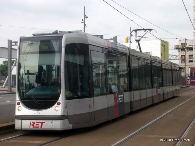
Rotterdam's Citadis:
 |
With tains will be traveling up to 100 km/h, mostly outside, an aerodynamic design probably is important.
Quote:
Originally Posted by swimmer_spe
Could they not make vehicles like the Toronto Rocket?
|
In what way? The Toronto Rocket is powered by a third rail as opposed to overhead wires, so if power supply is the issue, we couldn't.
Quote:
Originally Posted by Hybrid247
I just noticed something odd about Cyrville station. The east side fare gates will be on Level 2 while the west side gates will be on Level 1. That must mean that the entirety of Level 1 is over 100 meters long, possibly long enough for two 59-meter LRV units, and won't require an extension in the future.
|
I had noticed that too. According to
GeoOttawa, platform length is 100 meters. Future expansion will be to the east (or north/east, depending on how you look at it), so the opposite side of the platform gates.
Quote:
Originally Posted by capital_urbanite
I fail to even see the need for exploded station maps?! Leave it to Ottawa to bloatify something that should be super simple.
Just put a list of the amenities available at each station on the website. Once I'm at the station, signs and intuitive architectural design will shepard me to where I want to go.
|
I think it's an important step in order to introduce people to a very different way of getting around. This isn't the relatively simple Transitway stations of the past, these are very large and complex metro stations. Certain stations like Bayview aren't intuitive at all. You have to enter from Albert on the eastbound platform, go down to the concourse and back up to the westbound platform. Or Tunney's where the washrooms are on the (future) westbound platform. Or the subway stations with a bunch of entrances, some with elevators, others without.
I can certainly understand the complaints design wise, but those opposing the concept of having such maps is puzzling to me.
Quote:
Originally Posted by PHrenetic
Good Day.
Yeah... I had just kinda noticed the same thing in several station outlines in the Ottawa GeoOttawa train overlay maps, where several stations seem to be indicated as built out to 100 m. , and several of the planned Phase 2 stations also seem to be getting indicated as at 100 m. straight off. Other stations indicate the empty box of the reserved 10 m additional space.
This would seem to be confirmation that at least some stations are being built as max'ed out immediately. Long-term money-saving (How Odd !!). 
Interesting! |
Based on GeoOttawa, Stage 2 station lengths vary from 90 meters (for example Iris), to 100 meters (Baseline and Moodie) up to 120 meters (Cleary and New Orchard, within and between the cut and cover tunnel, where it would be extremely expensive and disruptive to expand in the future).


 Prev
Prev


 Linear Mode
