Quote:
Originally Posted by Obadno

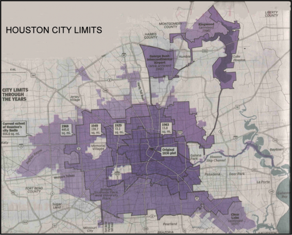
Yeah we always get dinged here because huge areas of the "city" are city preserves, riverbed and large empty nothing in the northern "city limits"
|
that is one reason why straight-up population/city limits land area calcs can be poor as a comparison tool.
in chicago's case, we have two major international airports inside city limits that take up 14 sq. miles of completely uninhabited land.
additionally, on the far south side there's the lake calumet industrial area which is inside city limits and consists of 18 sq. miles of uninhabited industrial wastelands.
that's 32 sq. miles of uninhabitted land in chicago right there. that's nearly the size of the entire city of miami!
many of the smaller cities with tighter city limits don't include things like giant airports or more than a dozen sq. miles of industrial wastelands, so their average density figures look better on paper.
weighted density figures, which typically look at smaller geographies like census tracts, and then weight the tracts where more people live more heavily, work much better as a comparison tool.


 Prev
Prev


 Linear Mode
