Quote:
Originally Posted by goodgrowth

Well that's a whole other issue. I was just talking about people driving to and from Labrador itself. But even if Quebec decided to put the north shore highway there to get to the rest of Quebec/mainland Canada (aka civilization) is it really going to be that much better than the existing route? Are people/tourists from Canada and the States going to travel on a Quebec highway through nowhere or go through The Maritimes and use the ferry? My guess is the latter. Same with people from St. John's/most of island. Are you going to us drive up Northern Peninsula then through barely populated part of Quebec or go through The Maritimes? I think the latter.
|
From a tourist point of view, if you're looking to site see along the way, the ferry is a no brainer. If you're just looking to get on and off the island it depends I guess.
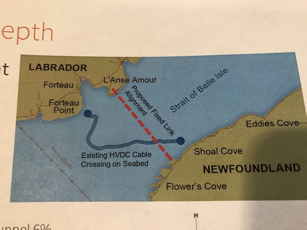
It's 1322 km (15.5 hour) drive from Montreal to Kegashka, QC, which is the furthest the coastal highway goes in Quebec. There's a straight-line distance of 270 km between Kegashka and the next stretch of road at Vieux-Fort, QC. The distance between Vieux-Fort and Point Amour is 96km (1.5 hours). So we're talking about a 20 hour drive to the tunnel. It's then a 10 hour drive to St. John's, being a total time of appx 30 hours to get from Montreal to St. John's.
Currently as it stands with highway infrastructure in place, it takes 2350 km (31 hours) to get from Montreal to Point Amour, and then 10 hours to St. John's for 41 hours total.
Compare that to the Maritime route: 1451 km (14.5 hours) from Montreal to North Sydney, a 6'ish hour ferry ride to Port Aux Basque, and then a 10 hour drive to St. John's for a total time of 30.5 hours.
Ultimately truckers who dont want to be bothered by the ferry schedule would prefer the Labrador route if the highway were completed, but I would personally rather get out of the car and stretch my legs on a boat instead of driving through more wilderness.





 Prev
Prev







 Linear Mode
