HomeDiagramsDatabaseMapsForum About
     

Go Back   SkyscraperPage Forum > Global Projects & Construction > City Compilations


Closed Thread

 
Thread Tools Display Modes
     
     
  #7181  
Old Posted Aug 16, 2016, 3:34 AM
Comrade's Avatar
Comrade Comrade is offline
 
Join Date: Jan 2002
Posts: 9,645
Quote:
Originally Posted by Future Mayor View Post
What's interesting, and a point that was brought up in the article, is that perceived crime is a major concern for the area. I have a client buying a home just a block and a half off of North Temple, family members were concerned about the "Crime" in Rose Park. Based on the Stats from Salt Lake City Police Department, District 1 is the second lowest in number of Tier 1 crimes of all 7 Council Districts, the only one lower is District 6, Foothill area. So it truly is about changing perceptions rather than reducing overall crime.
I think the perception comes probably more from the violent crime aspect of the area.

Of the five homicides in SLC between Jan. 1st and the end of July, two happened in District 1, two in District 2 (Poplar Grove, Glendale area) and one in District 3 (West Cap Hill, Cap Hill, Avenues, Downtown, etc). Most people look at the west side in one clump and hardly defined by district boundaries. In fact, I bet most Salt Lakers, and Utahns, could not tell you where District 1 ends and where District 2 begins - or where Rose Park ends and Glendale begins. It's all the same and, unfortunately, a bulk of the major crime still happens on the city's west side ... whether it's western downtown, Rose Park, Glendale or Poplar Grove.
     
     
  #7182  
Old Posted Aug 16, 2016, 3:50 AM
Liberty Wellsian Liberty Wellsian is offline
 
Join Date: Oct 2015
Posts: 810
Quote:
Originally Posted by Future Mayor View Post
What's interesting, and a point that was brought up in the article, is that perceived crime is a major concern for the area. I have a client buying a home just a block and a half off of North Temple, family members were concerned about the "Crime" in Rose Park. Based on the Stats from Salt Lake City Police Department, District 1 is the second lowest in number of Tier 1 crimes of all 7 Council Districts, the only one lower is District 6, Foothill area. So it truly is about changing perceptions rather than reducing overall crime.
Most of SLC is hit and miss. There are little pockets all over the city that produce crime(and the opportunity for theft that businesses provide). Trust your eyeballs, if the place next door is scummy you're going to have problems. Otherwise it's a pretty safe city all over.
     
     
  #7183  
Old Posted Aug 16, 2016, 7:47 AM
Stenar's Avatar
Stenar Stenar is offline
 
Join Date: Jul 2008
Posts: 3,234
Quote:
Originally Posted by transistor View Post
You can rest easy, this rendering has the mountains exactly where downtown Denver should be. The real thing is bound to be substantially less picturesque.

Its a hotel in the middle of nowhere surrounded by single family homes and half-empty strip malls filled with chain restaurants. If I remember correctly, its probably closer to 3 miles from the airport or so, but that's no mans land. I doubt it will be able to draw much away from downtown Denver, especially since you know, people want to go to conferences in places where there are restaurants, sights, and semblances of human existence.
Google Maps says this Aurora hotel development is 9.4 miles from the Denver airport. I'll take their word for it.
     
     
  #7184  
Old Posted Aug 16, 2016, 10:51 AM
delts145's Avatar
delts145 delts145 is online now
 
Join Date: Aug 2006
Posts: 20,799
Quote:
Originally Posted by transistor View Post
You can rest easy, this rendering has the mountains exactly where downtown Denver should be. The real thing is bound to be substantially less picturesque.

Its a hotel in the middle of nowhere surrounded by single family homes and half-empty strip malls filled with chain restaurants. If I remember correctly, its probably closer to 3 miles from the airport or so, but that's no mans land. I doubt it will be able to draw much away from downtown Denver, especially since you know, people want to go to conferences in places where there are restaurants, sights, and semblances of human existence.

With that many hotel rooms, and what seems to be a lot of ancillary entertainment, I imagine they're trying to create something of a self contained island. They can book people in for conventions and provide them with enough activity to capture a certain amount of dollar traffic. Also, it would be pretty easy to provide groups with sightseeing bus tours into downtown Denver. Interesting, how they drew the mountains so close, as if this thing is more of a mountain resort, than being located out on the plains, in the middle of nowhere. I always get a kick out of the perception people generally have of Denver being located in the mountains, and not on the plains.
     
     
  #7185  
Old Posted Aug 16, 2016, 11:49 AM
flyinpenguin flyinpenguin is offline
 
Join Date: Jan 2016
Posts: 53
Convention Hotel

Recently there has been mention that the county needs to step in and build the hotel and if successful it can be sold off to a new owner. This is exactly what needs to happen. It is also essentially what West Valley City did in building the Embassy Suites. I believe in their case due to economic timing the developer wasn't able to obtain financing so they structured it as a lease to own.
     
     
  #7186  
Old Posted Aug 16, 2016, 1:20 PM
Marvland's Avatar
Marvland Marvland is offline
 
Join Date: Oct 2014
Posts: 674
Quote:
Originally Posted by Future Mayor View Post
What's interesting, and a point that was brought up in the article, is that perceived crime is a major concern for the area. I have a client buying a home just a block and a half off of North Temple, family members were concerned about the "Crime" in Rose Park. Based on the Stats from Salt Lake City Police Department, District 1 is the second lowest in number of Tier 1 crimes of all 7 Council Districts, the only one lower is District 6, Foothill area. So it truly is about changing perceptions rather than reducing overall crime.
Thanks for this. So true. I'm a Fairpark guy. Other than some typical urban problems, mostly surrounding run down, do-nothing, slum-lorded four and eight-plexes, my neighborhood is super quiet. The North Temple corridor (I HATE the NOTE branding, seems sooo Denver in 2010, which is sooo Seattle in 2005) is bisected by a few neighborhoods that do have small islands of crime, mostly packed in within a block of North Temple. 8th West and North Temple is a hotbed of —, mostly because those motels haven't turned yet (which they will eventually). Guadalupe is my favorite urban ethnic hood though. Fairpark/North Temple has a bunch of homeless people milling about.

A lot of people like to focus on the East Side, but no other corridor in the city will change more over the next ten years than North Temple. This is why the city needs to get the TSA changes "just so". I'm extremely worried about a few of these proposed changes whose whole purpose seems to be to make the planning department's jobs easier, which is bass-ackward. I'm working really hard on this issue right now. TSA zoning is the best zoning we have and we're just barely scratching the surface. The worst thing they can do is tame it too much.
     
     
  #7187  
Old Posted Aug 16, 2016, 4:59 PM
LeVaJe LeVaJe is offline
 
Join Date: Nov 2014
Posts: 30
Quote:
Originally Posted by Future Mayor View Post
A couple of issues I see with that.
1) I believe the LDS Church owns both those parcels that you outlined, or at least a portion of the blue block. I don't believe the city and/or county own anything on that northern block, (assessors site is down), except SL School district, so they don't have property to facilitate a land swap.

2) The LDS Church has more plans than just BYU Salt Lake Center, on the block in Red, including an expanded LDSBC. If I'm not mistaken the overall design is to have a nearly continuous path, from State St all the way to 300 W, mid-block.

3) If convention companies are demanding contiguous exhibit/expo space, connecting under S. Temple won't facilitate that.
The assessors site is not working properly because it is trying to load unsecure content in a secure page. You can get it to work if you remove the "s" from the "https:"
http://slco.org/assessor/new/javaapi2/parcelviewext.cfm?parcel_ID=&query=Y
     
     
  #7188  
Old Posted Aug 16, 2016, 6:14 PM
wong21fr's Avatar
wong21fr wong21fr is online now
 
Join Date: Feb 2002
Posts: 13,126
Quote:
Originally Posted by delts145 View Post
With that many hotel rooms, and what seems to be a lot of ancillary entertainment, I imagine they're trying to create something of a self contained island. They can book people in for conventions and provide them with enough activity to capture a certain amount of dollar traffic. Also, it would be pretty easy to provide groups with sightseeing bus tours into downtown Denver. Interesting, how they drew the mountains so close, as if this thing is more of a mountain resort, than being located out on the plains, in the middle of nowhere. I always get a kick out of the perception people generally have of Denver being located in the mountains, and not on the plains.
You're correct in this analysis. This is a Gaylord hotel and is meant for those closed ecosystem conventions that use the Gaylord circuit and just go to a different resort year after year. Though it's not in Denver, it's in our — suburb of Aurora and its those idiots out there that are taking it up the — to the tune of $400M in subsidies. They're the only ones desperate enough to give up that much money for this craptacular project to try and get their banal town on the map.

The renderings of the project having the Rockies so close is a typical Colorado thing, more so for this project as its been branded as Gaylord Rockies.
     
     
  #7189  
Old Posted Aug 16, 2016, 6:51 PM
Stenar's Avatar
Stenar Stenar is offline
 
Join Date: Jul 2008
Posts: 3,234
Quote:
Originally Posted by wong21fr View Post
You're correct in this analysis. This is a Gaylord hotel and is meant for those closed ecosystem conventions that use the Gaylord circuit and just go to a different resort year after year. Though it's not in Denver, it's in our — suburb of Aurora and its those idiots out there that are taking it up the — to the tune of $400M in subsidies. They're the only ones desperate enough to give up that much money for this craptacular project to try and get their banal town on the map.

The renderings of the project having the Rockies so close is a typical Colorado thing, more so for this project as its been branded as Gaylord Rockies.
$81 million of the subsidy is coming from the state.
     
     
  #7190  
Old Posted Aug 16, 2016, 7:13 PM
Marvland's Avatar
Marvland Marvland is offline
 
Join Date: Oct 2014
Posts: 674
Quote:
Originally Posted by Comrade View Post
I think the perception comes probably more from the violent crime aspect of the area.

Of the five homicides in SLC between Jan. 1st and the end of July, two happened in District 1, two in District 2 (Poplar Grove, Glendale area) and one in District 3 (West Cap Hill, Cap Hill, Avenues, Downtown, etc). Most people look at the west side in one clump and hardly defined by district boundaries. In fact, I bet most Salt Lakers, and Utahns, could not tell you where District 1 ends and where District 2 begins - or where Rose Park ends and Glendale begins. It's all the same and, unfortunately, a bulk of the major crime still happens on the city's west side ... whether it's western downtown, Rose Park, Glendale or Poplar Grove.
Very limited data set there. Here. Let me fix that for you: http://www.neighborhoodscout.com/ut/salt-lake-city/crime/. I would argue that when you control for the homeless shelter proximity and the massive amount of run down commercial in the North Temple corridor, the NW quadrant, WEST OF I-15 is the safest urban sector in the city. West Temple south (basically the CG corridor), Central City east and the central Avenues have way higher crime.
     
     
  #7191  
Old Posted Aug 16, 2016, 7:16 PM
wong21fr's Avatar
wong21fr wong21fr is online now
 
Join Date: Feb 2002
Posts: 13,126
Quote:
Originally Posted by Stenar View Post
$81 million of the subsidy is coming from the state.
True, though it was sought by Aurora, think of it as a local grant.
     
     
  #7192  
Old Posted Aug 17, 2016, 1:17 AM
AllOutOfBubbleGum's Avatar
AllOutOfBubbleGum AllOutOfBubbleGum is offline
 
Join Date: Feb 2014
Posts: 303
Quote:
Originally Posted by wong21fr View Post
You're correct in this analysis. This is a Gaylord hotel and is meant for those closed ecosystem conventions that use the Gaylord circuit and just go to a different resort year after year. Though it's not in Denver, it's in our — suburb of Aurora and its those idiots out there that are taking it up the — to the tune of $400M in subsidies. They're the only ones desperate enough to give up that much money for this craptacular project to try and get their banal town on the map.

The renderings of the project having the Rockies so close is a typical Colorado thing, more so for this project as its been branded as Gaylord Rockies.
     
     
  #7193  
Old Posted Aug 17, 2016, 3:32 AM
Comrade's Avatar
Comrade Comrade is offline
 
Join Date: Jan 2002
Posts: 9,645
Quote:
Originally Posted by Marvland View Post
Very limited data set there. Here. Let me fix that for you: http://www.neighborhoodscout.com/ut/salt-lake-city/crime/. I would argue that when you control for the homeless shelter proximity and the massive amount of run down commercial in the North Temple corridor, the NW quadrant, WEST OF I-15 is the safest urban sector in the city. West Temple south (basically the CG corridor), Central City east and the central Avenues have way higher crime.
I'm confused as to what you're fixing for me? It's clear most the homicides the city experiences happens on the west side and a great deal of the violent crime, as well. It doesn't mean it's overall got a worse crime rate, but it's got a worse overall reported, as in local media, crime rate - which plays into perception.

Just looking at homicides, assault with a deadly weapon, robbery and — assault (so, not theft, which is one of the largest crimes in SLC...and something that, while big, is not necessarily scary).

Between I-80 to the north, 201 to the South, I-15 to the East and 215 to the West, or roughly, a good chunk of the Glendale neighborhood, between February and today, there've been 89 incidents shown. Same metrics, with I-80 the southern border now, and Rose Park Golf Course now the northern border, so, the Rose Park area, you have 165 incidents shown. That's a total of 254 incidents of that kind on the city's west side.

In a more vast area, between 300 West to the west, 1300 South to the south - and all the way to the U to the east (and up to the northern tip of the city), so, basically, most of downtown, a good chunk of Central City, the Avenues, the U area, Trolley Square and so on, there were 214 incidents.

There's 122 incidents in the area south of this - including Sugar House, which, when coupled with central Salt Lake, certainly has a higher overall crime amount than west SLC - but Sugar House is not Central City.

These #s taken from the city's official website. What does it mean? There's a reason people feel the west side is less safe than the rest of the city. With that said, downtown could skew the numbers even more, though depending on what area of downtown you're looking at (I think the Rio Grande area has a strong western vibe, while, say, Library Square is more Central City).

Regardless, there's something to it.

     
     
  #7194  
Old Posted Aug 17, 2016, 3:55 AM
Liberty Wellsian Liberty Wellsian is offline
 
Join Date: Oct 2015
Posts: 810
This discussion got me geeking out on city-data maps.

The population of the city is more concentrated than I thought. I figured that the population lived on about 40-50% of the land but judging by this map it's closer to 25%. (Edit: looks like you have to type Salt Lake City into the dialog to show the city borders)

http://www.city-data.com/#mapOSM?mapOSM[zl]=11&mapOSM[c1]=40.79353864997009&mapOSM[c2]=-111.92047119140624&mapOSM[s]=blocks3&mapOSM[fs]=false

Salt Lake County (again type Salt Lake county into the dialog to show borders)

http://www.city-data.com/#mapOSM?mapOSM[zl]=10&mapOSM[c1]=40.66813955408042&mapOSM[c2]=-111.90811157226562&mapOSM[s]=blocks3&mapOSM[fs]=false
     
     
  #7195  
Old Posted Aug 17, 2016, 4:56 AM
Marvland's Avatar
Marvland Marvland is offline
 
Join Date: Oct 2014
Posts: 674
Quote:
Originally Posted by Comrade View Post
I'm confused as to what you're fixing for me? It's clear most the homicides the city experiences happens on the west side and a great deal of the violent crime, as well. It doesn't mean it's overall got a worse crime rate, but it's got a worse overall reported, as in local media, crime rate - which plays into perception.

Just looking at homicides, assault with a deadly weapon, robbery and — assault (so, not theft, which is one of the largest crimes in SLC...and something that, while big, is not necessarily scary).

Between I-80 to the north, 201 to the South, I-15 to the East and 215 to the West, or roughly, a good chunk of the Glendale neighborhood, between February and today, there've been 89 incidents shown. Same metrics, with I-80 the southern border now, and Rose Park Golf Course now the northern border, so, the Rose Park area, you have 165 incidents shown. That's a total of 254 incidents of that kind on the city's west side.

In a more vast area, between 300 West to the west, 1300 South to the south - and all the way to the U to the east (and up to the northern tip of the city), so, basically, most of downtown, a good chunk of Central City, the Avenues, the U area, Trolley Square and so on, there were 214 incidents.

There's 122 incidents in the area south of this - including Sugar House, which, when coupled with central Salt Lake, certainly has a higher overall crime amount than west SLC - but Sugar House is not Central City.

These #s taken from the city's official website. What does it mean? There's a reason people feel the west side is less safe than the rest of the city. With that said, downtown could skew the numbers even more, though depending on what area of downtown you're looking at (I think the Rio Grande area has a strong western vibe, while, say, Library Square is more Central City).

Regardless, there's something to it.

East side is pretty much "East if the Freeway". Let's not kid ourselves. All of us Salt Lakers know what it means. You don't get to say Rio Grande has a "Western vibe" just because you say it does and you know how bad it is. We should also note that these are very incomplete pictures from the "crime reports" website we're quoting here. They don't contemplate population density etc only geographic boundaries. Soooo:

Here's a snapshot of the six month period (totally insufficient, but alas, that's what the website allows so) in the NW Quadrant, with North Temple as the southern boundary. I'm not willing to leave out robbery or assault reports because those are definitely "scary". The tally: 725 incidences.


Here's a snapshot of the six month period in the SW Quadrant, bounded by roughly 8th West (because I-15 is squiggly there) on the East, South Temple to the north and 1700 S. to the south. The tally: 643 incidences. Bringing our "West Side Grim Total" to 1350ish.


Here's a snapshot of the East Side as defined by roughly 8th West on the west and 1700 S. to the south, excluding Sugarhouse. The "East Side Grim Total": 2600ish incidences.


  #7196  
Old Posted Aug 17, 2016, 5:03 AM
Comrade's Avatar
Comrade Comrade is offline
 
Join Date: Jan 2002
Posts: 9,645
I don't get what point you're trying to make. You kinda are all over the map. You might want to bring it back to a central point. Are we talking Central City or all of eastern Salt Lake City? Because they're not one in the same. Moreover, the eastern part of the city has a much larger population than the west side, which means it should have an overall higher amount of crimes committed. So, even if I concede that point - you're still wrong.

There are 54,812 people in Districts 1 and 2 according to the Salt Lake City 2010 Census Atlas. Those two districts make up the most defined area of the western part of Salt Lake City. Every other district, which is east of I-15, has a combined population of 131,626.

Beyond that - the original borders I used on crime for the west side, went as east as I-80, so, even in my original post, I used the same boundaries you're suggesting. Moreover, downtown is, for all intensive purposes, its own entity, as it is in almost every major U.S. city.

Bottom line: In terms of homicide and violent crime, Salt Lake's west side certainly has a higher crime rate per capita than the city's east side. So, while the overall numbers would be larger if you include everything east of I-15, there's also way more people - almost 100,000 more.
     
     
  #7197  
Old Posted Aug 17, 2016, 5:50 AM
Marvland's Avatar
Marvland Marvland is offline
 
Join Date: Oct 2014
Posts: 674
Quote:
Originally Posted by Comrade View Post
I don't get what point you're trying to make. You kinda are all over the map. You might want to bring it back to a central point. Are we talking Central City or all of eastern Salt Lake City? Because they're not one in the same. Moreover, the eastern part of the city has a much larger population than the west side, which means it should have an overall higher amount of crimes committed. So, even if I concede that point - you're still wrong.

There are 54,812 people in Districts 1 and 2 according to the Salt Lake City 2010 Census Atlas. Those two districts make up the most defined area of the western part of Salt Lake City. Every other district, which is east of I-15, has a combined population of 131,626.

Beyond that - the original borders I used on crime for the west side, went as east as I-80, so, even in my original post, I used the same boundaries you're suggesting. Moreover, downtown is, for all intensive purposes, its own entity, as it is in almost every major U.S. city.

Bottom line: In terms of homicide and violent crime, Salt Lake's west side certainly has a higher crime rate per capita than the city's east side. So, while the overall numbers would be larger if you include everything east of I-15, there's also way more people - almost 100,000 more.
Well, you sort of caught on to my point of how inaccurate these raw stats were, hence: "We should also note that these are very incomplete pictures from the "crime reports" website we're quoting here. They don't contemplate population density etc only geographic boundaries." You linked the police department's official numbers, which are not official technically, but crimereport.com, where my screenshots came from. Those numbers are garbage without context. That's the point. My original link from neighborhood scout, which uses a deeper proprietary ranking algorithm. Although I have no idea how they rank or if they "remove theft":


Look, my point is that you've failed to prove anything without proper statistical methods. You have a hunch and that's great. The west side is "terrible". More houses for me to buy up. I am, however, really glad my car hasn't been broken into here since I moved here 15 years ago from Sugarhouse, where it was a bi-yearly occurrence (anecdotal I know) and I haven't been chased by drug dealer dogs once. Good enough for me.
     
     
  #7198  
Old Posted Aug 17, 2016, 6:06 AM
Comrade's Avatar
Comrade Comrade is offline
 
Join Date: Jan 2002
Posts: 9,645
I proved it with actual police statistics of crime committed. Three of the five homicides so far this year have taken place on the city's west side, despite, as I already mentioned, it having a much smaller overall population than anything east of I-15.

Of the seven murders in Salt Lake City last year, six happened on the city's west side.

Of the seven homicides in 2014, five were committed on the city's west side - with the other two happening downtown. Zero were located on the city's east side.

So, in the last two and a half years, 14 of the city's 19 homicides have taken place on the city's west side. That's not an insignificant number. Especially when you consider the west side is not even half the city's population.

This discussion just isn't about the facts - it's also about perception. Like I said, the perception is rooted in the fact more high-profiled crime comes from the city's west side. A car being broken into in Sugar House is not going to be reported on the news. Someone getting beaten with a baseball bat in Rose Park, however, will. Overall, in terms of the crime we look at as the most troubling, much of it continues to come from the smaller west side, despite, like I said, the area having a much smaller overall population compared to SLC's east side.
     
     
  #7199  
Old Posted Aug 17, 2016, 11:24 AM
delts145's Avatar
delts145 delts145 is online now
 
Join Date: Aug 2006
Posts: 20,799
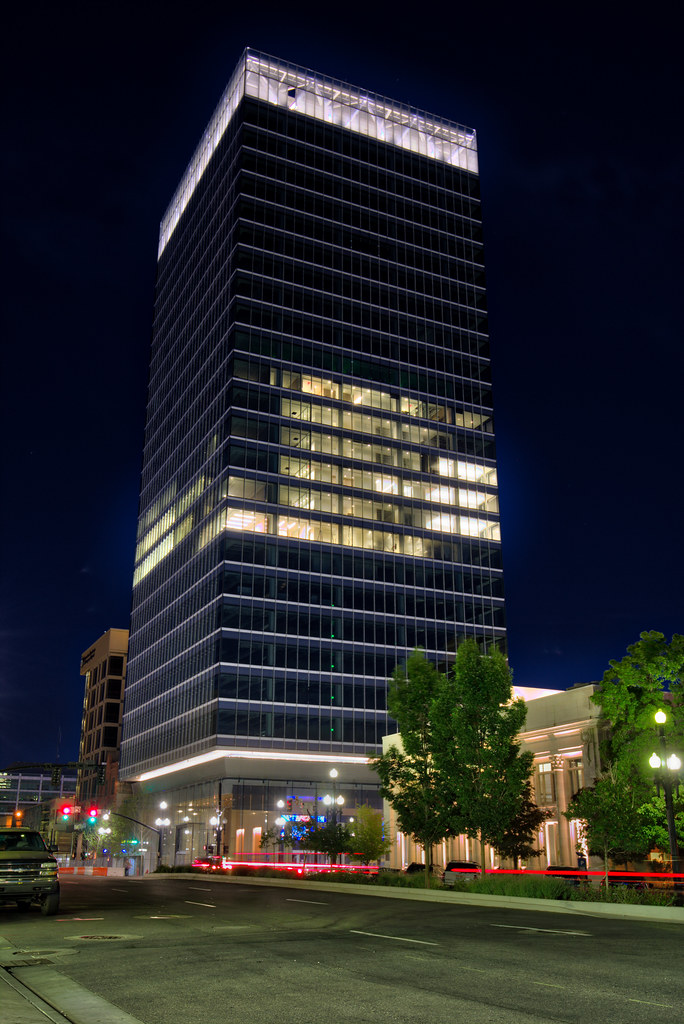
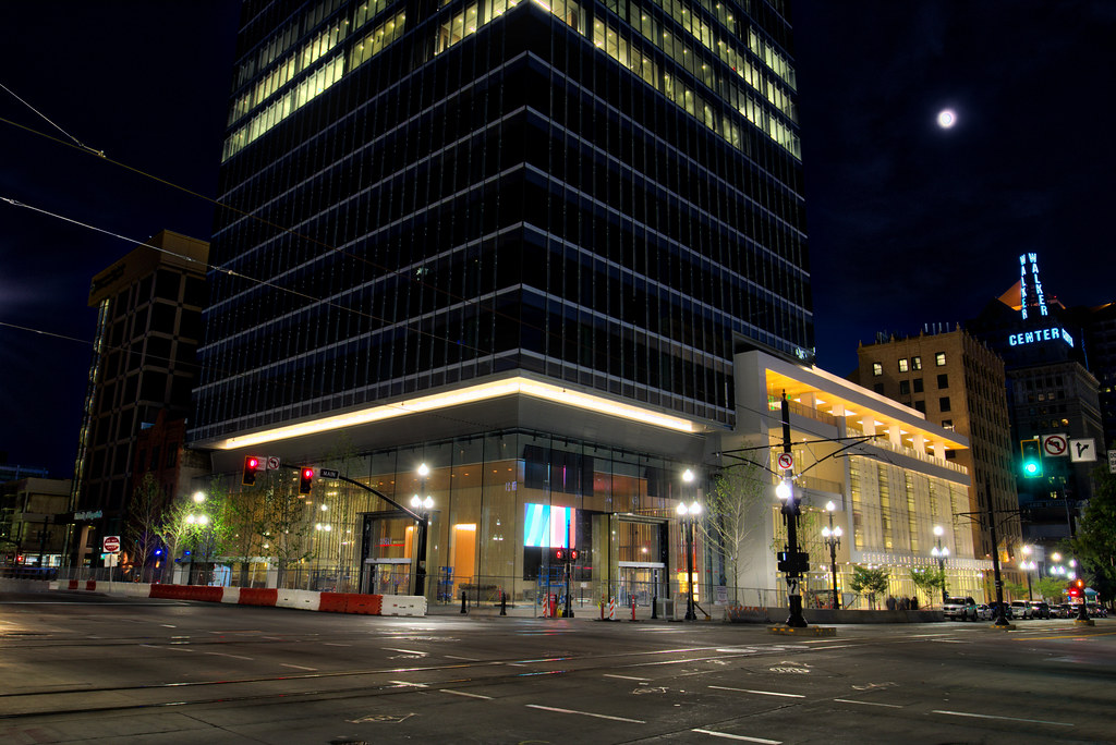
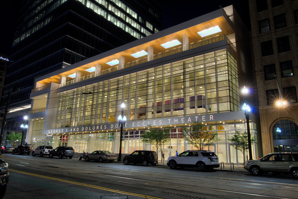
Photo Bump

August 13th

Quote:
Originally Posted by T-Mac View Post
Found some time to get downtown tonight and took a few shots. Here are a couple of them and I will try to post more tomorrow sometime after I finish processing them.


Pics By T-Mac


.
     
     
  #7200  
Old Posted Aug 17, 2016, 12:44 PM
Marvland's Avatar
Marvland Marvland is offline
 
Join Date: Oct 2014
Posts: 674
Quote:
Originally Posted by Comrade View Post
I proved it with actual police statistics of crime committed. Three of the five homicides so far this year have taken place on the city's west side, despite, as I already mentioned, it having a much smaller overall population than anything east of I-15.

Of the seven murders in Salt Lake City last year, six happened on the city's west side.

Of the seven homicides in 2014, five were committed on the city's west side - with the other two happening downtown. Zero were located on the city's east side.

So, in the last two and a half years, 14 of the city's 19 homicides have taken place on the city's west side. That's not an insignificant number. Especially when you consider the west side is not even half the city's population.

This discussion just isn't about the facts - it's also about perception. Like I said, the perception is rooted in the fact more high-profiled crime comes from the city's west side. A car being broken into in Sugar House is not going to be reported on the news. Someone getting beaten with a baseball bat in Rose Park, however, will. Overall, in terms of the crime we look at as the most troubling, much of it continues to come from the smaller west side, despite, like I said, the area having a much smaller overall population compared to SLC's east side.
You're right about this discussion not being about facts. Short timeline horizon? Check. Cherry picked data? Check. Nebulous definition of data (ie, East Side)? Check. So, playing your game and entering "homicides" I see three for the last six months all of them on the East side and by east side I mean east of State. I note it includes the nifty "baseball bat" homophobic rage murder from a week ago at 5th and 5th. It does not include the murder of John Williams of Gastronomy because it is not yet adjudicated (another problem with this data set).

Aaaaaaand Go! Your turn.
     
     
This discussion thread continues

Use the page links to the lower-right to go to the next page for additional posts
 
 
Closed Thread

Go Back   SkyscraperPage Forum > Global Projects & Construction > City Compilations
Forum Jump


Forum Jump


All times are GMT. The time now is 8:54 PM.


Powered by vBulletin® Version 3.8.7
Copyright ©2000 - 2026, vBulletin Solutions, Inc.