HomeDiagramsDatabaseMapsForum About
     

Go Back   SkyscraperPage Forum > Regional Sections > Canada > Alberta & British Columbia > Vancouver > Transportation & Infrastructure


Reply

 
Thread Tools Display Modes
     
     
  #1701  
Old Posted Jun 7, 2016, 10:11 PM
officedweller officedweller is offline
Registered User
 
Join Date: Jul 2001
Location: Vancouver
Posts: 41,479
Article regarding possible relocation of Massey Tunnel hydro lines to become overhead lines:

http://vancouversun.com/news/local-news/...s-could-soon-rise-above-deas-island-park
Reply With Quote
     
     
  #1702  
Old Posted Jun 16, 2016, 12:35 AM
Stingray2004's Avatar
Stingray2004 Stingray2004 is offline
Registered User
 
Join Date: Jan 2004
Location: White Rock, BC (Metro Vancouver)
Posts: 3,145
Those 5 piles at the south end of the GMT? Test piles driven ~200 feet into the ground to collect geo-technical data for the engineering/design phase of the project:

Video Link
Reply With Quote
     
     
  #1703  
Old Posted Jun 16, 2016, 2:26 AM
Metro-One's Avatar
Metro-One Metro-One is offline
Registered User
 
Join Date: Sep 2008
Location: Japan
Posts: 17,900
How deep it is until bedrock there?
__________________
Bridging the Gap
Check out my Flickr: https://www.flickr.com/photos/30634635@N03/with/29495547810/ and Youtube channel https://www.youtube.com/channel/UCV0_0h9qKlhxXFxuAey_q6Q
Reply With Quote
     
     
  #1704  
Old Posted Jun 16, 2016, 3:33 AM
Stingray2004's Avatar
Stingray2004 Stingray2004 is offline
Registered User
 
Join Date: Jan 2004
Location: White Rock, BC (Metro Vancouver)
Posts: 3,145
Quote:
Originally Posted by Metro-One View Post
How deep it is until bedrock there?
The Fraser River bed, in that locale, is a 600 m (1,969 ft) thick layer of sediment on top of bedrock.

And the new GMB, with deep-piled foundations, will make the GMB safe for a 1 in 2,475 year earthquake.

However, for whatever reason, the pilings will not go down to bedrock. Apparently, that's not required. But complex structural engineering/seismic is not my forte, and frankly, over my head. Perhaps, someone on here, knowledgeable in that field, may be able to shed some more light on same.

I have previously sniffed around on the same topic vis-a-vis the new PMB and IBT Engineers has this tidbit suggesting that the piles thereto did not go down to bedrock either:

Quote:
Foundations for the new Port Mann Bridge are generally 1.8-m (5.9-ft) steel piles or drilled shafts, supported on a firm ground till layer under the loose sand deposits at a depth below the river.
[emphasis added]

http://www.ibtengineers.com/PROJECTS/PortMann/portmann-1.html

Reply With Quote
     
     
  #1705  
Old Posted Jun 16, 2016, 3:53 AM
Marshal Marshal is offline
perhaps . . .
 
Join Date: Dec 2015
Location: Vancouver
Posts: 1,493
The main thing to note is that friction piles can provide all the structural support needed (for anything) so long as they are properly placed. The important variables are 1) the design of the piles themselves, 2) the composition of the soils they are placed in, and 3) the length of the pile that is engaging (generating friction as a resisting force). In this case, 600m is a very long way to reach bedrock, so there is probably plenty of resistance in the sediments above that can be utilized without any need to go that deep.

Last edited by Marshal; Jun 16, 2016 at 8:11 AM.
Reply With Quote
     
     
  #1706  
Old Posted Jun 16, 2016, 3:56 AM
Metro-One's Avatar
Metro-One Metro-One is offline
Registered User
 
Join Date: Sep 2008
Location: Japan
Posts: 17,900
Interesting stuff. Amazing how deep the bedrock is there.
__________________
Bridging the Gap
Check out my Flickr: https://www.flickr.com/photos/30634635@N03/with/29495547810/ and Youtube channel https://www.youtube.com/channel/UCV0_0h9qKlhxXFxuAey_q6Q
Reply With Quote
     
     
  #1707  
Old Posted Jun 20, 2016, 12:03 AM
Klazu's Avatar
Klazu Klazu is offline
Registered User
 
Join Date: Apr 2012
Location: Above Metro Vancouver clouds
Posts: 10,394
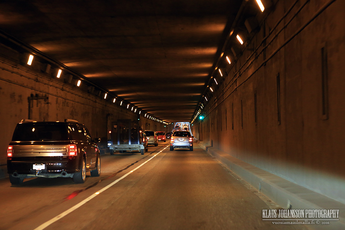
Just a random tunnel photo.

Reply With Quote
     
     
  #1708  
Old Posted Jun 20, 2016, 2:25 AM
Kisai Kisai is offline
Registered User
 
Join Date: Jun 2014
Location: Burnaby
Posts: 1,153
Quote:
Originally Posted by Marshal View Post
The main thing to note is that friction piles can provide all the structural support needed (for anything) so long as they are properly placed. The important variables are 1) the design of the piles themselves, 2) the composition of the soils they are placed in, and 3) the length of the pile that is engaging (generating friction as a resisting force). In this case, 600m is a very long way to reach bedrock, so there is probably plenty of resistance in the sediments above that can be utilized without any need to go that deep.
It may not be required, but that assumes that the sediment doesn't move, or won't be dredged and weaken it at some point.

AFAIK (I'm not a bridge engineer either) only two piles would need to hit bedrock (eg at the center span Pylon) to "anchor" the bridge from flowing downstream, sinking or rotating, the rest are only providing support to the other Pylons as the road deck is anchored to them as the pylon's force is straight down.

Ever try to pull a hose or fence post out of the ground? It's nearly impossible if it was driven into sand. But there is a natural ground creep that happens from underground water.

600m piles might not be doable simply because past a certain point the piles don't add any more support that wider piles wouldn't offer.
Reply With Quote
     
     
  #1709  
Old Posted Jun 20, 2016, 7:55 AM
Marshal Marshal is offline
perhaps . . .
 
Join Date: Dec 2015
Location: Vancouver
Posts: 1,493
Quote:
Originally Posted by Kisai View Post
It may not be required, but that assumes that the sediment doesn't move, or won't be dredged and weaken it at some point.

AFAIK (I'm not a bridge engineer either) only two piles would need to hit bedrock (eg at the center span Pylon) to "anchor" the bridge from flowing downstream, sinking or rotating, the rest are only providing support to the other Pylons as the road deck is anchored to them as the pylon's force is straight down.

Ever try to pull a hose or fence post out of the ground? It's nearly impossible if it was driven into sand. But there is a natural ground creep that happens from underground water.

600m piles might not be doable simply because past a certain point the piles don't add any more support that wider piles wouldn't offer.
Sorry because I don't have the time right now, but piles and the scale of the geology simply don't work in any way like you talking. I'll try to remember and explain tomorrow.
Reply With Quote
     
     
  #1710  
Old Posted Jun 25, 2016, 5:00 AM
officedweller officedweller is offline
Registered User
 
Join Date: Jul 2001
Location: Vancouver
Posts: 41,479
Quote:
June 24, 2016: The Ministry of Transportation and Infrastructure has submitted its application to the Agricultural Land Commission (ALC).
To review the application in its entirety please click on the following link:
ALC Application Sections 1-3 https://engage.gov.bc.ca/masseytunnel/files/2016/06/ALC-Application-Sections-1-3.pdf
ALC Application Sections 4-6 https://engage.gov.bc.ca/masseytunnel/files/2016/06/ALC-Application-Sections-4-6.pdf
ALC Application Sections 7-10 https://engage.gov.bc.ca/masseytunnel/files/2016/06/ALC-Application-Sections-7-10.pdf
http://engage.gov.bc.ca/masseytunnel/whatsnew/
Reply With Quote
     
     
  #1711  
Old Posted Jun 25, 2016, 5:19 AM
officedweller officedweller is offline
Registered User
 
Join Date: Jul 2001
Location: Vancouver
Posts: 41,479
These maps show the lands to be acquired for the right-of-way - shown in blue.
The pink lands are existng right-of-way lands used for agriculture.

All from this report:
https://engage.gov.bc.ca/masseytunnel/files/2016/06/ALC-Application-Sections-1-3.pdf


Reply With Quote
     
     
  #1712  
Old Posted Jun 25, 2016, 5:23 AM
officedweller officedweller is offline
Registered User
 
Join Date: Jul 2001
Location: Vancouver
Posts: 41,479
Now for the interesting stuff.

Here are close ups of the Steveston Hwy interchange, south end of the bridge and Hwy 17A interchange showing the bus stations and pedestrian and bike access ramps.

I'm not sure what the yellow line is - looks like bus station access (?).

All from:
https://engage.gov.bc.ca/masseytunnel/files/2016/06/ALC-Application-Sections-1-3.pdf


Steveston Hwy Interchange
(note ped/ bike paths on both sides of the bridge):
I just realized that the basketweave ramps allow a bus stop at the yellow box (elevator?) on the road above the median bus station -
and the bus door will be on the proper curb side.


Ped/Bike ramps to River Road
(note ped/bike paths on both sides of the bridge):


Hwy 17A Interchange:
Bus station access looks to be on the outside curbs for this conventional overpass.


Last edited by officedweller; Jun 25, 2016 at 5:36 AM.
Reply With Quote
     
     
  #1713  
Old Posted Jun 25, 2016, 5:27 PM
cleowin cleowin is offline
Registered User
 
Join Date: Dec 2013
Posts: 53
The Steveston Highway Interchange looks like one of those American Basketweave interchanges, pretty impressive!
Reply With Quote
     
     
  #1714  
Old Posted Jun 25, 2016, 5:37 PM
Klazu's Avatar
Klazu Klazu is offline
Registered User
 
Join Date: Apr 2012
Location: Above Metro Vancouver clouds
Posts: 10,394
Quote:
Originally Posted by cleowin View Post
The Steveston Highway Interchange looks like one of those American Basketweave interchanges, pretty impressive!
Unfortunately it's only going to be a 3-level stack.

How do I read those diagrams? Is there going to be a ramp down to River Road or not?
Reply With Quote
     
     
  #1715  
Old Posted Jun 25, 2016, 7:24 PM
excel excel is offline
Registered User
 
Join Date: Oct 2005
Location: Calgary
Posts: 3,484
Pretty impressive interchanges.
Reply With Quote
     
     
  #1716  
Old Posted Jun 26, 2016, 1:20 AM
Metro-One's Avatar
Metro-One Metro-One is offline
Registered User
 
Join Date: Sep 2008
Location: Japan
Posts: 17,900
I really hope this goes through as shown. What I also really like about these interchanges (and the project in general) is it shows that you can do major highway upgrades within tight footprints. I feel if in other provinces the Steveston interchange would be a huge sprawling monster using up twice the land (or more).
__________________
Bridging the Gap
Check out my Flickr: https://www.flickr.com/photos/30634635@N03/with/29495547810/ and Youtube channel https://www.youtube.com/channel/UCV0_0h9qKlhxXFxuAey_q6Q
Reply With Quote
     
     
  #1717  
Old Posted Jun 26, 2016, 8:38 AM
Marshal Marshal is offline
perhaps . . .
 
Join Date: Dec 2015
Location: Vancouver
Posts: 1,493
I agree with all the excitement and am also impressed with the designs.

Grumpy time: These could be reduced/simplified quite a bit so that the 'gold standard' budget could free up money to finish other road projects: finish the SFPR properly, or make the Mary Hill/Laugheed Hwy free flowing to Maple Ridge, as examples, etc.

Do we really need that level of exchange at Steveston Hwy? I thought of this when I squinted and the interchange looks like the meeting of two main freeways. But Steveston Hwy is far from that. It goes east to very little, and very little developable land for the future, and it goes west to a very low growth, low density area.

Here's a thought though: maybe Steveston Hwy will be extended east way out past No 9 Rd. and a connection with the Alex Fraser/Queensborough nexus. That might be a useful.
Reply With Quote
     
     
  #1718  
Old Posted Jun 26, 2016, 8:18 PM
adrianroam95 adrianroam95 is offline
Registered User
 
Join Date: Aug 2010
Location: Coquitlam, BC
Posts: 214
Here is a short thread on existing examples of dedicated bus lanes that cross over one another to provide access to a central median platform for passengers:

http://humantransit.org/2012/06/request-for-information-busways-that-cross-over-at-stations.html

Some prominent examples in North America include:
  • I-110 and I-105 in Los Angeles
  • 46th Street and I-35W in Minneapolis

Some points that come to mind:
  • Having one central platform instead of two side platforms reduces the physical footprint of the busway and is a good deterrent for criminal behaviour (CPTED).
  • Having a bus stop located under a freeway interchange might be unappealing to transit riders due to high noise and air pollution.
  • Clear signage and/or traffic control is required at the crossovers to reduce the risk of distracted/negligent drivers crossing into oncoming traffic.

Last edited by adrianroam95; Jun 26, 2016 at 8:35 PM.
Reply With Quote
     
     
  #1719  
Old Posted Jun 26, 2016, 8:47 PM
libtard's Avatar
libtard libtard is offline
Dahvie Fan
 
Join Date: Aug 2012
Posts: 1,307
Quote:
Originally Posted by Marshal View Post
I agree with all the excitement and am also impressed with the designs.

Grumpy time: These could be reduced/simplified quite a bit so that the 'gold standard' budget could free up money to finish other road projects: finish the SFPR properly, or make the Mary Hill/Laugheed Hwy free flowing to Maple Ridge, as examples, etc.

Do we really need that level of exchange at Steveston Hwy? I thought of this when I squinted and the interchange looks like the meeting of two main freeways. But Steveston Hwy is far from that. It goes east to very little, and very little developable land for the future, and it goes west to a very low growth, low density area.

Here's a thought though: maybe Steveston Hwy will be extended east way out past No 9 Rd. and a connection with the Alex Fraser/Queensborough nexus. That might be a useful.
Extending steveston highway that far would never work. And yes this interchange is pivotal. East of 99 gets back up all the way to silvercity. West is even worse, getting backed up all the way to shell road. Unless you've been in this area at rush hour you wouldn't understand
Reply With Quote
     
     
  #1720  
Old Posted Jun 27, 2016, 12:57 AM
urbancanadian urbancanadian is offline
Registered User
 
Join Date: Aug 2014
Location: Vancouver
Posts: 713
Quote:
Originally Posted by adrianroam95 View Post
  • Having one central platform instead of two side platforms reduces the physical footprint of the busway and is a good deterrent for criminal behaviour (CPTED).
  • Having a bus stop located under a freeway interchange might be unappealing to transit riders due to high noise and air pollution.
  • Clear signage and/or traffic control is required at the crossovers to reduce the risk of distracted/negligent drivers crossing into oncoming traffic.
This would make a strong case for marking the bus-only lanes in the standard red paint.

I still think these areas need to be treated more like bus stations than just bus stops, if that makes sense.
Reply With Quote
     
     
This discussion thread continues

Use the page links to the lower-right to go to the next page for additional posts
 
 
Reply

Go Back   SkyscraperPage Forum > Regional Sections > Canada > Alberta & British Columbia > Vancouver > Transportation & Infrastructure
Forum Jump


Forum Jump


All times are GMT. The time now is 6:20 PM.

     
SkyscraperPage.com - Privacy Statement - Top

Powered by vBulletin® Version 3.8.7
Copyright ©2000 - 2026, vBulletin Solutions, Inc.