HomeDiagramsDatabaseMapsForum About
     

Go Back   SkyscraperPage Forum > Regional Sections > Canada


Closed Thread

 
Thread Tools Display Modes
     
     
  #3941  
Old Posted Apr 13, 2015, 11:03 AM
ghYHZ ghYHZ is offline
Registered User
 
Join Date: Aug 2007
Location: Antigonish NS
Posts: 496
Quote:
Originally Posted by jeremy_haak View Post
The CTMA Vacancier diverting to North Sydney raises the question of whether the ferry docks are standardized so that most ferries can use any given ferry dock, or if they are specially constructed for each ferry and CTMA Vacancier simply has one built in North Sydney for precisely these situations........
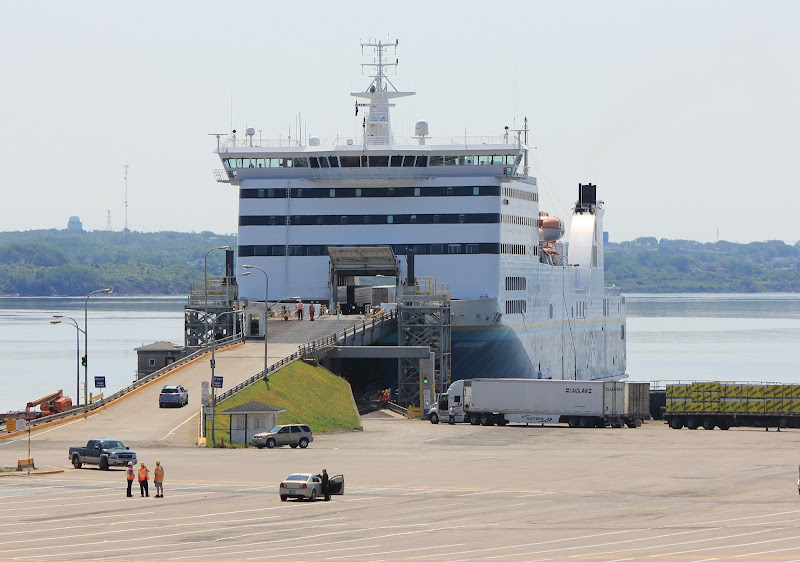
Don’t think they have any special facilities constructed in North Sydney for the CTMA Ferries and don’t recall it ever being there before. In the photo posted above you can see the Vacancier used the lower dock only and probably just lowered its aft ramp onto the dock. The upper level was not used but in this photo you can see Marine Atlantic normally uses both levels.


A new Ferry has just been purchased for the Digby – Saint John run. It previously operated in Greece……watch around the 3:10 minutes mark where it just sweeps in and lowers its aft ramp onto a concrete sea wall.

https://www.youtube.com/watch?v=v0Ht7Gh3_CE
     
     
  #3942  
Old Posted Apr 13, 2015, 12:01 PM
Taeolas Taeolas is offline
Registered User
 
Join Date: Oct 2009
Location: Fredericton
Posts: 5,021
Over Easter I was in North Sydney for a wedding, and we were driving around and got to see the Ferry coming in. Was neat to see its nose lift right up to expose the upper and lower ramps. (But we didn't stick around long enough to see the ramps lowered).

I've never taken the ferries; is there a way for vehicles on one deck to get to the other deck if they can't use one of the ramps for some reason? Or are they hosed if one of the ramps is broken/disabled?
     
     
  #3943  
Old Posted Apr 13, 2015, 3:39 PM
ghYHZ ghYHZ is offline
Registered User
 
Join Date: Aug 2007
Location: Antigonish NS
Posts: 496
Quote:
Originally Posted by Taeolas View Post
I've never taken the ferries; is there a way for vehicles on one deck to get to the other deck if they can't use one of the ramps for some reason? Or are they hosed if one of the ramps is broken/disabled?
There’s internal hoistable ramps on the vessels.

For Instance, the Atlantic Vision boards on two levels at North Sydney but when it reaches Argentia....there's just one level. The lower deck is unloaded first, the internal ramp is lowered and then the vehicles on the upper deck just drive down the ramp and off.

Last edited by ghYHZ; Apr 13, 2015 at 5:56 PM.
     
     
  #3944  
Old Posted Apr 19, 2015, 6:28 PM
Innsertnamehere's Avatar
Innsertnamehere Innsertnamehere is offline
Registered User
 
Join Date: Jan 2010
Location: Hamilton
Posts: 12,831
Provincial government is in Sault Ste Marie tomorrow to make an announcement about their $31.5 billion infrastructure fund..

Guessing its something about twinning Highway 17.

https://twitter.com/StevenDelDuca/status/589855471768440832

Quote:
In #SaultSteMarie Monday to provide more details on Ontario's 10-yr, $31.5B plan to improve transit + roads & highways all across province.
     
     
  #3945  
Old Posted Apr 20, 2015, 1:17 AM
Loco101's Avatar
Loco101 Loco101 is offline
Registered User
 
Join Date: May 2013
Location: Timmins, Northern Ontario
Posts: 8,957
Will it be the completion of the Sault by-pass?
     
     
  #3946  
Old Posted Apr 20, 2015, 3:07 AM
Dwils01's Avatar
Dwils01 Dwils01 is offline
Urban Fanactic
 
Join Date: Mar 2010
Location: Coquitlam
Posts: 3,282
The city filed a request to get funding from the province for the second half of the Second Line widening and Black Road widening because the government said they had no plans to look at completing the 17 by-pass through Rankin for at least 10 years.

I will be very surprised if it's anything other than that.
     
     
  #3947  
Old Posted Apr 20, 2015, 3:50 AM
Innsertnamehere's Avatar
Innsertnamehere Innsertnamehere is offline
Registered User
 
Join Date: Jan 2010
Location: Hamilton
Posts: 12,831
the "all across the province" part makes me think otherwise.
     
     
  #3948  
Old Posted Apr 20, 2015, 3:57 AM
jmt18325's Avatar
jmt18325 jmt18325 is offline
Heart of the Continent
 
Join Date: Apr 2009
Location: Winnipeg
Posts: 7,286
Quote:
Originally Posted by Innsertnamehere View Post
the "all across the province" part makes me think otherwise.


This is just one of the many parts...all across the province.
     
     
  #3949  
Old Posted Apr 20, 2015, 9:21 PM
eternallyme eternallyme is offline
Registered User
 
Join Date: Mar 2009
Posts: 5,243
Quote:
Originally Posted by Dwils01 View Post
The city filed a request to get funding from the province for the second half of the Second Line widening and Black Road widening because the government said they had no plans to look at completing the 17 by-pass through Rankin for at least 10 years.

I will be very surprised if it's anything other than that.
The outer bypass is much more useful IMO than widening Second Line East and Black Road. The next issue is connecting the bypass to the city more conveniently...where to make the connection?
     
     
  #3950  
Old Posted Apr 20, 2015, 9:42 PM
SignalHillHiker's Avatar
SignalHillHiker SignalHillHiker is offline
I ♣ Baby Seals
 
Join Date: Jul 2012
Location: Sin Jaaawnz, Newf'nland
Posts: 36,268
A timelapse of the Torbay Bypass with hilariously unsettled weather.

http://www.cbc.ca/nl/features/newburbia/timetravel/torbay-road-timelapse.html
__________________
Note to self: "The plural of anecdote is not evidence."
     
     
  #3951  
Old Posted Apr 21, 2015, 3:51 AM
Loco101's Avatar
Loco101 Loco101 is offline
Registered User
 
Join Date: May 2013
Location: Timmins, Northern Ontario
Posts: 8,957
Quote:
Originally Posted by eternallyme View Post
The outer bypass is much more useful IMO than widening Second Line East and Black Road. The next issue is connecting the bypass to the city more conveniently...where to make the connection?
I agree. The bypass doesn't even have to go through Rankin First Nation. But it will have to go through some private properties and conservation land.
     
     
  #3952  
Old Posted Apr 21, 2015, 4:15 AM
jmt18325's Avatar
jmt18325 jmt18325 is offline
Heart of the Continent
 
Join Date: Apr 2009
Location: Winnipeg
Posts: 7,286
So it was just a small pot of money for connecting link roads...yawn.
     
     
  #3953  
Old Posted Apr 21, 2015, 4:35 AM
1overcosc's Avatar
1overcosc 1overcosc is offline
Registered User
 
Join Date: Jun 2013
Location: Eastern Ontario
Posts: 12,377
Quote:
Originally Posted by jmt18325 View Post
So it was just a small pot of money for connecting link roads...yawn.
Boring it is, but it's a very essential piece of infrastructure in Ontario's smaller communities. I for one am glad that the largest infrastructure spending spree in Ontario's history is including at least some items that are important even if they do not have political glamour.
     
     
  #3954  
Old Posted Apr 21, 2015, 4:41 AM
jmt18325's Avatar
jmt18325 jmt18325 is offline
Heart of the Continent
 
Join Date: Apr 2009
Location: Winnipeg
Posts: 7,286
Quote:
Originally Posted by 1overcosc View Post
Boring it is, but it's a very essential piece of infrastructure in Ontario's smaller communities.
But I got excited for nothing....
     
     
  #3955  
Old Posted Apr 21, 2015, 2:48 PM
eternallyme eternallyme is offline
Registered User
 
Join Date: Mar 2009
Posts: 5,243
Here's a possible routing I came up with:


Some highlights:

* Highway 17 is detoured around the northeast corner of Sault Ste. Marie. For through traffic, it would take about 5 minutes to go from the Rankin turn to Sixth Line (on the northern fringe), instead of about 20 minutes today.

* The northern/western terminus would be at Great Northern Road north of the ACR underpass (likely an at-grade intersection initially), although it would be easy to extend farther north (west) and build an interchange there with the configuration.

* Local traffic is connected to Sault Ste. Marie by an extension of Carmen's Way, which could initially be built as an expressway-standard road before upgrading to a freeway later. It would connect to 17 at an interchange south of Fourth Line, and would be routed to minimize disruption and avoid a conservation area.

* The Rankin turn on 17 (where it turns south to reach Trunk Road) would become an interchange serving the eastern part of SSM.

* Old Garden River Road and the ACR would pass under 17, while Fourth Line (realigned slightly) and Fifth Line would pass over 17. An interchange may be possible at Fourth Line to serve areas to the east of 17, but that could be problematic due to weaving and also due to traffic issues on a rural minor arterial (not to mention the development that would likely come to that area).

     
     
  #3956  
Old Posted Apr 21, 2015, 5:31 PM
Dwils01's Avatar
Dwils01 Dwils01 is offline
Urban Fanactic
 
Join Date: Mar 2010
Location: Coquitlam
Posts: 3,282
While I would like to see that happen, that will be pretty difficult to do.

The Rankin Reserve has not been too cooperative when it comes to building a highway through their land so it could take years to come to an agreement there.

The link to the States using the hydro corridor is a good idea but I for see some problems when it gets closer to the southern part of Peoples Road linking up with Carmen's Way. People here will do anything to get something stopped if it will destroy their neighbourhood. There was a huge thing when Carmen's Way was first proposed and it would get rid of a street with lots of people on it. The end result was three years delay and a much higher cost to build it.

The eastern/northern bypass is pretty good since you stayed west of Hiawatha Highlands Conservation Area. Again the same problem might arise with people in the area losing their property and not wanting a freeway right where they live. Also it cuts through Wishart Park which the Hiawatha Highlands Conservation area has taken over and is a popular hiking area in the summer and a cross-country ski area in the winter. The only other problem I see is that there have been two new subdivisions built on Fourth Line in that area. Putting the freeway through there with the new subdivisions going in could be a problem. There is also the terrain in the area that is difficult to work with but that's a typical problem you face around Lake Superior.

I would like something like this to happen but I don't see it coming to fruition other than the part that goes through the Rankin Reserve.
     
     
  #3957  
Old Posted Apr 23, 2015, 5:01 PM
sonysnob sonysnob is offline
Registered User
 
Join Date: Aug 2011
Posts: 1,797
MTO is initiating detail design for the widening of the QEW east of the Cawthra Road interchange to the West Mall. This is the first phase of the medium term plan to construct HOV lanes along the QEW through southern Mississauga. The detail design phase (including utility relocation) is scheduled to be completed by the end of 2017, so actual construction won't begin until at least 2018. (But nevertheless, progress).

Quote:
9. Description of Project:
This EOI Notice will be used to shortlist qualified Service Providers to undertake the detail design for the widening/rehabilitation of QEW from east of Cawthra Road to the westerly limit of The East Mall Bridge – a distance of approximately (5 km). Consulting firms short listed at the EOI stage, will be requested (through RFP) to submit proposals for this assignment.

This assignment involving the above-mentioned specialties will include all TPM service provider services for preparation of detail design contract(s) drawings and documentation for Major Highway Widening to accommodate future widening; widening/replacing bridges including Ogden Pedestrian Bridge, Dixie Road Underpass and Etobicoke Creek Bridge; rehabilitation of QEW-West Mall Ramp over Etobicoke Creek and QEW-West Mall Ramp over the QEW; ramp reconfiguration at Dixie Road interchange; relocation of North and South Service Roads; modification/new construction of private accesses; replacement of culverts; stormwater management with the addition of stormsewers and ponds; replacement/repair of retaining wall and noise wall; reinstatement/upgrade of ATMS; and upgrade of pavement structure and illuminations.

The TPM Service Provider will be responsible for overall detail design study, includes providing recommendations on construction staging; geometric and roadside safety improvements to facilitate all the works within the project limit; the development of traffic management plans including traffic staging and/or detours investigations; internal and external Constructability Review; Highway Element Investment Review (HEIR); confirmation of property requirements and preparation of property request; verification of utility plan and preparation of a detailed composite utility plan of all existing and future utility relocation (including sanitary and watermain); detailed strategy plan(s) to complete utility relocations by December 2017; undertaking of Public Information Centre (PIC) and/or Community Workshop; and assist in negotiation of cost sharing with municipalities for various improvements etc.

This project will also include all work necessary to produce complete contract packages suitable for tender for the construction of above mentioned works and other operational/safety improvement. The TPM consultant may need to bundle the above works into several combination of contracts for construction considering the timing for design and environmental approval, level of work involved, structural condition/priority, staging requirement, corridor impacts, program funding, and conflict with adjacent contracts etc.

All necessary environmental clearances, approvals, permits and authorization that may apply shall be obtained including, but not limited to, approvals as required by Transport Canada and/or Department of Ocean and Fisheries for navigable waterways.

This part of the project is classified as Group “B” under the MTO Class Environmental Assessment for Provincial Transportation Facilities (2000). A Transportation and Environmental Study Report for this project is being prepared and will be completed by summer 2015. A draft copy will be provided with the RFP. As part of the assignment Design and Construction Reports are required.


10. Assignment approximate start and completion dates:
Pre-contract engineering phase: October 2015 to December 2017
Construction administration phase: (tentative timing) N/A

Last edited by sonysnob; Apr 23, 2015 at 5:24 PM.
     
     
  #3958  
Old Posted Apr 23, 2015, 5:17 PM
Innsertnamehere's Avatar
Innsertnamehere Innsertnamehere is offline
Registered User
 
Join Date: Jan 2010
Location: Hamilton
Posts: 12,831
Thats part of the Dixie interchange reconstruction is it not? It was the only major project they actually added in the 2015 Highways program IIRC.

Also, what was the first phase?
     
     
  #3959  
Old Posted Apr 23, 2015, 5:24 PM
sonysnob sonysnob is offline
Registered User
 
Join Date: Aug 2011
Posts: 1,797
Quote:
Originally Posted by Innsertnamehere View Post
Thats part of the Dixie interchange reconstruction is it not? It was the only major project they actually added in the 2015 Highways program IIRC.

Also, what was the first phase?
This is the first phase, second is a typo (I misread the full extents of the project description on my first read). I've fixed the original post.
     
     
  #3960  
Old Posted Apr 26, 2015, 2:38 AM
FrAnKs's Avatar
FrAnKs FrAnKs is offline
Registered User
 
Join Date: Jul 2005
Location: Ville de Québec / Quebec city
Posts: 5,930
Edit.
__________________
PROVINCE OF QUEBEC ==> 9 050 000
MONTREAL METRO ==> 4 600 000
QUEBEC CITY METRO ==> 900 000

Last edited by FrAnKs; Apr 27, 2015 at 11:29 PM.
     
     
This discussion thread continues

Use the page links to the lower-right to go to the next page for additional posts
 
 
Closed Thread

Go Back   SkyscraperPage Forum > Regional Sections > Canada
Forum Jump


Forum Jump


All times are GMT. The time now is 11:22 AM.

     
SkyscraperPage.com - Privacy Statement - Top

Powered by vBulletin® Version 3.8.7
Copyright ©2000 - 2026, vBulletin Solutions, Inc.