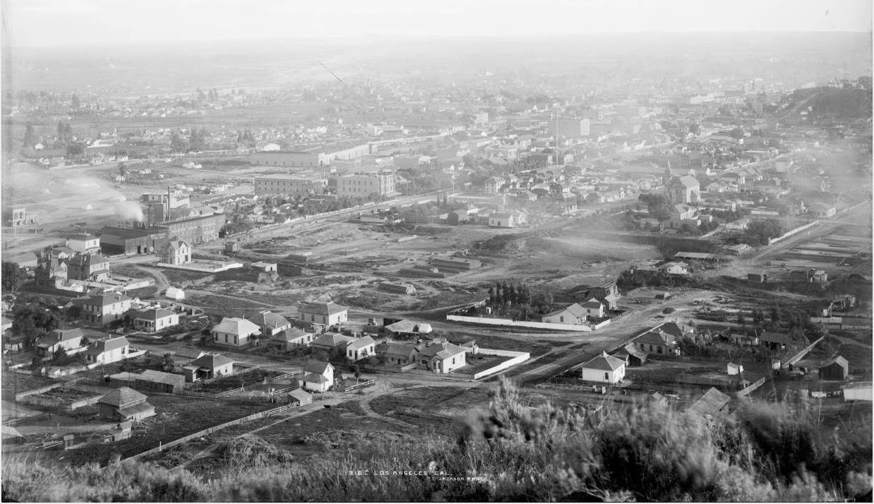
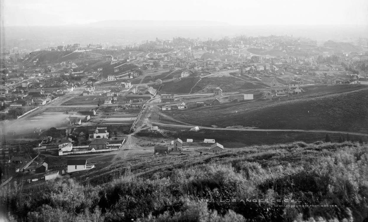
Here is a two-shot panorama from the Denver Public Library's William Henry Jackson collection. The photos look south from the hillside just south of what is now the Dodger Stadium parking lot.
DPL estimates the date at c. 1885-1910, but I'm fairly certain the photos were taken around the spring of 1888.
UPDATE: No, it was taken c. Oct-Nov 1887. There is some overlap between the two photos.
The Left Half
Running left to right across the bottom is Bernard Street. The "T" intersection of Bernard and Yale Street is just to the right of bottom center, partially obscured by the tip of a plant in the foreground.
Near the left edge of the photo, smoke is coming from the Baker Iron Works, which fronts on Buena Vista Street (now North Broadway). The largely empty area between Buena Vista and Yale is the
excavation of the City Brick Company. The street parallel to and between Buena Vista and Yale that ends at the south end of the excavation site is Castelar Street (now North Hill).
Denver Public Library --
http://digital.denverlibrary.org/cdm/singleitem/collection/p15330coll21/id/12624/rec/2
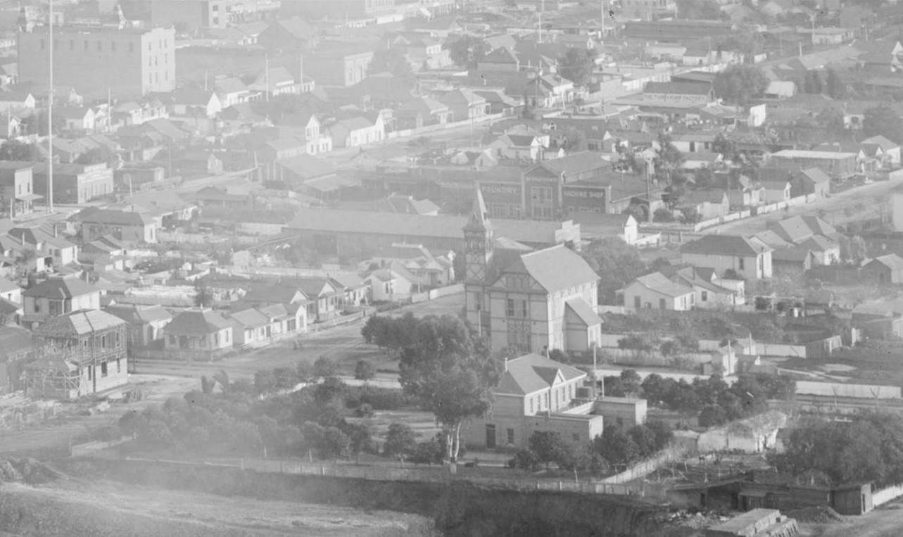
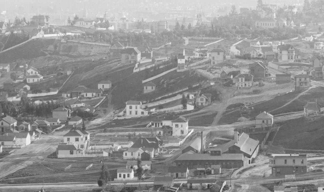
This is a closeup of the area just south of the brickyard excavation. At bottom center, the two-story building with the two one-story wings and the big front yard is the French Benevolent Society Hospital.
The building to the south with the tower is the Castelar Street School on the SW corner of Castelar and College. In the upper left corner is the Clinton Block at the NW corner of what was then Upper Main
and Walters (now North Spring and Ord). The Clinton Block will later be known as the Sunset Hotel. It is not in the 1887 LA City Directory, but it's in the 1888 CD.
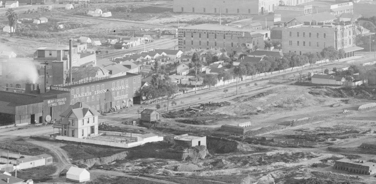
Here's a closer look at the Baker Iron Works; behind it, through the smoke, you can barely make out the Capitol Milling building on Alameda. The three-story building to the right of Baker Iron Works,
with the writing on the left side and across the top, is occupied by the Heywood Bros. It is on the SW corner of Upper Main and College St. That building burned down on November 9, 1887, but in
this photo it has obviously been rebuilt
(No, actually it hasn't burned down yet).
The three-story building next to Heywood Bros, which is actually on the NE corner of Buena Vista and College, is the Mullally Block. The July 1, 1887
Los Angeles Times describes the plans for the
Mullally Block as being "in the hands of the architect," so its construction must not have been far off. At the far right edge of the photo past the Mullally Block is the Woodhead residence on the
SE corner of Buena Vista and College.
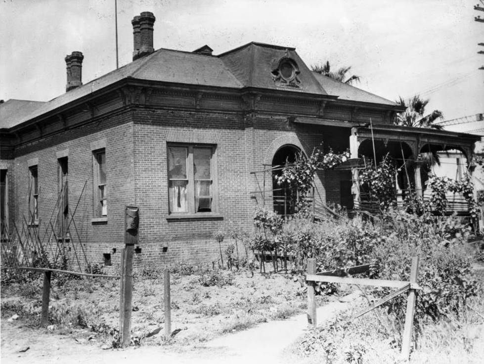
Here's the Woodhead residence in 1883. The note at USCDL indicates the home was "built by Mullally," which would have been Joseph Mullally, Los Angeles brick maker and builder of the
Mullally Block across the street. [Upon further review, this might be quite a bit after 1883. The house looks a bit run down, like the porch used to wrap around the house.]
USCDL --
http://digitallibrary.usc.edu/cdm/singleitem/collection/p15799coll65/id/1726/rec/4
The Right Half
The U-shaped industrial plant just to the left of the middle of the photo belongs to the Los Angeles Pressed Brick Company at the SW corner of College and Cleveland, which is one block west of Yale.
The road in the right foreground that runs off into the ravine is now Stadium Way; today you'd pass the old Naval Armory on the right just up the hill on that road. The trees barely visible in the
lower right corner are planted around the old Jewish Cemetery in the ravine.
Denver Public Library --
http://digital.denverlibrary.org/cdm/singleitem/collection/p15330coll21/id/12621/rec/1
Here's a closeup of part of the right half. Near the upper right corner is the original Los Angeles High School building (at this time known as the Central School) with the Fort Moore Hill Cemetery
(labeled the IOOF Cemetery on the 1888 Sanborn Map) in front of it. The Los Angeles Pressed Brick Company at Cleveland and College is in the foreground.
Behind and to the left from the LA Pressed Brick Company, bounded on the west by Cleveland, on the east by Yale and on the south by Virgin (later Alpine), are the modest buildings of the Los Angeles
Orphans' Home Society, which sit on the back of the lot next to Cleveland. The 1888 Sanborn Map indicates that a larger, three-winged structure was being built on this site, and the December 2, 1888
Los Angeles Times says that the building had just been completed and was ready for occupancy. Since in this photo the construction of that new building hasn't even begun yet, that's why I date
these photos at around the Spring of 1888. BTW, at the left edge of the photo, near the base of the hill, is a windmill at the SW corner of Castelar and Walters (previously High Street, later Ord Street),
which you'll see in the next two photos.
These next two photos are not by William Henry Jackson, but look north at Sonoratown and the hillside where Jackson took the panoramic photos, which must have been near that trail leading up the
hillside at the center of the photo. The old Jewish Cemetery can be seen in the ravine in the distance at the left side of the photo below, taken c. 1885. The windmill at the SW corner of Castelar and
Walters is in the foreground.
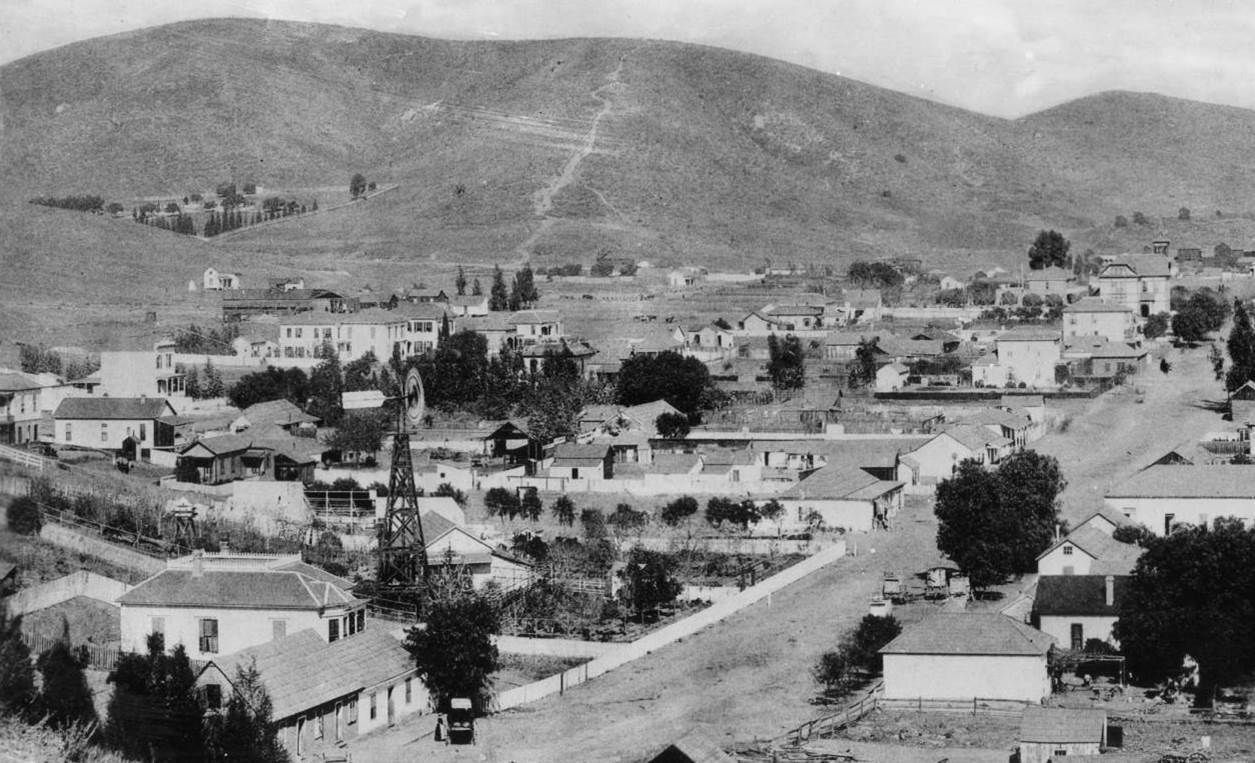
Huntington Digital Library --
http://hdl.huntington.org/cdm/singleitem/collection/p15150coll2/id/8307/rec/6
This is more or less the same view north over Castelar Street as the previous photo, but c. 1900. At left you can see the larger Orphans' Asylum building with its central tower. Also, the Castelar Street
School has been enlarged.
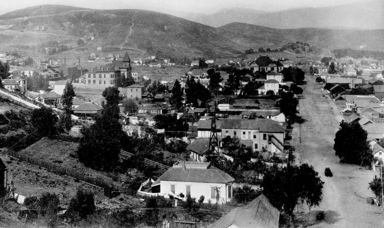
Huntington Digital Library --
http://hdl.huntington.org/cdm/singleitem/collection/p15150coll2/id/3614/rec/14


 Prev
Prev


 Linear Mode
