Quote:
Originally Posted by s211

Pretty sure this is SOP. Dumb? Do you want to be the province that has to re-jig it's signs every time a city annexes territory?
Nonetheless, I have seen the odd city listed as "City X Boundary" or "City Centre" on distance signs.
|
Really? I think you're wrong as it doesn't seem to be. On HWY 99 you cross a sign past Steveston that says 11km to Vancouver, 27km to Surrey. If you continue on HWY99 and onto Oak Street Bridge, 11km mark puts you at 66th street... not even Oakridge. So that's the city center?
27km also going to Surrey if you take any route either lands you in Delta or the closest to City Center in Surrey you get to is about 128th street and 88th Ave.
This was before the SFPR btw.
You then drive on HWY 1 just at 152nd interchange there is a sign that says "Burnaby 11, Vancouver 27."
So from that point along HWY 1, 27km = is only to downtown Vancouver if you exit 1st Ave. If you exit Grandview it leaves you at 12th and Cambie. Not that bad. Hastings and you don't get to downtown.
So that would seem to match your SOP like you claim... but it said 11KM to Burnaby... 11km from that sign puts you at.. Gaglardi which is guess what, the first exit into Burnaby and about 15km short of Metrotown.
I don't buy the SOP business. The mark distances purely on an imaginary point at the time they placed the sign and every single sign on every single highway picks a different dot because they all contradict themselves. Drive on HWY 1 and hit the sign at 152nd and it may be accurate to downtown Vancouver (City Center). Drive down HWY 99 from Seattle and hit the sign at Steveston, and the distance doesn't even put you at Oakridge. Same Ministry isn't it?
Should it all be "uniform" if it is SOP?
So I do actually think it is dumb sorry. If it was to city borders or better yet, the first exit you can get off the major highway and into the city in question, it would make far more sense and be far more simpler to make standard. How often do towns annex land in this Province really? And if you made it based on first exit, how often does that change? It changes when you completely reconfigure the highway in question or add/remove an exit at which point, you have to replace signs anyway! Wouldn't that be a better standard than a post office a city had back in 1805?





 Prev
Prev


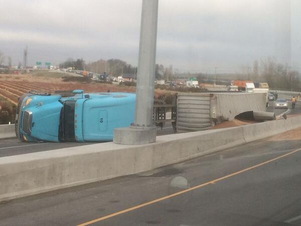


 Is this the first major accident on the SFPR?


 Linear Mode
