HomeDiagramsDatabaseMapsForum About
     

Go Back   SkyscraperPage Forum > Regional Sections > Canada > Alberta & British Columbia > Vancouver > Transportation & Infrastructure


Reply

 
Thread Tools Display Modes
     
     
  #761  
Old Posted Apr 9, 2013, 4:35 AM
b5baxter b5baxter is offline
Registered User
 
Join Date: May 2008
Posts: 187
fantasy map

Best transit fantasy map ever:
http://xkcd.com/1196/large/
Reply With Quote
     
     
  #762  
Old Posted Apr 9, 2013, 6:09 PM
nova9 nova9 is offline
Registered User
 
Join Date: Dec 2008
Location: Vancouver
Posts: 1,086
Quote:
Originally Posted by b5baxter View Post
Best transit fantasy map ever:
http://xkcd.com/1196/large/
this is like a megacity. i wonder if someone has merged the satellite maps that this fantasy transit system would cover. would LOVE to see that.
Reply With Quote
     
     
  #763  
Old Posted Apr 9, 2013, 6:23 PM
deasine deasine is offline
Vancouver Moderator
 
Join Date: Mar 2007
Posts: 5,747
^The Canada Line was clearly misnamed.
Reply With Quote
     
     
  #764  
Old Posted Apr 9, 2013, 8:10 PM
jsbertram jsbertram is offline
Registered User
 
Join Date: Sep 2009
Posts: 3,245
Quote:
Originally Posted by deasine View Post
^The Canada Line was clearly misnamed.
as what?
Reply With Quote
     
     
  #765  
Old Posted Apr 9, 2013, 11:27 PM
trofirhen trofirhen is offline
Registered User
 
Join Date: Oct 2008
Posts: 9,057
the north american fantasy subway map

Quote:
Originally Posted by b5baxter View Post
Best transit fantasy map ever:
http://xkcd.com/1196/large/
of interest was the fact that only cities with true subways - always grade seperated, elevated, or underground.(Seattle was not on the map, neither was Houston or Portland. They all use at-grade LRT)

My biggest surprise was Cleveland. I had understood that they had only at grade LRT there, but they appear to have several qualified subway lines as well.
Reply With Quote
     
     
  #766  
Old Posted Apr 10, 2013, 5:08 AM
deasine deasine is offline
Vancouver Moderator
 
Join Date: Mar 2007
Posts: 5,747
Quote:
Originally Posted by jsbertram View Post
as what?
Well according to the map, the Canada Line seems to be hugging the West Coast as opposed to going across Canada...
Reply With Quote
     
     
  #767  
Old Posted Apr 10, 2013, 3:01 PM
trofirhen trofirhen is offline
Registered User
 
Join Date: Oct 2008
Posts: 9,057
Quote:
Originally Posted by deasine View Post
Well according to the map, the Canada Line seems to be hugging the West Coast as opposed to going across Canada...
You might be confusing it with The Supercontinental
Reply With Quote
     
     
  #768  
Old Posted Apr 10, 2013, 3:51 PM
DKaz DKaz is offline
Registered User
 
Join Date: Nov 2008
Location: Kelowna BC & Edmonton AB
Posts: 4,301
Quote:
Originally Posted by trofirhen View Post
My biggest surprise was Cleveland. I had understood that they had only at grade LRT there, but they appear to have several qualified subway lines as well.
I'm also surprised. They have the one Red Line heavy rail subway and then the two LRTs, Green and Blue Line.

But then I read this... Daily ridership on the Red Line is 19,300 for the 31km long line. The two LRT lines combine for 29km of track and 10,800 passengers a day.
Reply With Quote
     
     
  #769  
Old Posted Apr 10, 2013, 11:46 PM
officedweller officedweller is offline
Registered User
 
Join Date: Jul 2001
Location: Vancouver
Posts: 41,802
Reply With Quote
     
     
  #770  
Old Posted Apr 11, 2013, 1:21 AM
trofirhen trofirhen is offline
Registered User
 
Join Date: Oct 2008
Posts: 9,057
Arrow cleveland subway infrastructure (duplicata)

Thank you for this. I think it is a good example of resourcefulness and forward-thinking. There might or might not be cues or examples for Vancouver to consider emulating. Hey, you never know.
Reply With Quote
     
     
  #771  
Old Posted Apr 11, 2013, 1:55 AM
trofirhen trofirhen is offline
Registered User
 
Join Date: Oct 2008
Posts: 9,057
Quote:
Originally Posted by DKaz View Post
I'm also surprised. They have the one Red Line heavy rail subway and then the two LRTs, Green and Blue Line.

But then I read this... Daily ridership on the Red Line is 19,300 for the 31km long line. The two LRT lines combine for 29km of track and 10,800 passengers a day.
Adding it all up, dividing it up by 12, 52, or 365. how does it compare to us? If anyone had the statistics, thatd'be great; I looked but could not find a precise, charted, comparison.
Reply With Quote
     
     
  #772  
Old Posted Apr 11, 2013, 4:37 AM
BCPhil BCPhil is offline
Registered User
 
Join Date: Jun 2009
Location: Surrey
Posts: 2,578
Quote:
Originally Posted by DKaz View Post
I'm also surprised. They have the one Red Line heavy rail subway and then the two LRTs, Green and Blue Line.

But then I read this... Daily ridership on the Red Line is 19,300 for the 31km long line. The two LRT lines combine for 29km of track and 10,800 passengers a day.
And that is for a metro region of 2 million people. Quite a ridership gap between 2 metros with a 300,000 population difference. And their system has a 30 year head start too.
Reply With Quote
     
     
  #773  
Old Posted Apr 11, 2013, 8:40 AM
nname nname is offline
Registered User
 
Join Date: Aug 2005
Posts: 5,106
Quote:
Originally Posted by trofirhen View Post
Adding it all up, dividing it up by 12, 52, or 365. how does it compare to us? If anyone had the statistics, thatd'be great; I looked but could not find a precise, charted, comparison.
Here's a comparison:

31 out of the 47 SkyTrain stations received more ridership than the 2 LRT lines combined - that include all but 2 stations on the Expo Line.

15 SkyTrain stations are busier than their entire heavy rail line ridership.

6 SkyTrain stations (Commercial-Broadway, Metrotown, Granville, Burrard, Waterfront, Surrey Central) are busier than the combined ridership of their entire system!

I think this is the approximate weekday ridership for our lines in 2011: Expo - 225,000; Millennium - 65,000; Canada - 115,000. The system total is around 405,000.
Reply With Quote
     
     
  #774  
Old Posted Jun 21, 2013, 9:16 AM
The_Animal's Avatar
The_Animal The_Animal is offline
Registered User
 
Join Date: Jun 2013
Location: Lower Mainland, BC
Posts: 35
It is an interesting viewpoint that you've taken here. I'm trying to look at it from an ecological impact POV while still putting the Skytrain through an area that will benefit from the transportation linkage.

(I'm sure there will be rolling eyes going "Oh...God, here's one of those damned "tree-huggers"!!) Unfortunately, for me, the King George Skytrain route that you have put has come uncomfortably close to the "Serpentine Fen Migratory Bird Sanctuary". Loud noises such as the Skytrain's wheels on the rails can interfere with the birds at that sanctuary. Perhaps a detour through 72nd Avenue and down 152 straight down towards White Rock might perhaps be a better route.

http://www.venturevancouver.com/image/serpentine-fen-map-of-bird-sanctuary
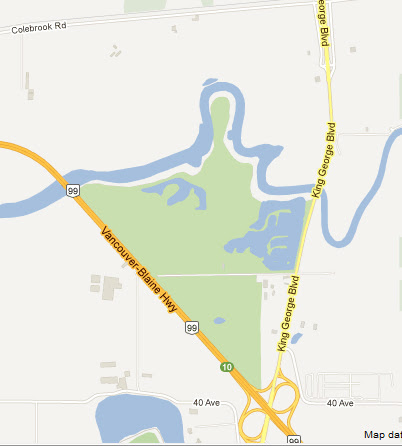

screencap from Google Maps.
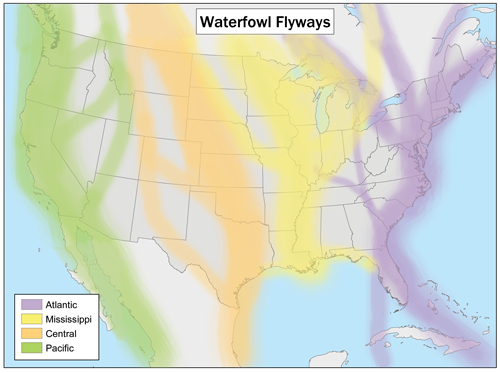

Wikipedia Commons attrib. Creative Commons.
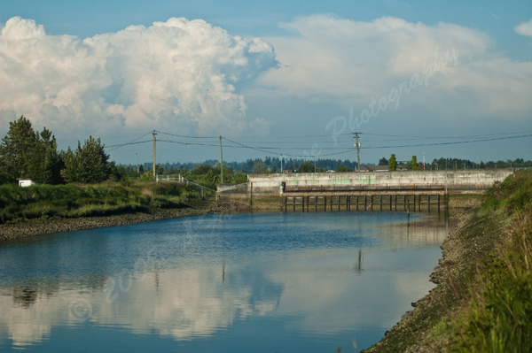

(my image) - photographed by Haruo Chikamori (me), FalconRose Photography.

The proximity of the Skytrain would be way too close to the sanctuary to be viable. It is a two lane highway going down King George and there is no leeway for Skytrain pillars without Serpentine Fen being affected. And the ALR is on the opposite side of the King George Hwy.

Any attempt to put the Skytrain through King George Hwy. will cause an deafening hue and cry from the local wildlife and conservation people.

The viable option is 152nd Street.

Reply With Quote
     
     
  #775  
Old Posted Jun 21, 2013, 6:58 PM
Jebby's Avatar
Jebby Jebby is offline
........
 
Join Date: Dec 2010
Location: Mexico City
Posts: 3,330
Why would SkyTrain even be built out anywhere close to that bird sanctuary? There is absolutely nothing there...if SkyTrain is built down King George it would most likely end around 72nd Ave.
Reply With Quote
     
     
  #776  
Old Posted Jun 21, 2013, 8:14 PM
MIPS's Avatar
MIPS MIPS is offline
SkyTrain Nut
 
Join Date: Mar 2013
Location: Kamloops
Posts: 2,118
That whole area is also hard to stabilize for earthquakes.
I have to agree. As much as the SkyTrain is nice and the line extending almost right to the US border would be nice you're almost doubling the length of the system and we don't have the space at the OMC to add that many more trains. Either you run it as part of the loop and stretch the wait time between cars throughout the whole system or you run a separate line with 5-10 trains that go back and fourth between Surrey (at twice or triple the time between trains than seen on Expo or Millenium) and White Rock with the occasional train that runs express to Waterfront.

On the other hand, the SkyTrain can run pretty quiet if you have very long straight sections and you raise the edges of the guideway. Running straight down 152nd might be okay.
Reply With Quote
     
     
  #777  
Old Posted Jun 22, 2013, 2:28 AM
xd_1771's Avatar
xd_1771 xd_1771 is offline
(daka_x)
 
Join Date: Aug 2010
Location: Metro Vancouver, Canada
Posts: 1,742
Quote:
Any attempt to put the Skytrain through King George Hwy. will cause an deafening hue and cry from the local wildlife and conservation people.
Then we might as well exclude rail altogether. Light rail can be pretty noisy too, particularly where wheels hit curves and no articulated bogies mean squealing and screeching (and there's a bit of rail down there). On the other hand, there's no rail transit planned to go down there anyway.

To be honest, the largely obstruction-free, free-flow nature of KGB there and the potential of express service to Semiahmoo proceeding down Highway 99 to 152nd suits the corridor well for competitive bus rapid transit, so long as capacity does not become an issue.

EDIT: Speaking of transit fantasies, I did this concept some time ago of what a post-2040 Expo Line extension east of Waterfront down the Hastings corridor could look like. There's a whole section of it, actually, that could be built along the rail line as elevated and much less expensive. No tunnels would seem necessary until Victoria Drive. Alignments are detailed, along with station locations and footprint, engineering challenges and potential property acquisitions. I took slopes into account - the big tunnel east of Victoria drive actually fits very well with the land contour. I wonder if the Powell St overpass might create some compatibility issues, though...

https://maps.google.ca/maps/ms?msid=215703449418191845718.0004da887a8ed3f5818f9&msa=0

Last edited by xd_1771; Jun 22, 2013 at 3:39 AM.
Reply With Quote
     
     
  #778  
Old Posted Jun 22, 2013, 7:36 AM
trofirhen trofirhen is offline
Registered User
 
Join Date: Oct 2008
Posts: 9,057
Quote:
Originally Posted by xd_1771 View Post

EDIT: Speaking of transit fantasies, I did this concept some time ago of what a post-2040 Expo Line extension east of Waterfront down the Hastings corridor could look like. There's a whole section of it, actually, that could be built along the rail line as elevated and much less expensive. No tunnels would seem necessary until Victoria Drive. Alignments are detailed, along with station locations and footprint, engineering challenges and potential property acquisitions. I took slopes into account - the big tunnel east of Victoria drive actually fits very well with the land contour. I wonder if the Powell St overpass might create some compatibility issues, though...

https://maps.google.ca/maps/ms?msid=215703449418191845718.0004da887a8ed3f5818f9&msa=0
I always thought a Hastings Line would be a good idea. It could go through the "node" downtown, then through the West End, under the bay, and connect up as the Arbutus Line to 41st. But that's just wishful thinking, of course.
Reply With Quote
     
     
  #779  
Old Posted Jun 22, 2013, 11:49 AM
Jebby's Avatar
Jebby Jebby is offline
........
 
Join Date: Dec 2010
Location: Mexico City
Posts: 3,330
Quote:
Originally Posted by xd_1771 View Post
Then we might as well exclude rail altogether. Light rail can be pretty noisy too, particularly where wheels hit curves and no articulated bogies mean squealing and screeching (and there's a bit of rail down there). On the other hand, there's no rail transit planned to go down there anyway.]
Pay no attention to that post. It reeked of enviro-nazi. There is no, and probably will never be, any plan to expand SkyTrain or any other rapid transit that far south

Why would any same person think that translink would build rapid transit all the way to the border??

I hope that didn't sound to harsh towards the poster who suggested that, it just made no sense to bring up the bird 'sanctuary.' As if animals really meant anything to human development (as seen in countless projects worldwide)
Reply With Quote
     
     
  #780  
Old Posted Jun 22, 2013, 12:44 PM
The_Animal's Avatar
The_Animal The_Animal is offline
Registered User
 
Join Date: Jun 2013
Location: Lower Mainland, BC
Posts: 35
Quote:
Originally Posted by Jebby View Post
Pay no attention to that post. It reeked of enviro-nazi. There is no, and probably will never be, any plan to expand SkyTrain or any other rapid transit that far south

Why would any same person think that translink would build rapid transit all the way to the border??

I hope that didn't sound to harsh towards the poster who suggested that, it just made no sense to bring up the bird 'sanctuary.' As if animals really meant anything to human development (as seen in countless projects worldwide)
It was in response to the OP who started this whole thread off in Page 1. Pal.

https://maps.google.com/maps/ms?ie=UTF8&...8,-122.866287&spn=0.334651,0.917358&z=11

Just pointing out that his idea of a Skytrain all the way to White Rock would have to consider a few points. Sorry if it stepped on your toes. DEAL.
Reply With Quote
     
     
This discussion thread continues

Use the page links to the lower-right to go to the next page for additional posts
 
 
Reply

Go Back   SkyscraperPage Forum > Regional Sections > Canada > Alberta & British Columbia > Vancouver > Transportation & Infrastructure
Forum Jump


Forum Jump


All times are GMT. The time now is 5:44 PM.


Powered by vBulletin® Version 3.8.7
Copyright ©2000 - 2026, vBulletin Solutions, Inc.

