HomeDiagramsDatabaseMapsForum About
     

Go Back   SkyscraperPage Forum > Regional Sections > Canada


Reply

 
Thread Tools Display Modes
     
     
  #581  
Old Posted Feb 16, 2013, 6:39 PM
bulliver's Avatar
bulliver bulliver is offline
 
Join Date: Feb 2009
Posts: 3,729
Construction of a fixed-link crossing of the MacKenzie River near Fort Providence began in 2008 and opened November 30, 2012. This is the first time there has been a permanent all weather crossing linking Yellowknife, the capital of the Northwest Territories, with the rest of the Canadian highway network. Previously motorists had to use the MV Merv Hardie ferry in the summer and an ice bridge in the winter, with a significant interruption in spring and fall.

The project was plagued with construction delays and budget overruns. The bridge is 1.045 kilometres long (1.6km including the approach causeways), 10.4 meters wide, and has 27.2 meters of clearance for shipping, requiring a 3.5% grade on the bridge deck. The cost of construction was 202 million CAD.

Deh Cho is the traditional name of the MacKenzie River by the local Dene people, and means "big water".

This image was shot from the south side of the river, east of the bridge.
15 image panorama, stitched using hugin. It's a little soft, as I had to hand-hold at 300mm.


Much bigger:

Reply With Quote
     
     
  #582  
Old Posted Feb 16, 2013, 8:44 PM
Chadillaccc's Avatar
Chadillaccc Chadillaccc is offline
 
Join Date: Feb 2011
Posts: 22,842
Wow, excellent photo Bulliver!
Reply With Quote
     
     
  #583  
Old Posted Feb 16, 2013, 9:03 PM
1ajs's Avatar
1ajs 1ajs is offline
 
Join Date: Jul 2005
Posts: 26,527
Reply With Quote
     
     
  #584  
Old Posted Feb 16, 2013, 9:12 PM
Metro-One's Avatar
Metro-One Metro-One is offline
 
Join Date: Sep 2008
Posts: 18,040
A couple pretty cool posts there!

Great picture Bulliver!

And what is the story behind that demolition?
Reply With Quote
     
     
  #585  
Old Posted Feb 16, 2013, 9:17 PM
1ajs's Avatar
1ajs 1ajs is offline
 
Join Date: Jul 2005
Posts: 26,527
Quote:
Originally Posted by Metro-One View Post
A couple pretty cool posts there!

Great picture Bulliver!

And what is the story behind that demolition?
the bridge was damaged a few yrs back during a flood last yr they closed it down because the peers are unstable
Reply With Quote
     
     
  #586  
Old Posted Feb 17, 2013, 2:18 AM
bulliver's Avatar
bulliver bulliver is offline
 
Join Date: Feb 2009
Posts: 3,729
Thanks guys...I had a blast driving to Yellowknife for the first time. The profile pic doesn't really show how steep it is...here's another shot from head on whilst driving over...could cause problems if it was iced right up:
Reply With Quote
     
     
  #587  
Old Posted Feb 27, 2013, 10:42 PM
Dwils01's Avatar
Dwils01 Dwils01 is offline
 
Join Date: Mar 2010
Posts: 3,286
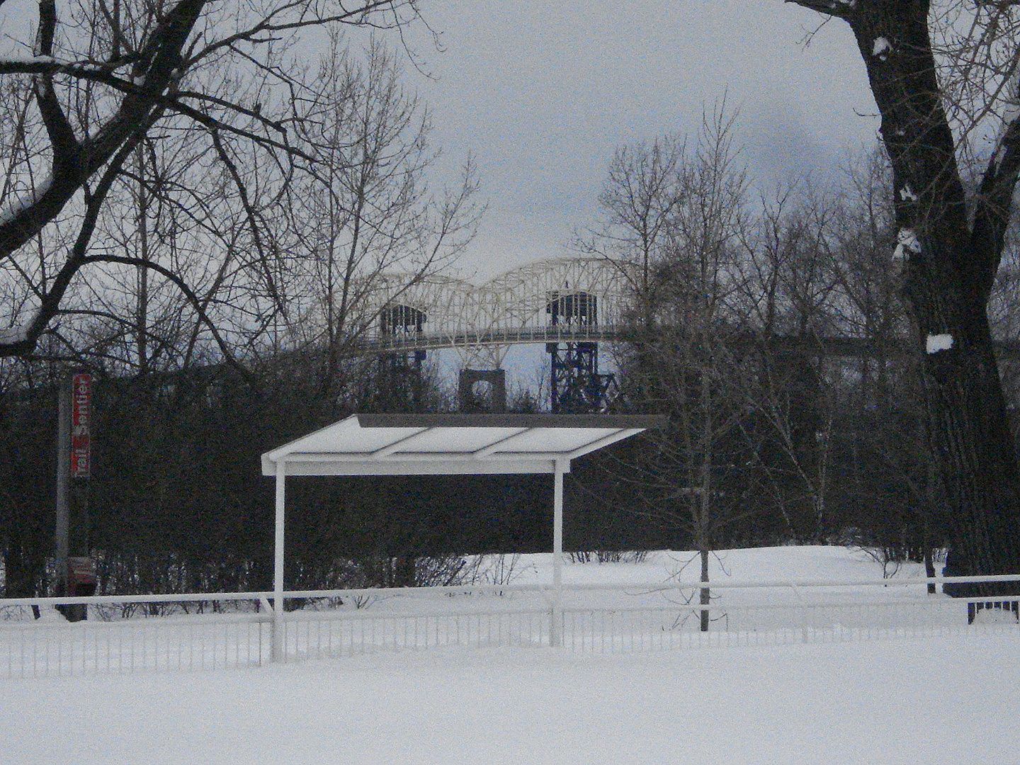
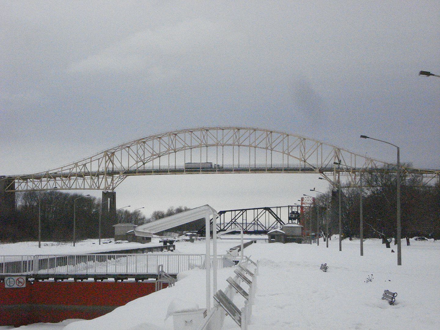
The International Bridge, Sault Ste. Marie Ontario and Michigan.


Photo's by me from today.
Reply With Quote
     
     
  #588  
Old Posted Feb 28, 2013, 12:38 AM
leftimage leftimage is offline
 
Join Date: Feb 2011
Posts: 786
Damn, lots of snow in Sault Sainte Marie.
Reply With Quote
     
     
  #589  
Old Posted Feb 28, 2013, 1:03 AM
vid's Avatar
vid vid is offline
 
Join Date: Apr 2004
Posts: 39,065
They're on the snowy side of the lake. A bit further north they get around 3 meters of it every winter.
Reply With Quote
     
     
  #590  
Old Posted Feb 28, 2013, 3:53 AM
Dwils01's Avatar
Dwils01 Dwils01 is offline
 
Join Date: Mar 2010
Posts: 3,286
That's average for us. Last few winters were not normal, we got a lot less snow than usual.
Batchawana Bay to Wawa is a real bad area for snow squalls. the Highway gets closed a lot there especially between Batchawana Bay and Montreal River Harbour.
I'm happy we don't get as much snow as up there.
Reply With Quote
     
     
  #591  
Old Posted Mar 1, 2013, 1:20 AM
vid's Avatar
vid vid is offline
 
Join Date: Apr 2004
Posts: 39,065
Thunder Bay has seen declining snow every year for three years now. We're at maybe a fifth of what we should have, right now, and it's melting fast. If we don't have a rainy spring, this is going to be a really bad fire/drought season.
Reply With Quote
     
     
  #592  
Old Posted Mar 1, 2013, 1:43 AM
Dwils01's Avatar
Dwils01 Dwils01 is offline
 
Join Date: Mar 2010
Posts: 3,286
I heard there wasn't much snow up there. I have family in Schreiber and they were complaining at the beginning of February that there wasn't a good base to go snowmobiling. I didn't realize that it was that bad up there for the past three years.
Reply With Quote
     
     
  #593  
Old Posted Mar 3, 2013, 12:12 AM
bulliver's Avatar
bulliver bulliver is offline
 
Join Date: Feb 2009
Posts: 3,729
The Tompkins Landing Ice Bridge carries Alberta Secondary Highway 697 across the Peace River linking La Crete with Highway 35 about 50km south of High Level. The crossing is about 1.5km long, the speed limit is 10km/h, and only one vehicle is allowed on the ice at a time.


The ferry which services the crossing during summer:


In case you are wondering, my truck weighed just under 60,000kg (132,000lbs) when I drove on the ice...
Reply With Quote
     
     
  #594  
Old Posted Mar 11, 2013, 11:58 PM
davidivivid davidivivid is offline
 
Join Date: Jul 2010
Posts: 3,082
Reply With Quote
     
     
  #595  
Old Posted Mar 12, 2013, 3:30 AM
kw5150's Avatar
kw5150 kw5150 is offline
 
Join Date: Nov 2009
Posts: 5,807
I dont even understand this shot. That looks crazy

QUOTE=bulliver;6018126]Thanks guys...I had a blast driving to Yellowknife for the first time. The profile pic doesn't really show how steep it is...here's another shot from head on whilst driving over...could cause problems if it was iced right up:
[/QUOTE]
Reply With Quote
     
     
  #596  
Old Posted Mar 17, 2013, 6:12 AM
bulliver's Avatar
bulliver bulliver is offline
 
Join Date: Feb 2009
Posts: 3,729
^ Bit of tele compression happening there, but yeah, it's pretty steep. The MacKenzie river has no valley here, it's only a few meters below the banks, so the bridge needs a steep pitch to allow clearance for ship navigation.
Reply With Quote
     
     
  #597  
Old Posted Mar 17, 2013, 7:21 AM
Nouvellecosse's Avatar
Nouvellecosse Nouvellecosse is offline
 
Join Date: Aug 2005
Posts: 11,377
There's ship navigation on the MacKenzie river? I had no idea...
Reply With Quote
     
     
  #598  
Old Posted Mar 17, 2013, 4:04 PM
Andrewjm3D's Avatar
Andrewjm3D Andrewjm3D is offline
 
Join Date: Dec 2010
Posts: 1,702
Quote:
Originally Posted by davidivivid View Post
Great shot, I actually prefer the old steel bridge to it's newer suspension twin .
Reply With Quote
     
     
  #599  
Old Posted Mar 18, 2013, 2:44 AM
entheosfog's Avatar
entheosfog entheosfog is offline
 
Join Date: Sep 2006
Posts: 3,709
Ironworkers Memorial Bridge is in the forground, new and old Port Mann beyond that:
Reply With Quote
     
     
  #600  
Old Posted Mar 18, 2013, 6:40 AM
Chadillaccc's Avatar
Chadillaccc Chadillaccc is offline
 
Join Date: Feb 2011
Posts: 22,842
Excellent vantage point
Reply With Quote
     
     
This discussion thread continues

Use the page links to the lower-right to go to the next page for additional posts
 
 
Reply

Go Back   SkyscraperPage Forum > Regional Sections > Canada
Forum Jump


Forum Jump


All times are GMT. The time now is 8:54 AM.


Powered by vBulletin® Version 3.8.7
Copyright ©2000 - 2026, vBulletin Solutions, Inc.