So
here is my contribution to the discussion of Regional Higher order transit. Some of you may have seen this before, I've been refining it a bit.
Some explanation is probably required. What I've done with this design is used some logical future thinking of needed infrastructure over the next 5 to 20 years and used them as opportunities not just to focus on cars, but also to look for opportunities for higher order transit. So when the times comes for a 3rd harbour crossing - lets put in an LRT tunnel. When the MacDonald eventually needs to be replaced (due to age), same thing - add an LRT track. Eventually a NW Arm link will be needed, add LRT to the mix.
The plan doesn't really put a timeline for all this to be built out, I'm guessing between 25 and 50 years (at least). There are three forms of higher order transit here:
- Urban Streetcar (Tram);
- LRT (similar to Calgary or Vancouver); and
- High Speed Ferry.
Part of the routing goes back to what I spoke of earlier, serving key trip generation locations (employment centres, downtown, shopping destinations) but also focuses on a multi-modal approach. This way, it builds redundancy into the network so that if one system goes down you may have other options. For example: I've assumed Shannon Park would be the location of the future stadium (that's my preference) - so it has a streetcar, LRT and future high speed ferry. If the ferry is unable to be in service, there are other options available to get there. This way, one service may be crowded at the beginning but as other forms of transit come on line, they begin to take the load as well.
I've used Vancouver's skytrain system as a model and most routes begin/end at "Waterfront" station, which is essentially the ferry terminal. Scotia Square will also be a key interconnection point, as the Waterfront Station would have 4 of the 5 lines departing from it. 2 lines would follow a shared track in a curved direction from Waterfront up to SS (under the Historic Properties) while the other two would have a curve direction in an opposite direction going up the hill and eventually under Barrington. They would then branch off in their respective directions.
The streetcars uses a philosophy of 'shared routing' as much as possible. The Agricola/Windsor SCs share the same track starting at the Armoury into downtown along Hollis and the same outbound track back to the Armoury. The same is true for the two Dartmouth SC's along Wyse Road.
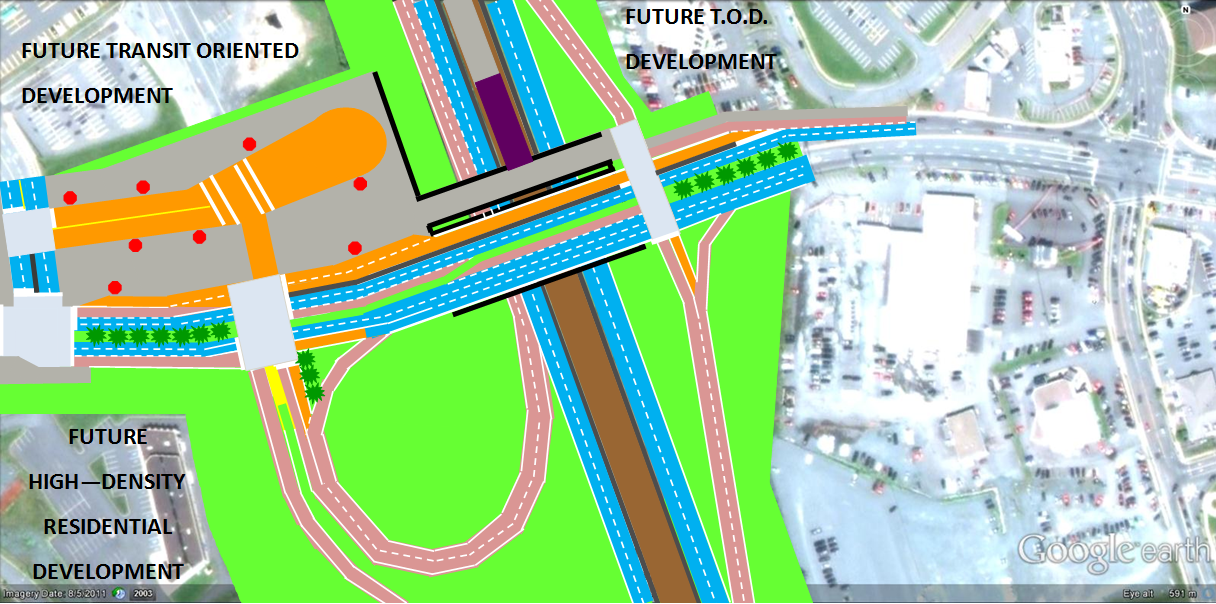
All forms of transit will become catalysts for redevelopment, so I've focused the SC's mainly on existing corridors in the Regional Centre plan to bolster, support and increase density. The same is true for some of the LRT routes, but they are also being used to create suburban pockets of density as well (Portland Street is great example of a future suburban TOD corridor).
There is also a crosstown link from Sackville/Bedford to Dartmouth and a future routing to the Airport. Where the LRT or SC lines would be hitting potential future greenfield sites, they can be used as means to create much denser urban neighbourhoods centred around a transit oriented village, then dropping in scale and height as you get away from the station.
The one issue I haven't resolved is whether I'm more of a Calgary/Edmonton type LRT fan (where you create designated LRT priority crossings at grade) or more of a Vancouver Skytrain elevated fan. I realize with an elevated system, these is much more cost, but I have to admit the fact that it's automated and wouldn't require as much human investment for operators (thus if there is a strike it could still run) has it's perks!
Enjoy!


 Prev
Prev


 Linear Mode
