HomeDiagramsDatabaseMapsForum About
     

Go Back   SkyscraperPage Forum > Regional Sections > Canada > Ontario > London > Transportation & Infrastructure


Reply

 
Thread Tools Display Modes
     
     
  #361  
Old Posted Aug 23, 2011, 1:01 PM
MolsonExport's Avatar
MolsonExport MolsonExport is offline
Touching grass everyday.
 
Join Date: Oct 2003
Location: Otisburgh
Posts: 51,480
all part of the common nonsense revolution of Harris et al.
__________________
The whole problem with the world is that fools and fanatics are always so certain of themselves, and wiser people so full of doubts. (Bertrand Russell). Sweet Loretta fart thought she was a cleaner, but she was a frying pan. (John Lennon)
Reply With Quote
     
     
  #362  
Old Posted Aug 23, 2011, 4:22 PM
go_leafs_go02 go_leafs_go02 is offline
Registered User
 
Join Date: Dec 2007
Location: London, ON
Posts: 2,406
Quote:
Originally Posted by haljackey View Post


Short answer: no. Technically Highway 4 doesn't exist in London except between Lambeth and the south city limits. The province downloaded many King's highways to municipalities and they don't want any of them back.
Actually, Highway 4 is only under control of the MTO from Glanworth/Littlewood Drive south to the London/Elgin Country border near the Ford plant.

Pretty sure everything north of there (Highway 401 interchange) right to the north City limits is all municipal. Likely the overpass over Highway 402 and the ramp intersections are, but the remainder isn't. And yes, downloading the highways was a horrible decision. I'm OK with downloading the jurisdiction to municipalities or counties, but they should have kept the numbering system and signage under MTO's control. Now Ontario has probably the most confusing highway signing network in North America. Provincial Highways, County Roads, Municipal Roads, etc..

You can't follow Highway 4 through London - the signage is definitely iffy in spots too.
Reply With Quote
     
     
  #363  
Old Posted Aug 23, 2011, 5:37 PM
haljackey's Avatar
haljackey haljackey is offline
User Registered
 
Join Date: Apr 2010
Location: London, Ontario
Posts: 3,485
Yeah downloading had its pros and cons but it sure made things a lot more confusing.

For example in Greater Toronto there's:
-Highway 7
-Highway 407 (ETR)
-Regional Road 7 (which can differ depending on which regional municipality you're in)
-County Road 7
-(And Highway 7A if you count it.)

The province should at least try to keep the original routes numbered. For example, if Highway 2 was renumbered it would provide a trans-provincial route alternative to the 401, which would be helpful to people who do not like to drive on freeways (like the elderly).

Still, I think Highway 4's route in London made no sense. If it comes into the city on Colonel Talbot/Warncliffe and exits on Richmond, wouldn't it make more sense to have it not wind through the city? Just connect it via Warncliffe/Western/Richmond.
__________________
My Twitter

My Simcity Stuff
Reply With Quote
     
     
  #364  
Old Posted Aug 23, 2011, 7:39 PM
Simpseatles's Avatar
Simpseatles Simpseatles is offline
Wannabe Urbanite
 
Join Date: Aug 2010
Location: Waterloo/London
Posts: 708
Quote:
Originally Posted by haljackey View Post
Still, I think Highway 4's route in London made no sense. If it comes into the city on Colonel Talbot/Warncliffe and exits on Richmond, wouldn't it make more sense to have it not wind through the city? Just connect it via Warncliffe/Western/Richmond.
Yes, this is something I've often wondered about myself. By making the highway wind to the southwest of the city, and bypass St. Thomas, it ruined what could have been a logical connection with St. Thomas. With a big, built up highway 4 going directly from downtown St. Thomas to downtown London (via Wellington), we could have become a much more interconnected metro. Instead we have a couple 2 lane country roads, and kilometeres of farmland between the 2 cities of the "metro region". It makes no sense.
__________________
"Sometimes I wonder if the world's so small, that we can never get away from the sprawl.
Living in the sprawl the dead shopping malls rise like mountains beyond mountains and there's no end in sight." -Arcade Fire
Reply With Quote
     
     
  #365  
Old Posted Aug 23, 2011, 10:26 PM
go_leafs_go02 go_leafs_go02 is offline
Registered User
 
Join Date: Dec 2007
Location: London, ON
Posts: 2,406
Quote:
Originally Posted by Simpseatles View Post
Yes, this is something I've often wondered about myself. By making the highway wind to the southwest of the city, and bypass St. Thomas, it ruined what could have been a logical connection with St. Thomas. With a big, built up highway 4 going directly from downtown St. Thomas to downtown London (via Wellington), we could have become a much more interconnected metro. Instead we have a couple 2 lane country roads, and kilometeres of farmland between the 2 cities of the "metro region". It makes no sense.
The Highway designations all make sense based on a former road network. Remember Highway 2 used to be the Mother-Road of Ontario back in the day, and Highway 4 made sense how it worked connecting down to Port Stanley and bypassing St. Thomas.

You gotta look into past history to understand how the road network worked BEFORE the 400-series Highways came around. There used to be a website showing the MTO road maps for each year, take a look to see how easy it was before they downloaded all those highways and turned them into municipal roads. Here's the website showing snippets of each map, but it doesnt' show the province before mass downloading occured. http://www.ontarioroadmaps.ca/Maps/Official_Ontario/Official_Collection.htm
Reply With Quote
     
     
  #366  
Old Posted Aug 24, 2011, 12:15 AM
Simpseatles's Avatar
Simpseatles Simpseatles is offline
Wannabe Urbanite
 
Join Date: Aug 2010
Location: Waterloo/London
Posts: 708
Quote:
Originally Posted by go_leafs_go02 View Post
The Highway designations all make sense based on a former road network. Remember Highway 2 used to be the Mother-Road of Ontario back in the day, and Highway 4 made sense how it worked connecting down to Port Stanley and bypassing St. Thomas.

You gotta look into past history to understand how the road network worked BEFORE the 400-series Highways came around. There used to be a website showing the MTO road maps for each year, take a look to see how easy it was before they downloaded all those highways and turned them into municipal roads. Here's the website showing snippets of each map, but it doesnt' show the province before mass downloading occured. http://www.ontarioroadmaps.ca/Maps/Official_Ontario/Official_Collection.htm
Very interesting website!

I suppose I can see now that the route highway 4 takes is the shortest between highway 2, and Port Stanley, while bypassing St. Thomas.

Anyways, I stumbled upon this map, and was struck by how much larger K-W, Brantford, and Guelph look compared to London at the time. It must be reflecting city limits, because there is no way, that these places were larger than London in 1957!
Also, it shows the first part of the 401 completed in our region.


http://www.ontarioroadmaps.ca/Maps/Official_Ontario/Official_Collection.htm
__________________
"Sometimes I wonder if the world's so small, that we can never get away from the sprawl.
Living in the sprawl the dead shopping malls rise like mountains beyond mountains and there's no end in sight." -Arcade Fire
Reply With Quote
     
     
  #367  
Old Posted Aug 24, 2011, 12:51 AM
go_leafs_go02 go_leafs_go02 is offline
Registered User
 
Join Date: Dec 2007
Location: London, ON
Posts: 2,406
Quote:
Originally Posted by Simpseatles View Post
Very interesting website!

I suppose I can see now that the route highway 4 takes is the shortest between highway 2, and Port Stanley, while bypassing St. Thomas.

Anyways, I stumbled upon this map, and was struck by how much larger K-W, Brantford, and Guelph look compared to London at the time. It must be reflecting city limits, because there is no way, that these places were larger than London in 1957!
Also, it shows the first part of the 401 completed in our region.


http://www.ontarioroadmaps.ca/Maps/Official_Ontario/Official_Collection.htm
Even that snippet of a map is fantastic. Highway 2 used to drop down into Ingersoll and then follow along the river towards Woodstock. Highway 100 (which somehow became Airport Road) went from Thamsford up to St. Marys (or what used to be Highway 19 about 12 years ago).

And to think, all those red roads were largely provincial highways back in the day...really wish at least the signed part of the network came back, and all County Roads, Municipal Roads, and Regional Roads were removed from the system...
Reply With Quote
     
     
  #368  
Old Posted Aug 24, 2011, 1:26 AM
MolsonExport's Avatar
MolsonExport MolsonExport is offline
Touching grass everyday.
 
Join Date: Oct 2003
Location: Otisburgh
Posts: 51,480
Love the old maps. would be a great idea for a thread.
__________________
The whole problem with the world is that fools and fanatics are always so certain of themselves, and wiser people so full of doubts. (Bertrand Russell). Sweet Loretta fart thought she was a cleaner, but she was a frying pan. (John Lennon)
Reply With Quote
     
     
  #369  
Old Posted Sep 1, 2011, 5:41 AM
Pimpmasterdac's Avatar
Pimpmasterdac Pimpmasterdac is offline
Registered User
 
Join Date: Jul 2010
Location: London
Posts: 701
Hyde Park Widening

Browsing around London Transportation planning and saw the city finally did an update on the plans for Hyde Park Rd Widening.

Unfortunately the plans for the widening seem to be filled of gimmicks, NIMBY-ism, lack of foresight and overall cheapness.

Oxford & Hyde Park although they propose a double left turn they want to eliminate a right turn, due to fears of the evil expropriation, even though 7/11 and gas station across from it are closed.

Here's a comparison of what would be the best and what the "experts" want to be done.


At Gainsborough, The city wants to have separate turning lanes with normal width of lanes and a nice median like UWO. However the NIMBY crowd appears to be cluckin up a storm and want the lanes to be narrower (i.e. traffic calming) and fewer lanes for Hyde Park (yet none for Gainsborough)

Here's another comparison of what's best and what the Nimby crowd wants.


Here's the full plan for those interested. It's disappointing the city seems to cave to the demands of every little group who has the slightest complaint. They seem to want London set back in the past with not hopes of growth for the future.

Hopefully the city grows a pair and does whats best for the whole west end, not just exclusive uppity neighbourhoods.

Reply With Quote
     
     
  #370  
Old Posted Sep 1, 2011, 5:46 PM
go_leafs_go02 go_leafs_go02 is offline
Registered User
 
Join Date: Dec 2007
Location: London, ON
Posts: 2,406
The "road diet" is 3.3m wide travel lanes (down from 3.5m). In Surrey, BC, they use 3.3m wide travel lanes WITH a 3.0m right lane next to a 1.3m bike lane.

It's a truck route, and while signed at 60 km/h, it has average speeds between 70 - 80 km/h. I've cycled there once, and it was too narrow for me. Here's a streetview:

http://maps.google.ca/?ll=49.119157,-122...3A9bdoxekWjgcoTfQ&cbp=12,250.23,,0,10.31

3.3m lanes aren't narrow. 3.0m lanes are getting there, but still work. You have nothing to worry about with that road diet.

And a proposed roundabout at Hyde park and Sunningdale. That's a GREAT idea.

biggest mistake - going down to 1.2m wide bike lanes under the CP overpass. There's gotta be a better way. 1.2m is TINY. That's a major pinch point especially with trucks in the right lane.
Reply With Quote
     
     
  #371  
Old Posted Sep 8, 2011, 7:41 PM
haljackey's Avatar
haljackey haljackey is offline
User Registered
 
Join Date: Apr 2010
Location: London, Ontario
Posts: 3,485
The problem with the rail overpass on Hyde Park Road is that it was designed to span a 4 lane road, not 4 lanes + 2 bike lanes. Thus everything needs to be squeezed down you still want them to go under.

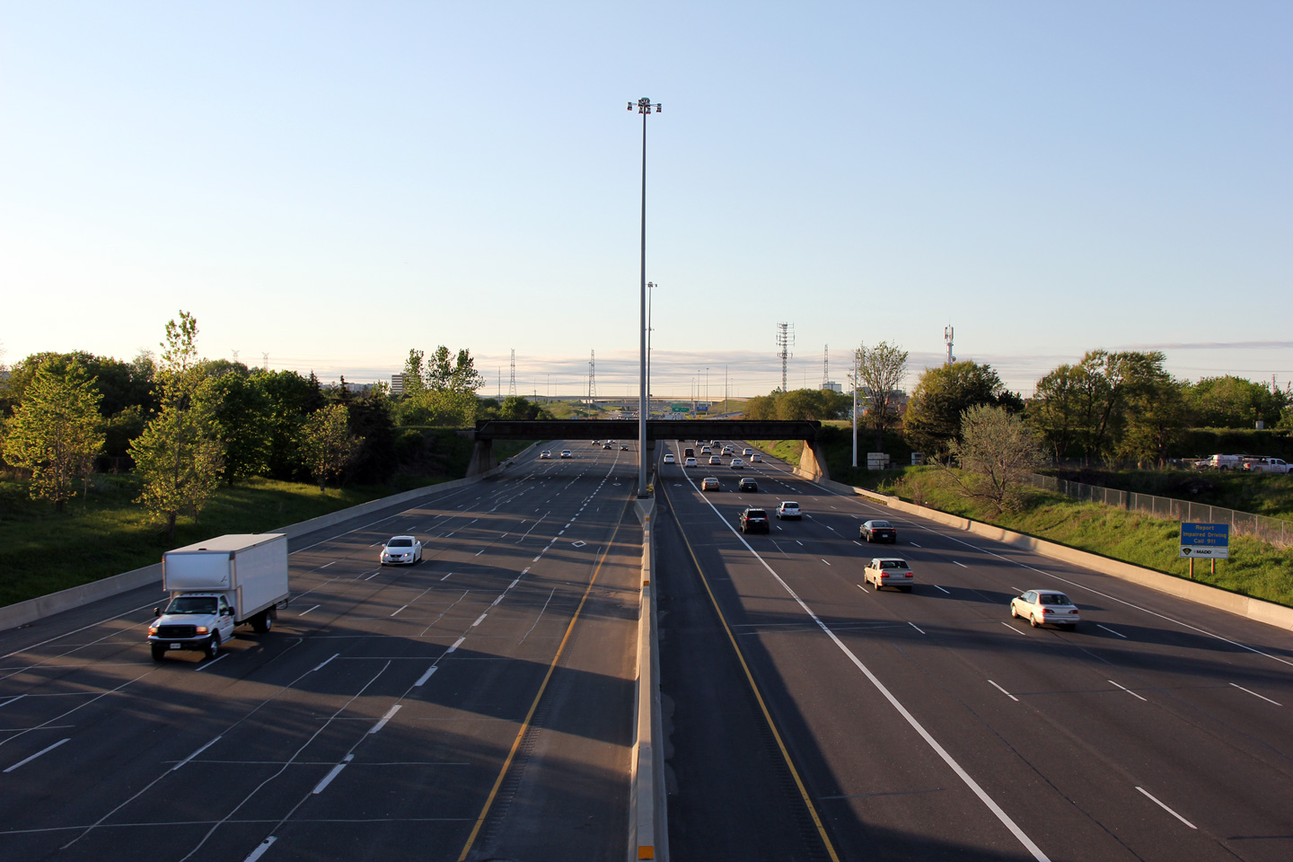
Consider what the MTO did when they widened Highway 404 and added HOV lanes. This rail overpass wasn't wide enough to support shoulders or the HOV buffers, so they had to squeeze everything together.


http://www.asphaltplanet.ca/ON/hwy_404-406_images/Hwy404_Images.htm

----

Moving on, the roadwork on Dundas Street is done. Very relieved to see the work complete.


And Progress is being made at the Sarnia Road rail overpass too:
__________________
My Twitter

My Simcity Stuff
Reply With Quote
     
     
  #372  
Old Posted Sep 9, 2011, 1:49 AM
MolsonExport's Avatar
MolsonExport MolsonExport is offline
Touching grass everyday.
 
Join Date: Oct 2003
Location: Otisburgh
Posts: 51,480
^great updates. Otherwise, I fear more examples of London "thinking small". I hate sprawl, but it is here, so it must be serviced, unless the city/province can agree on a light rail link along Wellington-Richmond Corridor and concomitant densification; perhaps also eventually another line along Oxfart from Hyde Park to Airport. And HSR in the QC-Windsor Corridor. The city would be a candidate to boom like never before.

I enjoyed reading the Hyde park report. But I couldn't help but think that the preferred option (with respect to CN overpass) was the "fuck the pedestrian" option. This is 1970 thinking. How long will this attitude persist? Also, the expressed desire to keep the historical buildings in Hyde park. As I write this, the old house next to the United Church has been demolished; the church is now being dismantled. What are they going to save? that grotty fugly used car lot building on the northwest corner? too little, too late.
__________________
The whole problem with the world is that fools and fanatics are always so certain of themselves, and wiser people so full of doubts. (Bertrand Russell). Sweet Loretta fart thought she was a cleaner, but she was a frying pan. (John Lennon)

Last edited by MolsonExport; Sep 9, 2011 at 2:03 AM.
Reply With Quote
     
     
  #373  
Old Posted Sep 11, 2011, 8:58 PM
Kokkei Mizu's Avatar
Kokkei Mizu Kokkei Mizu is offline
Registered User
 
Join Date: Aug 2010
Posts: 447
I'm surprised that with the reconstruction of Horton St, they didn't bury the utility lines... Now with the new Goodwill open, the road is becoming more and more dense and a part of downtown. Those wires really get in the way and detract from the city streetscape. Anybody else agree?
Reply With Quote
     
     
  #374  
Old Posted Sep 12, 2011, 3:27 AM
Wharn's Avatar
Wharn Wharn is offline
Torontonian Refugee
 
Join Date: Jan 2011
Location: Oxy County
Posts: 982
Quote:
Originally Posted by Kokkei Mizu View Post
I'm surprised that with the reconstruction of Horton St, they didn't bury the utility lines... Now with the new Goodwill open, the road is becoming more and more dense and a part of downtown. Those wires really get in the way and detract from the city streetscape. Anybody else agree?
I'd be the wrong person to ask, because I actually like overhead utility wires (but not huge hydro poles). Weird, I know, but there's something about them that pleases me.

Quote:
Originally Posted by go_leafs_go02 View Post
3.3m lanes aren't narrow. 3.0m lanes are getting there, but still work. You have nothing to worry about with that road diet.
Does anyone know how wide the lanes are on Wharncliffe between Oxford and Base Line? I've always found them to be way too narrow in some sections (particularly near Horton St.) and on a few occasions I've had people from the opposing lanes wander onto my side of the road in order to dodge obstacles. The speed limit is 50 but it would honestly have to be 40 to be safe. Hopefully they aren't planning something similar for Hyde Park.

Last edited by Wharn; Sep 12, 2011 at 3:40 AM.
Reply With Quote
     
     
  #375  
Old Posted Sep 12, 2011, 5:16 AM
Pimpmasterdac's Avatar
Pimpmasterdac Pimpmasterdac is offline
Registered User
 
Join Date: Jul 2010
Location: London
Posts: 701
Quote:
Originally Posted by Wharn View Post
Does anyone know how wide the lanes are on Wharncliffe between Oxford and Base Line? I've always found them to be way too narrow in some sections (particularly near Horton St.) and on a few occasions I've had people from the opposing lanes wander onto my side of the road in order to dodge obstacles. The speed limit is 50 but it would honestly have to be 40 to be safe. Hopefully they aren't planning something similar for Hyde Park.
The local yokels are proposing these "diet lanes" at Molsons favourite intersection of liver & onions. Somehow have these diet lanes, a difference of 2 feet will breathe life in the intersection that regular sized lanes will suck up.

Wharncliffe is between Baseline & Oxford is its own hell with no centre-turn lane. City plans going back to the 80s called for a centre turn lane along Wharncliffe from Baseline to Oxford (as well as new underpasses). 30 years later we still have the same congested shitty road just more people using them.

On Hyde Park Rd the problem is they want to get rid of right hand turn lanes, which the cities own reports say will be needed within ~10 years. The city needs to think whats good for the WHOLE city, not what some stuck up NIMBY residents think. Hyde Park is the most western north-south road that we'll have. Expanding it properly will help relieve Wonderland and push back the need to widen to 6 lanes. But knowing our weak kneed council they'll cave to these whiners and probably push back construction to 2020.
Reply With Quote
     
     
  #376  
Old Posted Sep 12, 2011, 6:30 PM
GreatTallNorth2 GreatTallNorth2 is offline
Registered User
 
Join Date: May 2006
Posts: 1,758
Why is everyone obsessed with the government building roads and spending so much money on infrastructure outside the city of London? We need major spending on projects IN the city. The more highways, etc. that get funding for outside the city, the more sprawl we will have. And we need that, like we need Anne Marie back in the mayors chair.
Reply With Quote
     
     
  #377  
Old Posted Sep 12, 2011, 6:54 PM
haljackey's Avatar
haljackey haljackey is offline
User Registered
 
Join Date: Apr 2010
Location: London, Ontario
Posts: 3,485
Quote:
Originally Posted by GreatTallNorth2 View Post
Why is everyone obsessed with the government building roads and spending so much money on infrastructure outside the city of London?
This is due to the fact that London's connections to the outside world are just as crappy as what we have in the city.

Also, consider that some roads outside the urban area (like 401/402) are provincial roads, and they will fork over a lot money on these routes compared to municipal roads. (It's better bang for the buck from out city's standpoint.)
__________________
My Twitter

My Simcity Stuff
Reply With Quote
     
     
  #378  
Old Posted Sep 12, 2011, 11:11 PM
Snark Snark is offline
Registered User
 
Join Date: May 2006
Posts: 505
Quote:
Originally Posted by haljackey View Post
This is due to the fact that London's connections to the outside world are just as crappy as what we have in the city.
Er, uh, what?
Reply With Quote
     
     
  #379  
Old Posted Sep 13, 2011, 2:00 AM
GreatTallNorth2 GreatTallNorth2 is offline
Registered User
 
Join Date: May 2006
Posts: 1,758
My thoughts are that the government seems to give money to projects that the city wants. K/W wanted LRT and they got a ton of cash from the Feds and Province. Same goes for Ottawa, Toronto, Mississauga, etc. Windsor has a new $1.5 billion parkway. We are getting 401 highway upgrades, which really doesn't help transportation in the city. I'm not saying the 401 upgrades won't be nice, but can you imagine that money being spent on in city projects. It would do so much for the in city transportation needs.
Reply With Quote
     
     
  #380  
Old Posted Sep 13, 2011, 3:15 AM
Snark Snark is offline
Registered User
 
Join Date: May 2006
Posts: 505
Quote:
Originally Posted by GreatTallNorth2 View Post
My thoughts are that the government seems to give money to projects that the city wants. K/W wanted LRT and they got a ton of cash from the Feds and Province. Same goes for Ottawa, Toronto, Mississauga, etc. Windsor has a new $1.5 billion parkway. We are getting 401 highway upgrades, which really doesn't help transportation in the city. I'm not saying the 401 upgrades won't be nice, but can you imagine that money being spent on in city projects. It would do so much for the in city transportation needs.
Careful, some of that stuff has nothing to do with the city getting benefit. The Windsor parkway for example is being done not to benefit Windsor, it's a missing link in the NAFTA superhighway network that badly needs to be filled in. If Windsor were not there and the link was still missing, the project would still be going forward. This project may in fact have a somewhat detrimental effect on the City: when complete 90% of the border crossing traffic will bypass the city all together instead of being forced to drive through it.

Ottawa is in NCC territory, therefore gets lots of extra cash from the Feds.

I do agree though, that in some cases the higher levels of government will listen to the requests of the locals. The 401 upgrades are a case in point:

The 401 upgrades in London aren't intended to improve the city's transportation network per se, it is a piece of the puzzle of the regional economic strategy. Airport cargo terminal, declaration of a free trade zone for the city, improvements to the freeway network, and the new water reservoir are part of the same strategy. The announcement of two new factories in the innovation park in the past month is just the sort of thing that the strategy is targeting.
Reply With Quote
     
     
This discussion thread continues

Use the page links to the lower-right to go to the next page for additional posts
 
 
Reply

Go Back   SkyscraperPage Forum > Regional Sections > Canada > Ontario > London > Transportation & Infrastructure
Forum Jump


Forum Jump


All times are GMT. The time now is 2:51 AM.


Powered by vBulletin® Version 3.8.7
Copyright ©2000 - 2026, vBulletin Solutions, Inc.