Looks like a great feeder line. I think a segment going up 200th or 208th to Walnut Grove would be good too, and maybe one along 88th or 96th to Tynehead, which Surrey wants to turn into another relatively dense residential area.
Now you may ask, why shift the line over to Lougheed Town Centre station rather than the current terminus of the 145, Production Way station?
Production Way station is generally too small to play a significant transfer role at this point. In the mornings, the single narrow stairway is jammed with people, a majority of which are students heading to SFU but also including some local residents heading the opposite way towards Vancouver and elsewhere. The reverse happens in the afternoons. (Part of the problem is due to the fact that SkyTrain hasn't fixed the escalator yet, which has been out of service for months.)
Transfers are made easier. It should be noted that some places may be poorly served in requiring too many transfers if a gondola still remains at Production Way station. At the moment, the Tri-Cities are poorly served since the major buses from there terminate at Lougheed but students must travel one stop west to catch the 145. When Evergreen opens, this may change and the whole lower section of Burnaby and New West may be poorly served as people would have to change trains at Lougheed just to head one stop west for the gondola. All of this transferring is inefficient and slow, and to me it's more ideal to place the necessary transfer at a place where they'd have to change lines or modes anyway.
Any quibbles about this plan? Well... two... at least...
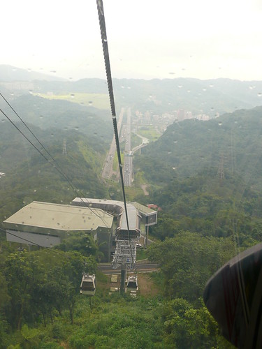
Residents will probably be unnerved by a gondola running over their heads. The plan tries to minimize construction impacts at least by placing towers on empty park and school lands.
BC Hydro would have to be involved in this project as the route proposed crosses over some important transmission wires that would have to be buried underground for a distance for safety.
Well.. your plan seems to be a bit cost prohibitive, as each turn, even a 10 degree one, will probably require building a station. Something like this..
Also, the cars will slow to a crawl for each turn it makes. Based on two systems I've travelled before, each mid-station and turn will add about 1min to the travel time.
From your proposal, seems like it require a minimum of 7 stations?
I've altered the proposal. Basic shape of the route remains but it's more straight. Unfortunately this means that the towers will have to sit on top of some people's homes (or in other words costly expropriation). In addition I didn't realize that there was a stream running through the proposed midpoint station so now it looks more like a leaf in my attempt to squeeze it in.
Now, you may ask yourself... isn't a straight route from the top and bottom better? Truth is, maybe. One of the biggest problems are the residents below; I felt that a diagonal route that avoids Forest Grove would be the less disruptive solution (although the residents of Lougheed Town Centre / Burquitlam will certainly loathe this proposal). There's also the environment that we have to consider, as we're building a line on the side of Burnaby Mountain, a protected conservation area. A straight-line route may require the cutting of more trees along the route for sight and safety clearances, and of course, cut too many, and you'll get insane environmental protests again. In a way the reverse of the above is desired; if you build in populated areas the need to build in conservation areas is reduced significantly (and therefore the need to cut down trees).
In the end, there's a fine line that has to be treaded if and when this proposal moves ahead... do something wrong, and some very vocal groups will love to shoot things down (unfortunately).
It's been a few months since I did the last proposal, so I'm proposing a new one. This is a bit more detailed than before, and the route got changed by popular opinion, but the concept remains the same.
Note that it's not possible to do a straight line between Lougheed Station and SFU without demolishing the high-rise apartment blocks down at Lougheed Town Centre or moving the lower station outside a convenient transfer walking distance range (then again most SFU students will have to walk long distances anyway to get to the gondola, so that might be a moot point).... and I will severely criticize any plan considering having the gondola end up at Production Way Stn (even if it's cheaper and it's a straight line) because I notice that a lot of people at the moment do have to like take an extra one-station hop from Lougheed towards Production Way simply because there's no SFU buses from Lougheed itself. The situation may "ease" once Millennium converts to Evergreen, but then Surrey students going to Burnaby campus and vice versa will have to do something similar. Both situations ruin the whole point of convenient transfers that's supposed to make transit viable, and it should be avoided and replaced with something like or similar to the plan above.
The crosstown route might be necessary, but I think you're missing a key part of the puzzle: the replacement of the 130. That route is quite congested with CapU, BCIT, Metrotown, Brentwood, and Burnaby Heights all along the way... not to mention the seasonal PNE (sometimes).
Also... what happened to Abbotsford? Wiped off the map? The connection with Mission may be critical. And how did Chilliwack, Aggaziz, and the outer fringes of the region grow so big? Your map is completely scaled way off on the eastern portion of the region.
I do not understand the logic of your line 8 "U" at the Olympic Village vicinity. What does that achieve, if anything, especially in its current "express" layout form with no stops in between?
Finally, I see that you used Inkscape... however, to be able to export your map, it has to fit on the page (which I see sitting empty on the second last image). Usually the command "fit to selection" in the page properties somewhere will help.
The crosstown route might be necessary, but I think you're missing a key part of the puzzle: the replacement of the 130. That route is quite congested with CapU, BCIT, Metrotown, Brentwood, and Burnaby Heights all along the way... not to mention the seasonal PNE (sometimes).
I don't take the bus too often (30 minutes in between each bus, no thanks), so I don't know any of the busy bus routes, except the ones around my area. If you've seen Willingdon Ave, you know it's very residential from Kingsway to Moscrop. I don't think residents would really want to hear a subway every few minutes.
Also... what happened to Abbotsford? Wiped off the map? The connection with Mission may be critical. And how did Chilliwack, Aggaziz, and the outer fringes of the region grow so big? Your map is completely scaled way off on the eastern portion of the region.
I'm one of those geographical distorters (look at Columbia to Lougheed) when it comes to maps, especially if there are no waterways around the area.
I do not understand the logic of your line 8 "U" at the Olympic Village vicinity. What does that achieve, if anything, especially in its current "express" layout form with no stops in between?
Before I made a map of it online, I made one copy (around 2007) and revised it like 4 times. The line was originally supposed to go from UBC to Stanley Park, which was supposed to happen, but then I realized there was the Millenium Line, so the Arbutus Line eventually connected to that line, and I never bothered to fix it.
Finally, I see that you used Inkscape... however, to be able to export your map, it has to fit on the page (which I see sitting empty on the second last image). Usually the command "fit to selection" in the page properties somewhere will help.
Replies in bold.
Last edited by Toddlertoddy; Jan 26, 2011 at 3:20 PM.
ummm... the 130 bus is every 7-10 minutes 15 evenings and weekends. very busy route
Plus there is the peak period 125 route that goes between BCIT and Patterson, and many students ride the 25 between Brentwood and BCIT, or will take it to Nanaimo station just to avoid the crowds on the 130.
I've always thought that the next rapid transit route that's not on the radar (IE after Evergreen, Surrey and Broadway/UBC) will be from downtown down Hastings, past the PNE to Willingdon, then past Brentwood, BCIT, and up to Metrotown. There is a lot of demand and room for BCIT to grow if they didn't require so much space for parking. In the near future there will be need for at least Light Rail along the route, if not Skytrain.
No doubt the next major line to be considered will be Hastings, but I expect it will end at PNE, which is the last major transit destination along that corridor. I can't imagine a SkyTrain line ever going up Burnaby Heights. In terms of transit density, there is simply nothing there!
BCIT is an unfortunate victim of its location - halfway between two transit lines and unlikely ever to have a line built to it. Perhaps it is time for BCIT to explore a new/replacement location for its main campus. It already has several satellite campuses around the region.
Couldn't they start running a B-line from Waterfront to Metrotown via Hastings and Willingdon through Brentwood & BCIT in the future?
__________________
"you're eating chicken periods" - Vid
"I love eggs, especially the ones with runny yolks" - Me
"EWWWWWWWWWWWWWWWWWWWWWW, you're disgusting!" - Vid
Couldn't they start running a B-line from Waterfront to Metrotown via Hastings and Willingdon through Brentwood & BCIT in the future?
I suppose, but if you just start looking at north-south routes north of the Fraser in general, I doubt Willingdon would be the first on the list to be built.
Like I said before, I think that the line you describe would be a waste of money through its most expensive section - i.e. the section from PNE to Brentwood. And between Brentwood to Metrotown there is only one worthwhile stop.
By far the cheapest way to connect a Hastings line to Millennium Line would be to turn south at the PNE and follow the edge of Highway 1 down to M-line.
I think you might under estimate the amount of people that go along willingdon not to mention that BCIT just voted for the Upass so thing are going to get worse.
Well, the hill up to Metrotown would be a significant cost, requiring an Evergreen-like bored tunnel. This is why I think a "Willingdon line" would be a non-starter.
But it would be very cheap to connect BCIT to Millennium Line - and the PNE in the opposite direction - with a short spur line originating at Gilmore Station.
There would be handful of stations, and simple elevated guideways on unbuilt land, mostly flat grade. It would be very cost-effective.
I wonder what the transit planners think of building short spurs in strategic locations?
Well, the hill up to Metrotown would be a significant cost, requiring an Evergreen-like bored tunnel. This is why I think a "Willingdon line" would be a non-starter.
But it would be very cheap to connect BCIT to Millennium Line - and the PNE in the opposite direction - with a short spur line originating at Gilmore Station.
There would be handful of stations, and simple elevated guideways on unbuilt land, mostly flat grade. It would be very cost-effective.
I wonder what the transit planners think of building short spurs in strategic locations?
How would short spurs integrate well with the rest of the transit network? You can't have an M-line train originating at VCC- Clark going up 3 or more different spurs. You'll end up confusing the hell out of people. Instead of spurs, why not just have express buses connecting key locations to the nearest stations?
Further, why not have a B-line first to establish whether the Hastings-Welligdon line, or even just a hastings line, would be effective, and establish ridership?
__________________
"you're eating chicken periods" - Vid
"I love eggs, especially the ones with runny yolks" - Me
"EWWWWWWWWWWWWWWWWWWWWWW, you're disgusting!" - Vid
How would short spurs integrate well with the rest of the transit network? You can't have an M-line train originating at VCC- Clark going up 3 or more different spurs.
Sure you can, some places like NY and London have lots of spurs dangling off of main lines. You look at the sign on the front of each train to see which terminus it's going to. The trains combine to give more frequent service on the shared segments. Not saying it's necessarily a good idea for our network, but it's not unusual.





 Prev
Prev




 Linear Mode
