Here you will find the most indepth information resource of the construction of a rapid transit rail line at Skyscraperpage

 INTRODUCTION
The Canada Line, formerly known as the Richmond-Airport-Vancouver Rapid Transit Rail Line ("RAV Line"), is a new 19-km automated rapid transit line of the Greater Vancouver Transportation Authority (TransLink) currently under construction. The line is being built and will be operated by a private sector engineering firm, SNC-Lavalin (InTransitBC), for 35 years.
The line will be the third for Vancouver, Canada and will be added to the existing rapid transit system but will not use linear induction motor technology, rather standard
third rail technology. Despite the fact the line will use different technology, it is unclear whether or not it will be branded "SkyTrain" as the other two existing lines.
The Canada Line will connect downtown Vancouver to the Vancouver International Airport and Richmond City Centre in time for the 2010 Winter Olympics. The line is expected to carry
100,000 passengers per day at launch on November 29, 2009 and
142,000 passengers by 2021.
CONSTRUCTION BEGAN IN SEPTEMBER 2005 AND WILL BE COMPLETED ON NOVEMBER 29, 2009.
 ROUTE
ROUTE
The Vancouver section of the line will run underground from Waterfront Station, with a cut-and-cover tunnel under Granville Street between Hastings and Dunsmuir and a bored tunnel under Granville and Davie Street and False Creek to the 2nd Avenue station on Cambie Street, where it will run as a cut-and-cover tunnel as far as 64th Avenue with the two directions either side-by-side or stacked on separate decks.
From there, the line will be elevated, crossing the North Arm of the Fraser River via a new cable-stayed bridge. At the proposed Bridgeport Station, the line would split, with the main line heading south on an elevated track along Number 3 Road to Richmond City Centre. A branch line will cross the Middle Arm of the Fraser River, connecting Bridgeport Station to stations on Sea Island and terminating at Vancouver International Airport. Portions of the airport branch will be at-grade in order to accommodate a future elevated taxiway for aircraft over the line. In addition, 400 metres of the final segments of the Richmond and Airport branches are single-tracked instead of double tracked to cut project costs and to appease Richmond City Council, which considered the overhead line an eyesore and had been fighting for an at-grade line.
- Elevated: ~7 kms
- At-grade: ~1.7 kms
- Bored tunnel: ~ 2.5 kms
- Cut & cover tunel: ~8 kms
TOTAL: 19 kms
Travel times southbound
from downtown Vancouver will be 25 minutes to Richmond Centre and 26 minutes to the airport terminus. Northbound, trains will leave Richmond City Centre and YVR every six minutes heading to Vancouver. The departures will be coordinated to allow for a train every three minutes on the main line in Vancouver.
- Richmond frequency: ~6 minutes
- Airport frequency: ~6 minutes
- Combined Vancouver frequency: ~3 minutes
Bridges
- North Arm Fraser River Bridge
- Middle Arm Fraser River Bridge
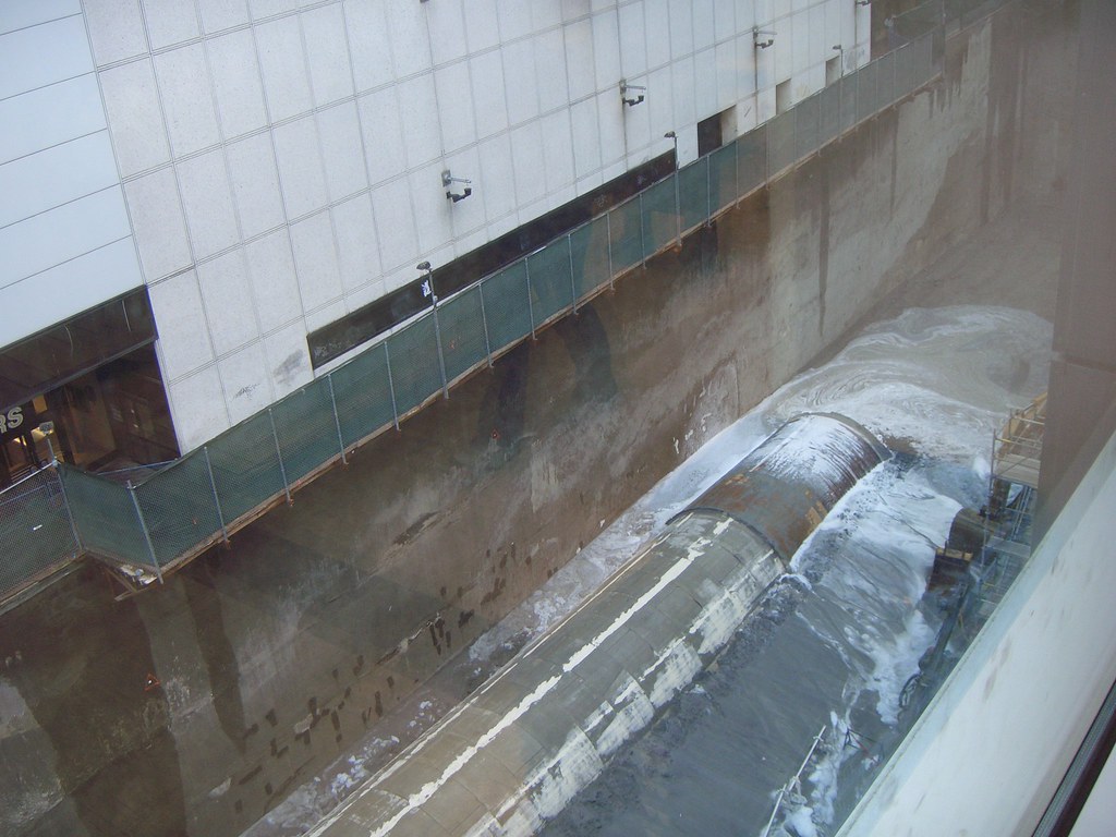
Canada Line tunnel boring machine, "Sweet Leilani"
 FREQUENCY
INTIAL SERVICE PLAN in 2009/2010
FREQUENCY
INTIAL SERVICE PLAN in 2009/2010
7-day frequency (32 vehicles/16 trains required)
Early Morning
- Waterfront to Bridgeport: 6 minutes
- Bridgeport to YVR: 12 minutes
- Bridgeport to Richmond Centre: 12 minutes
Morning Peak Period
- Waterfront to Bridgeport: 3 mins 45 secs
- Bridgeport to YVR: 7 mins 30 secs
- Bridgeport to Richmond Centre: 7 mins 30 secs
Mid-Day
- Waterfront to Bridgeport: 3 mins 45 secs
- Bridgeport to YVR: 7 mins 30 secs
- Bridgeport to Richmond Centre: 7 mins 30 secs
Afternoon Peak Period
- Waterfront to Bridgeport: 3 mins 45 secs
- Bridgeport to YVR: 7 mins 30 secs
- Bridgeport to Richmond Centre: 7 mins 30 secs
Evening
- Waterfront to Bridgeport: 6 minutes
- Bridgeport to YVR: 12 minutes
- Bridgeport to Richmond Centre: 12 minutes
Late Night
- Waterfront to Bridgeport: 10 minutes
- Bridgeport to YVR: 20 minutes
- Bridgeport to Richmond Centre: 20 minutes
SERVICE PLAN (will kick in when line gets busier)
7-day frequency (36 vehicles/18 trains required)
Early Morning
- Waterfront to Bridgeport: 6 minutes
- Bridgeport to YVR: 12 minutes
- Bridgeport to Richmond Centre: 12 minutes
Morning Peak Period
- Waterfront to Bridgeport: 3 minutes 10 secs
- Bridgeport to YVR: 6 minutes 20 secs
- Bridgeport to Richmond Centre: 6 minutes 20 secs
Mid-Day
- Waterfront to Bridgeport: 3 minutes 10 secs
- Bridgeport to YVR: 6 minutes 20 secs
- Bridgeport to Richmond Centre: 6 minutes 20 secs
Afternoon Peak Period
- Waterfront to Bridgeport: 3 minutes 10 secs
- Bridgeport to YVR: 6 minutes 20 secs
- Bridgeport to Richmond Centre: 6 minutes 20 secs
Late Night
- Waterfront to Bridgeport: 10 minutes
- Bridgeport to YVR: 20 minutes
- Bridgeport to Richmond Centre: 20 minutes
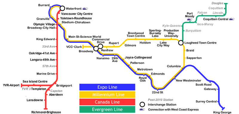
STATIONS
Stations are proposed to be built in two stages: 16 stations will be built for the line's projected opening prior to the 2010 Winter Olympics, with up to three additional stations being added after the line opens.
Stations platforms will range from 40 and 50 metres in length. Stations that are 40 metres are expandable to 50 metres. The proposed stations are listed below.
Vancouver
- Waterfront (connection to Expo and Millennium Lines, West Coast Express and SeaBus) - 50 metres
- Vancouver City Centre (Granville Street at Robson Street) - 50 metres
- Yaletown-Roundhouse (Davie Street near Mainland Street) - 40 metres
- Olympic Village (Vancouver 2010 Olympic Village, SouthEast False Creek, Granville Island) - 40 metres
- Broadway-City Hall (Cambie Street at West Broadway) - 50 metres
- King Edward (Cambie Street at King Edward Avenue) - 40 metres
- Oakridge-41st Avenue (Cambie Street at West 41st Avenue, next to Oakridge Centre) - 50 metres
- Langara-49th Avenue (Cambie Street at West 49th Avenue) - 40 metres
- Marine Drive (Cambie Street at Southwest Marine Drive) - 40 metres
Richmond
- Bridgeport (north of Bridgeport Road in Richmond; major transit exchange for suburban buses; new 1,000 car park and ride; link to Airport branch) - 40 metres
- Aberdeen (No. 3 Road at Cambie Road) - 40 metres
- Lansdowne (No. 3 Road at Lansdowne Road; 2-3 blocks away from the Richmond Olympic Oval speed skating venue) - 40 metres
- Richmond-Brighouse (No. 3 Road at Cook Road, adjacent to the Richmond Centre shopping mall) - 50 metres
Vancouver International Airport
- Templeton (to be located north of Grant McConachie Way, near Templeton Street) - 40 metres
- Sea Island Centre (to be located on Grant McConachie Way, near the Air Canada service centre) - 40 metres
- YVR-Airport Terminal (adjacent to the main terminal of Vancouver International Airport) - 50 metres
Future stations post-2010
- 33rd Avenue (Cambie Street at West 33rd Avenue, next to Queen Elizabeth Park in Vancouver)
- 57th Avenue (Cambie Street at West 57th Avenue in Vancouver)
- Capstan Way (No. 3 Road at Capstan Way in Vancouver)
- YVR-3 (Vancouver International Airport future terminal expansion)
Station architects
- Segment One: Downtown (Waterfront, Vancouver City Centre and Yaletown-Roundhouse Stations) – VIA Architecture & PBK;
- Segment Two: North Cambie (Olympic Village and Broadway-City Hall Stations) – Stantec;
- Segment Three: Central Cambie (King Edward, Oakridge-41st Avenue and Langara-49th Avenue Stations) – Hotson Bakker Boniface Haden;
- Segment Four: Fraser River (Marine Drive and Bridgeport Stations) – VIA Architecture & PBK;
- Segment Five: No 3 Road (Aberdeen, Lansdowne and Richmond-Brighouse Stations) – Busby Perkins Will;
- Segment Six: Sea Island (Templeton Station, Sea Island Centre Stations) – Walter Francl;
- Segment Seven: Sea Island/Terminal (YVR-Airport Station) – Kasian Architects.
TECHNOLOGY
The Canada Line will not use the proprietary Bombardier Advanced Rapid Transit linear induction technology, but rather another fully automated transit vehicle using more conventional motors than the linear induction motor used in trains on the Expo and Millennium lines. The Request For Proposals also required that the system have
an ultimate capacity of 15,000 pphpd (leaving the choice of technology and platform length to the proponent) and required a maximum travel time between YVR and downtown Vancouver of 24 minutes.
The new line will also be automated like the other two existing lines.
VEHICLES
The trains (ROTEM EMU) will be designed and built in South Korea by Rotem Company, a division of Hyundai Motor Group.
In total twenty fully-automated articulated trains are on order. Capacity of the new trains is estimated at 334 people, with a top speed of 80 km/h. Married pairs of gangway connected cars will be 41 metres long and 3 metres wide, both longer and wider than the ART fleet used by the current SkyTrain lines, and will have electronic ‘Next Destination’ signs on each train. These trains are currently used by Hong Kong's MTR and KCR.
Technical Summary
- Train Configuration: 2-car trains
- Maximum speed: 80 km/h
- End to End Journey time: 25-26 mins
- Passenger capacity: 400 per train
- Seating configuration: Side-by-side transverse seats, flip-up seats at wheelchair and bicycle positions
- Bicycle accommodation: 2 per train
- Wheelchair accomodation: 4 per train
- Length: 41 metres
- Width: 3 metres
- Height: 3.6 metres
- Weight: 76 tonnes empty
Features
- Air conditioned interior
- Wide aisles between seats for smooth passenger flow
- Walkway between vehicles
- Accessible for wheelchairs, strollers and bicycles
- Passenger silent alarm
- Emergency passenger-operated intercom panels
- Electronic “Next Station” signs in each train
- Electronic “Destination” signs on the outside of each train
- Public Address System announcing next stations
- Modern vandal-resistant finishes
- Silver stainless steel exterior
- Fully automated and driverless operations
I have to say that i really love new logo, very sleek......maybe a different brand from SkyTrain is a great thing, but i still think it should still be NAMED SkyTrain.


Incomplete Canada Line train from the factory in South Korea

Update - September 2007


 COST
COST
CAN$2 BILLION
- Government of Canada: $300 million
- Government of British Columbia: $400 million
- Greater Vancouver Transportation Authority (Translink): $400 million
- Vancouver International Airport: $250 million
- InTransitBC (SNC-Lavalin; private sector): $650+ million


 Prev
Prev


 [/IMG]


 Linear Mode
