Quote:
Originally Posted by Docere

There doesn't seem to be any agreed upon unit that defines London's metropolitan area.
So what is it? The Function Urban Area? London and the surrounding home counties (and all local authorities within)? Something else?
|
A metropolitan area measures the level of connectivity to an
urban area, or more accurately urban sprawl.
The issue in the context of London is that the
Green Belt (London and Home Counties) Act 1938 implemented a hard restriction on urban sprawl which is why the outer layer of London is dominated by interwar (or earlier) housing abruptly abutting agricultural land.
The Metropolitan Green Belt of London covers an area of 5,189km2, enveloping not just swathes of Outer London, but much of the surrounding Home Counties. Not only is there a physical limit of London’s urban area expanding outwards, the Green Belt also stops Home County towns such as High Wycombe from expanding towards London. You can get infill development (demolish an old barn to build 10 homes, etc…) and some local authorities can reallocate the Green Belt to enable development, but there can’t be a net loss. Nor is the Green Belt just focused on London and its hinterland. Oxford and Cambridge, and other British cities have their own Green Belts. There are also National Parks, Areas of Outstanding Natural Beauty, etc… that prevent the UK, or at least England merging into one urban mass.
If you go by the strict definition, then London’s metro area will be smaller relative to other metro areas, simply because it didn’t sprawl. Even with the broad growth in and around London, I can’t see the Green Belt being abolished to allow for the various components to merge into one urban area.
Yuri is correct in saying that you could try and fudge or create models that try to bridge that anti-sprawl measure which creates a variety of outcomes, but there will never be an apples to apples comparison.
Quote:
Originally Posted by Docere
There's been some discussion of Slough joining up with London - not sure what's become of that.
|
Whilst that gap between London and Slough is just 0.7km at its narrowest point, it has been, and likely will remain for ever as part of the Green Belt.
Quote:
Originally Posted by mhays
You can get commuter trains to several towns anywhere in the southeast coasts (Channel, bay near the Thames etc.). Some seem borderline doable for a daily commute to a core London station (say <75 minutes). A lot more would work if you're a few stations inland.
|
London does possess a large rail network with all-day bi-directional service that spans a vast area, but I don’t think that is a measure of the size of London’s metro, more the connectivity of London and its environment.
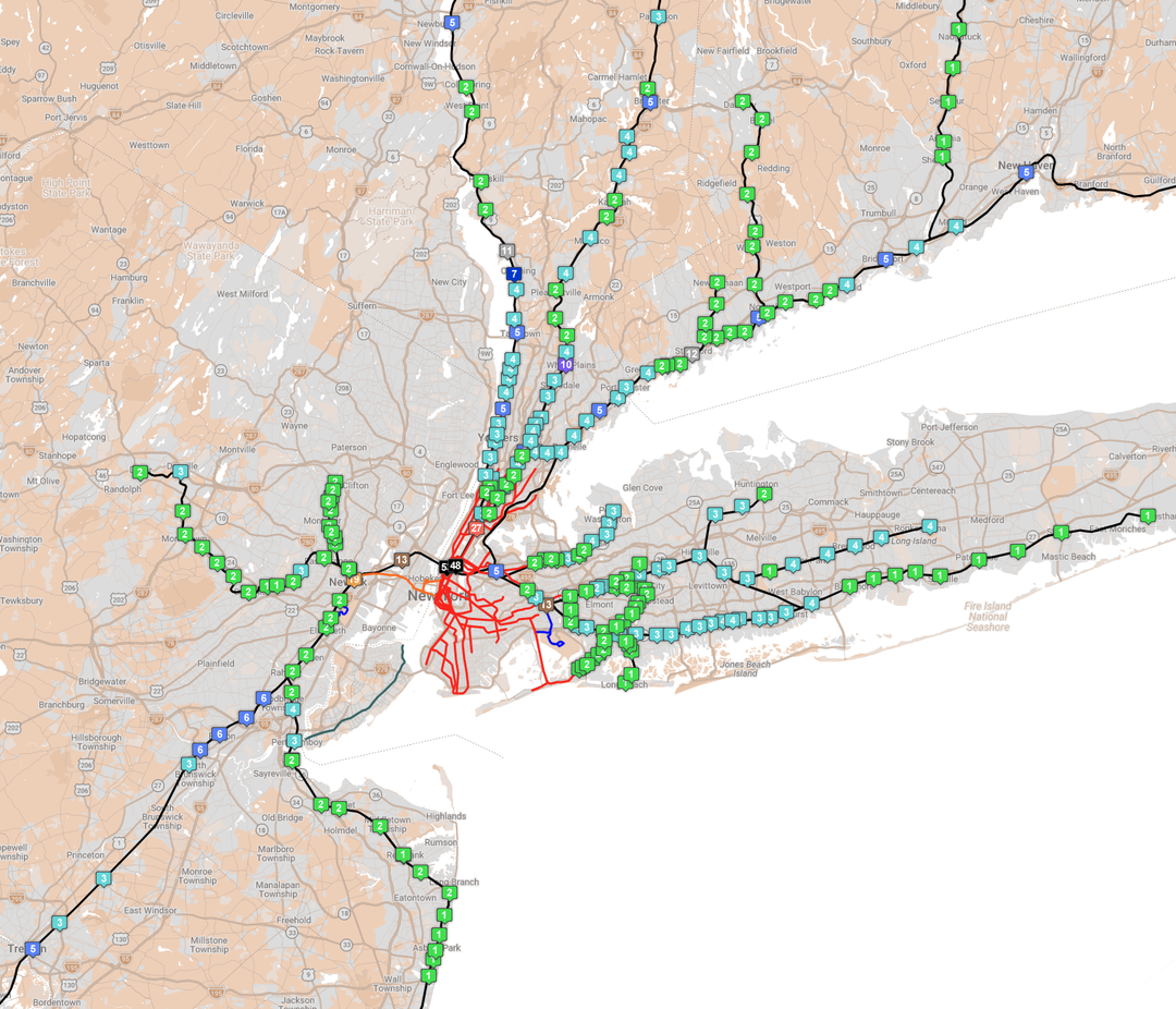
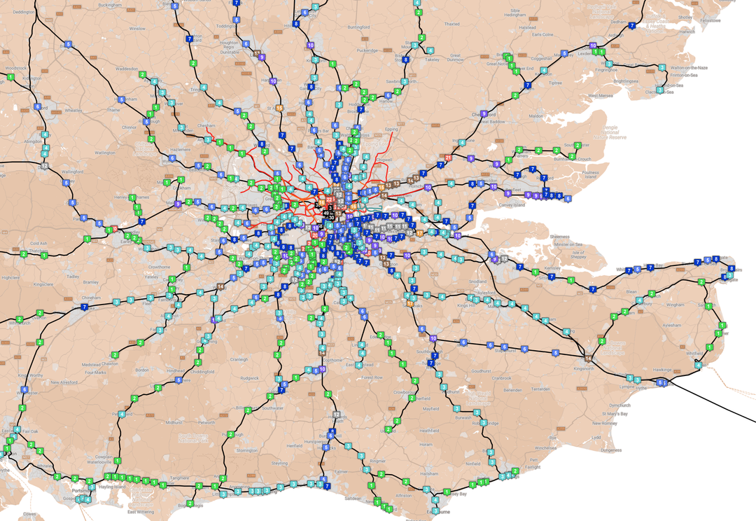
I created these curious maps before the pandemic (they pre-date the Elizabeth Line, East Side Access, etc…), which show the frequency of direct trains arriving into Central London and Manhattan between 0800-0859 on a weekday.
Quote:
Originally Posted by Docere
I dunno. The GO Train runs from Toronto to Kitchener for example, and certainly we hear how it's all becoming one metropolitan area or it's all one area now. But only about 5% of the Waterloo Region workforce commutes to the Greater Toronto Area.
|
I don’t think Brighton is part of a London ‘metro’, but there are six train stations in Brighton & Hove that have a regular all-day bi-directional service to London. 144 (direct) trains depart Brighton & Hove each weekday.





 Prev
Prev


 Linear Mode
