HomeDiagramsDatabaseMapsForum About
     

Go Back   SkyscraperPage Forum > Regional Sections > Canada > Alberta & British Columbia > Vancouver > Transportation & Infrastructure


Reply

 
Thread Tools Display Modes
     
     
  #5861  
Old Posted Nov 26, 2024, 12:53 AM
chowhou's Avatar
chowhou chowhou is offline
Registered User
 
Join Date: Sep 2019
Location: East Vancouver (No longer across the ocean!)
Posts: 3,914
I think everyone saying it makes no sense for cylists is thinking of Mountain between the highway and 18th which I agree is definitely not conduicive to pedestrians or cyclists. However, the plan proposed by staff is only for the stretch between 18th and 27th which is really quite flat. Doesn't seem like the worst idea to me.
Reply With Quote
     
     
  #5862  
Old Posted Nov 26, 2024, 12:59 AM
jollyburger jollyburger is offline
Registered User
 
Join Date: Dec 2015
Posts: 15,831
Quote:
Originally Posted by djmk View Post
I would never ride my bike on the southern portion of Mountain Highway as it currently is. And walking seems weird too. Like where are these people walking to? Driving it is sketchy enough.

I understand why people might think its a bad idea to make room for bikes. The slope really is steep, the traffic already bad, and lynn valley gets an incredible amount of rain.

If would make more sense if the paths along Lynn Creek could meet up with Lynn Valley but I suspect the slope is too steep for that.
Honestly if they are building the overpass near Loutet it probably makes more sense to have a dedicated bike lanearound that area down to Lower Lynn. I mean the grade — there as well but I guess that's what you get for living on the side of a mountain.

https://www.cnv.org/streets-transportation/transportation-projects/casano-loutet-overpass
Reply With Quote
     
     
  #5863  
Old Posted Nov 26, 2024, 2:19 AM
Tvisforme's Avatar
Tvisforme Tvisforme is offline
Registered User
 
Join Date: Sep 2014
Location: Metro Vancouver
Posts: 2,182
Quote:
Originally Posted by djmk View Post
I would never ride my bike on the southern portion of Mountain Highway as it currently is. And walking seems weird too. Like where are these people walking to? Driving it is sketchy enough. I understand why people might think its a bad idea to make room for bikes. The slope really is steep, the traffic already bad, and lynn valley gets an incredible amount of rain. If would make more sense if the paths along Lynn Creek could meet up with Lynn Valley but I suspect the slope is too steep for that.
I don't mind using Mountain Highway southbound, given that the slope allows you to keep pace with vehicles. Northbound, I take the Salop Trail on the west side of the highway and I'd likely continue with that even with the proposed upgrades, rather than climbing the hill adjacent to traffic. I'd almost rather see a single southbound lane on Mountain Highway with the northbound route coming up through the side streets

Quote:
Originally Posted by jollyburger View Post
Honestly if they are building the overpass near Loutet it probably makes more sense to have a dedicated bike lanearound that area down to Lower Lynn. I mean the grade — there as well but I guess that's what you get for living on the side of a mountain.

https://www.cnv.org/streets-transportation/transportation-projects/casano-loutet-overpass
The District of North Vancouver is also upgrading their bike network on the west side of the highway to tie into the City's upcoming overpass:

https://www.dnv.org/streets-transportation/kirkstone-park-salop-trail-cycling-route

The City has plans under development to upgrade the connections from Lynn Valley to Lonsdale just north of the highway.


Quote:
Originally Posted by jollyburger View Post
Didn't hear about this but I wonder how much traffic they are expecting on this route.

https://www.shapeyourcity.ca/portside-greenway
Im looking forward to this upgrade as I like doing a loop over the bridges. Wall Street is not too bad, although it is kind of bumpy in spots, but there's a stretch on Powell that I don't like since you're either in traffic or on a narrow sidewalk. This route is really convenient for eastern North Shore riders heading towards downtown.

Reply With Quote
     
     
  #5864  
Old Posted Nov 26, 2024, 4:42 PM
CanSpice's Avatar
CanSpice CanSpice is offline
Registered User
 
Join Date: Dec 2014
Location: New Westminster, BC
Posts: 2,733
New West is planning a separated bike lane on Seventh Street to connect downtown and uptown, removing a car lane and about 35 parking spaces:

Quote:
Seventh Street provides a direct north-south connection through Downtown neighbourhoods and the Brow of the Hill. The corridor runs for approximately 1.2 km from Sixth Avenue in Uptown to Agnes Street in downtown New Westminster. This corridor provides a direct connection to the Agnes Greenway as well as connections to Douglas College, the Provincial Law Courts, Royal City Centre and the broader commercial area in Uptown New Westminster.

The corridor is not an existing bicycle route and is located on a local street with steep grades. Seventh Street has street parking on both sides of the street, serving single-detached and multi-detached houses.

The Seventh Street corridor changes will make this route more comfortable for most active transportation users, with less traffic, lower speed vehicles, and traffic separation. This will enable people to move comfortably and safely on foot, bicycle, and other non-motorized wheels and improve safety and connections for pedestrians and cyclists.
https://www.beheardnewwest.ca/seventh-street
Reply With Quote
     
     
  #5865  
Old Posted Nov 30, 2024, 7:56 AM
jollyburger jollyburger is offline
Registered User
 
Join Date: Dec 2015
Posts: 15,831
Reply With Quote
     
     
  #5866  
Old Posted Jan 12, 2025, 12:02 AM
Lexus's Avatar
Lexus Lexus is online now
Registered User
 
Join Date: Jul 2018
Location: Vancouver | BC | Canada
Posts: 2,871
Quote:
Originally Posted by Lexus View Post
Didn't realize it's being mentioned already

2024-03-28

Much needed and long overdue improvement in Mew West along Skytrain pathway

Untitled by Lexus LX600, on Flickr

Untitled by Lexus LX600, on Flickr
2025, Jan 11

Approximately 75% has been completed. It's nice to see a curb separation between the bike and pedestrian portions. Lights have dual lamps. When one goes out, it takes forever to get replaced. In this configuration, at least one lamp should remain on at all times."


Untitled by Lexus LX, on Flickr

Untitled by Lexus LX, on Flickr

Untitled by Lexus LX, on Flickr

This is the last stretch yet to be paved.

Untitled by Lexus LX, on Flickr
Reply With Quote
     
     
  #5867  
Old Posted Jan 12, 2025, 11:30 PM
Zepfancouver's Avatar
Zepfancouver Zepfancouver is offline
Registered User
 
Join Date: Aug 2017
Location: Vancouver
Posts: 2,656
I like that bake lane, I would ride the skytrain up the hill just to coast or race down on a bicycle, skateboard or longboard all day long.
Reply With Quote
     
     
  #5868  
Old Posted Jan 13, 2025, 6:11 PM
SFUVancouver's Avatar
SFUVancouver SFUVancouver is offline
Registered User
 
Join Date: Dec 2006
Location: Hamilton
Posts: 6,731
^ What a fantastic improvement. I recall biking along there a few times a long while back and it was sketchy, to say the least.
Reply With Quote
     
     
  #5869  
Old Posted Jan 13, 2025, 6:51 PM
jollyburger jollyburger is offline
Registered User
 
Join Date: Dec 2015
Posts: 15,831
With no dedicated cycling light/buttons are they just free to go when it's clear?
Reply With Quote
     
     
  #5870  
Old Posted Jan 13, 2025, 9:34 PM
logicbomb logicbomb is offline
Joshua B.
 
Join Date: Sep 2010
Posts: 1,258
Really hope they use the remaining former BCER ROW to widen the BC Parkway pathway between 22nd Street Stn and Joyce.
Reply With Quote
     
     
  #5871  
Old Posted Jan 13, 2025, 9:58 PM
mcj mcj is offline
Registered User
 
Join Date: Dec 2021
Location: New West
Posts: 1,275
Quote:
Originally Posted by logicbomb View Post
Really hope they use the remaining former BCER ROW to widen the BC Parkway pathway between 22nd Street Stn and Joyce.
That's the plan for most of the Burnaby portions of it from Boundary to Royal Oak at least. 3 metre minimum width for the bike path through Burnaby, plus other amenities.
Reply With Quote
     
     
  #5872  
Old Posted Jan 13, 2025, 10:56 PM
Lexus's Avatar
Lexus Lexus is online now
Registered User
 
Join Date: Jul 2018
Location: Vancouver | BC | Canada
Posts: 2,871
Quote:
Originally Posted by jollyburger View Post
With no dedicated cycling light/buttons are they just free to go when it's clear?
Correct. It just runs along Stewardson Way, and there is minimal traffic crossing the bike pathway.
Reply With Quote
     
     
  #5873  
Old Posted Jan 14, 2025, 12:20 AM
jollyburger jollyburger is offline
Registered User
 
Join Date: Dec 2015
Posts: 15,831
Quote:
Originally Posted by Lexus View Post
Correct. It just runs along Stewardson Way, and there is minimal traffic crossing the bike pathway.
I just thought if someone has a dedicated left turn green I doubt they are going to be expecting anyone to go through. At least the visibility lines are good for both cyclists/cars.
Reply With Quote
     
     
  #5874  
Old Posted Feb 24, 2025, 10:36 PM
Lexus's Avatar
Lexus Lexus is online now
Registered User
 
Join Date: Jul 2018
Location: Vancouver | BC | Canada
Posts: 2,871
2025 Feb 23

Multi-use pathway | New Westminster

My video: https://youtu.be/o-lJ4Lgs_nc?si=4Wsyr9Ot7OUJUaBi
Reply With Quote
     
     
  #5875  
Old Posted Mar 3, 2025, 1:30 AM
Lexus's Avatar
Lexus Lexus is online now
Registered User
 
Join Date: Jul 2018
Location: Vancouver | BC | Canada
Posts: 2,871
Quote:
Originally Posted by Lexus View Post
2025 Feb 23

Multi-use pathway | New Westminster

My video: https://youtu.be/o-lJ4Lgs_nc?si=4Wsyr9Ot7OUJUaBi
2025, March 1

Pathway is fully pawed and seems like will be opening soon:

My video: https://youtu.be/lBvlInZ2BL0?si=0__b2JIZ56CjEheM
Reply With Quote
     
     
  #5876  
Old Posted Mar 3, 2025, 5:35 PM
Jimbo604 Jimbo604 is offline
Registered User
 
Join Date: Jan 2012
Posts: 1,888
Quote:
Originally Posted by Lexus View Post
2025, March 1

Pathway is fully pawed and seems like will be opening soon:

My video: https://youtu.be/lBvlInZ2BL0?si=0__b2JIZ56CjEheM
Looks super nice. Separate pedestrian and bike lines is a big upgrade too.

Makes the section at the end of the video by the Public Storage look at bit 'meh', but at least that section is better than by 3rd Ave/Quayside Dr (if it hasn't changed since this Aug 2024 Streetview):
https://maps.app.goo.gl/mYmMXoq1xjHJ9YLj9

This 2022 Streetview gives a better look:
https://maps.app.goo.gl/6bfckeWFUTpeCvep8
Reply With Quote
     
     
  #5877  
Old Posted Mar 3, 2025, 6:25 PM
CanSpice's Avatar
CanSpice CanSpice is offline
Registered User
 
Join Date: Dec 2014
Location: New Westminster, BC
Posts: 2,733
Quote:
Originally Posted by Jimbo604 View Post
Looks super nice. Separate pedestrian and bike lines is a big upgrade too.

Makes the section at the end of the video by the Public Storage look at bit 'meh', but at least that section is better than by 3rd Ave/Quayside Dr (if it hasn't changed since this Aug 2024 Streetview):
https://maps.app.goo.gl/mYmMXoq1xjHJ9YLj9

This 2022 Streetview gives a better look:
https://maps.app.goo.gl/6bfckeWFUTpeCvep8
Yep, that part at 3rd/Quayside hasn't changed at all.
Reply With Quote
     
     
  #5878  
Old Posted Mar 10, 2025, 2:30 AM
jollyburger jollyburger is offline
Registered User
 
Join Date: Dec 2015
Posts: 15,831
Quote:
Changes proposed for contentious cyclist speed gates on Stanley Park seawall

As part of an effort to enhance accessibility, the Vancouver park board is proposing changes to sections of the Stanley Park seawall that have pathways shared by pedestrians and cyclists at Lumbermen’s Arch, Prospect Point and Third Beach.

In May 2024, the park board approved a motion asking for changes to existing maze gates, also known as speed gates, where cyclists must disembark and walk their bikes due to high pedestrian traffic.

The gates have long been a point of contention for cyclists. The gates are inaccessible to adaptive bicycles, hand cyclists and bikes with trailers, and “pose significant accessibility challenges, add hazards and create inequities for certain users,” according to the park board report.
https://vancouversun.com/news/changes-pr...list-speed-gates-on-stanley-park-seawall

Quote:
The maze gates can be removed and replaced with new features that align with best practices,
such as chicanes, vertical deflections, pathway narrowing, textured pavements and materials,
landscaping, planters, furniture, visual cues and signs, and interactive feedback displays. The
details of these design techniques are provided in Section 4 of the appended report.
Staff are seeking Board direction to proceed with the removal of the maze gates and
implementation of alternative solutions to enhance accessibility on the Seawall paths as follows.
The proposed solutions utilize cost-effective rapid implementation construction techniques and fit
within the Vancouver parks and transportation standards.
https://parkboardmeetings.vancouver.ca/2...awallCyclingPath-ReportBack-20250310.pdf
Reply With Quote
     
     
  #5879  
Old Posted Mar 11, 2025, 12:57 AM
mattropolis's Avatar
mattropolis mattropolis is offline
matt in the city
 
Join Date: May 2004
Location: BC
Posts: 394
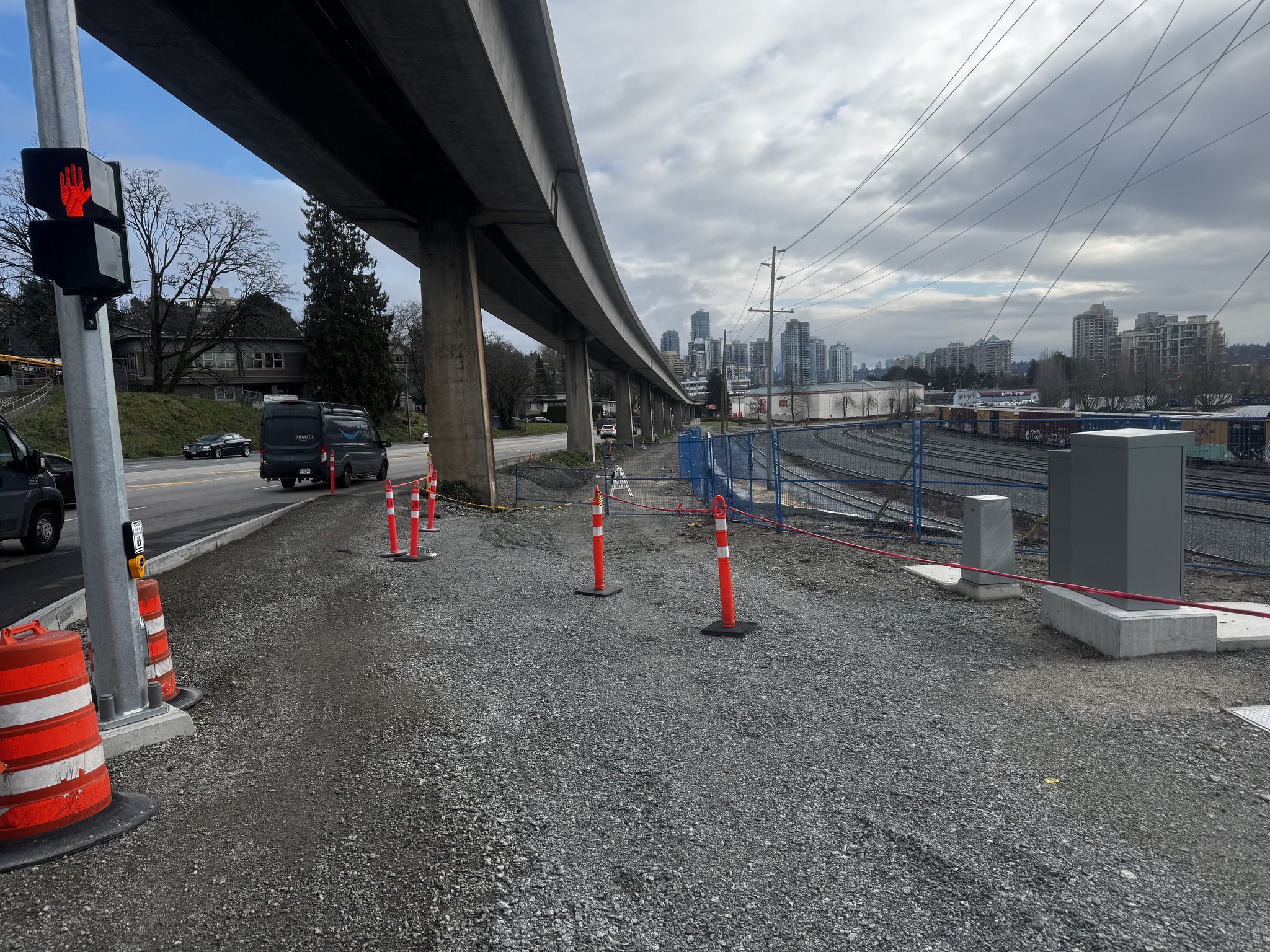
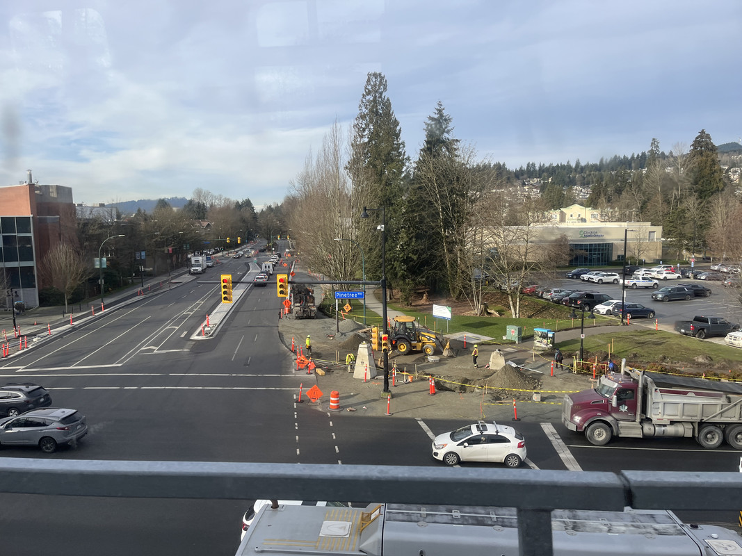
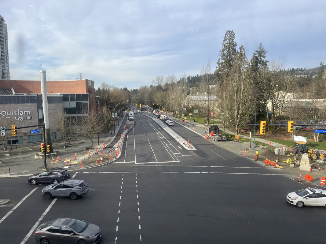
Photos of the new bike lanes on Guildford in Coquitlam.


Taken by me on Jan 23rd. They are replacing the painted bike gutters with proper separated lanes.
Reply With Quote
     
     
  #5880  
Old Posted Mar 19, 2025, 5:45 AM
Lexus's Avatar
Lexus Lexus is online now
Registered User
 
Join Date: Jul 2018
Location: Vancouver | BC | Canada
Posts: 2,871
Quote:
Originally Posted by Lexus View Post
2025, March 1

Pathway is fully pawed and seems like will be opening soon:

My video: https://youtu.be/lBvlInZ2BL0?si=0__b2JIZ56CjEheM
2025, March 16
My video. It's almost complete:

https://youtu.be/d1WXlIfnyT8

• Video Link
Reply With Quote
     
     
This discussion thread continues

Use the page links to the lower-right to go to the next page for additional posts
 
 
Reply

Go Back   SkyscraperPage Forum > Regional Sections > Canada > Alberta & British Columbia > Vancouver > Transportation & Infrastructure
Forum Jump


Forum Jump


All times are GMT. The time now is 2:45 PM.


Powered by vBulletin® Version 3.8.7
Copyright ©2000 - 2026, vBulletin Solutions, Inc.