Quote:
Originally Posted by darkharbour

I appreciate the detail and mapping it out, however as a counterpoint, the character of those marginal/transition areas is important to consider, same with the community on either end. McEwan is a small mobile home area essentially, whereas the KV example is over 25,000 people. The area you highlighted that connects the two has two of the most expensive housing developments in the province in it, is fully lined by houses, a large mosque, a number of businesses, etc. so hardly a break in the fabric of the city.
Admittedly I am biased in this discussion because I have a lot of experience with residents and politicians from KV claiming that they are distinct from Saint John, which I feel undermines our ability to cooperate regionally. The more we can get the two KV towns to consider their role as members of the greater Saint John community - statistically, financially, socially - the better off we'll be.
|
Appreciate the feedback darkharbour, and please don't take me wrong, I
fully agree that KV and Saint John exist as intrinsically linked Urban and Suburban areas and there should absolutely be more regional cooperation between the two.
That being said for the purpose of this discussion of a POPCTR, a
contiguous built up area with consistent population density, I do not agree.
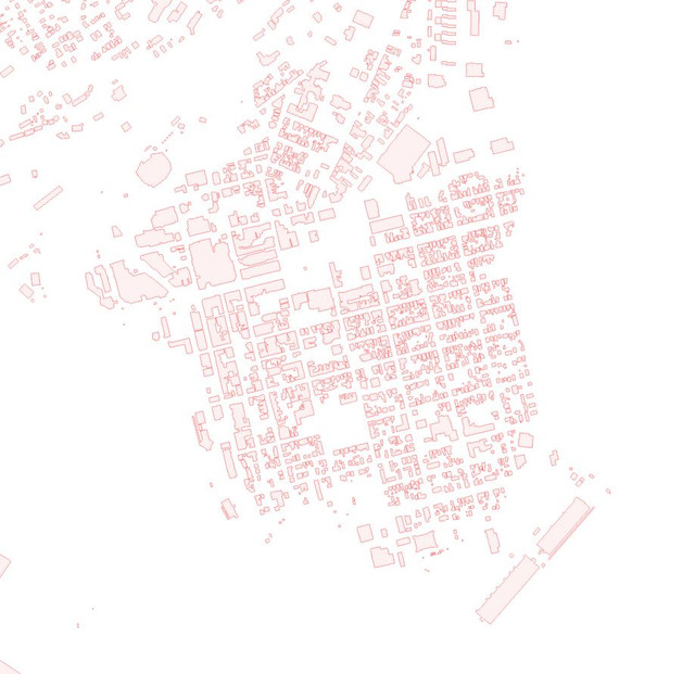
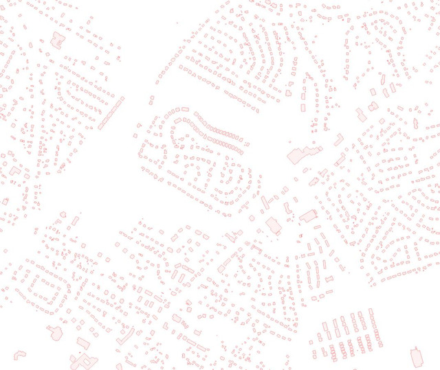
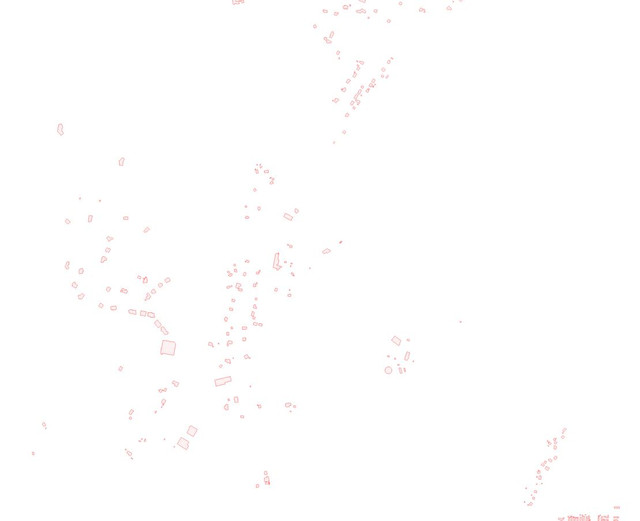
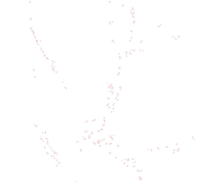
I will present an additional comparison using the GeoNB mapping system which can show us maps of
buildings alone with no other visual interference and this helps us see better the built up density of an area.
I will show a few areas below, these are ranked in order of their density and I will slot the area in question (Brookville / Drury Cove) in where it seems to belong.
These images are all at the same scale and each contain roughly the same land area of about 6 - 8 Km2
Remember the line is
400 people per Km2 to be considered part of a POPCTR.
1. Uptown Saint John
This is the most densely built up area in NB
Population density is about 5000 per Km2
This IS included in a POPCTR
 2. Central KV
Typical suburban area
Population density is about 700 per Km2
This IS included in a POPCTR
 3. Grand Barachois
Developing waterfront rural area on the Northumberland coast
Population density is about 200 per Km2
This is NOT included in a POPCTR
 4. Brookville / Drury Cove
Low develpment area between SJ and Rothesay (due to difficult terrain).
Population density is about 50 per Km2
This is NOT included in a POPCTR
 5. Durham Bridge
Rural area north of Fredericton
Population density is about 25per Km2
This is NOT included in a POPCTR
I think the simple fact that the entirety of Uptown SJ would fit inside this transition area of Brookville / Drury Cove should be proof enough that a scattering of about 100 buildings over that same land area is not "built up"

. I'm thinking part of the confusion comes from the sense "on the ground" that they are linked because people tend to drive 80 - 90 on Rothesay Ave in this section therefore our sense of time and space is a bit warped in a way, Rothesay Ave itself has a decent level of buildings especially when driving by at speed, and this gives the impression of more of a link, but true density is more than one street deep.





 Prev
Prev




 Linear Mode
