HomeDiagramsDatabaseMapsForum About
     

Go Back   SkyscraperPage Forum > Discussion Forums > Transportation


Reply

 
Thread Tools Display Modes
     
     
  #3201  
Old Posted May 14, 2024, 2:59 PM
38 Geary 38 Geary is online now
你的媽媽
 
Join Date: Jan 2012
Location: The Bay
Posts: 11,847
Quote:
Meeting Tomorrow For Diridon Station Redevelopment, San Jose


BY: ANDREW NELSON 5:30 AM ON MAY 14, 2024

New project details have been revealed ahead of tomorrow’s meeting about expanding the Diridon Station in San Jose. The Valley Transit Authority’s Diridon Joint Policy Advisory Board will review three design options to accommodate increased Caltrain services, integrate High-Speed Rail, and connect to the future BART extension. As expected for an infrastructure project in the Bay Area, the costs are astronomical, ranging from $2.5 billion to $13 billion.

The station expansion is expected to facilitate future service increases, including triple the hourly Caltrain trips, double the Capitol Corridor trips and four High-Speed Rail trips per hour. The three alternatives include elevated train tracks, at-grade train tracks, or stacked train tracks. Mott MacDonald, a global engineering firm, is responsible for drafting the alternatives.

At-Grade
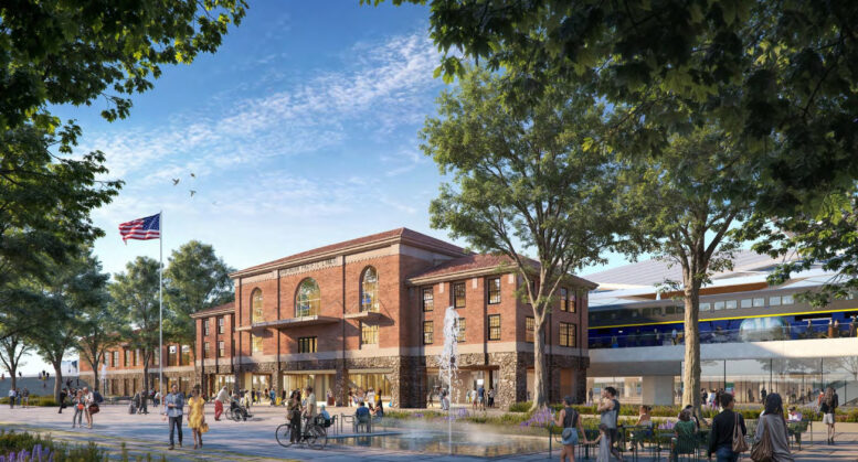
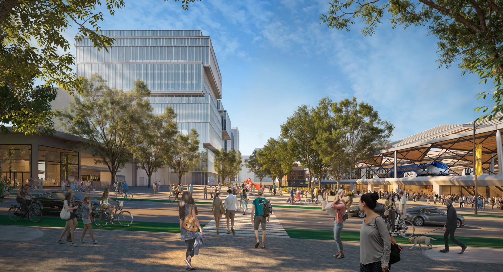
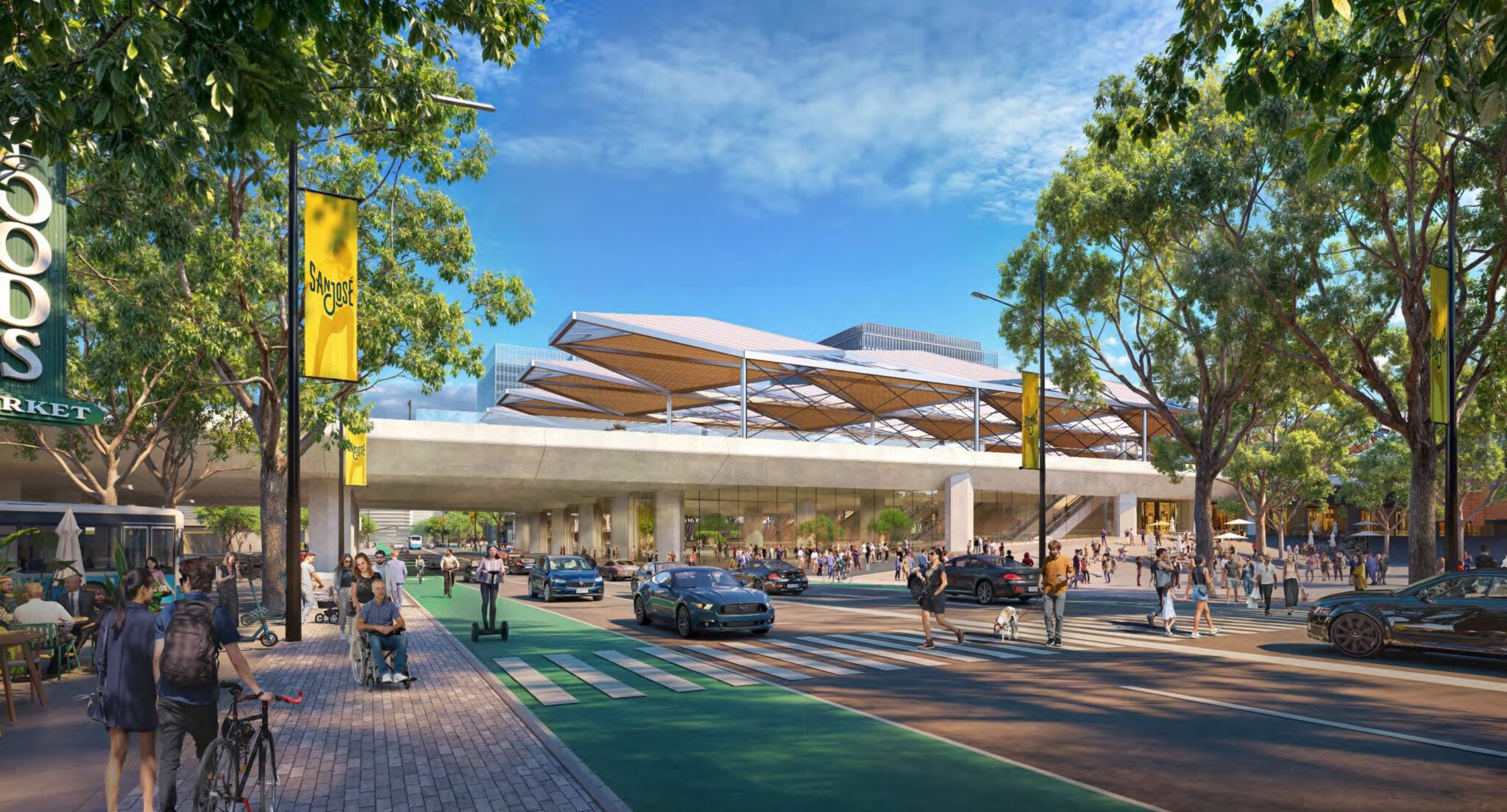
The cheapest option will keep the tracks at grade while coincidentally making the most significant changes to the area around the Diridion Station. While kept at its existing elevation, the historic brick train station will be set above a new cobblestone-clad ground level. The station will remain the landmark entrance leading into the concourse.

Stacked
The Stacked option is the second most expensive option, but it would still create a new ground-level floor to the historic station building. This second alternative would not impact the PG&E facility and historic building on the south edge of Diridon Station.

Elevated
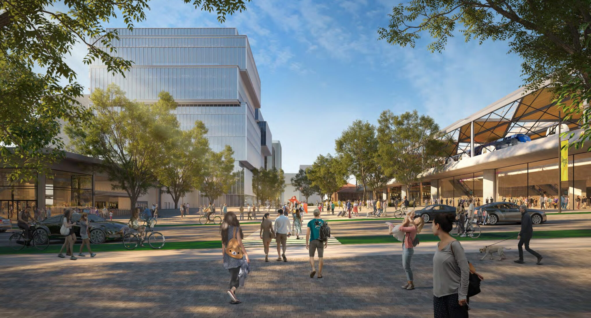
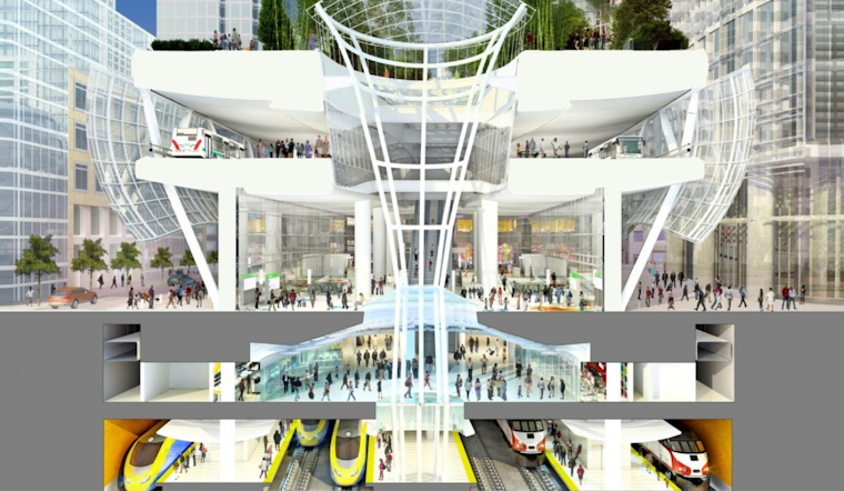
The most expensive option, which the VTA expects to cost at least $13 billion at the moment, will elevate train tracks and retain the historic structure’s positioning. The elevated and at-grade alternatives will require modifications for the PG&E facility, while the elevated plans require the Caltrain Central Equipment Maintenance and Operations Facility, or CEMOF to be relocated.
https://sfyimby.com/2024/05/meeting-tomorrow-for-diridon-station-redevelopment-san-jose.html
Reply With Quote
     
     
  #3202  
Old Posted May 14, 2024, 3:23 PM
38 Geary 38 Geary is online now
你的媽媽
 
Join Date: Jan 2012
Location: The Bay
Posts: 11,847
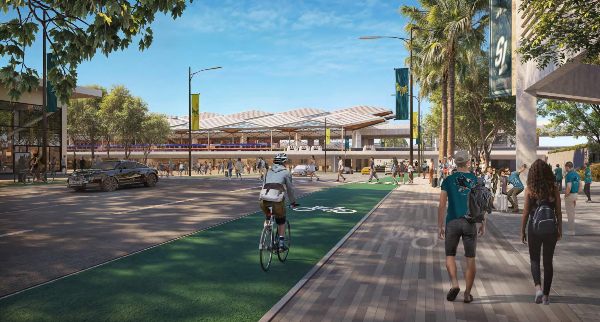
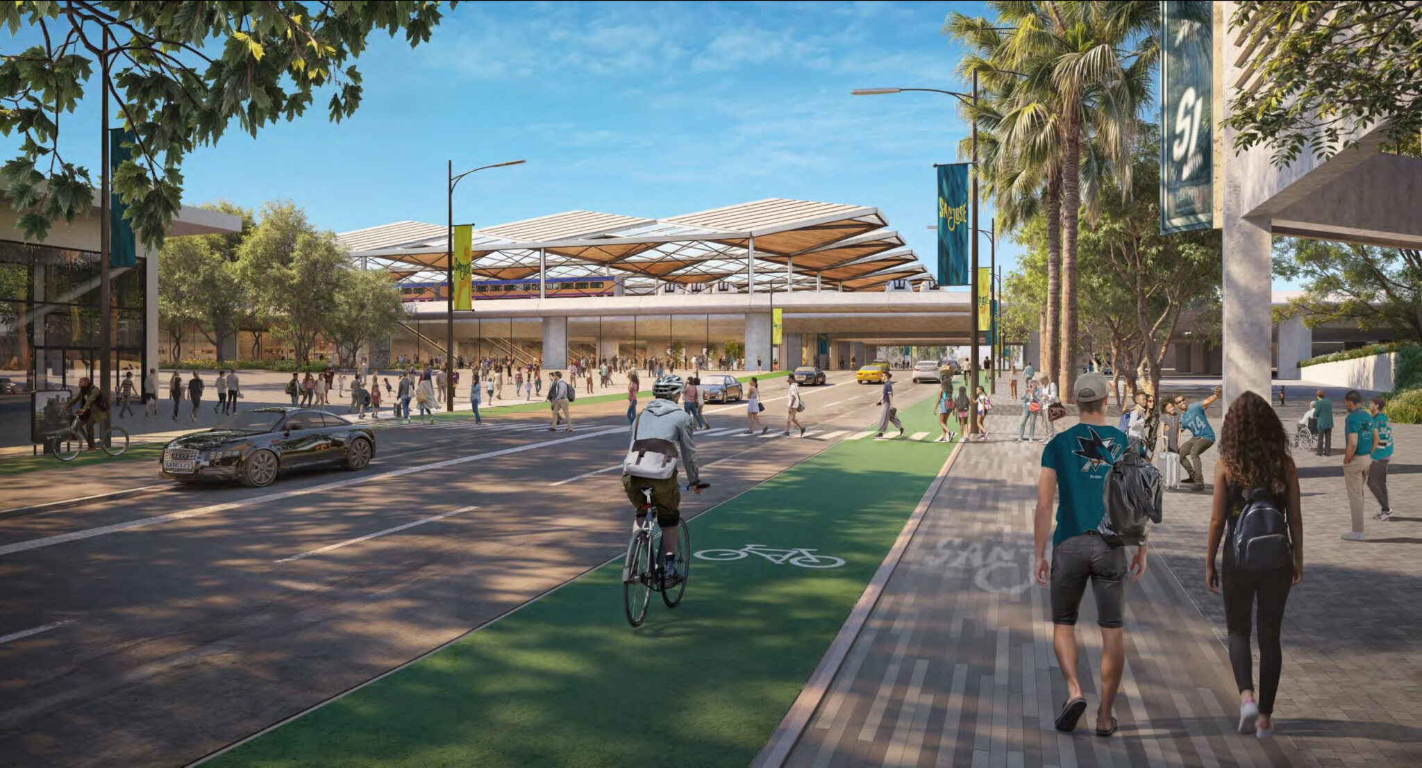
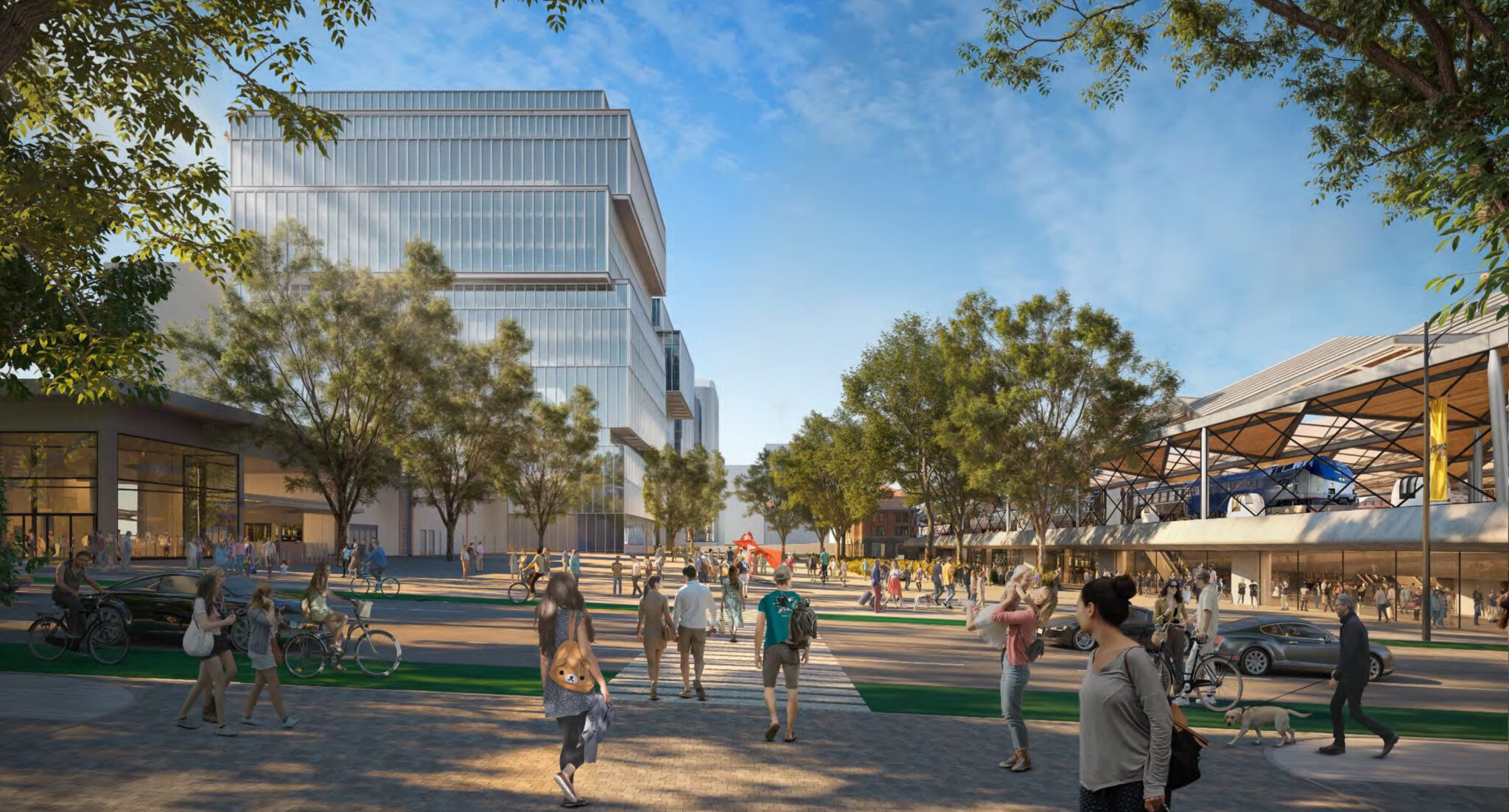
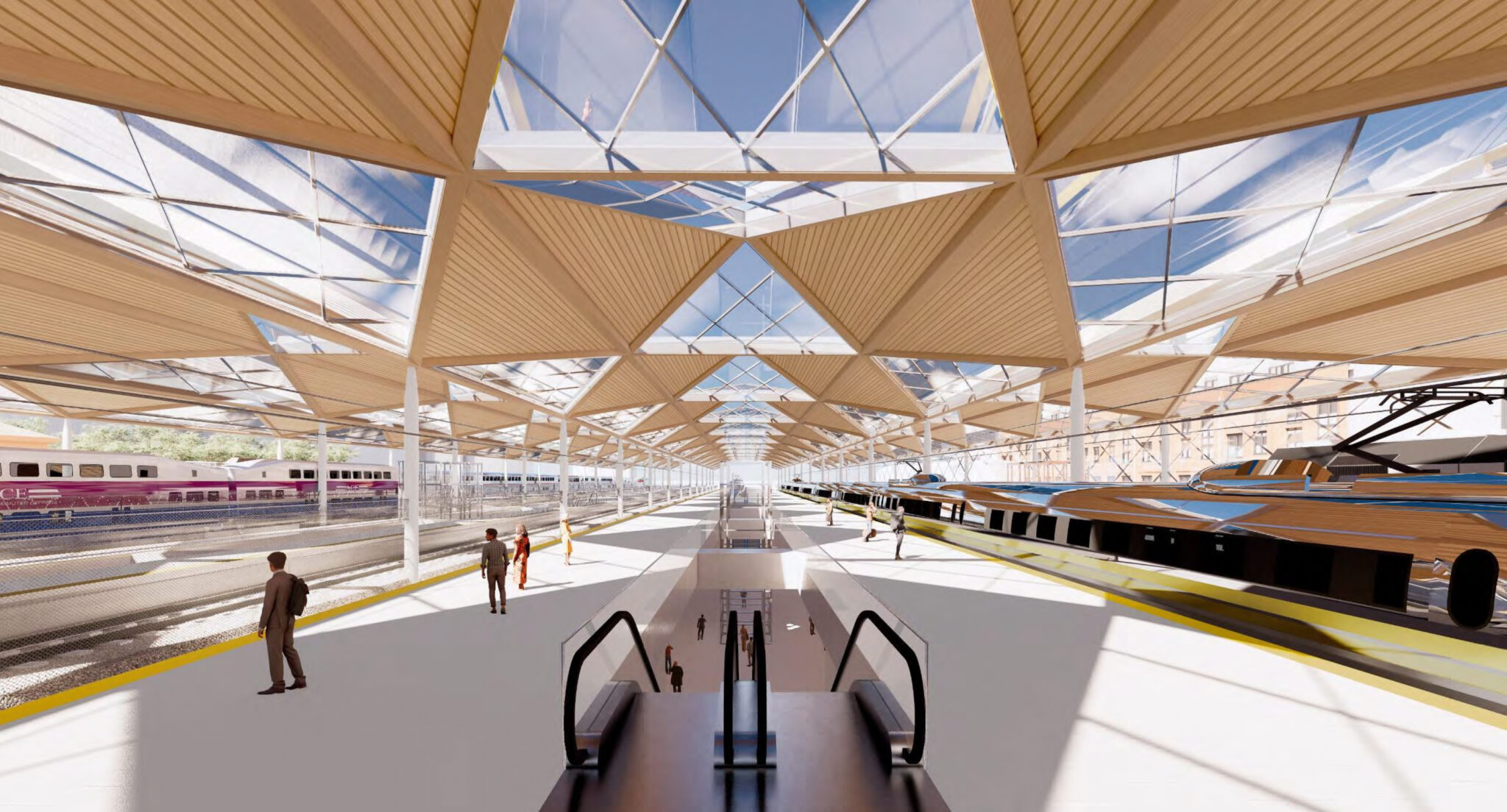
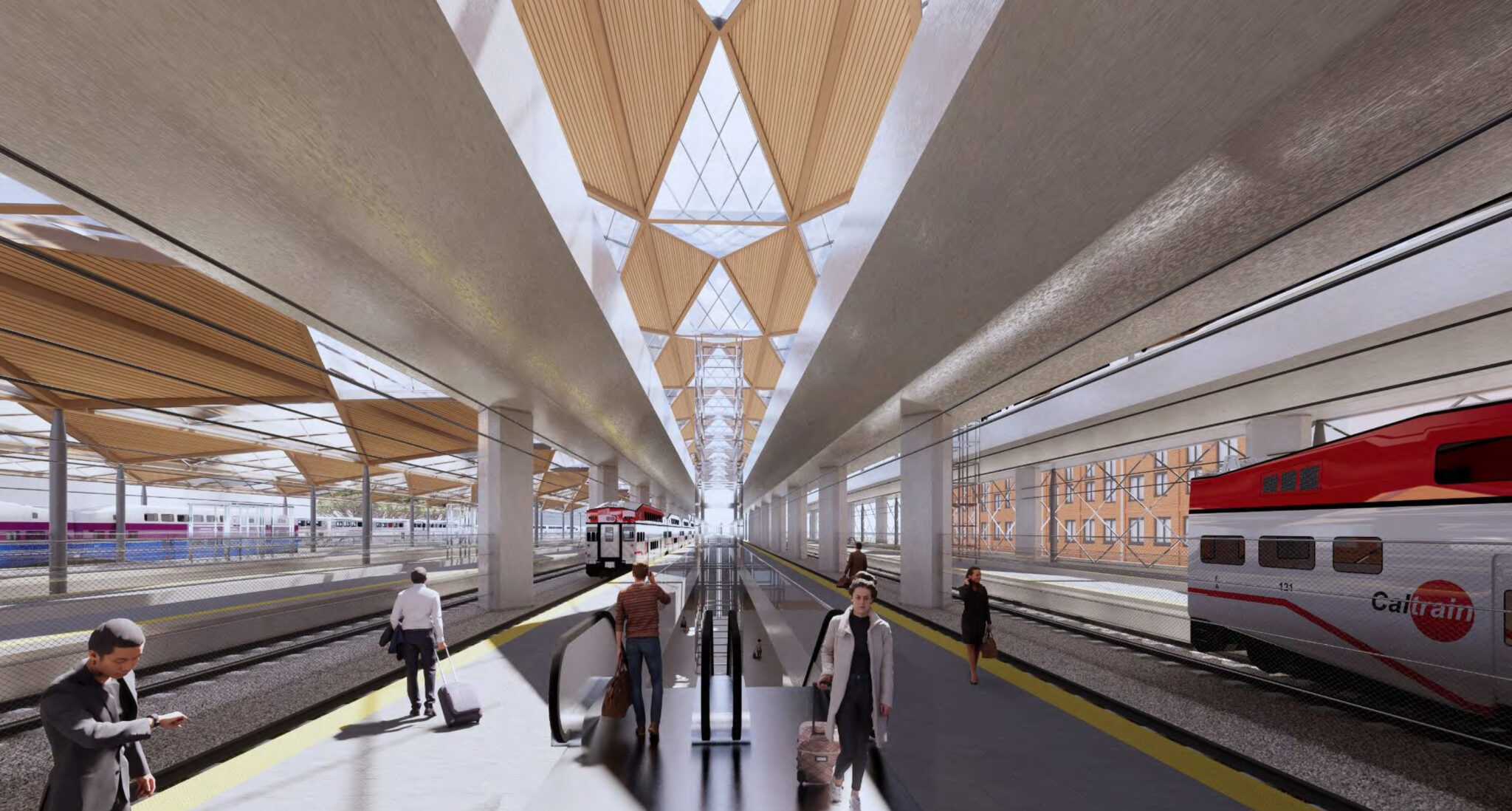
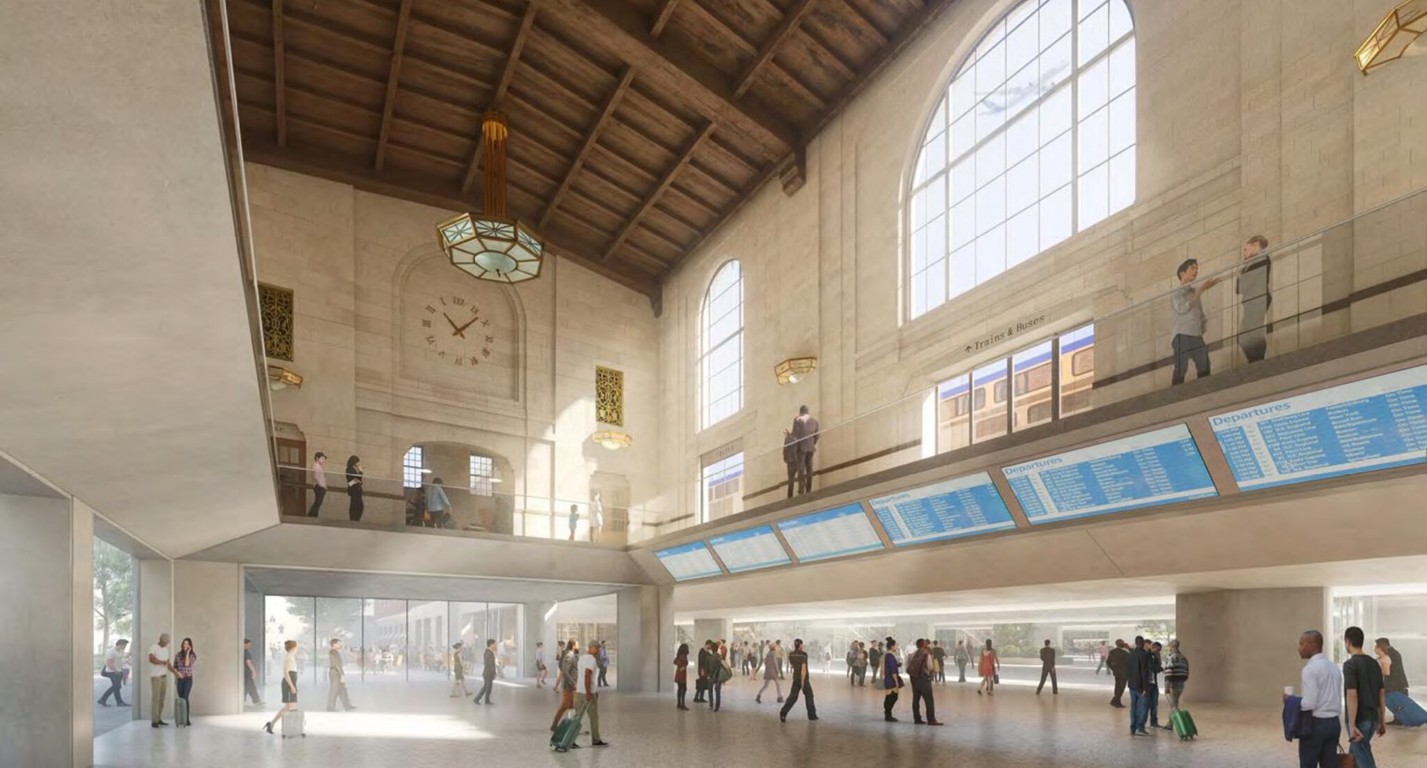
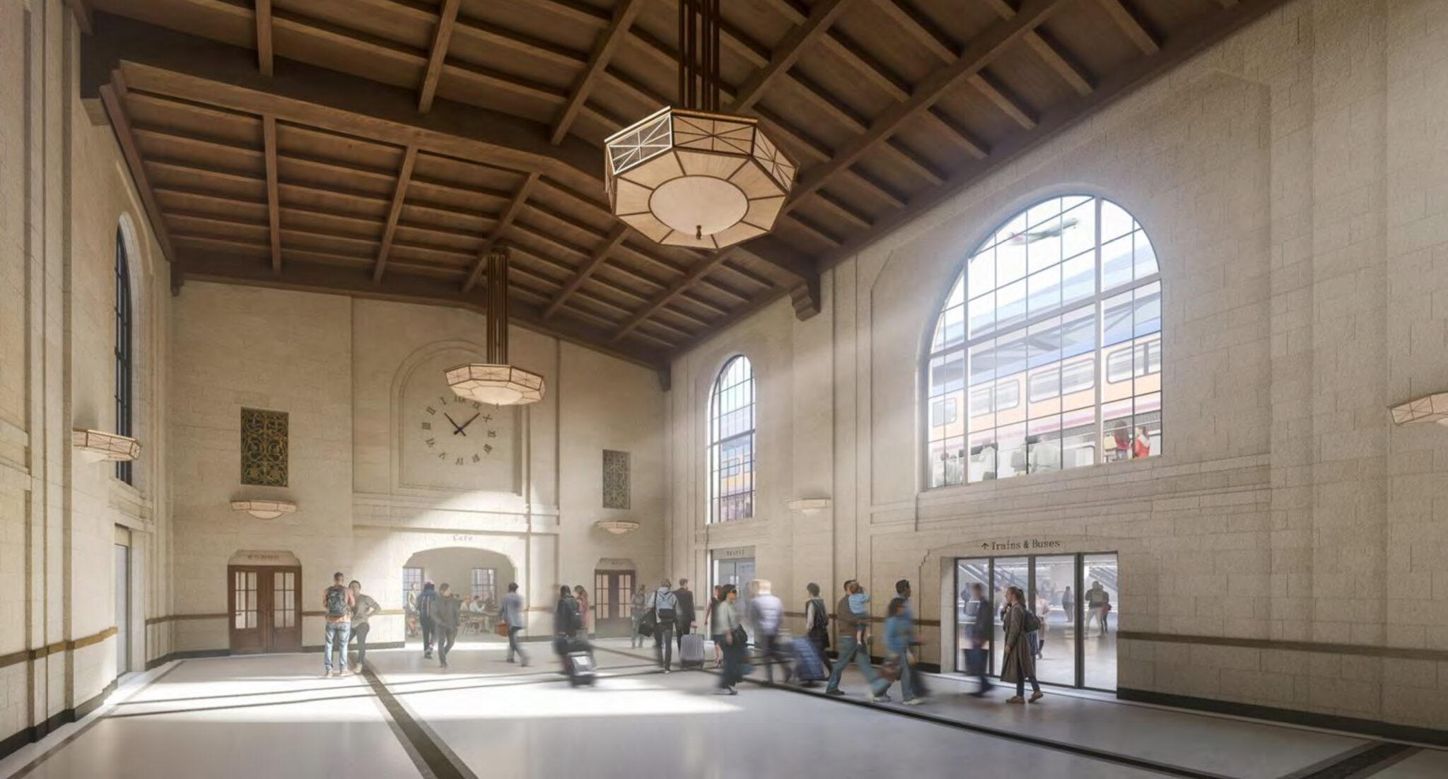
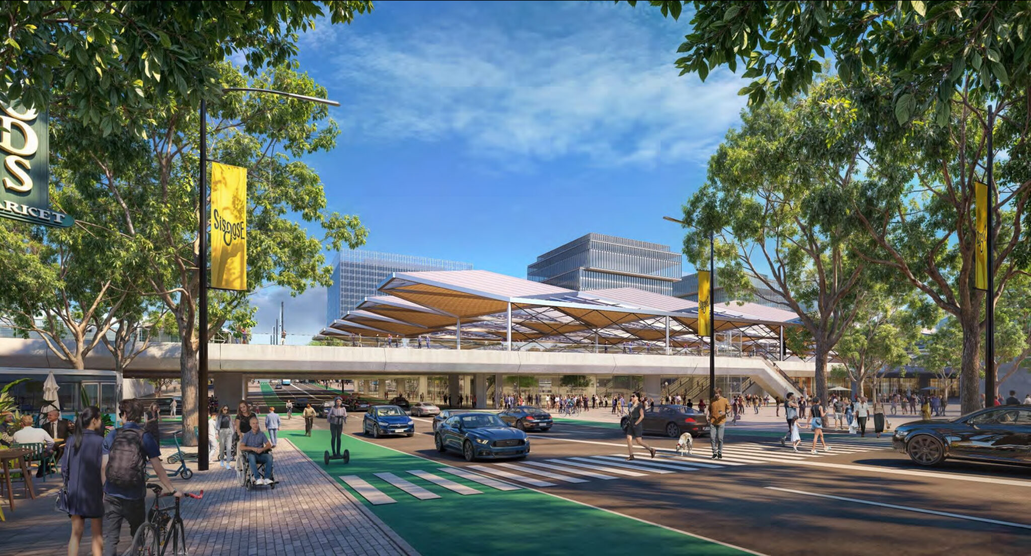
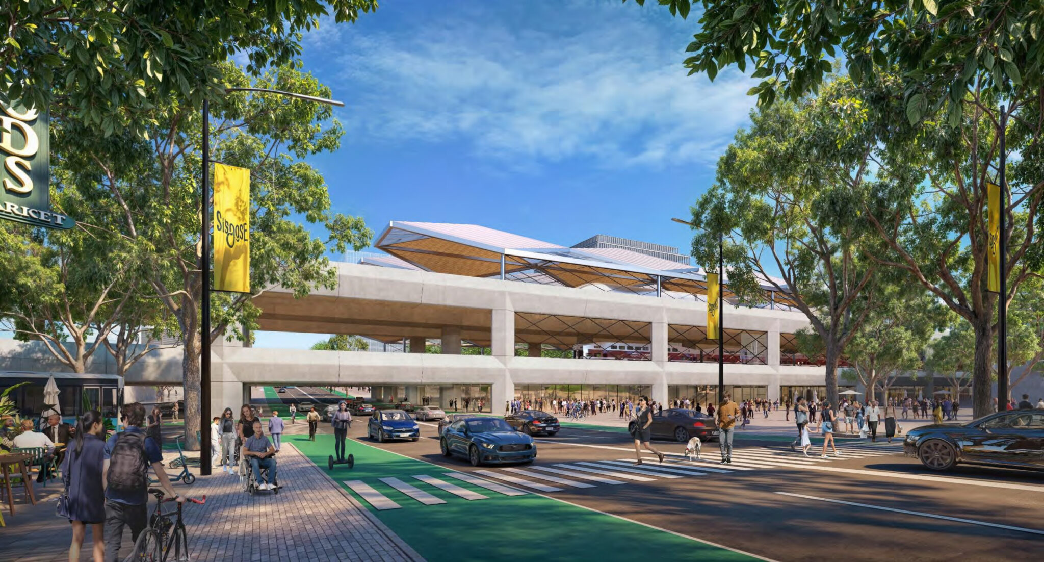
And the renderings:

Looking west from SAP

At-Grade


Stacked


Elevated


Looking south from Cahill Plaza

At-Grade


Stacked


Elevated


Looking south from platform

At-Grade


Stacked


Elevated


Diridon Station

At-Grade


Stacked


Elevated


Looking east along Santa Clara Street

At-Grade


Stacked


Elevated


https://sfyimby.com/2024/05/meeting-tomorrow-for-diridon-station-redevelopment-san-jose.html
Reply With Quote
     
     
  #3203  
Old Posted May 15, 2024, 8:00 PM
38 Geary 38 Geary is online now
你的媽媽
 
Join Date: Jan 2012
Location: The Bay
Posts: 11,847
Quote:
Originally Posted by Bikemike View Post
San Jose needs to up its urbanism game and start now to aggressively build-out first/last mile infrastructure to Diridon and other stations in ancitipation of BART, HSR, and vastly improved Caltrain service

Its 2040 general plan was a great start - one of the few Californian cities that "get it". SJ is a suburban hellhole, but its leadership is more progressive in many ways than more urban and famously "liberal" cities Oakland and Berkeley, which are overly car-oriented in thinking, and who only deserve credit for inheriting a pre-war built environment.

While SJ has fully decoupled parking from development and streamlined the approvals process for housing density, denser and more urban berkeley and oakland are still fighting its self-described "progressive" NIMBY residents to retain removal of street parking.

In its leveraging of a growing rail transit network, SJ should take inspiration from Montreal and Toronto - far and away the North American leaders in modern urbanism
Agreed. SJ still has a long ways to go before its local transit system is robust enough to complement HSR. Caltrain electrification and BART should help with that, but VTA needs improvements as well with its light rail and bus lines for more local trips. Some improvements with TOD are happening, but they need to think bigger and progress faster. Focusing on the area around Diridon will provide a good foundation. There's been a few decent new developments around there recently, but still a lot of empty land and surface parking lots.
Reply With Quote
     
     
  #3204  
Old Posted May 20, 2024, 11:03 PM
38 Geary 38 Geary is online now
你的媽媽
 
Join Date: Jan 2012
Location: The Bay
Posts: 11,847
Quote:
SAN FRANCISCO'S CALTRAIN EXPANSION PROJECT RECEIVES $3.4 BILLION BOOST TOWARD SALESFORCE TRANSIT CENTER HUB
By Tony Ng
Published on May 20, 2024


The dream of seamlessly connecting San Francisco to its surrounding Bay Area neighbors and the vast stretches of California received a financial shot in the arm with a hefty $3.4 billion from Uncle Sam. According to NBC Bay Area, the federal government has granted the funds needed to push Caltrain into the city's bustling financial hub at the Salesforce Transit Center.

Known as 'The Portal,' the project aims to bring Caltrain into the heart of downtown and eventually serve as the northern terminus for the state of California's high-speed rail ambition. By making the train line extension a reality, regional connectivity is poised to quickly improve—at least if everything goes according to plan. The massive sum represents 41% of the project's current estimated cost, and the total project includes extending the Caltrain line by 1.8 miles and developing two underground stations. This commitment will hopefully accelerate the project that, as The San Francisco Examiner reported, is scheduled to open its services around 2032 or 2033.

The Transbay Joint Powers Authority, which is managing 'The Portal' project, recently made it known they have now banked over two-thirds of the estimated cost required. Adam Van de Water, the entity's executive director, told his agency's board via The San Francisco Examiner that "only a handful of projects in the United States that have that level of commitment."
https://hoodline.com/2024/05/san-francis...st-toward-salesforce-transit-center-hub/
Reply With Quote
     
     
  #3205  
Old Posted May 25, 2024, 7:26 PM
38 Geary 38 Geary is online now
你的媽媽
 
Join Date: Jan 2012
Location: The Bay
Posts: 11,847
Quote:
What's inside SFO's $2.4 billion renovation
SFGATE contributor Jim Glab rounds up air travel and airport news for our weekly column Routes
By Jim Glab, Freelance Writer
May 25, 2024

Look for some big changes at San Francisco International’s Harvey Milk Terminal 1 in June. The final phase of the terminal’s ongoing $2.4 billion renovation is set for completion June 11, giving the facility a new check-in area, a mezzanine-level security checkpoint, two new gates, five new concessions, a museum gallery, a common-use lounge and a walkway connecting every terminal at the airport post-security. Toward the end of June, Alaska Airlines is set to make a big move at SFO, relocating its check-in counters, gates and baggage services from Terminal 2 to the Harvey Milk Terminal. Alaska’s new operation will be close to its Oneworld partner, American Airlines. “Alaska’s new lobby will boast new technology that will allow guests to get through the check-in process more efficiently and give them more time to relax in Alaska’s new lounge (also opening this summer) and enjoy new amenities in Harvey Milk Terminal 1,” the airport said.

With the Terminal 1 project finishing up in June, the airport is slated to shift its efforts to Terminal 3 in July. That’s when it plans to begin its $2.5 billion Terminal 3 West Modernization Project, which will renovate 500,000 square feet of the western portion of the terminal. It will also expand the terminal, adding another 250,000 square feet for a greater variety of new food and beverage concessions. “During this project, United Airlines will operate a larger number of flights in Terminal 2, and new temporary walkways will open to route passengers around the construction area,” SFO said.
https://www.sfgate.com/travel/article/ch...-to-vegas-la-phoenix-denver-19474730.php
Reply With Quote
     
     
  #3206  
Old Posted May 25, 2024, 7:39 PM
38 Geary 38 Geary is online now
你的媽媽
 
Join Date: Jan 2012
Location: The Bay
Posts: 11,847
And a refresher on the Terminal 3 West Modernization Project.

https://www.sf.gov/sites/default/files/2023-10/231004_CDRC_CD_FINAL.pdf
Reply With Quote
     
     
  #3207  
Old Posted Jun 3, 2024, 1:07 AM
johnsk johnsk is offline
Registered User
 
Join Date: Jan 2024
Posts: 3
SF has one of the better transit systems in the country but it has so much potential to grow it to be faster, more efficient, and world class to further reduce car dependancy.

As someone living in the city without a car, I am often fed up with how slow or infrequent both muni rail and buses can be. So I made my fantasy SF Muni Map since the city has been awefully quiet and slow regarding expansion plans, especially the extension of T line to Fisherman's Wharf and Marina, and building that Geary line.

This is a fantasy map - and is not perfect - but for those who are interested, this is what I have come up with:

1. Geary Line that branches out to cover booth Sunset and outer Sunset and also goes through Transit center and Mission Bay. It can also connect both Richmond and sunset residents to the Daly City Bart station for easier SFO connection and also serve the new Stonestown development. While subway would be super efficient, an automated monorail would be as efficient and much cheaper (and much more reliable / faster than at-grade light rail, and less intrusive than elevated light rail.) Not to mention the killer views when going through GG park and views of Downtown and the Bay at Geary and Masonic. In my mind, it could go under ground around Cathedral hill area as the street narrows past Van Ness. It can resurface right before or after Transit center.

2. Extension of T line to North Beach, Fisherman's Wharf, and Marina. This is a no brainer.

3. A new line (probably at-grade light rail with a few tunnels to cut through the hills) to replace or compliment the 22 bus on Fillmore. It would probably have to run on Webster, as it is a wider street and less hilly. It can utilize the existing tracks on Church st that J runs on once it goes south of Duboce St.

4. Conversion of Van Ness 49 bus to either monorail or subway. Would be the North/South spine of the city.

5. More of a distant future thing once (hopefully) sunset becomes denser, but a line that runs through Noriega street and connects sunset with Castro, Mission/Soma, Mission Bay (UCSF, Chase Center)

6. Lastly, break down F Market Vintage Streetcar line into 2 lines. F Market would end at Embarcadero, and bring back E line but extend it to Marina Greens or even Fort Point through the existing tunnel under fort mason.


Hope you enjoy this fantasy map of mine, and would love to hear your thoughts on if any of this would make our transit system better. And especially curious how you all would feel about monorail on Geary and/or Van Ness.


Reply With Quote
     
     
  #3208  
Old Posted Jun 3, 2024, 1:31 AM
38 Geary 38 Geary is online now
你的媽媽
 
Join Date: Jan 2012
Location: The Bay
Posts: 11,847
^ Wow, sweet map! Definitely a lot of great ideas there.

1. I definitely agree with the Geary line being the next crucial point of emphasis for growth. IIRC it's one of the busiest bus lines in the country in terms of ridership, so conversion to grade separated rail makes sense. I think for me, the debate is mainly around whether or not it should be Muni light rail or BART heavy rail. Either way, I think it should be grade separated, most likely via subway. I think first phase should probably go down Geary and hook up with 19th Ave down to Stonestown. The Sunset line is also intriguing and useful but probably lower priority as a Phase II expansion. At grade light rail would be a nonstarter for me since we need more rapid transit, and at grade light rail isn't that.

2. Extension of T Line to North Beach and Fisherman's Wharf and the Marina is also definitely high up there on the priority list. I'd probably put that above the Phase II Outer Richmond-Outer Sunset line.

3. Not sure how feasible this one is. I'd probably do a Van Ness style BRT line here first down Webster and see how the ridership fares, or perhaps a 22R Fillmore Rapid. Webster is also only wider once you reach south of Bush.

4. Agree that conversion of Van Ness to a subway line is a logical next step for improvement.

5. This one is an interesting one that I haven't thought of before but it also makes a lot of sense to add a rapid transit connection from the Sunset directly to major employment and entertainment centers in Mission Bay. The City does definitely need more and faster grade separated east-west and north-south routes that don't require being stuck in traffic or going all the way downtown first.

6. Seems like a decent idea as well.

Overall, lots of interesting ideas and definitely a very cool map! Welcome to the forum, and please let me know your thoughts on my thoughts.
Reply With Quote
     
     
  #3209  
Old Posted Jun 3, 2024, 3:16 AM
Nouvellecosse's Avatar
Nouvellecosse Nouvellecosse is online now
Volatile Pacivist
 
Join Date: Aug 2005
Location: Nova Scotia
Posts: 11,366
Somehow I never noticed how far the current Caltrain terminal is from the main part of the CBD. How do people commuting to downtown offices usually make that final leg currently? Not like it's an hour walk or anything but looks like it's a good 15-20 minutes depending on the part of the CBD one is going to.
__________________
"The reasonable man adapts himself to the world; the unreasonable one persists in trying to adapt the world to himself. Therefore all progress depends on the unreasonable man." - George Bernard Shaw
Don't ask people not to debate a topic. Just stop making debatable assertions. Problem solved.
Reply With Quote
     
     
  #3210  
Old Posted Jun 3, 2024, 5:07 AM
38 Geary 38 Geary is online now
你的媽媽
 
Join Date: Jan 2012
Location: The Bay
Posts: 11,847
Quote:
Originally Posted by Nouvellecosse View Post
Somehow I never noticed how far the current Caltrain terminal is from the main part of the CBD. How do people commuting to downtown offices usually make that final leg currently? Not like it's an hour walk or anything but looks like it's a good 15-20 minutes depending on the part of the CBD one is going to.
I think it depends on which part of downtown their office is in, but options include transferring onto bus or light rail, as well as biking.
Reply With Quote
     
     
  #3211  
Old Posted Jun 3, 2024, 6:02 AM
craigs's Avatar
craigs craigs is offline
Registered User
 
Join Date: May 2019
Location: Los Angeles
Posts: 11,043
Quote:
Originally Posted by homebucket View Post
I think it depends on which part of downtown their office is in, but options include transferring onto bus or light rail, as well as biking.
Are you old enough to remember those blue jitney cabs that served the Caltrain station in the olden days? I took those sometimes. Usually I took the bus.
Reply With Quote
     
     
  #3212  
Old Posted Jun 3, 2024, 6:35 AM
38 Geary 38 Geary is online now
你的媽媽
 
Join Date: Jan 2012
Location: The Bay
Posts: 11,847
Quote:
Originally Posted by craigs View Post
Are you old enough to remember those blue jitney cabs that served the Caltrain station in the olden days? I took those sometimes. Usually I took the bus.
Actually no! I just Googled it and I don't remember them at all! I wonder if I did see them and just dismissed them as being an airport shuttle or something. Never registered to me.

@Nouvellecosse, I'll also add that these days if you really want to lean into the tech bro look, you can also ride an electric scooter or hoverboard.
Reply With Quote
     
     
  #3213  
Old Posted Jun 3, 2024, 2:43 PM
johnsk johnsk is offline
Registered User
 
Join Date: Jan 2024
Posts: 3
Thank you I definitely agree with you and thanks for sharing your thoughts.

1. I personally lean more towards MUNI for Geary line since it can provide better headways and serve the city residents better. BART would not be as frequent, will have a few stops, and would be the most expensive option and take the longest to build. IMO, the only way BART would make sense is if it also provides a direct connection to SFO (and further south if BART ever gets extended) and potential Mission Bay/Dog Patch. TBH, not sure how useful a direct connection to East Bay would be in this case, which is what one of the options of Link 21.
I was thinking Monorail would still be under MUNI, just a different mode: more modern, grade separated, automated with up to 1 min headways, same benefits as subway but a lot cheaper, and a funner ride which could also draw tourists since it'd have an awesome view/rider experience. Think a more modern Seattle monorail with better views.

2. I agree, T should be the higher priority. Geary line would probably be split in 3-4 phases and built over decades. the ridership on T would grow dramatically if connected to Marina, although lets have longer platforms and maybe not as unnecessarily big/deep stations as central subway. There could even be a shuttle service from Presidio/Lucas Film studios to 4th/King or Mission Bay without going all the way to Sunnyvale to complement the existing T and provide better headways in the core part of the city.

3. It is definitely the most tricky one. Using the tracks on church st would make the project easier on the southern end, and light rail can be at grade on Webster. But North of Bush is where it gets tricky and might have to go under ground. But I agree, a Rapid/BRT bus service would make more sense and can be done sooner. The city really needs better North/South transit as it is currently overcrowded and takes so long. Other challenges, even with BRT line, would be that Fillmore corridor is too narrow and crowded, and the many steep hills also do not help.


Quote:
Originally Posted by homebucket View Post
^ Wow, sweet map! Definitely a lot of great ideas there.

1. I definitely agree with the Geary line being the next crucial point of emphasis for growth. IIRC it's one of the busiest bus lines in the country in terms of ridership, so conversion to grade separated rail makes sense. I think for me, the debate is mainly around whether or not it should be Muni light rail or BART heavy rail. Either way, I think it should be grade separated, most likely via subway. I think first phase should probably go down Geary and hook up with 19th Ave down to Stonestown. The Sunset line is also intriguing and useful but probably lower priority as a Phase II expansion. At grade light rail would be a nonstarter for me since we need more rapid transit, and at grade light rail isn't that.

2. Extension of T Line to North Beach and Fisherman's Wharf and the Marina is also definitely high up there on the priority list. I'd probably put that above the Phase II Outer Richmond-Outer Sunset line.

3. Not sure how feasible this one is. I'd probably do a Van Ness style BRT line here first down Webster and see how the ridership fares, or perhaps a 22R Fillmore Rapid. Webster is also only wider once you reach south of Bush.

4. Agree that conversion of Van Ness to a subway line is a logical next step for improvement.

5. This one is an interesting one that I haven't thought of before but it also makes a lot of sense to add a rapid transit connection from the Sunset directly to major employment and entertainment centers in Mission Bay. The City does definitely need more and faster grade separated east-west and north-south routes that don't require being stuck in traffic or going all the way downtown first.

6. Seems like a decent idea as well.

Overall, lots of interesting ideas and definitely a very cool map! Welcome to the forum, and please let me know your thoughts on my thoughts.
Reply With Quote
     
     
  #3214  
Old Posted Jun 3, 2024, 2:50 PM
ardecila's Avatar
ardecila ardecila is offline
TL;DR
 
Join Date: Jun 2006
Location: the city o'wind
Posts: 16,998
Quote:
Originally Posted by Nouvellecosse View Post
Somehow I never noticed how far the current Caltrain terminal is from the main part of the CBD. How do people commuting to downtown offices usually make that final leg currently? Not like it's an hour walk or anything but looks like it's a good 15-20 minutes depending on the part of the CBD one is going to.
Caltrain is a bit unusual in North America because of the volume of "reverse commuting". Lots of people living in SF but commuting to Silicon Valley. SV is very sprawled, so Caltrain has encouraged riders to bring their bikes for the last few miles. So a lot of riders will bike to 4th/King, get on a train to Palo Alto or Sunnyvale, and bike again to their office in some tech campus.

I was shocked the first time I saw it - I'm used to Metra in Chicago, Caltrain uses identical trains to Metra but with huge bike storage areas in each car. Neat concept, but of course it really works best for young able-bodied workers.

If you're doing a traditional commute up the Peninsula into SF, you can change to Muni T-Third tram at 4th/King to get closer to Market St office towers. There's also buses, taxi/rideshare, bikeshare, scooters, and walking. And of course you can change to BART at Millbrae for a direct ride to Embarcadero, but that's a lot slower.
__________________
la forme d'une ville change plus vite, hélas! que le coeur d'un mortel...
Reply With Quote
     
     
  #3215  
Old Posted Jun 3, 2024, 2:52 PM
Busy Bee's Avatar
Busy Bee Busy Bee is online now
Closeted Normie
 
Join Date: Feb 2006
Location: on the artistic spectrum
Posts: 13,231
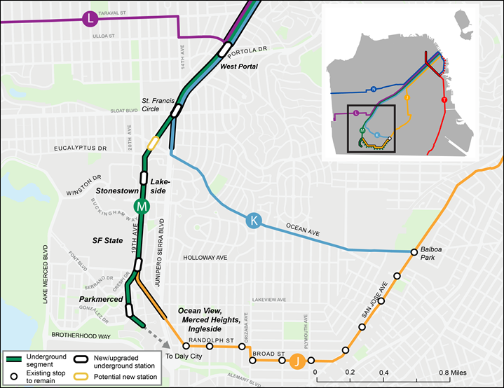
This is probably the most expensive option but I'd actually prefer Geary be both Muni and BART (stacked underground using cut-and-cover) with Muni functioning as more of a local and BART for express trips from outer Geary west of Route 1 and regional movement without requiring a Market St transfer. Muni would end at the end of Geary and BART would turn south down 19th, or a combination of Sunset Blvd and 19th depending on ease of build with a sweep under Pine Lake Park or Sloan Blvd and a turn back under either 19th or Junipero Serra based on ease of build to rejoin at Daly City. Another alternative would be a deep bore sweep under the Lowell High, Stonestown, SFSU vicinity before turning south on 19th.
__________________
The guy above me designs synthetic hairballs for ceramic cats

Sic semper tyrannis
Reply With Quote
     
     
  #3216  
Old Posted Jun 3, 2024, 3:40 PM
38 Geary 38 Geary is online now
你的媽媽
 
Join Date: Jan 2012
Location: The Bay
Posts: 11,847
Quote:
Originally Posted by Busy Bee View Post
This is probably the most expensive option but I'd actually prefer Geary be both Muni and BART (stacked underground using cut-and-cover) with Muni functioning as more of a local and BART for express trips from outer Geary west of Route 1 and regional movement without requiring a Market St transfer. Muni would end at the end of Geary and BART would turn south down 19th, or a combination of Sunset Blvd and 19th depending on ease of build with a sweep under Pine Lake Park or Sloan Blvd and a turn back under either 19th or Junipero Serra based on ease of build to rejoin at Daly City. Another alternative would be a deep bore sweep under the Lowell High, Stonestown, SFSU vicinity before turning south on 19th.
This is actually a pretty good idea and the first time I've heard of it. It makes a lot of sense. As johnsk noted, Muni would be able to provide more frequent headways, smaller, but more stations with less distance in between, but BART would provide faster, more regional service (ie if someone wanted to get from Japantown or Inner Richmond to Stonestown/SFSU, both of which are prime for massive redevelopment, or Daly City quickly). I think a connection with this line to the existing Daly City station would also be most ideal.
Reply With Quote
     
     
  #3217  
Old Posted Jun 3, 2024, 6:10 PM
Busy Bee's Avatar
Busy Bee Busy Bee is online now
Closeted Normie
 
Join Date: Feb 2006
Location: on the artistic spectrum
Posts: 13,231
Conventional thinking with US agencies would say it would be double the cost, but I don't think it would. First of all a dual-mode Geary subway would by definition no longer be just a Geary Blvd project as the BART would be part of a much larger BART outer belt project and a 2nd Transbay Tube. The projects together would be a major capital investment to say the absolute least. I do believe it would be exceptionally ideal though. Under this scenario as I mentioned BART acts as an express, especially for outer Geary trips downtown, southward, and cross-bay; MUNI Metro acts as a Geary Blvd rail local with station spacing in the arena of 1/3 mile; and Muni bus acts as a Geary Blvd hyperlocal with traditional non-BRT stop spacing and service level distributing to nearest rail stations and traversing Geary length for riders wishing to stay on surface.

A few basic concepts:
  1. Outer belt BART would be serviced by trains using a new second Transbay Tube. Specifically how and where that route enters downtown SF would need to be determined. Outer belt BART line would run under Geary before turning south either just west of Park Presidio Blvd to run below 19th Ave; OR run under Geary until the vicinity of 30th Ave before sweeping south in a deep bore likely under 36th Ave with a possible station location at Balboa.

  2. Muni Metro would operate on the top level with BART below just as under Market. The Muni Metro subway would daylight just west of Masonic and run in the median all the way until roughly 43rd Ave in Outer Richmond. BART would continue underground until turning south for alternate routings of 19th Ave or Sunset Blvd. In downtown SF, Geary Muni Metro could potentially cross under Market and loop around or adjacent to Salesforce Transbay Terminal before returning to Geary. Montgomery BART station would also be served by this new line.

  3. Joint Muni Metro and BART stations would be located at Union Square downtown and at Van Ness, Divisadero, Park Presidio Blvd. (or 25th Ave if Sunset Blvd route taken)

  4. Possible BART stations at 25th Ave and/or 36th Ave/Balboa depending on whether Sunset Blvd or 19th Ave is chosen. BART station at Judah, positioned between Judah and Lincoln Way, would feature convenient northern station access from Lincoln Way and Golden Gate Park whether under Sunset or 19th Ave.

    Taraval St after that.

    A station either at or near Sloat Blvd or Ocean Ave in Merced Manor interchanging with (K) and (M) Muni Metro depending on Sunset or 19th routing. Finally a station servicing Parkmerced and SFSU at Holloway Ave either under 19th Ave or Junipero Serra depending on outer belt routing. Daly City station would likely need radical expansion or rebuilding to accomidate this expansion coming in from the north. Interlined south of Daly City.
__________________
The guy above me designs synthetic hairballs for ceramic cats

Sic semper tyrannis

Last edited by Busy Bee; Jun 3, 2024 at 6:21 PM.
Reply With Quote
     
     
  #3218  
Old Posted Jun 4, 2024, 12:29 AM
veep veep is offline
BANNED
 
Join Date: Feb 2024
Location: San Francisco
Posts: 155
MUNI needs to go down 19th to complete the undergrounding of the M. It's basically two birds with one stone. The M and the 19th/Geary line would share tracks between Stonestown and DC BART.


BART is basically a complete system once the SJ tunnel is finished. There is no need for major expansion. Just add a few infill stations here and there and call it a day.

It's MUNI that needs rapid expansion. SF is in this weird twilight zone where getting around the geographically massive Bay Area is often quicker and more convenient than getting around tiny little SF.
Reply With Quote
     
     
  #3219  
Old Posted Jun 4, 2024, 1:23 AM
Nouvellecosse's Avatar
Nouvellecosse Nouvellecosse is online now
Volatile Pacivist
 
Join Date: Aug 2005
Location: Nova Scotia
Posts: 11,366
Quote:
Originally Posted by homebucket View Post
I think it depends on which part of downtown their office is in, but options include transferring onto bus or light rail, as well as biking.
Quote:
Originally Posted by ardecila View Post
Caltrain is a bit unusual in North America because of the volume of "reverse commuting". Lots of people living in SF but commuting to Silicon Valley. SV is very sprawled, so Caltrain has encouraged riders to bring their bikes for the last few miles. So a lot of riders will bike to 4th/King, get on a train to Palo Alto or Sunnyvale, and bike again to their office in some tech campus.

I was shocked the first time I saw it - I'm used to Metra in Chicago, Caltrain uses identical trains to Metra but with huge bike storage areas in each car. Neat concept, but of course it really works best for young able-bodied workers.

If you're doing a traditional commute up the Peninsula into SF, you can change to Muni T-Third tram at 4th/King to get closer to Market St office towers. There's also buses, taxi/rideshare, bikeshare, scooters, and walking. And of course you can change to BART at Millbrae for a direct ride to Embarcadero, but that's a lot slower.
Yes I did kind of forget about the bi-directional nature of the line since most commuter rail in NA is very CBD centric. But it's great that there are last mile options for those doing more traditional commutes.
__________________
"The reasonable man adapts himself to the world; the unreasonable one persists in trying to adapt the world to himself. Therefore all progress depends on the unreasonable man." - George Bernard Shaw
Don't ask people not to debate a topic. Just stop making debatable assertions. Problem solved.
Reply With Quote
     
     
  #3220  
Old Posted Jun 10, 2024, 6:56 PM
38 Geary 38 Geary is online now
你的媽媽
 
Join Date: Jan 2012
Location: The Bay
Posts: 11,847
Quote:
Caltrain Runs Eight Trains Simultaneously on Newly Completed Corridor
06/10/2024

Upon the substantial completion of all major construction for Caltrain Electrification, the agency conducted a successful test of eight trains running simultaneously on the corridor. This marks the final corridor wide test before the launch of electrified service in September, as well as the last weekend service change for the Electrification project.

...

Caltrain plans on launching its electric service on September 21, which will feature a San Francisco to San Jose trip in under an hour, peak hour trains every 15-20 minutes at 16 stations and trains every half hour during mid-day, evenings and weekends. Additionally, 10 traction power facilities, which will provide, distribute and regulate electricity to the OCS and electric trains, were installed between the San Francisco and San Jose.

After the successful substantial completion of Electrification infrastructure through out 51-mile corridor between San Francisco and San Jose, Caltrain, Stadler and design-build contractor Balfour Beatty could safely conduct the eight-train power contingency test to stress the electrical power system and simulate real time September full EMU service schedule. The successful completion ensures that eight EMU trainsets can properly perform under various power configurations. Caltrain’s historic electrification project is the first undertaking in North America in a generation in which diesel trains and their infrastructure components are transitioned to an electrified system.  This year marks the 160th anniversary of San Francisco-San Jose rail service.
https://www.caltrain.com/news/caltrain-runs-eight-trains-simultaneously-newly-completed-corridor
Reply With Quote
     
     
This discussion thread continues

Use the page links to the lower-right to go to the next page for additional posts
 
 
Reply

Go Back   SkyscraperPage Forum > Discussion Forums > Transportation
Forum Jump


Forum Jump


All times are GMT. The time now is 4:08 PM.


Powered by vBulletin® Version 3.8.7
Copyright ©2000 - 2026, vBulletin Solutions, Inc.