I was looking to see what land the city needed to acquire for the Baseline-Greenbank intersection rebuild. In geoOttawa, I selected the layer Property Parcels and, under that, selected City Owned Lands. This highlighted all of the city-owned lands in blue (the default colour). It does not colour in road allowances, so any areas beside the road that were previously acquired as an expansion of the road allowance don’t get highlighted.
I was a bit surprised to see the homes along the south of Baseline that have been acquired by the city, presumably for this project. I suspect that the land was bought so that slivers can be taken off; then the remaining land will be resold.
City owned land around the Baseline-Greenbank intersection:
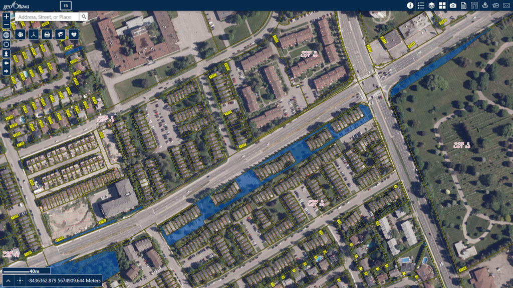
The land acquired from Pinecrest Cemetery had to taped to the east because it could not go any further due to occupied burial plots. It will be interesting to see what happens when – IF – the western half of the Baseline BRT is built.
I also scanned around to other areas. Check out what the city owns downtown:
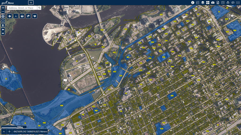
It looks as if the city owns most of the land fronting on Albert through LeBreton Flats. Also, Wellington, in front of Parliament Hill is being shown as city owned land – and NOT as a road allowance (which are not coloured).
Surprisingly, it is also showing the land that the NAC is built on as being owned by the city.


 Microsoft Edge on my desktop. Same issue with the laptop in the house. I could get to the start page on my Iphone on Safari. Even installed Opera browser and no luck.


 Linear Mode
