HomeDiagramsDatabaseMapsForum About
     

Go Back   SkyscraperPage Forum > Discussion Forums > City Discussions


Reply

 
Thread Tools Display Modes
     
     
  #41  
Old Posted Nov 29, 2023, 11:11 PM
ChiSoxRox's Avatar
ChiSoxRox ChiSoxRox is offline
Registered User
 
Join Date: Mar 2007
Location: Boston, MA
Posts: 2,510
Quote:
Originally Posted by JManc View Post
Is that along the 5 where you either continue on to Sacramento or take 580/880/80 into SF?
No, that sign is right after the Lost Hills exit, a bit north of Bakersfield.
__________________
Like the pre-war masonry skyscrapers? Then check out my list of the tallest buildings in 1950.
Reply With Quote
     
     
  #42  
Old Posted Nov 29, 2023, 11:38 PM
plinko's Avatar
plinko plinko is offline
them bones
 
Join Date: Jul 2001
Location: Santa Barbara adjacent
Posts: 7,428
^They exist further south as well. I know there is at least one between the Grapevine and the 5/99 split.
__________________
Even if you are 1 in a million, there are still 8,000 people just like you...
Reply With Quote
     
     
  #43  
Old Posted Nov 29, 2023, 11:42 PM
plinko's Avatar
plinko plinko is offline
them bones
 
Join Date: Jul 2001
Location: Santa Barbara adjacent
Posts: 7,428
I suppose. But also there is often a difference between what you see on the surface street entry ramps vs. what they have on the freeway overheads. I see those differences all over LA.

I still always think it's weird that it says Santa Monica on the 405. Of course the eastbound 10 signs at the same interchange say 'Los Angeles', even though you are already well inside Los Angeles.

Quote:
Originally Posted by sopas ej View Post
Actually, it does make sense to me. Going south on the 405 from say, the San Fernando Valley, the control city is "Santa Monica," but then when you get to the 10, the control city for the westbound 10 is "Santa Monica," so that's how you would continue on to Santa Monica. Continuing south on the 405 at the 10, the control city is then "LAX/Long Beach." When you get to the 105, the control city is "Long Beach" (because you're directed to the westbound 105 if you want to go to LAX). Past Long Beach, if I remember correctly, the control city becomes "Irvine/San Diego," and then past Irvine, it becomes "San Diego."

Control cities (at least in California) aren't to be taken literally; they're just a general direction kind of thing. Many years ago, I remember a coworker saying "I don't know why the 405 south says "San Diego," the 405 doesn't even go into San Diego." I was like 'forehead slap.'
__________________
Even if you are 1 in a million, there are still 8,000 people just like you...
Reply With Quote
     
     
  #44  
Old Posted Nov 29, 2023, 11:49 PM
JManc's Avatar
JManc JManc is online now
Dryer lint inspector
 
Join Date: Feb 2003
Posts: 38,660
Quote:
Originally Posted by ChiSoxRox View Post
No, that sign is right after the Lost Hills exit, a bit north of Bakersfield.
I knew it was along 5 somewhere just wasn't sure where exactly. I recall similar signs on that drive because SF and Sacramento are depicted as almost the same distance even though they are nowhere near each other.
Reply With Quote
     
     
  #45  
Old Posted Nov 30, 2023, 1:05 AM
TWAK's Avatar
TWAK TWAK is online now
Resu Deretsiger
 
Join Date: Feb 2004
Location: Lake County, CA
Posts: 15,648
Quote:
Originally Posted by JManc View Post
I knew it was along 5 somewhere just wasn't sure where exactly. I recall similar signs on that drive because SF and Sacramento are depicted as almost the same distance even though they are nowhere near each other.
I-5 has it and I wonder if other routes do, well that along with those southbound water signs. Driving in a (almost) desert and there's signs complaining about water usage...lol.
Drawing a blank if it's like that for 5 around Redding and Shasta.
__________________
#RuralUrbanist

Last edited by TWAK; Nov 30, 2023 at 1:36 AM.
Reply With Quote
     
     
  #46  
Old Posted Nov 30, 2023, 4:55 AM
jmecklenborg jmecklenborg is offline
Registered User
 
Join Date: Jul 2003
Posts: 3,262
Quote:
Originally Posted by iheartthed View Post
Are states only used as the control on the section near where Indiana, or through the loop?

It appears that there are two sections where "Kentucky" is used liberally - from the Ohio River north through Indiana to I-74, and then again from the Ohio River (the other bridge) north easterly to I-71.

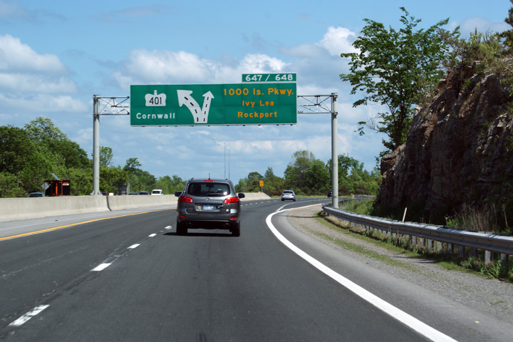
About 20 miles east of the Indiana section:


More:


The only spot where "Ohio" appears to be used is on that single Indiana entrance ramp. "Ohio" does not appear to be used anywhere in Kentucky, and neither is "Indiana".

As a piece of wild trivia, I noticed that the old rest stop ramps are still intact on the east side of the loop:


Hard to believe, but there was actually a rest stop on the loop highway - no doubt the only example of this situation in the United States. This is back when they thought that people were actually going to use the loop highway as a bypass. Per google, the loop was completed in 1979, about five years after I-71. There were also plans to upgrade OH 32 to full interstate specs and designate it as I-74, so that might have been some of the motivation for the rest stop, since I-74 would have been interlined with I-275 across the top of the city and the existing I-74 inside the loop would have been renamed something like I-174.
Reply With Quote
     
     
  #47  
Old Posted Nov 30, 2023, 5:48 AM
L41A's Avatar
L41A L41A is offline
Registered User
 
Join Date: Jun 2007
Location: Peace Up, A-Town Down
Posts: 902
Quote:
Originally Posted by ChiSoxRox View Post
I'm curious what the most distant control city signage is.

I-10 in Texas is the winner so far. 554 miles west to El Paso in San Antonio and El Paso returns the favor.

Other long ones:

I-80 spliting from I-15 in Salt Lake City has Reno as the control city. Downtown Reno is 517 miles from that sign. However, Reno uses Elko as the eastbound control city. Going the other way on I-80, Cheyenne is 440 miles.

At the I-10/I-20 split, Dallas and Fort Worth are listed, with downtown Dallas being 465 miles from the split.

At the I-17/I-40 split in Flagstaff, Los Angeles is 465 miles.

Vegas to Salt Lake? 421 miles

(The farthest NYC sign I've found in Ohio is 396 miles from the GWB.)
In Virginia on I-95, Atlanta is a control city.
Downtown Atlanta is 510 miles from that sign in Petersburg, VA area. It makes sense because its for junction of I-85 and I-95 and the sign includes the far closest metro (Durham) with interstate interchange and the farther metro (Atlanta).
However, if you were traveling from that area to Atlanta depending on the time of day it may be faster to take I-95 to I-20 because I-85 traffic could be bad thru the Carolinas (Charlotte, Greensboro, Greenville and then Northeast Metro Atlanta).


Also, in metro Atlanta Southside, Tampa is included on the I-285 interchange with I-75.
Downtown Tampa is 445 miles from that sign.

These examples do most show multiple cities - a closer metro and a farther metro (which I think is good especially at interchanges.)
Reply With Quote
     
     
  #48  
Old Posted Nov 30, 2023, 6:43 AM
Blitz's Avatar
Blitz Blitz is offline
Registered User
 
Join Date: Jul 2001
Location: Windsor, Ontario
Posts: 4,532
Quote:
Originally Posted by iheartthed View Post
"Canada" is used as a control in Detroit, but not Windsor. I believe "USA" is used as the control on the Canadian side instead of "Detroit".
The controls say "Bridge to Canada" and "Bridge to USA" or "Tunnel to Canada" and "Tunnel to USA". Apparently this is done to ensure people don't accidentally end up crossing the border since tourists might not realize that Windsor is in a different country. On the control signs in Detroit, they've recently added the Canadian flag to the signs to make it even more clear.

American side:
https://www.google.com/maps/@42.3252...8192?entry=ttu

Canadian side:
https://www.google.com/maps/@42.2473...8192?entry=ttu
Reply With Quote
     
     
  #49  
Old Posted Nov 30, 2023, 7:10 AM
SIGSEGV's Avatar
SIGSEGV SIGSEGV is offline
He/his/him. >~<, QED!
 
Join Date: Jun 2018
Location: Loop, Chicago
Posts: 6,141
Quote:
Originally Posted by ChiSoxRox View Post
I'm curious what the most distant control city signage is.

I-10 in Texas is the winner so far. 554 miles west to El Paso in San Antonio and El Paso returns the favor.

Other long ones:

I-80 spliting from I-15 in Salt Lake City has Reno as the control city. Downtown Reno is 517 miles from that sign. However, Reno uses Elko as the eastbound control city. Going the other way on I-80, Cheyenne is 440 miles.

At the I-10/I-20 split, Dallas and Fort Worth are listed, with downtown Dallas being 465 miles from the split.

At the I-17/I-40 split in Flagstaff, Los Angeles is 465 miles.

Vegas to Salt Lake? 421 miles

(The farthest NYC sign I've found in Ohio is 396 miles from the GWB.)

The I-15 / I-70 split in middle-of-nowhere Utah I believe lists Denver, 505 miles away,.
__________________
And here the air that I breathe isn't dead.
Reply With Quote
     
     
  #50  
Old Posted Nov 30, 2023, 12:48 PM
Innsertnamehere's Avatar
Innsertnamehere Innsertnamehere is offline
Registered User
 
Join Date: Jan 2010
Location: Hamilton
Posts: 11,733
Cross border references have always interested me. I don’t t think I can recall seeing Canadian highway references in the US (ie “TO ON-401” or similar), and there are few American references in Canada as well. The on that comes to mind is a sign for I-81 on the 401 in the Thousand Islands area:

https://maps.app.goo.gl/8L2EQUzex6A4suLt7?g_st=ic

Also - I forget exactly where on the highway the sign is, but along the 400 north of Toronto there is a sign indicating the distance to Rainy River (the end of highway 11), some 1,800km away. Anyone seen one further than that? It’s like having a sign in NYC indicating the distance to Miami..
Reply With Quote
     
     
  #51  
Old Posted Nov 30, 2023, 2:09 PM
cactuspunk's Avatar
cactuspunk cactuspunk is offline
(Oo=vw=oO) .:R32
 
Join Date: Jul 2001
Location: Atlanta
Posts: 393
Quote:
Originally Posted by L41A View Post
Also, in metro Atlanta Southside, Tampa is included on the I-285 interchange with I-75.
Downtown Tampa is 445 miles from that sign.

These examples do most show multiple cities - a closer metro and a farther metro (which I think is good especially at interchanges.)
Tampa is also included on Atlanta northside signs at the 75 and 285 split which is 468 miles from the sign. https://maps.app.goo.gl/2sgUaYcxj8Yb1Lzw5
Reply With Quote
     
     
  #52  
Old Posted Nov 30, 2023, 2:09 PM
PhilliesPhan's Avatar
PhilliesPhan PhilliesPhan is offline
Registered User
 
Join Date: Aug 2014
Location: Philadelphia
Posts: 1,282
As someone who grew up in Philly and took annual trips to the DMV to visit family, I've always found it weird how 95 North between Baltimore and the 95/295/495 interchange in Delaware uses New York as a control city instead of Philadelphia. At the very least, New York and Philadelphia should be control cities. I can only think of two reasons why this is the case:

1.) To push through traffic onto the Jersey Turnpike or 295 via the Delaware Memorial Bridge. Both roadways are great for avoiding Philadelphia traffic while heading northbound.

2.) The formerly discontinuous state of 95 in Bucks County. Before 95 was officially completed years ago, 95 would cross the Schudder Falls Bridge north of Trenton and die off around 195.

Are either of my reasons correct, or does anyone know the real reason why Philadelphia isn't a control city on 95N between Baltimore and Wilmington?

It's also weird how New Jersey uses Camden as a control city on 95S (at least south of the 195/7A interchange) when 95 doesn't even pass through Camden.
__________________
No one outsmarts a Fox!

Temple University '18 ']['
Reply With Quote
     
     
  #53  
Old Posted Nov 30, 2023, 2:14 PM
Zeej Zeej is offline
Registered User
 
Join Date: Aug 2017
Location: Montréal
Posts: 481
Quote:
Originally Posted by MolsonExport View Post
The 401 Eastbound past Toronto uses Kingston as a Control sign, then Cornwall (the latter is a two-bit city of 45K). Montreal (4.4 million) is ignored, aside from a few mileage distance signs.
Meanwhile, Toronto (despite being 550kms away) and not Kingston is the A20W control city in Montreal.

Personally, I prefer the more standardized Interstate system (Quebec kind of adopts this) where the next large city is generally the control. I remember taking road trips down the East Coast as a child being excited at the prospect of veering right to Boston/Buffalo or staying course to New York (driving through Albany). Somehow the possibilities were exhilarating, to a nerdy kid.
Reply With Quote
     
     
  #54  
Old Posted Nov 30, 2023, 2:24 PM
Acajack's Avatar
Acajack Acajack is offline
Unapologetic Occidental
 
Join Date: Aug 2006
Location: Province 2, Canadian Empire
Posts: 68,955
Quote:
Originally Posted by Innsertnamehere View Post
Cross border references have always interested me. I don’t t think I can recall seeing Canadian highway references in the US (ie “TO ON-401” or similar), and there are few American references in Canada as well. The on that comes to mind is a sign for I-81 on the 401 in the Thousand Islands area:
Montreal is the (or a, along with Plattsburgh) control city on I-87 in New York State from the Albany area all the way north to the border.

"Vancouver BC" is a control city on I-5 in Washington State, from the Seattle area northwards I think. They add BC to distinguish it from Vancouver WA.

I don't believe Toronto is a control city on any US Interstate.

And yes I think Ontario always uses "Bridge to USA" as the control city (sic) for all border crossings, and never the actual American city across the border. Note that AFAIK as I know all of Ontario's borders with major US highways are water and not land borders - so there is always a bridge.
__________________
The Last Word.
Reply With Quote
     
     
  #55  
Old Posted Nov 30, 2023, 2:30 PM
Acajack's Avatar
Acajack Acajack is offline
Unapologetic Occidental
 
Join Date: Aug 2006
Location: Province 2, Canadian Empire
Posts: 68,955
Quote:
Originally Posted by MolsonExport View Post
The 401 Eastbound past Toronto uses Kingston as a Control sign, then Cornwall (the latter is a two-bit city of 45K). Montreal (4.4 million) is ignored, aside from a few mileage distance signs.


And within Toronto itself, on Canada's busiest highway (the 401), there are actually no control cities at all, just EAST and WEST. I guess the Ontario Ministry of Transportation assumes that even people arriving from all over the world at Pearson airport and renting cars will instinctively know in which direction from Toronto all major cities are.

https://www.google.com/maps/@43.7217...8192?entry=ttu
__________________
The Last Word.
Reply With Quote
     
     
  #56  
Old Posted Nov 30, 2023, 2:36 PM
Acajack's Avatar
Acajack Acajack is offline
Unapologetic Occidental
 
Join Date: Aug 2006
Location: Province 2, Canadian Empire
Posts: 68,955
In Montreal and suburbs you get New York as a control city for Quebec Autoroute 15 southbound, which turns into Interstate 87 at the New York border.

https://www.google.com/maps/@45.3770...8192?entry=ttu
__________________
The Last Word.
Reply With Quote
     
     
  #57  
Old Posted Nov 30, 2023, 2:39 PM
Acajack's Avatar
Acajack Acajack is offline
Unapologetic Occidental
 
Join Date: Aug 2006
Location: Province 2, Canadian Empire
Posts: 68,955
On Interstate 81 in upstate NY, "Canada" is used as a control city north of Watertown. But it's only on a relatively short segment. Maybe 40-50 km.

There are AFAIK no references to Canada or Canadian cities on signs in the Syracuse area. Northbound it's all Watertown.
__________________
The Last Word.
Reply With Quote
     
     
  #58  
Old Posted Nov 30, 2023, 2:44 PM
Acajack's Avatar
Acajack Acajack is offline
Unapologetic Occidental
 
Join Date: Aug 2006
Location: Province 2, Canadian Empire
Posts: 68,955
"Vermont" as a control city in the outermost eastern suburbs of Montreal, and the use of the Interstate 89 shield in Quebec:

https://www.google.com/maps/@45.4090...8192?entry=ttu

"Vermont" again as a control city about 90 minutes further east, just outside Sherbrooke. Interstate 91 shield used in Quebec:

https://www.google.com/maps/@45.2940...8192?entry=ttu
__________________
The Last Word.
Reply With Quote
     
     
  #59  
Old Posted Nov 30, 2023, 2:56 PM
Acajack's Avatar
Acajack Acajack is offline
Unapologetic Occidental
 
Join Date: Aug 2006
Location: Province 2, Canadian Empire
Posts: 68,955
Not really a control city but "Juarez Mex" with rare Spanish diacritics (for US signs) on I-10 in El Paso.

https://www.google.com/maps/@31.7780...8192?entry=ttu
__________________
The Last Word.
Reply With Quote
     
     
  #60  
Old Posted Nov 30, 2023, 2:58 PM
Tom In Chicago's Avatar
Tom In Chicago Tom In Chicago is offline
Moderator
 
Join Date: Jul 2001
Location: Sick City
Posts: 7,328
__________________
Tom in Chicago
. . .
Near the day of Purification, there will be cobwebs spun back and forth in the sky.
Reply With Quote
     
     
This discussion thread continues

Use the page links to the lower-right to go to the next page for additional posts
 
 
Reply

Go Back   SkyscraperPage Forum > Discussion Forums > City Discussions
Forum Jump


Thread Tools
Display Modes

Forum Jump


All times are GMT. The time now is 4:56 PM.

     
SkyscraperPage.com - Archive - Privacy Statement - Top

Powered by vBulletin® Version 3.8.7
Copyright ©2000 - 2024, vBulletin Solutions, Inc.