crazy intersections & interchanges


Imagine the cost of some of those elaborate, sprawling interchanges in LA and elsewhere. Imagine if similar sums were spent on rapid transit systems...
 
Shanghai

Outer Ring Road, Yan'An Elevated Road, Hongqiao Road and more. I've been drivin' this hundreds of times - actually it's easier to drive than it looks like from the air (if you can read Chinese that is - because the English text on the direction indicators is way too small...).

Image1-1.jpg

(Google Earth image)

(digging for some ground level shots in my photo archive....)
 
Last edited:
Not a roadway intersection, but this is a diagram of the Pennsylvania Rail
Road's "Zoo Interlocking" (Intersection of the Northeast Corridor and the
Harrisburg line, along with an interchange with the Reading Railroad)

Diagram was made in 1971 after simplification and removal of some
tracks.

zoo.gif

http://broadway.pennsyrr.com
 
Spaghetti Junction, Birmingham UK

spaghetti_junction.jpg


SpagettiJuncREX_468x344.jpg
scan0004_copy.jpg


more Swindon magic roundabout:

note: yellow van in the wrong

swindon.jpg
300px-Swindon_Magic_Roundabout_eng.svg.png


mrs.jpg


poor f*ckin bastards
mr.jpg


magic-adac.jpg


good idea at the time ;):
swindonRAB.jpg
 
Although the Cleveland area has a few roundabouts, this is possibly the stupidest location for one - the Steelyard Commons traffic circle. It's been nicknamed the "Vortex of Death" - not for the fact that it's a traffic circle but it serves TWO highway off-ramps (aka people going way faster than they should) along with the entrance to a major retail center:

steelyardcircle.jpg
 
In Phoenix, a flyover, a state route, railroad tracks, an arterial, collector, and local/residential streets all coming together:

int.jpg

Ugh, I was just about to post any road that has the misfortune of intersecting with Grand Avenue...

I-75 through the Mill Creek Valley in Cincinnati is another bad one. Due to the odd topography and antiquated roadways (the expressway was built in the 1950s and 60s), there's no one exit that's similar to any others until you get north of the city...

More info on I-75 from Cincinnati Transit:
75-westernhills2.jpg

Source
 
hwy 91a interchange - new westminster (Vancouver)

before:

nwx2003_existing.jpg


its actually more confusing afterwards but the traffic flows better as there are less stops and no more long backups

nwx2003_proposed.jpg


the airport interchange

small pic:
connector.jpg


in one alignement you almost face the way opposite way you were just facing - kinda crazy and very slow corners - there is a traffic light and traffic in rush hours backs up pretty bad

richmondairportinter.jpg


richmondairportinter2.jpg


richmondairportinter3copy.jpg
 
It was (thankfully) never built, but Phoenix once had an insane plan that probably would've taken the cake in this thread. The I-10 was incomplete and it needed to link through Phoenix as the final east-west link. As Phoenix is always fearful of becoming 'another LA' there was much resistance to building any freeways (which is hard to imagine nowadays). So a plan was hatched to put the I-10 on stilts, 100 feet above the ground, with giant 'heliocoils' to serve as on and off ramps, cars would have to loop 270 degrees to get to ground level. This plan looked like it was going to pass, but powerful newspaperman Walter Bimson used his paper, the Arizona Republic, to help kill it.

Anyway here's some pictures:

papagobook.jpg

papagoheli2.jpg

papagoheli.jpg

papagolegs.jpg

papagoheli1.jpg

i-010_papago_model.jpg

i-010_papago_helicoil.jpg


In a somewhat ironic twist, instead of putting the highway up in the sky, we ended up burying it, putting a tunnel under the city, dividing down and midtown Phoenix. Above it sits a (now crappy) park and the Central library:
deckparkad8.jpg


Edit: ooooh and a video of someone driving through the tunnel, fancy:
http://www.youtube.com/watch?v=x07j5lqWsQ8
 
There is only one horrible interchange in Milwaukee and it has been mostly fixed. The original was built in the 50's and was probably designed by a moron. Some of its wonderful features included tunnels built under the courthouse (great idea right?), random on ramps that fed right into the heart of the interchange and made it possible (though signs were posted prohibiting it) to cross 5 lanes of traffic and jump from on on ramp on one freeway (say 94 east) to an off ramp on another (say 43 north).

Another great feature was the genius ramp from 43 south to 94 west which consisted of a single exit only lane that only contacted 43 south for about 500 feet and began with an on ramp. You see ramps like this all the time, however they serve quiet side streets, they should not be used to CONNECT THE TWO BUSIEST FREEWAYS IN THE CITY. Due to traffic entering the lane on the on ramp and trying to get out of the exit only lane and traffic trying to get into the lane to use the ramp to 94 there were always massive traffic jams in the morning. As soon as they closed the onramp the jams all but disappeared, now that there is a proper dedicated ramp lane there is never any traffic at all..

Anyhow they tore it all down and rebuilt it an its great now!

The Old:
marquette010105.jpg

jsonline.com

The New:
mar5.jpg

tfhrc.gov

In both cases its definitely a classic "Spaghetti Bowl" interchange. Notice how the main ramps have been widened and split from their trunk highways sooner. Also notice the removal of the double circle onramp/offramp on the bottom left in the old picture, that alone freed up almost two blocks of wasted space downtown. Another major change is the increase in spacing of the local onramps and off ramps so that people no longer can fly across multiple lanes of traffic to access these ramps...
 
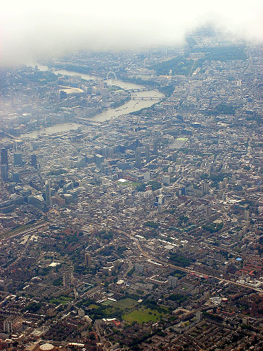
London is a nightmare to drive by, especially with the thousands of lanes, alleys and winding streets
preserved from the medieval streetplan. Impose on this a one way system and you've got a monster:

The West End:

london-map-full.jpg
map.png
london_soho.jpg


note the one way systems
sohomap2.jpg
location-map.gif


Map_Soho.jpg


Wards_Holborn_Covent_Garden_level_1.gif


brilliant 3D map of a slice of the West End here:

http://www.vistagram.co.uk/map.cfm?x=2106.00&y=884.00&id=210

lndscpTube.jpg


The City

map.gif


1liv-map-b.jpg
538_stgilescripplegatemap.jpg


Photos:

2839TheBishopsgateTower_pic7.jpg


londonthecityaerialyp4.jpg


PA180045-1.jpg


img1730az9.jpg


IMG_3424.JPG


map-c7bd9d4c299b.jpg
 
Last edited:


Back
Top