ATLANTA | Development Thread V


Status
Not open for further replies.
Plenty of room to accommodate the slopes? What grade assumption are you using to figure that? Even using a quite steep slope of five percent means it would need to depart Edgewood's grade 400 feet away from the bridge, and if you have to curve that just increases calculated grade in the track (think of a spiral staircase).

Sure looks like plenty of space to me:
11427852_10101723505373267_5133373583000480052_n.jpg

Over 1100 feet from Edgewood bridge to Irwin street, and 430 feet from Edgewood to Dekalb. The sloping parts wouldn't be on Edgewood, they would be on the Beltline and rise up to meet Edgewood.
 
I'm extremely optimistic about the park portion, for the record. I just don't like the transit part because it will ruin the trail.

Transit was part of the original vision, and the key driver of the Beltline's initial development plans. There's plenty of room for both, and it's been designed to accommodate both trails and transit.
 

I wonder why their map stops at 12th street? Looking at all of Midtown on the Atlanta devmap, from North ave to the Brookwood split, here are the numbers for each street in terms of developments that are either under construction, proposed, or recently completed:
Spring: 12
West Peachtree: 12
Peachtree: 10
Piedmont: 6
Juniper: 6
6th Street: 5
8th Street: 5
13th Street: 5
12th Street: 4

All of the other streets in Midtown have 3 or less developments. Note that some of these overlap; for example there are several developments that span the entire block between Spring and West Peachtree and are included in the total for both.
 
Sure looks like plenty of space to me:
11427852_10101723505373267_5133373583000480052_n.jpg

Over 1100 feet from Edgewood bridge to Irwin street, and 430 feet from Edgewood to Dekalb. The sloping parts wouldn't be on Edgewood, they would be on the Beltline and rise up to meet Edgewood.


The transit portion of the BeltLine route needs to start tunneling under the Edgewood Bridge (if not slightly before) based off the recent RFP for the Dekalb Avenue site for redevelopment. You're proposing this to be used as a ramp for transit rather than developable land - NOT what the BeltLine is trying to accomplish here.

Granted yes you could utilize the entire length of the corridor between Edgewood and Irwin streets but you're creating an awkward cross-traffic turning condition on top of the bridge.

I'm not sure I follow you at all. One of the key components of the Beltline is transit. If that means at *one* part of it there's a few hundred feet of ramp for a streetcar, that's fine. You can still develop adjacent to or on top of it. There's still 22 more miles of the Beltline loop for development. Even as currently planned, the streetcar will tunnel under the proposed North American Properties development between Edgewood and Dekalb. I just don't see the grade difference being an issue. It makes complete sense for the transit to go from Edgewood direct to the Beltline transit right-of-way.
 
I'm not sure I follow you at all. One of the key components of the Beltline is transit. If that means at *one* part of it there's a few hundred feet of ramp for a streetcar, that's fine. You can still develop adjacent to or on top of it. There's still 22 more miles of the Beltline loop for development. Even as currently planned, the streetcar will tunnel under the proposed North American Properties development between Edgewood and Dekalb. I just don't see the grade difference being an issue. It makes complete sense for the transit to go from Edgewood direct to the Beltline transit right-of-way.

I'm not arguing a transit ramp on the north side other than a potentially awkward cross-traffic turn on top of a bridge.

But the grade difference is an issue when it comes to looking at the southern edge of the Edgewood bridge in this area. Once you study the underlying zoning for these parcels you'll understand that the Historic Inman Park Overlay restricts the height of development in this area so a high-rise is out of the options. The FAR is PRETTY restrictive as well (less than 1.5 with all the bonuses) ...thus making it difficult to develop on top of it even without a transit ramp on the south side. My point was putting in a ramp on the south side of Edgewood bridge down to the BeltLine isn't logical based on the route of the BeltLine transit ROW where it tunnels already at grade. How do you descend from Edgewood South and descend with enough length to get under Dekalb Avenue?

To use "22 more miles of BeltLine loop for development" as reasoning is absurd. Just throwing away a development opportunity for a transit ramp at Deklab Avenue - a gateway for the trail Eastside Trail (which is essentiually the Gunby Street ROW) seems like a wasted opportunity. The BeltLine doesn't even own the areas highlighted in the graphic in blue as open land so they cannot control what happens there.

Having studied these sites for development opportunities it is a very challenging site as-is with the tunneling transit projected to cut through the middle of the site.
 
No way can those too-big streetcars navigate such little streets. Run it out Decatur St./Dekalb Ave. to the orphaned Beltine segment and then up Airline St., then loop it to the west in back of the existing Edgewood commercial structures, over to Randolph and then return on Edgewood. That's the only way I can imagine to do it.
 
The transit portion of the BeltLine route needs to start tunneling under the Edgewood Bridge (if not slightly before) based off the recent RFP for the Dekalb Avenue site for redevelopment. You're proposing this to be used as a ramp for transit rather than developable land - NOT what the BeltLine is trying to accomplish here.

Granted yes you could utilize the entire length of the corridor between Edgewood and Irwin streets but you're creating an awkward cross-traffic turning condition on top of the bridge.

I represent the owner of Studioplex. None of that property north of Edgewood or west of the BeltLine is owned by BeltLine. It's private property recently zoned for mixed-use development.

The BeltLIne corridor is extremely narrow on this section. I think it's only 40 feet wide.
 
I mean, there are over 3k multi-family units under construction in Midtown alone not to mention the Eastside neighborhoods, West Midtown, and Buckhead. That number seems way too low for Atlanta.
 
Have you ever been in a city with a light rail/park integrated? There are a ton of these all around Europe.....

Yes I have. I'm in Moscow right now actually. I also work in the railroad industry, and having a busy recreational path 10-15' off of the centerline of an active track scares the bejesus out of me.

This ROW is not all that wide--50 feet in many places. That's a tight squeeze for two-direction railroad tracks and a 15' wide recreational path. It sure won't feel like much of a park after that.
 
I mean, there are over 3k multi-family units under construction in Midtown alone not to mention the Eastside neighborhoods, West Midtown, and Buckhead. That number seems way too low for Atlanta.

I think that's developments, not units. Whether it's a building with 300 units or a two-unit duplex it would still just be one multi-family permit.


As for the Beltline east side streetcar alignment, it sounds like there's a mix of things (who owns the land, slope of the site and height of the Edgewood bridge, need for development on the site, etc) that would prevent a direct approach on Edgewood. But the current proposed route just seems bizarre to me, like they didn't learn any lessons from the existing portion of the streetcar.
 
I mean, there are over 3k multi-family units under construction in Midtown alone not to mention the Eastside neighborhoods, West Midtown, and Buckhead. That number seems way too low for Atlanta.

Are there really 3000 units under construction in Midtown right now (and not just planning or some other phase?)

In any event, the number is for permits issued... And it doesn't give a timeframe other than "2015"... so any permit issued in 2014 wouldn't be included... and I assume any permit issued after the release of the chart wouldn't be included either, so it might just be (and probably is) just a few months worth of permit issues.
 
Yes I have. I'm in Moscow right now actually. I also work in the railroad industry, and having a busy recreational path 10-15' off of the centerline of an active track scares the bejesus out of me.

This ROW is not all that wide--50 feet in many places. That's a tight squeeze for two-direction railroad tracks and a 15' wide recreational path. It sure won't feel like much of a park after that.

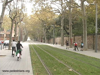
Plenty of ways to combine light rail with a multi-use trail and park or commercial space.

transitlinetrail.jpg


cctfreiburg.jpg


e132dccd9b26d93368c3ec59d3a5ba95.jpg


70o-LIGHT-RAIL-TRANSIT-facebook.jpg


medium_Burl_1.jpg


302205102_9a8561ed34.jpg
 
Are there really 3000 units under construction in Midtown right now (and not just planning or some other phase?)

In any event, the number is for permits issued... And it doesn't give a timeframe other than "2015"... so any permit issued in 2014 wouldn't be included... and I assume any permit issued after the release of the chart wouldn't be included either, so it might just be (and probably is) just a few months worth of permit issues.

There are 2870 units under construction in midtown now.
 
Are there really 3000 units under construction in Midtown right now (and not just planning or some other phase?)

In any event, the number is for permits issued... And it doesn't give a timeframe other than "2015"... so any permit issued in 2014 wouldn't be included... and I assume any permit issued after the release of the chart wouldn't be included either, so it might just be (and probably is) just a few months worth of permit issues.

Correct. These are the new residential permits from Jan to April as provided by the Census Bureau. It's a pretty volatile number month to month, so I wouldn't put a massive amount of stock in a single four month period. Much better to look at 2014, or the 12 months ended in April 2015.
 
shivtim--most of those pictures include some significant separation of rail and path uses. Hopefully the narrow ROW the Beltline offers is substantial enough to have a safe separation of some kind.

With the grade on Edgewood issue, my assumption is that they want the streetcar to meet the Beltline at grade so that in the future it can turn either direction onto the Beltline.
 
Status
Not open for further replies.


Back
Top