HomeDiagramsDatabaseMapsForum About
     

Go Back   SkyscraperPage Forum > Regional Sections > United States > Mountain West


Reply

 
Thread Tools Display Modes
     
     
  #8441  
Old Posted Dec 19, 2020, 8:20 PM
New_Future_Mayor's Avatar
New_Future_Mayor New_Future_Mayor is offline
Registered User
 
Join Date: Aug 2020
Location: Salt Lake City
Posts: 50
Quote:
Originally Posted by Hatman View Post
Haha, I guess my new approach to transit funding is going to be pure quid pro quo: for every new freeway, we also have to get 1 new transit mega project. You want to upgrade US-6? Then you need to build my train to Moab!
If this happens, I'll become the biggest pro-freeway booster this transit thread has ever seen!
The ironic thing is that when each of your new projects gets built because of the upgraded road project, the upgraded road project won't have been needed.

For instance, had they spent the money on double tracking FrontRunner that they are using to add yet another lane on I-15 through the mi-south end of the valley, the increased FrontRunner capacity and speed would have cancelled out the need for the road project.
Reply With Quote
     
     
  #8442  
Old Posted Dec 21, 2020, 9:25 AM
i-215's Avatar
i-215 i-215 is offline
Exit 298
 
Join Date: Sep 2003
Location: Greater Los Angeles
Posts: 3,346
Quote:
Originally Posted by New_Future_Mayor View Post
For instance, had they spent the money on double tracking FrontRunner that they are using to add yet another lane on I-15 through the mi-south end of the valley, the increased FrontRunner capacity and speed would have cancelled out the need for the road project.
That only works when land use accommodates the mode.

I've never ridden Metrolink ONCE in three years because land use sucks near the stations -- versus Frontrunner (which I rode 8-10 times a year) because F.R. dumps you off right at the Gateway/Arena. And a lot of office and high-rise residential is popping up along the stations. Not enough yet to cancel out I-15 upgrades entirely, but certainly laying groundwork for future decades.
__________________
(I've sadly learned...) You can take the boy out of Utah, but you can't take the Utah out of the boy
Reply With Quote
     
     
  #8443  
Old Posted Dec 21, 2020, 6:43 PM
New_Future_Mayor's Avatar
New_Future_Mayor New_Future_Mayor is offline
Registered User
 
Join Date: Aug 2020
Location: Salt Lake City
Posts: 50
Quote:
Originally Posted by i-215 View Post
That only works when land use accommodates the mode.

I've never ridden Metrolink ONCE in three years because land use sucks near the stations -- versus Frontrunner (which I rode 8-10 times a year) because F.R. dumps you off right at the Gateway/Arena. And a lot of office and high-rise residential is popping up along the stations. Not enough yet to cancel out I-15 upgrades entirely, but certainly laying groundwork for future decades.
While I agree for the most part, double tracking FrontRunner while not expanding 15 anymore will bring a substantial amount of new riders, even those required to drive to the station to get into downtown. If the drive to the station and the ride into downtown takes 30 minutes and the drive into downtown is 45-60 that is going to increase ridership some. Obviously better land use surrounding the stations will also be a huge boast.
Reply With Quote
     
     
  #8444  
Old Posted Dec 22, 2020, 5:22 AM
Hatman's Avatar
Hatman Hatman is offline
Registered User
 
Join Date: Aug 2013
Location: Salt Lake City, Utah
Posts: 1,430
Quote:
Originally Posted by New_Future_Mayor View Post
The ironic thing is that when each of your new projects gets built because of the upgraded road project, the upgraded road project won't have been needed.

For instance, had they spent the money on double tracking FrontRunner that they are using to add yet another lane on I-15 through the mi-south end of the valley, the increased FrontRunner capacity and speed would have cancelled out the need for the road project.
Ba dum ba ba! The Mayor's back!

Interesting point. It will be like when the Legacy Parkway opened just a few months after the original FrontRunner line. I remember some highway advocates making a big deal that they got the entire legacy parkway for the cost of the FrontRunner line, and that they would prove that the freeway was more useful. I thought it was a dumb comparison because the Legacy Parkway was only as long as 2 stations on FrontRunner (SLC to Farmington), and the only obvious comparison was that freeways took up sooo much more land.

Anyway, I'll update my fantasy funding scheme to stipulate that the projects must be aiming to solve separate issues. If the state spends $X dollars on a new passing lane in some far-off mountain pass, then the state must also spend $Y dollars on upgraded bus stops along the Wasatch Front.
I would say that the funding should be equal, but since federal grants are proportioned differently based on freeway or not-a-freeway, we'll probably get more funding for transit if we don't specify it being the exact amount.
Reply With Quote
     
     
  #8445  
Old Posted Dec 23, 2020, 3:21 PM
Atlas's Avatar
Atlas Atlas is online now
Space Magi
 
Join Date: Sep 2006
Location: Salt Lake City
Posts: 1,843
__________________
r/DevelopmentSLC

Last edited by Atlas; Dec 23, 2020 at 4:18 PM.
Reply With Quote
     
     
  #8446  
Old Posted Dec 24, 2020, 2:12 AM
Hatman's Avatar
Hatman Hatman is offline
Registered User
 
Join Date: Aug 2013
Location: Salt Lake City, Utah
Posts: 1,430
It's about time something happened at Clearfield station. This plan looks as good as any. I hope they leave space near the station to fully grade-separate the platform access (have stairs/elevators/escalators up or down to the platform from and intermediate level).
Reply With Quote
     
     
  #8447  
Old Posted Dec 24, 2020, 5:31 AM
Orlando's Avatar
Orlando Orlando is offline
Registered User
 
Join Date: Nov 2007
Location: Seattle, WA
Posts: 3,991
Access to the article is locked unless your a subscriber. Can you please copy and paste the article in here?
Reply With Quote
     
     
  #8448  
Old Posted Dec 24, 2020, 7:14 AM
Hatman's Avatar
Hatman Hatman is offline
Registered User
 
Join Date: Aug 2013
Location: Salt Lake City, Utah
Posts: 1,430
Trax Fantasy Maps 1/3

I've made three fantasy TRAX maps I'd like to share over Christmas break. Each one requires some specific explanations, so I will post them one at a time.

This first map is designed to show what awesomeness awaits if the Rio Grande Plan is adopted. Gone is the Blue Line terminus at Salt Lake Central on 600 West; instead, it is replaced with a loop of track at 400 West, 450 West, and 700 South. The Green Line realignment that UTA has been mulling for years finally happens and forms a connection with the Rio Grande Depot. Lastly, I've incorprated the S-Line into the TRAX network and renamed it the Silver Line. I imagine 2 car trains traveling directly between Sugarmont, Central Pointe, and downtown. Once downtown, the silver line travels around the loop clockwise while the Blue Line travels counter clockwise. By operating directionally, the Blue and Silver lines together have the capacity requirements of only a single line. This means that during peak hours, trains will be able to run at 8-minute frequencies across all lines. Downtown tracks will see a train arrive every 2 minutes.


Overall, I think this is a highly plausible plan, and I would be very disappointed if something like this didn't happen. The most fantastical element of this plan is the incorporation of the S-Line - but, after this loop project ends all talk of a downtown streetcar line, the S-Line will be left as the lone streetcar in the system. At that point, there will be no reason to maintain the artificial distinction between a street-running TRAX line and a 'streetcar' without a street - and so the platforms will be doubled in length, regular 2-car TRAX trains will begin to run, the full 2 miles will receive a true double-track, and the junction with the main TRAX trunk will be upgraded to mirror the Green Line. These are not big projects, and if development projections along the S-Line hold true, these upgrades will become necessary soon enough anyway.
The other fantastical element is the high frequency of 8 minutes per line, which is half the time of the current gap between trains per line. This is based on the theoretical minimum of two minutes between trains, which is governed by a theoretical maximum of a train passing through a downtown stoplight every 2 minutes. This frequency will be sufficient for the time being, but in the future, SLC will demand a much higher frequency in order to feed its growing urban core. This capacity improvement project will have to directly address the main bottleneck of the TRAX system, which will be the section of track between 7th south and 21st south, where 4 lines will share only two tracks. With a train arriving every 2 minutes, the crossing arms will need to activated on average Every Minute during peak hours, which will inevitably become a safety and traffic hazard for the growing community.
Something will need to be done about that section of track... but I'll leave that for my next post.

Last edited by Hatman; Dec 26, 2020 at 6:52 AM. Reason: Typo in map
Reply With Quote
     
     
  #8449  
Old Posted Dec 27, 2020, 10:07 PM
downtownslcresident downtownslcresident is offline
Registered User
 
Join Date: Nov 2011
Posts: 108
Love this! Let’s see the other maps!
Reply With Quote
     
     
  #8450  
Old Posted Dec 28, 2020, 7:25 PM
New_Future_Mayor's Avatar
New_Future_Mayor New_Future_Mayor is offline
Registered User
 
Join Date: Aug 2020
Location: Salt Lake City
Posts: 50
Hopefully Clearfield City looks at Farmington Station and realizes that it is a TAD (adjacent) and nothing even close to TOD, and works with the developers to actually build a true TOD. I don't like the fact that the proposal is saying only 1,000 residents but possible 67,000 sf of retail. Yes I realize it is meant to be somewhat of a destination, but build enough residential to kill two birds, built in customers for both UTA and for the retail within the development.
Reply With Quote
     
     
  #8451  
Old Posted Dec 30, 2020, 9:59 AM
Hatman's Avatar
Hatman Hatman is offline
Registered User
 
Join Date: Aug 2013
Location: Salt Lake City, Utah
Posts: 1,430
Trax Fantasy Maps 2/3

This fantasy map only covers the distance between Fashion Place West and Ballpark, or 7.5 miles. This is the main 'trunk' of the TRAX system. Currently all 3 lines use parts of this ROW, and I want to see 5 lines use it in the future. Obviously, there are several roadblocks to getting 5 lines to share 1 corridor.
  • Track Capacity. 2 tracks will not be enough.
  • Grade-Crossing Capacity. Level crossings with so many trains is not feasible or safe.

Additionally, I'd like to see some changes to this part of the valley.
The area between I-15 and State Street, and between 13th South and 5400 South contains over 2,700 acres. Let's call this the TRAX TRUNK district. Right now it is pretty undesirable, and most people rush between State Street and I-15 in their cars, never giving the area much thought. It is full of old light industry from the 2 railroad lines (TRAX and FrontRunner) that pass through the district, but that is slowly changing. Bit by bit, more apartments are being built, but they are not always being built on good urbanist principles. This is not good, because this area has the potential to be a major residential district for people commuting by TRAX into downtown.

For comparison, consider the land between 400 West, South Temple, 700 East, and 900 South. How many people live and work in this area? How much economic growth does this area generate?
Well, it's only HALF the size of the TRAX TRUNK district. Half!

So here's my crazy plan! (And obviously I'm not going to talk to any salt lake planners about this one until the Rio Grande plan is properly vetted.)
  • Elevate TRAX between Ballpark (1300 South) and Murray Central (5400 South). Mostly on fill material to save costs, but there will also be many bridges over existing and reconstructed roads. I estimate about 30 bridges, depending on how many new east-west connections you want to put under the elevated TRAX line.
  • Add 2 Express Tracks to the alignment. Generally, the TRAX ROW is 60 feet wide, so there is plenty of space for 2 more tracks. These tracks will not have platforms at all stations, and will serve to get trains from Murray to downtown with as few stops as possible.
  • Add more stations! The stations in the TRAX TRUNK district are much too far apart - about every mile. This will not help the area develop into a truly urban space. Stations need to be every half mile or less. So, in my map, I have laid out 10 station locations that I think will correspond with a new urban neighborhood.
  • Create a special tax district. In order to pay for this ambitious plan, the area between State Street, I-15, 1300 South, and 5400 South will fall under a new tax district. The new tax will not kick in unless the property is redeveloped. Once redevelopment occurs, the higher rate of taxes for the new apartments, offices, or retail space will pay for the (loaned) cost of construction and upkeep of the new elevated TRAX lines.


Overall, I imagine the elevated stations looking something like the beautiful stations in Charlotte, NC:


Operations of the line will be very similar to the Red/Purple 4-track mainline in Chicago, where Purple (express) trains bypass local stations on the outside tracks:
(I can't make the time stamp work, so please just skip to 40 seconds into the video)
Video Link


In the coming years, the high density of stations will allow for a high density of apartments and businesses. Entire neighborhoods that do not exist now can grow up around this revitalized TRAX line. Projects like the Millcreek pedestrian trail, which is building a footpath along the creek westward from Fitts Park, can stretch the benefits of this project deeper into the east side of the valley.

How is this line to be operated? Does it get its own color?
Next time, I will finish my Fantasy Map series and go completely off the deep end. Overall, it has been very fun to let out all these little ideas as I prepare for more serious projects, like pitching the Rio Grande plan. I don't think these fantasy maps are pure fantasy - I think something like this will need to happen someday - but since that day is far away at present, I'm content at calling them free-time fantasies.

Last edited by Hatman; Dec 30, 2020 at 10:10 AM. Reason: Image sizes
Reply With Quote
     
     
  #8452  
Old Posted Dec 30, 2020, 4:39 PM
RC14's Avatar
RC14 RC14 is offline
Registered User
 
Join Date: May 2007
Location: Salt Lake City, Utah
Posts: 978
I liked your first map. I think that is exactly what needs to happen. I especially like that you extended the S line into downtown via the existing ROW. I think this would make the S line much more useful. When I am giving someone directions to anywhere via TRAX they almost always stop listen the moment I use the word transfer.

I'm not as excited about the second map. Mostly because I think you added too many stations and I think TRAX, in that area, needs to be more commuter oriented. Adding 10 more stations would slow down commutes considerably and make driving preferable. However, I do think we could consider adding stations at 1700 and 2700 south.

I also like the idea of an express LRT line and elevating the main line.

My "off the deep end" proposal has always been to eventually convert TRAX south of 1300 South to a full Metro rail system. This system would connect to SL Central/Rio Grande and the rest of the system via the unused ROW that currently veers west north of 1300 South. TRAX north of 1300 south would continue as LRT and or street cars. An airport/SLC metro rail line could run along the existing UP ROW south of North Temple to Rio Grande.
__________________
Real estate agent working in Salt Lake and Ogden
Reply With Quote
     
     
  #8453  
Old Posted Dec 31, 2020, 9:16 AM
Hatman's Avatar
Hatman Hatman is offline
Registered User
 
Join Date: Aug 2013
Location: Salt Lake City, Utah
Posts: 1,430
Trax Fantasy Maps 3/3

Okay, one last map.
Map 1 is something I think is possible in the short term, so long as the Rio Grande Plan is followed.
Map 2 is a bit of crazy-town, but I don't think it is unjustified. Like the Rio Grande Plan, it utilizes a special tax district to pay for transit improvements that will in turn underutilized industrial areas into urban neighborhoods. The trunk project, including the stop spacing, is based heavily on the Chicago CTA north shore line, so there is precedent for such a thing working in the real world.
Map 3 returns to my old thoughts on Autonomous Rail Vehicles (from my embarrassing old autonomy blog), which I still predict will fundamentally change how transit systems work.

Imagine a 3-car train reaching a place where the line splits 3 ways. Our human-operated trains with a single human driver can go in only one direction. Three trains will need to go by before every line is served by a train. Not with autonomous trains. Like autonomous cars, each car of a future smart train will be able to operate automatically, without a human driver. When a 3-car train comes to a 3-way way junction, the train will uncouple and each train car will go down a separate route.
Imagine trying to catch a train downtown, but instead of getting on the right colored train, you get onto the right colored car, because every train will have at least one car headed to where you want to go.


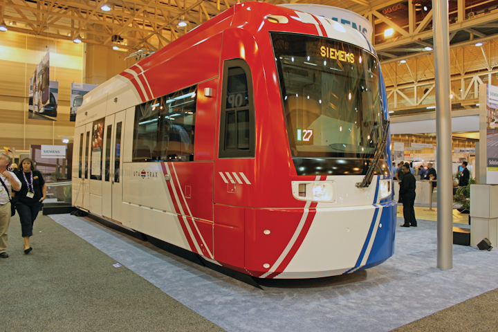
Though not autonomous yet, the S70 LRT vehicles (the same as UTA TRAX) in Portland have passenger seating in place of an operator cab on one end of most cars. This is how all LRT cars will look when they become autonomous.


Mock-up of a TRAX car without a mechanical coupler. See also the UTA S-Line and the Atlanta Streetcar.

So how will a light rail network operate when individual cars have no human operator, and are not coupled to each other?
The answer is, they will operate in Platoons: groups of train cars, operating like a single train at stations, through intersections with cars, and around sharp curves that restrict speed. When the branch lines begin to, uh, branch out, then the cars will all go their separate ways - but in the downtown area, the cars will need to work together to achieve the maximum capacity.

In Map 1, I proposed 2 downtown loops. In map 2, I proposed a 4-track 'Trunk' between Ballpark and Murray to increase capacity. Now in Map 3, in addition to 3 new branch lines I would like to see, I am proposing that all stations downtown be lengthened to support 6-car operations. There will need to be crosswalks at both ends of the station, and one in the middle too, in order to handle the expected demands - but even with 12' crosswalks at all three locations, this station should be just short enough to fit everywhere that there is currently a station downtown:

Diagram of 6 TRAX cars stopping at a downtown station in 2 groups of 3.

So now, finally, I present you with my ultimate TRAX Fantasy Map:


Including the 2 Circulator routes, I have created a total of 12 routes converging on downtown (as opposed to the current 6). Combining this with a hard limit of 2 minutes between trains downtown, and you get a frequency of a TRAX car arriving every 4 minutes across ALL Lines. No matter what TRAX station you begin at, there will definitely be a TRAX car headed for downtown within 4 minutes of your arrival.
As for the downtown loops, if there is a 6 car platoon arriving every 2 minutes, that means there will be 180 cars arriving ever hour. Assuming a maximum capacity of 225 people per car, we get a maximum of 40,500 people per hour arriving in downtown per direction. But because the downtown loops can be approached from either direction, and because we have a 4-track TRUNK line leading directly into downtown, we can assume that 2 trains will be entering the downtown loop from either end of the loop every 2 minutes.
So the final hourly capacity of TRAX into downtown reaches 81,000 people per hour. For reference, the current maximum capacity into downtown (assuming 4 car trains on all 3 lines 4 times an hour) is just over 10,000 passengers per hour. With 10x the current passenger capacity, downtown Salt Lake can become insanely dense, which of course it will, since there will be no parking lots, no parking garages, no on-street parking, or any need for storing unneeded vehicles. Downtown will be for people, and neighborhoods will be reconfigured to prioritize people, not vehicles. Getting into downtown via a car will be a serious pain. It will be much easier (and cheaper), to ditch your car at a TRAX station (it will drive itself away, no need for a park-and-ride!), and hop on the next TRAX car, which will arrive in less minutes than you have fingers on one hand.
Can TRAX handle a majority of traffic arriving into downtown? Well, 1) TRAX will also have the help of BRT on State Street and 2nd South, as well as 2 commuter rail lines - and 2) 80,000 people per hour is approaching NYC subway numbers for capacity (just one line, not network), which is pretty insane for a light rail system. So yeah, I think TRAX, with this configuration, will be able to handle Salt Lake City's transit needs for a very, very long time.

Overall, this project has been mostly therapeutic for me - getting incessant ideas out of my head so that I can focus on other things, like work, family, and the Rio Grande plan. But I don't think it is entirely a project of self-indulgence. The day of the Robotaxi is coming, and with it the death of all transportation forecasts. My car can already do basically all the freeway driving on its own, so long as I keep a hand on the wheel. Sometime next year it will be able to do ALL driving EVERYWHERE on its own with the same stipulation. It won't be much longer before robotaxis arrive in force - and when they do it will be a Dreadnaught moment for every transportation agency in the world.
The Dreadnaught, if you recall, was a battleship so overpowered that it made every other naval ship in the world obsolete. Navies worldwide began scraping, replacing, or upgrading their entire fleets so that they would not be caught off guard by the new tech. The same thing will happen for transportation planning. Robotaxis will make every long-term transportation forecast, model, and plan totally wrong, because all of these models were constructed around the ability of human drivers to inefficiently use up road capacity.
So what will these transportation planners do? Will they panic and quit? Will they plug their eyes and ears and go on building more capacity that won't be needed? Or will they turn to transit?
And if they do turn to transit, which projects will they work on?

I hope that, just maybe, I can plant a few seeds now before the Dreadnaughts arrive. Hopefully I can one day take a train from downtown to the Cottonwood Transit center, and do so without waiting. But even if that never happens, at least I got these ideas out of my head and onto the internet, so that now I can get my brain back for more important things.
Peace out, guys, and have a happy new year!

Last edited by Hatman; Dec 31, 2020 at 9:45 AM. Reason: spelling and clarity
Reply With Quote
     
     
  #8454  
Old Posted Dec 31, 2020, 4:36 PM
Makid Makid is offline
Registered User
 
Join Date: Jun 2006
Posts: 2,004
I saw this and just had to post it here...

https://www.buildingsaltlake.com/new...ntral-station/

New plan puts trains in Downtown SLC underground – and makes the Rio Grande depot a real central station

- Click link above to support BSL please.
Reply With Quote
     
     
  #8455  
Old Posted Dec 31, 2020, 4:42 PM
Atlas's Avatar
Atlas Atlas is online now
Space Magi
 
Join Date: Sep 2006
Location: Salt Lake City
Posts: 1,843
Congrats Hatman on the continuing success of your proposal Hopefully the Trib picks it up next!
__________________
r/DevelopmentSLC
Reply With Quote
     
     
  #8456  
Old Posted Jan 3, 2021, 1:39 AM
bob rulz bob rulz is offline
Registered User
 
Join Date: May 2010
Location: Sugarhouse, SLC, UT
Posts: 1,466
That's awesome that it's gotten attention from the right people! Let's hope that attention results in something.
Reply With Quote
     
     
  #8457  
Old Posted Jan 6, 2021, 4:29 PM
Makid Makid is offline
Registered User
 
Join Date: Jun 2006
Posts: 2,004
There was an update yesterday by UTA during the SLC Council Work session on the SLC Davis connector (BRT).

Video Link
Reply With Quote
     
     
  #8458  
Old Posted Jan 12, 2021, 3:13 AM
stayinginformed stayinginformed is offline
Registered User
 
Join Date: May 2008
Location: Salt Lake City
Posts: 574
Governor Cox included $350 million for Front Runner in his proposed budget. What will $350 million cover?
Reply With Quote
     
     
  #8459  
Old Posted Jan 12, 2021, 4:18 AM
Makid Makid is offline
Registered User
 
Join Date: Jun 2006
Posts: 2,004
Quote:
Originally Posted by stayinginformed View Post
Governor Cox included $350 million for Front Runner in his proposed budget. What will $350 million cover?
It depends on how it is used.

It would cost roughly $1 Billion to fully double track FrontRunner.

UTA Estimates that it will cost roughly $500 Million to $600 Million to do enough selective double tracking to allow for 15 minute frequencies.

I honestly would love to hear a deal for $350 Million for 3 years, as this would cover the full double tracking and some ROW purchases for a future express line.

Of course, I would love it even more if it was a 5 year commitment at $350 Million as that would allow for double tracking and electrifying the line.
Reply With Quote
     
     
  #8460  
Old Posted Jan 21, 2021, 8:20 AM
downtownslcresident downtownslcresident is offline
Registered User
 
Join Date: Nov 2011
Posts: 108
All I have to say is, are you f**king kidding me?! WHY DONT WE UNDERSTAND YET THAT WE NEED TO INVEST IN OUR COMMUNITIES?!


UTA discards proposal for $1 billion TRAX at Point of Mountain; seeks bus rapid transit there instead:

https://www.sltrib.com/news/politics...Um8JLtZYHod83g
Reply With Quote
     
     
This discussion thread continues

Use the page links to the lower-right to go to the next page for additional posts
 
 
Reply

Go Back   SkyscraperPage Forum > Regional Sections > United States > Mountain West
Forum Jump


Forum Jump


All times are GMT. The time now is 11:21 PM.

     
SkyscraperPage.com - Archive - Privacy Statement - Top

Powered by vBulletin® Version 3.8.7
Copyright ©2000 - 2024, vBulletin Solutions, Inc.