Quote:
Originally Posted by ProphetM

Since you posted that great aerial, I will use it again:

I actually think they have the location of the caption correct, excepting your note that today's Hill Place would still have been called Hill St. at the time. There is a street sign on a post in the photo and it's a shame that LAPL hasn't posted a larger picture where we could simply read the sign! Looking at the 1921 Baist map, Teed street hits Sunset almost straight across from that Coke-signed building. If this were the corner at Teed, the view of that building would be almost head-on. The bigger apartment building is across and slightly west of the intersection with Teed, but it's east of the intersection in the photo.
I'll post it again so I can add the modern view from Hill Place & Sunset.

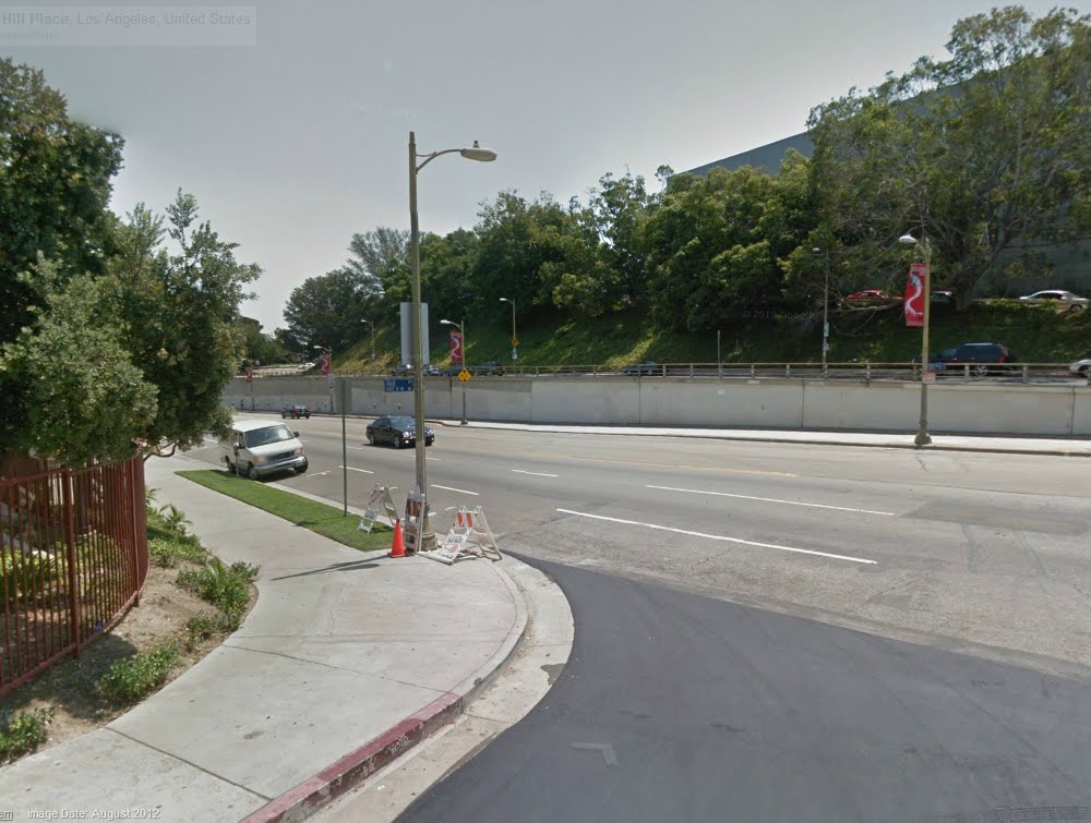 Google Street View
What used to be Hill Street south of Sunset is now Fort Moore Place that goes up the hill next to the school. In place of the buildings on the south side of Sunset, we have a new Hill Place at a much lower angle so it can connect to the new Hill St. at the left. |
Funny you should bring that up. I've been planning a post on the problems I've run into with the Baist maps. Blasphemy, I know but there you have it. And in particular I have a problem with their placement of Teed Street. With the tremendous change in topography in this area in the last sixty plus years I'm not sure I see the value of your modern images. But with Teed...well let's look at the J.W. Robinson mansion for a moment...
here's a nice shot...(would you say the Robinsons were located on the west side of Teed Street or the east side?)
 View of Sonora Town from Fort Moore Hill looking north along Castelar Street, C.C. Pierce, ca.1895
Sonora Town looking north from Fort Moore Hill, circa 1895. J.W. Robinson mansion on hilltop, left, overlooking Castelar Street (on the right, running directly away from the camera). Bella Vue (ne Bellevue this section of which would later become part of Sunset Boulevard) is below frame running right to left. The two-story Victorian style home of Joseph Winchester Robinson, located on Teed Street near Bella Vue Avenue, Los Angeles. A winged gargoyle watches over the entrance. Mr. Robinson was the owner of Boston Dry Goods which later became the J. W. Robinson Department Stores. Samuel and Joseph Carter Newsom were the architects. The house was built in 1887 at a cost of $10,000.
Photo from the C.C. Pierce collection/ The Huntington Library/Los Angeles Times.
here's another...(again, on which side of Teed Street does the Robinson mansion address?)
 Birdseye view of Sunset Boulevard and the Robinson residence looking north from Fort Hill, Los Angeles, C.C. Pierce, ca.1886
USC digital archive/Title Insurance and Trust, and C.C. Pierce Photography Collection, 1860-1960
and one last shot...(in this shot consider also the footprint of the house)
 View of the Robinson mansion on Teed Street, William H. Fletcher, 1890
The California History Room, California State Library
I think it's reasonable to say based on the photographic evidence the Robinson mansion was built on the east side of Teed Street overlooking Castelar from a relatively steep slope. No?
Now refer to the Baist map (either the 1921 or the 1914). What side of the street do they show the Robinson mansion on? The west side. Now how did that happen? Did the city fathers decide to cut an improved Teed Street road bed into the slope below the Robinson house and simply abandon the original Teed Street? In the 1914 Baist the Robinson mansion is shown on the west side of the street pretty much alone, while in the 1921 version the Robinson mansion is shown alongside of the Villa Cabrini orphanage which was built on land donated by the widow Robinson. And by the way, by this time both improvements are being shown with N. Hill Street addresses. Funny, huh? I'm actually beginning to think the street shown in all of those earlier shots of the Robinson mansion is actually N. Hill Street.


 Prev
Prev


 Linear Mode
