HomeDiagramsDatabaseMapsForum About
     

Go Back   SkyscraperPage Forum > Discussion Forums > City Discussions


Reply

 
Thread Tools Display Modes
     
     
  #281  
Old Posted Aug 14, 2021, 6:37 PM
Emprise du Lion Emprise du Lion is offline
Registered User
 
Join Date: Jul 2015
Location: Saint Louis
Posts: 341
Quote:
Originally Posted by Steely Dan View Post
We saw the same exact phenomenon in gentrifying north central neighborhoods in Chicago. Areas like Logan square, Avondale, Irving park, Albany park, and Portage park all saw population declines, not because of the black flight afflicting other areas of the city, but because of 2-flat deconversions, and the generally smaller household sizes of the wealthier people moving in.

It's not at all uncommon for first-wave gentrification to lead to a population loss, at least not in chicago's case, unless it's more of a "clean slate" area like Chicago's South loop where there weren't very many people at all living there to begin with and then developers went gangbusters throwing up dozens of residential towers over the past two decades.
That's definitely what we're seeing in the denser parts of south city, although certain neighborhoods are also gaining population while gentrifying because empty lots were filled with apartment buildings and infill SFH.

In many aspects it feels like St. Louis is following Chicago's model, but we're like a decade or so behind the curve.

Quote:
Originally Posted by ChiSoxRox View Post
Indeed, I'm seeing quite a few 8k/9k South City tracts.

Put another way, this density change isn't whether the densest parts are getting denser. Weighed population density will tell us that but that is a much more involved calculation, and the current Census files are a pain in the rear to work with. CSVs are next month, and then I'll get the weighted densities for cities, counties, and states.

Rather, this calculation tells us if the dense areas are spreading or contracting for a certain city. Detroit increased largely due to immigrant clusters in Hamtramck and Dearborn pushing over the threshold. Milwaukee dropped from the near northwest side hollowing out, and so on.
I've been clicking around the current tracts, and SFH conversions in south city have definitely done some damage, but some of these tracts are also wonky as hell.

For example, the vast majority of Soulard is considered to be low density because they put it in the same tract as Kosciusko, which is entirely industrial. DeBaliviere Place and part of the CWE are also in a low density tract because all of Forest Park is in the same tract. Same with a tract covering part of Tower Grove South because it's in the same tract as Tower Grove the actual park.

I get that this problem isn't unique to St. Louis, but it's rather annoying because I'd bet that all of those areas would also be 10,000+.

Also, with the continued population growth downtown, the two tracts that make up the majority of downtown will likely cross over the threshold by the next census.
Reply With Quote
     
     
  #282  
Old Posted Aug 14, 2021, 7:57 PM
Steely Dan's Avatar
Steely Dan Steely Dan is online now
devout Pizzatarian
 
Join Date: Jul 2001
Location: Lincoln Square, Chicago
Posts: 29,827
Quote:
Originally Posted by Emprise du Lion View Post
That's definitely what we're seeing in the denser parts of south city, although certain neighborhoods are also gaining population while gentrifying because empty lots were filled with apartment buildings and infill SFH.
There are always various, and at times competing, forces at play with neighborhood change, and the different stages of it

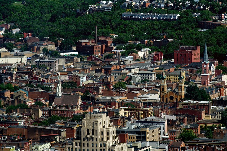
In mostly intact lower middle/working class neighborhoods with higher percentages of first/second gen immigrant families (almost always with higher household sizes), the first wave of gentrification usually leads to a population loss (exactly what we saw in Avondale during the past decade, -3,000 people / -7.6%).

But my neighborhood of Lincoln Square, just a couple of miles up the street from Avondale, is in later stage gentrification and a lot of those household size decrease issues have mostly sorted themselves out by now, and while 2-flat deconversions are still rampant here, property values have increased to the point where so many of the empty and underused lots along the main streets have been, and continue to be, redeveloped into 10 - 50 unit midrises, which allowed my neighborhood to offset all of those deconversions and even modestly grow by about 1,000 people (+2.5%).


Quote:
Originally Posted by Emprise du Lion View Post
In many aspects it feels like St. Louis is following Chicago's model, but we're like a decade or so behind the curve.
Let's hope!

The 4 community areas of greater downtown Chicago (Loop, Near North, Near West, Near South) gained nearly 60,000 people this past decade, for a combined population of ~245,000 people now!

If St . Louis could see even half that growth in its greater downtown area in this coming decade, it'd be a game changer for the city.
__________________
"Missing middle" housing can be a great middle ground for many middle class families.

Last edited by Steely Dan; Aug 14, 2021 at 9:02 PM.
Reply With Quote
     
     
  #283  
Old Posted Aug 14, 2021, 10:01 PM
Centropolis's Avatar
Centropolis Centropolis is offline
disneypilled verhoevenist
 
Join Date: Nov 2009
Location: saint louis
Posts: 11,866
St. Louis was kind of a popular cool kid of the midwest that fucked around and got lazy while (a very pale) Twin Cities was doing pullups and studying in the basement.
__________________
You may Think you are vaccinated but are you Maxx-Vaxxed ™!? Find out how you can “Maxx” your Covid-36 Vaxxination today!
Reply With Quote
     
     
  #284  
Old Posted Aug 15, 2021, 1:34 AM
ChiSoxRox's Avatar
ChiSoxRox ChiSoxRox is offline
Registered User
 
Join Date: Mar 2007
Location: Boston, MA
Posts: 2,496
Here is the list for population over 20,000 per square mile, except for Chicago (which would still be well over a million).

Twin Cities - 51,643
Milwaukee - 41,037
Madison - 35,514
Columbus - 31,592
Champaign - 22,271

(This group is likely running into resolution issues, down to 1 or 2 tracts each.)
(East) Lansing - 11,896
Ann Arbor - 6,052
Detroit - 4,656 (Hamtramck)
Iowa City - 4,165
Cincinnati - 3,836
Cleveland - 3,431 (Lakewood)

Twin Cities detail:
Minneapolis - 45,922
St. Paul - 5,721

St. Louis' peak census tract was in the 15k range in the Central West End. The densest census tract in Missouri is now in South Plaza, Kansas City.
__________________
Like the pre-war masonry skyscrapers? Then check out my list of the tallest buildings in 1950.
Reply With Quote
     
     
  #285  
Old Posted Aug 15, 2021, 4:01 AM
Steely Dan's Avatar
Steely Dan Steely Dan is online now
devout Pizzatarian
 
Join Date: Jul 2001
Location: Lincoln Square, Chicago
Posts: 29,827
^ sweet! Thanks once again for all of your number crunching!

A lot of big10 university towns on that list. I wonder how many of those tracts can be chalked up to student dorm warehouses?


Also no surprise to see the twin cities in the #2 spot again. Anyone noticing a pattern here?
__________________
"Missing middle" housing can be a great middle ground for many middle class families.
Reply With Quote
     
     
  #286  
Old Posted Aug 15, 2021, 4:20 AM
jmecklenborg jmecklenborg is offline
Registered User
 
Join Date: Jul 2003
Posts: 3,166
I'm not one of those people who gets excited about the census tract data, but it's a simple fact that flat cities like Detroit and Chicago that don't have a ton of geographic interruptions are going to be more easily comparable than those cities with much more complicated layouts like Cincinnati and Pittsburgh.

For example, here's a photo of the densest area in the United States outside NYC in the 1800s...but there is an immediate hillside gap with no residents:


Here's another shot of Cincinnati, showing how high-density row buildings (although many have been torn down in this area) contrast with zero-people hillsides:
Reply With Quote
     
     
  #287  
Old Posted Aug 15, 2021, 4:22 AM
ChiSoxRox's Avatar
ChiSoxRox ChiSoxRox is offline
Registered User
 
Join Date: Mar 2007
Location: Boston, MA
Posts: 2,496
Quote:
Originally Posted by Steely Dan View Post
^ sweet! Thanks once again for all of your number crunching!

A lot of big10 university towns on that list. I wonder how many of those tracts can be chalked up to student dorm warehouses?


Also no surprise to see the twin cities in the #2 spot again. Anyone noticing a pattern here?

Yeah, as a former Iowan I was not surprised at all to see Iowa City be the smallest metro on here. The 20k+ tract was downtown, covering some of the dorms, sorority row, and the houses that will have been subdivided into seven or eight rooms for rent.

The Big Ten also helps the Twin Cities, since several of the Minneapolis tracts are the U of M campus and environs. However, the main cluster in Minneapolis lies south of downtown in Whittier.

For Milwaukee, 20k filters out the northwest side. Instead Milwaukee's densest area is Walkers Point south of downtown and the Menominee industry, as well as a chunk of the lakeshore.
__________________
Like the pre-war masonry skyscrapers? Then check out my list of the tallest buildings in 1950.
Reply With Quote
     
     
  #288  
Old Posted Aug 15, 2021, 6:56 AM
emathias emathias is offline
Adoptive Chicagoan
 
Join Date: Sep 2007
Location: River North, Chicago, Illinois
Posts: 5,157
Saint Louis

I really want to like Saint Louis, and I mostly do. I grew up in Oregon, but I went to college in Indiana and one of my roommates was from there and I visited it with him a few times. Then my youngest brother went to college about 45 minutes east of there. So I have some good memories of it.

But then about seven years ago I took my then-husband down there for a weekend, very loose plans except to rent a car one day and go to Cahokia. Other than that, I thought the City would be more walkable, but it's really not, save for a few scattered blocks here and there.

And sadly I think it'll be several decades before it starts to change that in any substantial way, if ever.
__________________
[SIZE="1"]I like travel and photography - check out my [URL="https://www.flickr.com/photos/ericmathiasen/"]Flickr page[/URL].
CURRENT GEAR: Nikon Z6, Nikon Z 14-30mm f4 S, Nikon Z 24-70mm f/4 S, Nikon 50mm f1.4G
STOLEN GEAR: (during riots of 5/30/2020) Nikon D750, Nikon 14-24mm F2.8G, Nikon 85mm f1.8G, Nikon 50mm f1.4D
[/SIZE]
Reply With Quote
     
     
  #289  
Old Posted Aug 15, 2021, 3:24 PM
Steely Dan's Avatar
Steely Dan Steely Dan is online now
devout Pizzatarian
 
Join Date: Jul 2001
Location: Lincoln Square, Chicago
Posts: 29,827
Quote:
Originally Posted by ChiSoxRox View Post
Yeah, as a former Iowan I was not surprised at all to see Iowa City be the smallest metro on here. The 20k+ tract was downtown, covering some of the dorms, sorority row, and the houses that will have been subdivided into seven or eight rooms for rent.

The Big Ten also helps the Twin Cities, since several of the Minneapolis tracts are the U of M campus and environs. However, the main cluster in Minneapolis lies south of downtown in Whittier.

For Milwaukee, 20k filters out the northwest side. Instead Milwaukee's densest area is Walkers Point south of downtown and the Menominee industry, as well as a chunk of the lakeshore.
I'm guessing Madison, Columbus, and particularly Champaign also chalk up a good deal of their 20K+ ppsm tracts to their respective Big10 universities campuses?
__________________
"Missing middle" housing can be a great middle ground for many middle class families.
Reply With Quote
     
     
  #290  
Old Posted Aug 15, 2021, 5:58 PM
IWant2BeInSTL
Guest
 
Posts: n/a
Quote:
Originally Posted by emathias View Post
I really want to like Saint Louis, and I mostly do. I grew up in Oregon, but I went to college in Indiana and one of my roommates was from there and I visited it with him a few times. Then my youngest brother went to college about 45 minutes east of there. So I have some good memories of it.

But then about seven years ago I took my then-husband down there for a weekend, very loose plans except to rent a car one day and go to Cahokia. Other than that, I thought the City would be more walkable, but it's really not, save for a few scattered blocks here and there.

And sadly I think it'll be several decades before it starts to change that in any substantial way, if ever.
"A few scattered blocks here and there" is an exaggeration. it definitely depends on where you are in the city (for example, downtown is very poorly connected) but there are large swaths in the Central Corridor and on the South Side that are contiguously walkable. i mean, you were there for a weekend. how much of the city did you even see, mush less attempt to walk around in?
Reply With Quote
     
     
  #291  
Old Posted Aug 15, 2021, 6:06 PM
Emprise du Lion Emprise du Lion is offline
Registered User
 
Join Date: Jul 2015
Location: Saint Louis
Posts: 341
Quote:
Originally Posted by emathias View Post
I really want to like Saint Louis, and I mostly do. I grew up in Oregon, but I went to college in Indiana and one of my roommates was from there and I visited it with him a few times. Then my youngest brother went to college about 45 minutes east of there. So I have some good memories of it.

But then about seven years ago I took my then-husband down there for a weekend, very loose plans except to rent a car one day and go to Cahokia. Other than that, I thought the City would be more walkable, but it's really not, save for a few scattered blocks here and there.

And sadly I think it'll be several decades before it starts to change that in any substantial way, if ever.
Parts of south city remain very walkable, but they're also off the beaten path for someone coming into town for a weekend. Downtown's growing residential population will benefit it going forward, and the redevelopment going on in Midtown and The Cortex are creating more walkable areas in the central corridor that help heal it, but the issue remains that many of St. Louis' most popular neighborhoods are walkable in the sense that you can walk around in them but that walking somewhere else is hard.

They're basically islands, and Soulard is a good example of that. Running an interstate on one side and urban renewing the adjacent neighborhood to create an industrial zone weren't the best ideas in hindsight.
Reply With Quote
     
     
  #292  
Old Posted Aug 15, 2021, 6:11 PM
IWant2BeInSTL
Guest
 
Posts: n/a
Quote:
Originally Posted by jmecklenborg View Post
I'm not one of those people who gets excited about the census tract data, but it's a simple fact that flat cities like Detroit and Chicago that don't have a ton of geographic interruptions are going to be more easily comparable than those cities with much more complicated layouts like Cincinnati and Pittsburgh.
it's not just geographic interruptions. poorly drawn census tracts that chop up dense populations and spread them over park land and industrial space also misrepresent the true density distribution.
Reply With Quote
     
     
  #293  
Old Posted Aug 15, 2021, 6:18 PM
IWant2BeInSTL
Guest
 
Posts: n/a
Quote:
Originally Posted by Emprise du Lion View Post
...but the issue remains that many of St. Louis' most popular neighborhoods are walkable in the sense that you can walk around in them but that walking somewhere else is hard.

They're basically islands, and Soulard is a good example of that. Running an interstate on one side and urban renewing the adjacent neighborhood to create an industrial zone weren't the best ideas in hindsight.
there are certainly islands like Soulard, but the Central Corridor is walkable from Midtown west to downtown Clayton. and when i worked at Wash. U., i biked 7 miles a day (14 both ways) from Dutchtown in South City to Wash. U. at the central-western edge of the city, completely through contiguous, walkable neighborhoods and parks.
Reply With Quote
     
     
  #294  
Old Posted Aug 15, 2021, 6:57 PM
IWant2BeInSTL
Guest
 
Posts: n/a
One more comment on this: when people say a place is "walkable", i think they usually mean that they don't actually have to walk very far to find amenities. St. Louis has lost quite a few of its intra-neighborhood businesses over the years due to population loss, so there are only a few neighborhoods in which you can walk to dining, entertainment, shopping, etc. easily. tourists don't generally want to stroll around in residential neighborhoods far from hotels and tourist attractions, but that doesn't mean the infrastructure to do so isn't there. in my experience, you can't walk very far in ANY US city without encountering a stroad or a highway or an industrial area—and that includes places like Boston, Chicago, Philadelphia, and San Francisco—but those places are considered "walkable" because they have a higher density of local amenities.
Reply With Quote
     
     
  #295  
Old Posted Aug 15, 2021, 7:00 PM
ChiSoxRox's Avatar
ChiSoxRox ChiSoxRox is offline
Registered User
 
Join Date: Mar 2007
Location: Boston, MA
Posts: 2,496
Quote:
Originally Posted by Steely Dan View Post
I'm guessing Madison, Columbus, and particularly Champaign also chalk up a good deal of their 20K+ ppsm tracts to their respective Big10 universities campuses?
Like a bullseye. Madison also is helped by the isthmus constraining development.

Champaign is a fun case: every tract over 10k ppsm is also over 20k! You go right from packed student areas to more typical ~5k ppsm small city tracts.
__________________
Like the pre-war masonry skyscrapers? Then check out my list of the tallest buildings in 1950.
Reply With Quote
     
     
  #296  
Old Posted Aug 15, 2021, 11:45 PM
emathias emathias is offline
Adoptive Chicagoan
 
Join Date: Sep 2007
Location: River North, Chicago, Illinois
Posts: 5,157
Quote:
Originally Posted by IWant2BeInSTL View Post
One more comment on this: when people say a place is "walkable", i think they usually mean that they don't actually have to walk very far to find amenities. St. Louis has lost quite a few of its intra-neighborhood businesses over the years due to population loss, so there are only a few neighborhoods in which you can walk to dining, entertainment, shopping, etc. easily. tourists don't generally want to stroll around in residential neighborhoods far from hotels and tourist attractions, but that doesn't mean the infrastructure to do so isn't there. in my experience, you can't walk very far in ANY US city without encountering a stroad or a highway or an industrial area—and that includes places like Boston, Chicago, Philadelphia, and San Francisco—but those places are considered "walkable" because they have a higher density of local amenities.
Yes, this.
__________________
[SIZE="1"]I like travel and photography - check out my [URL="https://www.flickr.com/photos/ericmathiasen/"]Flickr page[/URL].
CURRENT GEAR: Nikon Z6, Nikon Z 14-30mm f4 S, Nikon Z 24-70mm f/4 S, Nikon 50mm f1.4G
STOLEN GEAR: (during riots of 5/30/2020) Nikon D750, Nikon 14-24mm F2.8G, Nikon 85mm f1.8G, Nikon 50mm f1.4D
[/SIZE]
Reply With Quote
     
     
  #297  
Old Posted Aug 16, 2021, 5:56 PM
edale edale is offline
Registered User
 
Join Date: Apr 2017
Posts: 2,225
St. Louis has some great walkable neighborhoods, but I agree they're not especially well connected. I think most of the midwest functions this way, though. There are lots of clusters and nodes of walkable business districts and residential neighborhoods, but you really still need a car to get around.

When I visited St. Louis, I knew of a couple neighborhoods I wanted to check out- Del Mar Loop, Central West End, Soulard, Forest Park...and I drove to each, parked the car and walked around for a bit, and then drove off to the next. Had a lovely visit and felt like I got to see a fair amount of the city in my brief visit. Had I tried to just walk everywhere (staying downtown, which I found lackluster tbh), I would have had a significantly worse impression of the city.

St. Louis' overall layout really reminds me of Cleveland more than anywhere else. You have downtown and some healthy adjacent core neighborhoods surrounded by a fairly large development/vibrancy gap (Midtown in Cleveland), and then the real cultural and economic heart of the metro further out. The CWE out to Wash U or Clayton is this for STL, and University Circle/Little Italy/Shaker Sq area is that for Cleveland. I think this type of layout can lead to these cities feeling less centralized, and less contiguously walkable.
Reply With Quote
     
     
  #298  
Old Posted Aug 16, 2021, 8:37 PM
IWant2BeInSTL
Guest
 
Posts: n/a
^ i'd say there are clusters of contiguous, walkable neighborhoods, and those clusters are disjointed from one another. interstates 64 and 44 really cut off the Central Corridor from South City, but everything south of 44—comprising a little less than half of the city's neighborhoods—is well connected and there isn't much empty space. again, though, it's mostly residential with a few small commercial nodes here and there. and like you said, a large swath of the Central Corridor (north of 44) is well connected including Clayton and the Central West End (and I'd add Midtown to that). and that's where most of the attractions are, so tourists don't usually venture into South City except maybe to visit the Botanical Garden. St. Louis' mortal wound is the combination of two east-west oriented highways (64 and 44) in close proximity to one another with rail yards in between. it creates a huge gash across the city. 64 cuts more down the middle, but 44 is mostly redundant and should be removed. it's a shame that North City has lost so much population, because its grid is less interrupted by highways than South City's.

one additional note: all the places that you mentioned visiting, with the exception of Soulard, are connected by Metrolink light rail, so you didn't actually have to drive to them.
Reply With Quote
     
     
  #299  
Old Posted Aug 17, 2021, 1:28 AM
SIGSEGV's Avatar
SIGSEGV SIGSEGV is offline
He/his/him. >~<, QED!
 
Join Date: Jun 2018
Location: Loop, Chicago
Posts: 6,036
Quote:
Originally Posted by IWant2BeInSTL View Post
^ i'd say there are clusters of connected neighborhoods, and those clusters are disjointed from one another. interstates 64 and 44 really cut off the Central Corridor from South City, but everything south of 44—comprising a little less than half of the city's neighborhoods—is well connected and there isn't much empty space. again, though, it's mostly residential with a few small commercial nodes here and there. and like you said, a large swath of the Central Corridor (north of 44) is well connected including Clayton and the Central West End (and I'd add Midtown to that). and that's where most of the attractions are, so tourists don't usually venture into South City except maybe to visit the Botanical Garden. St. Louis' mortal wound is the combination of two east-west oriented highways (64 and 44) in close proximity to one another with rail yards in between. it creates a huge gash across the city. 64 cuts more down the middle, but 44 is mostly redundant and should be removed. it's a shame that North City has lost so much population, because its grid is less interrupted by highways than South City's.

one additional note: all the places that you mentioned visiting, with the exception of Soulard, are connected by Metrolink light rail, so you didn't actually have to drive to them.
Yeah, it really looks like I-44 could just be truncated at Shrewsbury...
__________________
And here the air that I breathe isn't dead.
Reply With Quote
     
     
  #300  
Old Posted Aug 17, 2021, 2:51 AM
The North One's Avatar
The North One The North One is online now
Registered User
 
Join Date: Sep 2009
Posts: 5,522
Quote:
Originally Posted by jmecklenborg View Post
I'm not one of those people who gets excited about the census tract data, but it's a simple fact that flat cities like Detroit and Chicago that don't have a ton of geographic interruptions are going to be more easily comparable than those cities with much more complicated layouts like Cincinnati and Pittsburgh.
It doesn't really make any difference, census tract is a stupid way to compare urbanism, period. But it wont stop the statistic fetishists.
__________________
Spawn of questionable parentage!
Reply With Quote
     
     
This discussion thread continues

Use the page links to the lower-right to go to the next page for additional posts
 
 
Reply

Go Back   SkyscraperPage Forum > Discussion Forums > City Discussions
Forum Jump


Forum Jump


All times are GMT. The time now is 6:41 PM.

     
SkyscraperPage.com - Archive - Privacy Statement - Top

Powered by vBulletin® Version 3.8.7
Copyright ©2000 - 2024, vBulletin Solutions, Inc.