Hey!
Madrid (3,5mio, metro 6+mio inhabitants) is one of the largest cities in Europe but still has a diagram with less Buildings than Birmingham(~1,1mio), Manchester(~0,5mio), Hamburg (~1,9mio) or Frankfurt(~0,7mio), which all are just a fraction of Madrids size.
The Challenge: CAN WE COLLECTIVELY BRING MADRIDs DIAGRAM TO 150 Buildings?
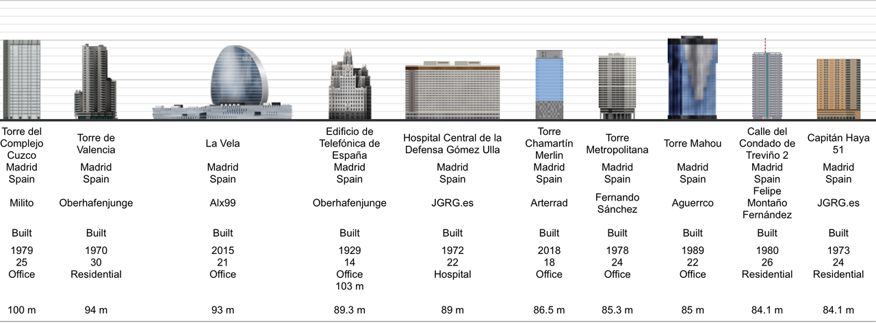
Also of the existing Diagrams, some Buildings like the four towers of the late 2000s and some Iconic Buildings have some very high quality Diagrams whereas the rest of the Diagram simply falls behind, being either poor quality drawings, the building not being really recognisable or the building having weirdly off heights.
Mahou Building for example is drawn 20m taller than it's actual size. (EDIT: Fixed by Etesia!)
Gómez Ulloa Hospital is drawn 15m shorter than it is(EDIT: Fixed by Etesia!)
Capitan Haya 51 is drawn 10m short
Cuzco IV is a nice drawing but its drawn 10-15 meters short
Torre Castilla on the other hand is 10m taller than in reality
and Edificio Bronce is again drawn 15m to tall
I checked all of the heighs on google earth and the database entries are correct, so this are false drawing heights!
This are just examples of the first two pages of the diagram, some things get even worse from here.
Madrids Diagram

This should not be seen as something disrespectful to the illustrators who put effort into those existing drawings, but rather highlight the need for better drawings for such an important European metropolis.
I made a start and tried already to give Madrid a little more graphical love. Maybe there are some of you who would like to join me and give Madrid a little more love as well.

 Collective Progress
 made since the beginning of this thread:
[IMG]
https://i.postimg.cc/zv53C9c4/sscss.png[IMG]


