HomeDiagramsDatabaseMapsForum About
     

Go Back   SkyscraperPage Forum > Photography Forums > Found City Photos

Reply

 
Thread Tools Display Modes
     
     
  #13361  
Old Posted Mar 17, 2013, 4:27 PM
MichaelRyerson's Avatar
MichaelRyerson MichaelRyerson is offline
Registered User
 
Join Date: Feb 2011
Location: Houston, Texas
Posts: 1,155

Exterior view of the second Los Angeles High School, Fort Moore Hill, Los Angeles, 1908

Photograph of the exterior view of the second Los Angeles High School, Fort Moore Hill, Los Angeles, 1908. The four-story brick building features a square clock tower, steep gables, dormer windows, and arched windows. Two entries are visible in this perspective -- one with a square portico at left and one under an arch at right. Trees sparsely surround the school. A wooden fence separates the school from the empty lot to the left. A large three-story building, Commercial High School, is adjacent to the school. Hill Street runs along the front of the school at right, while utility poles line the street. Three men are conversing on the sidewalk near the clock tower at left. And my favorite street light swings silently above the intersection waiting for twilight.

USC digital archive/Title Insurance and Trust, and C.C. Pierce Photography Collection, 1860-1960
Reply With Quote
     
     
  #13362  
Old Posted Mar 17, 2013, 9:20 PM
BifRayRock BifRayRock is offline
Registered User
 
Join Date: Apr 2012
Posts: 1,366
Quote:
Originally Posted by ethereal_reality View Post
This photo was captioned, "A view of downtown from the Chamber of Commerce 1930."

It doesn't help much, since there have been about 8 different locations for the Los Angeles Chamber of Commerce.
I believe the Herald-Examiner Building to the extreme lower right.

usc digital library


I spy a good location for two potential entertainment venues (Mayan & Belasco) next to the parking lot.

CalStLib


The "1930" photo date is probably at least four years late. See above image and http://forum.skyscraperpage.com/show...ostcount=13287

Reply With Quote
     
     
  #13363  
Old Posted Mar 17, 2013, 9:31 PM
BifRayRock BifRayRock is offline
Registered User
 
Join Date: Apr 2012
Posts: 1,366


Fascinating images originally posted by ER and Beaudry, notably containing the "PAN GAS" or "HY DRIL" advertising. http://forum.skyscraperpage.com/show...&postcount=928


http://forum.skyscraperpage.com/show...&postcount=928


So many details from the above photographs. (Still working on taking best advantage USC's reformat. Time consuming. Enlargements are translating poorly to host site.)


Finkel Arms - 912 S. Figueroa
http://digitallibrary.usc.edu/cdm/si...23466/rec/2225


USC Digital http://forum.skyscraperpage.com/show...postcount=9393

1941


http://digitallibrary.usc.edu/cdm/si.../id/1467/rec/5


Don Lee Cadillac
http://digitallibrary.usc.edu/cdm/si...23466/rec/2225


Pep Boys and Felix Chevrolet had their cartoon representatives. Western Auto Supply had its own: "Saving Sam." Wonder if the character was based upon a real person. Could it have been based on Western Auto's long-time founder and President, George Pepperdine? Doubtful, . . . different hairline (?)


George Pepperdine is also the founder of Pepperdine University, started in 1937. He had a residence on Adams (below). Pepperdine's Western Auto Supply also had many small retail outlets, including the noteworthy example on the Miracle Mile. Wonder if he liked griddle cakes?


1100 Grand Ave - Pre '26.
http://digitallibrary.usc.edu/cdm/si...id/22360/rec/6

http://digitallibrary.usc.edu/cdm/si...id/22360/rec/6

http://digitallibrary.usc.edu/cdm/si...23466/rec/2225

[/url]http://digitallibrary.usc.edu/cdm/co...5/id/933/rec/1

http://digitallibrary.usc.edu/cdm/co...5/id/933/rec/1


Circa 1929 - Western Auto Supply, Second and C Street, (San Diego - sorry)
http://cdn.calisphere.org/affiliates...i-res/9144.jpg


Circa 1937 - George Pepperdine Mansion, 3320 West Adams Blvd. (Demolished in '50s)
Lapl


Last edited by BifRayRock; Mar 18, 2013 at 2:53 AM.
Reply With Quote
     
     
  #13364  
Old Posted Mar 17, 2013, 9:37 PM
BifRayRock BifRayRock is offline
Registered User
 
Join Date: Apr 2012
Posts: 1,366


Circa 1933 - Western Auto Supply on Wilshire and Hauser. 5651 Wilshire. Dig those derricks. Wonder if the exterior was as equally impressive in color? Per GW's previous post, building went through several incarnations and is currently serving pancakes (bottom).


http://catalog.library.ca.gov/F/LJLD...002&format=999


http://catalog.library.ca.gov/F/LJLD...003&format=999
http://skyscraperpage.com/forum/show...postcount=6845


Last edited by BifRayRock; Mar 17, 2013 at 11:29 PM.
Reply With Quote
     
     
  #13365  
Old Posted Mar 17, 2013, 11:06 PM
BifRayRock BifRayRock is offline
Registered User
 
Join Date: Apr 2012
Posts: 1,366
Quote:
Originally Posted by GaylordWilshire View Post
The ghost of Dr. Brinkley... (as I post this, I wonder if we've seen this before...anyway...)

GSV


I became curious about Dr. L. A. Brinkley and his signs...not much turned up on him--but I did find more info on Dr. John R. Brinkley, discovered by BRR in connection with goat-nutter Dr. Wheeler (see prior post here). Here's a bit more of his story, excerpted from Wikipedia (boldface is mine):


"In 1922, Brinkley traveled to Los Angeles at the invitation of Harry Chandler, owner of the Los Angeles Times, who challenged Brinkley to transplant goat testicles into one of his editors. If the operation was a success, Chandler wrote, he would make Brinkley the 'most famous surgeon in America,' and if not then he should consider himself 'damned.' California didn't recognize Brinkley's license to practice medicine from the Eclectic Medical University, but Chandler pulled some strings and got him a 30-day permit. The operation was judged a success, and Brinkley received his promised attention in Chandler's paper, which sent many new customers Brinkley's way, including some Hollywood film stars. Brinkley was so taken with the city—and all the money it represented in the form of potential patients—that he began making plans to relocate his clinic there. But his hopes were dashed when the California medical board denied his application for a permanent license to practice medicine, having found his resume 'riddled with lies and discrepancies'.... Brinkley returned to Kansas.... Brinkley's activities inspired the film industry term 'goat gland' — the grafting of talkie sequences onto silent films to make them marketable."


Gotta love 'ole Harry making one of his editors a guinea pig...


Attention drawn to the street light globe ^^^^^. Possible optical illusion, but it looks unusual. Flickr


Secondarily, unable to decide which is more disturbing, certain decidedly noirish practices, allegedly performed in the name of medical science - OR another post: http://forum.skyscraperpage.com/show...postcount=8017 ?

- - -

Could they somehow be related?

Reply With Quote
     
     
  #13366  
Old Posted Mar 18, 2013, 12:15 AM
ProphetM ProphetM is offline
Registered User
 
Join Date: Jul 2012
Posts: 442
Quote:
Originally Posted by ethereal_reality:
This photo was captioned, "A view of downtown from the Chamber of Commerce 1930."

It doesn't help much, since there have been about 8 different locations for the Los Angeles Chamber of Commerce.
I believe the Herald-Examiner Building to the extreme lower right.

Quote:
Originally Posted by BifRayRock View Post


I spy a good location for two potential entertainment venues (Mayan & Belasco) next to the parking lot.

CalStLib


The "1930" photo date is probably at least four years late. See above image and http://forum.skyscraperpage.com/show...ostcount=13287

They appear to be pictures from virtually the exact same time. Aside from cars I'm having trouble finding any differences at all - the theatre site is in the same condition, including the temporary stuff built at the front of the property to cover the sidewalk. It might even be the same day - even the pattern of open windows on the Examiner building looks the same.
Reply With Quote
     
     
  #13367  
Old Posted Mar 18, 2013, 1:14 AM
John Drake's Avatar
John Drake John Drake is offline
Registered User
 
Join Date: Jun 2012
Posts: 3
Quote:
Originally Posted by tovangar2 View Post

http://foreignpolicyblogs.com

Necessary to paint the skyline in so one knows it's LA, probably unrecognizable in the unretouched photo. But I'd agree it was seriously inept, but sort of adorably hokey, which is why I picked it.

P.S. What is that pagoda in the middle ground?
Finally one that I can answer!
I'm a long-time lurker here who really appreciates this thread and its many contributors.
The pagoda is Hop Louie's in New Chinatown. This photo was taken on N. Hill street looking North just about where the current Hill St. exit from the southbound 110 descends into Chinatown.

Here is a clearer photo from a recent eBay auction:
Reply With Quote
     
     
  #13368  
Old Posted Mar 18, 2013, 2:04 AM
belmont bob belmont bob is offline
Registered User
 
Join Date: Dec 2012
Location: Los Angeles area
Posts: 177
Quote:
Originally Posted by John Drake View Post
Finally one that I can answer!
I'm a long-time lurker here who really appreciates this thread and its many contributors.
The pagoda is Hop Louie's in New Chinatown. This photo was taken on N. Hill street looking North just about where the current Hill St. exit from the southbound 110 descends into Chinatown.

Here is a clearer photo from a recent eBay auction:
These photos demonstrate what life was like in the late 40’s and 50’s…. I have clear memories of finishing up gym class and sitting down wheezing for a breath of air other than the smog…do we still have smog today..yeah some, but it’s a breeze of fresh ocean air by comparison. oh, and John your
use of "cleared photo" was not refering to the air...lol
Reply With Quote
     
     
  #13369  
Old Posted Mar 18, 2013, 3:24 AM
BifRayRock BifRayRock is offline
Registered User
 
Join Date: Apr 2012
Posts: 1,366
Quote:
Originally Posted by ProphetM View Post
They appear to be pictures from virtually the exact same time. Aside from cars I'm having trouble finding any differences at all - the theatre site is in the same condition, including the temporary stuff built at the front of the property to cover the sidewalk. It might even be the same day - even the pattern of open windows on the Examiner building looks the same.


Another minor observation. No trace of any comfort station on a certain traffic island. Find the nearest saloon? Wait, Prohibition is still in full swing.


This image is also dated 1930, and for obvious reasons, looks the part.

Belasco completed


http://digitallibrary.usc.edu/cdm/si...id/3790/rec/12


Reply With Quote
     
     
  #13370  
Old Posted Mar 18, 2013, 3:28 AM
rick m rick m is offline
Registered User
 
Join Date: Sep 2011
Posts: 225
Quote:
Originally Posted by belmont bob View Post
Well we know that the school system had a Polytechnic HS as well as a later Manual Arts HS so I guess it’s not unreasonable to have a commercial HS which just so happens to be built next to the original HS. If memory serves me, Poly was opened around 1905. So a big question would be – when the new LA HS was opened in 1917, did the commercial HS remain open as a HS up into c1925 as the LAPL picture asserts or was it really a predecessor Jr. High to the later Central JHS.
And does anyone know when the tower building was abandoned and eventually raised? Did the district quit using it in 1917 or was it still in use for some other purpose?
There are so many potential questions about the school, but also the site. We have seen many photos were the tower building stands out along with the Normal School, Court House and old City Hall so it was a prominent structure. I don’t know how much this whole subject rises to the level of noirish, but I find it to be an important aspect of the city’s development in particular that of the greater Bunker Hill area.
Following S.F.'s 1906 quake the tower was shortened by more than a third (to roofline height) as was decreed for our students safety- Proquest does have a Times article on structure's final removal and remodeling of the trade school in the 20s. Spence and Fairchild airphotos reveal such changes.
Reply With Quote
     
     
  #13371  
Old Posted Mar 18, 2013, 5:21 AM
JScott's Avatar
JScott JScott is offline
Registered User
 
Join Date: Feb 2013
Posts: 183
Quote:
Originally Posted by BifRayRock View Post


Another minor observation. No trace of any comfort station on a certain traffic island.

The only traffic island I can see here is the one at Broadway Place. The comfort station was at the junction of Spring, Main and 9th, and is obscured in this view.
__________________
Covina Past
Los Angeles Past
Reply With Quote
     
     
  #13372  
Old Posted Mar 18, 2013, 12:07 PM
MichaelRyerson's Avatar
MichaelRyerson MichaelRyerson is offline
Registered User
 
Join Date: Feb 2011
Location: Houston, Texas
Posts: 1,155
Quote:
Originally Posted by JScott View Post
The only traffic island I can see here is the one at Broadway Place. The comfort station was at the junction of Spring, Main and 9th, and is obscured in this view.
Jesus. I've been looking for it in the wrong place. sometimes, I amaze even me.
Reply With Quote
     
     
  #13373  
Old Posted Mar 18, 2013, 5:52 PM
MichaelRyerson's Avatar
MichaelRyerson MichaelRyerson is offline
Registered User
 
Join Date: Feb 2011
Location: Houston, Texas
Posts: 1,155

View from the Richfield Tower, Dick Whittington, 1930

A view of the Richfield Tower not frequently seen.

USC digital archive/Dick Whittington Photography Collection, 1924-1987


View from the Richfield Tower, Dick Whittington, 1930 (2)

A man (Dick Whittington?) gazes out at 1930's Los Angeles from atop the Richfield Tower.

USC digital archive/Dick Whittington Photography Collection, 1924-1987
Reply With Quote
     
     
  #13374  
Old Posted Mar 18, 2013, 6:58 PM
kznyc2k's Avatar
kznyc2k kznyc2k is offline
Registered User
 
Join Date: Apr 2005
Location: Back to Boston
Posts: 1,865
Cary Grant's signed slab of concrete from Earl Carroll's old club is up for sale on eBay. Opening bid is a cool $5,000.


Link to eBay auction

Short article over at the Daily Mirror

__________________
Politicians, ugly buildings and whores all get respectable if they last long enough.
Reply With Quote
     
     
  #13375  
Old Posted Mar 18, 2013, 9:24 PM
ethereal_reality's Avatar
ethereal_reality ethereal_reality is offline
Registered User
 
Join Date: Feb 2008
Location: Lafayette/West Lafayette IN, Purdue U.
Posts: 16,356

Last edited by ethereal_reality; Mar 18, 2013 at 10:17 PM.
Reply With Quote
     
     
  #13376  
Old Posted Mar 18, 2013, 10:01 PM
ethereal_reality's Avatar
ethereal_reality ethereal_reality is offline
Registered User
 
Join Date: Feb 2008
Location: Lafayette/West Lafayette IN, Purdue U.
Posts: 16,356
Quote:
Originally Posted by MichaelRyerson View Post

View from the Richfield Tower, Dick Whittington, 1930

A view of the Richfield Tower not frequently seen.

USC digital archive/Dick Whittington Photography Collection, 1924-1987
A M A Z I N G ! thanks for posting MichaelRyerson
Reply With Quote
     
     
  #13377  
Old Posted Mar 18, 2013, 10:37 PM
MichaelRyerson's Avatar
MichaelRyerson MichaelRyerson is offline
Registered User
 
Join Date: Feb 2011
Location: Houston, Texas
Posts: 1,155
Not to put too fine a point on it but reviewing all of these old posts what had escaped us, I think, was that Teed Street never actually existed beyond the map entries. Try as we might, we have yet to come up with a clear picture of Teed Street in the flesh. Just lines on a map or the graphic illustration of the birdseye maps. Even the Robinson mansion was ultimately given a N. Hill Street address as was the Villa Cabrini, Regina Coeli orphanage. As an aside, someone, rickm, I think, mentioned the other day that the Robinson mansion was torn down to make way for the orphanage but strictly speaking that isn't right. Here's a picture taken from the south side of Sunset showing both the ginger-bread of the Robinson mansion and the brick of the Villa Cabrini.


412sunset-1920 (2)

Photograph of a dilapidated adobe built by Francisco Manza on the west side at the north end of the Broadway Tunnel, Los Angeles, 1920. A collapsing picket fence leans in towards the property of the adobe at the right, leading to the main house which is partially obscured by a hill in the foreground. The adobes have plank veneers along their walls, and the adobe at the far left has a wash basin attached to its side. Several metal poles, which appear to be supports for unused clotheslines, hang in towards the adobes. In the background, telephone poles and across Sunset Boulevard up on the hill can be seen what's left of the J.W. Robinson mansion and just behind it the Villa Cabrini orphanage.

USC digital archive/California Historical Society Collection, 1860-1960/Title Insurance and Trust, and C.C. Pierce Photography Collection, 1860-1960

And, while we're at it, does anyone know what, if anything, the hill upon which the Robinson mansion was built was called? Did it have a name? Presumably Fort Moore Hill did not extend above Sunset. Any guesses? Suggestions for source material? Also, yesterday I ran across a reference to a Sugarloaf Hill. Any guesses on that?
Reply With Quote
     
     
  #13378  
Old Posted Mar 18, 2013, 11:06 PM
ethereal_reality's Avatar
ethereal_reality ethereal_reality is offline
Registered User
 
Join Date: Feb 2008
Location: Lafayette/West Lafayette IN, Purdue U.
Posts: 16,356

slide, circa 1954 -ebay


pool/1954 -ebay


It's still there....pretty much unchanged (except for the shrubbery and trees of course)


gvs


gvs


aerial

google
__

Last edited by ethereal_reality; Mar 18, 2013 at 11:27 PM.
Reply With Quote
     
     
  #13379  
Old Posted Mar 18, 2013, 11:49 PM
GaylordWilshire's Avatar
GaylordWilshire GaylordWilshire is offline
Registered User
 
Join Date: Nov 2009
Location: NYC
Posts: 3,703
Quote:
Originally Posted by BifRayRock View Post
Circa 1937 - George Pepperdine Mansion, 3320 West Adams Blvd. (Demolished in '50s)
Lapl


The rags-to-riches-to not exactly rags story of George Pepperdine began in Kansas... the full story of his Los Angeles life is here:
http://adamsboulevardlosangeles.blog...ease-also.html


As it turns out, all of the Pepperdine houses in Los Angeles aside from 3320 West Adams still stand.
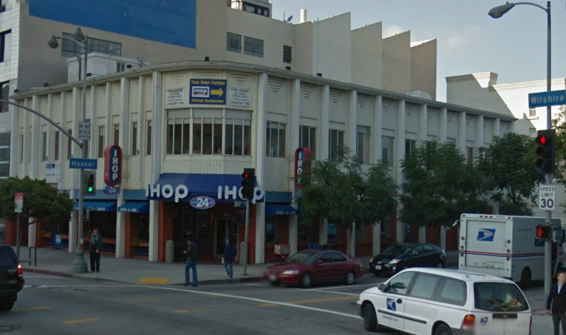
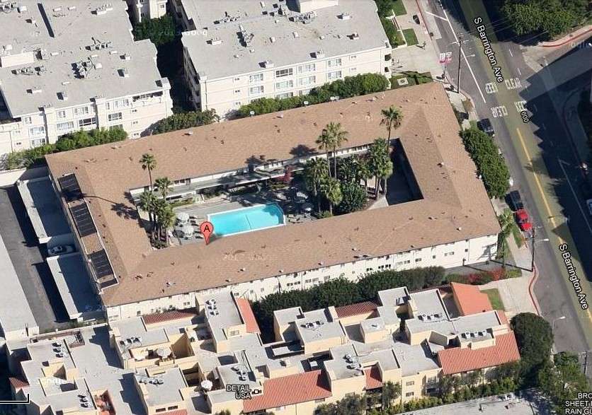
UPDATE: A BP for the demolition of 1201 N Las Palmas was issued on Apr 10, 2012


GSV
1201 N Las Palmas (ca. 1916-17) Jan 2011--demolished the next year


GSV
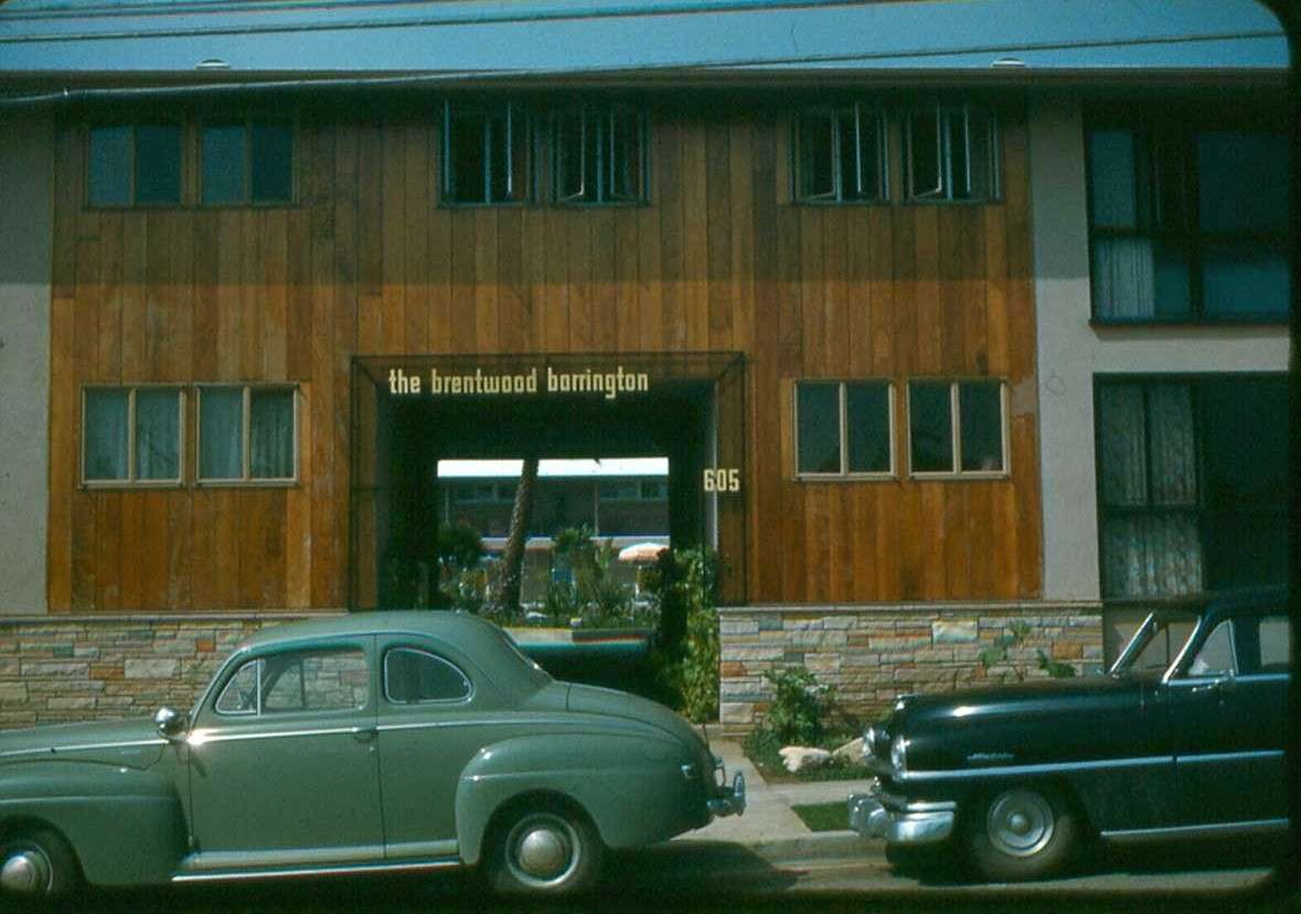
762 N Edgemont (ca. 1918-22)


Pepperdine

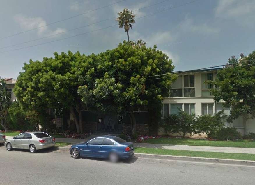
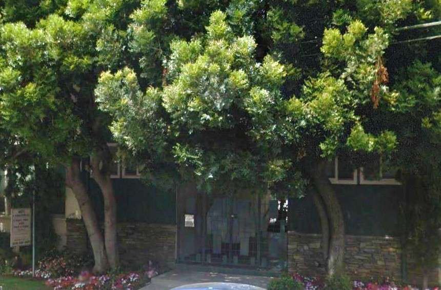
Front and rear of 157 N Catalina soon after completion. (Gotta love the gazing ball--it has been replaced with a house, but the two palms remain.) Its lines looks remarkably modern for 1924--the "now" shot reveals a house that could have been built in any recent ordinary SoCal subdivision.


As for 3320 West Adams Boulevard...


LAT July 12, 1908


Here's where I complain about the research in the book Images of America: West Adams (again; see this post). The book describes the house as having been built by the Pepperdines, but, as you can see above, it was built by George F Winter (in 1908), father of the builder of another interesting Winter house, the story of which is here. (Notice that the drawing is by Elmer Grey himself; at the time, before a major street renumbering program by the city, 3320 was numbered 2550.) Images of America: West Adams goes on to describe the tragedy of the "next occupants," the Carl Molines. The Molines were actually living with the Pepperdines at 3320 as employees in 1930 and were, as the book does mention, both were killed by a vehicle just in front of the house.

It wasn't as though George Pepperdine wound up on Skid Row; he died at the commodious 1614 Wellington Road:

GSV

Last edited by GaylordWilshire; Apr 19, 2018 at 9:58 PM.
Reply With Quote
     
     
  #13380  
Old Posted Mar 19, 2013, 1:16 AM
Chuckaluck Chuckaluck is offline
Registered User
 
Join Date: Apr 2012
Posts: 649
Quote:
Originally Posted by JScott View Post
The only traffic island I can see here is the one at Broadway Place. The comfort station was at the junction of Spring, Main and 9th, and is obscured in this view.


To some of us, every traffic island is a comfort station in the making!

You are, of course, correct in your observation; however, the prior observation may have been tongue-in-cheek-correct in noting no evidence of any comfort station (even if it would have been in the wrong location!)

I do not believe it has been covered before, but the stretch of Broadway Place near Olympic is apparently no longer a public thoroughfare. A 2010-article addresses this issue. http://blogdowntown.com/2010/08/5567...broadway-place Although your post should dispel further confusion, excepting the Main and 9th island, are there any other triangular-shaped traffic islands in the area? (This could prove helpful to those feeling the need, and prefer avoiding saloons.)

Similarly, are there other confirmed and fully-functional former “comfort stations?” GW’s articles focus on the 9th and Main station, but more were contemplated: “The budget for next year will probably contain an appropriation for moderately-priced comfort stations for various points.” http://forum.skyscraperpage.com/show....php?p=6045384

Finally, if I read the 2010-article correctly, the city did not undertake control and maintenance of the subject stretch of Broadway Place until 1919. Could there have been a private-for-hire comfort station there, unknown to the general public? :lol:

BTW, congratulations on your excellent blog! http://losangelespast.blogspot.com/


Circa 1922 - The Case Hotel is under construction and the text describes "a traffic cop stand[ing] on a small 'island' in the middle of the street where Broadway turns slightly westward past Broadway Place." Unfortunately, the image is too small for me to determine whether the traffic cop is on the island to direct traffic or seek comfort.
http://jpg3.lapl.org/pics46/00072714.jpg
Reply With Quote
     
     
This discussion thread continues

Use the page links to the lower-right to go to the next page for additional posts

Reply

Go Back   SkyscraperPage Forum > Photography Forums > Found City Photos
Forum Jump


Forum Jump


All times are GMT. The time now is 10:48 AM.

     
SkyscraperPage.com - Archive - Privacy Statement - Top

Powered by vBulletin® Version 3.8.7
Copyright ©2000 - 2024, vBulletin Solutions, Inc.