In reference to the CTA Belmont Flyover project:
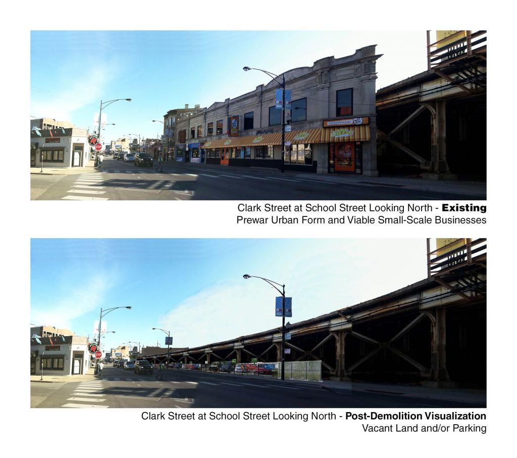
Since the CTA failed is failing to fully illustrate the magnitude of demolition and it's effect on the neighborhood, I've decided to do some quick visualizations that shows what happens and how it feels as a pedestrian when intact blocks are removed and replaced with vacant land and/or parking. Though there is potential for new development on some of these sites, even that would be unlikely to happen for 5-10 years once the project gets started.
The visualizations aren't intended to precisely show what the final infrastructure would look like, but they speak to the enormous impact that this project, as currently designed, would have on the neighborhood fabric as well as existing businesses and residents in the area. Feel free to share these among those interested.
It is essential that the CTA work with the community on a context-sensitive solution to improving efficiency on the Red, Purple and Brown Lines that doesn't create substantial negative impacts.
First up is Clark and School looking north, where the CTA want's to straighten a slight curve in the tracks at the expense of this block:


 Prev
Prev


 Linear Mode
