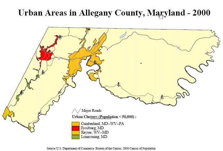
Cumberland (pop. 21,591) is the seat of Allegany County (pop. 74,930) in Western Maryland, and is located essentially haflway between Pittsburgh 115 miles to the northwest and Baltimore/Washington 130 miles to the southeast. Cumberland has an urban cluster population of 41,119 and is the hub of the Cumberland MD-WV Metropolitan Area, which numbers 102,008.
Located along I-68 (the elevated highway blasts right through the center of town) in Western Maryland's Ridge and Valley region, Cumberland is situated along the Potomac River. The mountainous terrain dominates Cumberland's urban form, as its neighborhoods twist around narrow valleys and scale steep hillsides. A dramatic and spectacular cityscape full of architectural interest hearkens to an important past.
Fort Cumberland was established by the British Army in the 1750s along what was then British America's western frontier. It was from Fort Cumberland that the British Army launched two unsuccessful attempts to dislodge French forces from Fort Duquesne at the present site of Pittsburgh. In 1754, a 22-year-old George Washington led a force northwest into the highlands near Uniontown, PA... they encountered French forces at the Battle of Jumonville Glen... which would be the opening engagement in the French & Indian War (which would escalate into the Seven Years' War). This was followed by the battle of Fort Necessity. In 1755, General Braddock (accompanied by Washington) led the British Army to a disastrous defeat upstream from Fort Duquesne at the Battle of the Monogahela.
In 1794, President George Washington returned to Cumberland to lead a militia force to quell the Whiskey Rebellion, a response amongst frontier farmers to an excise tax on whiskey.
The City of Cumberland was established in 1787, and it soon became a key transportation hub connecting the East Coast to points west as the National Road (or Cumberland Road... today's U.S. 40), C&O Canal and B&O Railroad all converged on the city. Cumberland grew as a mining and timber hub, and spawned heavy industry. The city was a major producer of glass, tires and paper... but in the latter half of the 20th century... most industrial plants closed. Cumberland and its region spiraled into long-term economic and population decline. The city is trying to leverage its impressive assets as a destination for historical, cultural and outdoors recreation tourism.


Wills Mountain as seen while squeezing through the Cumberland Narrows just west of Cumberland

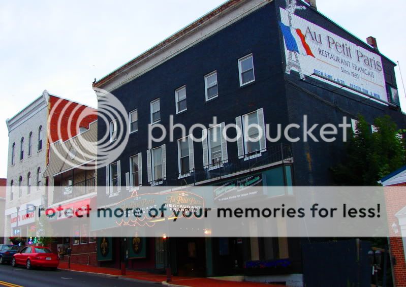
Downtown


whoa

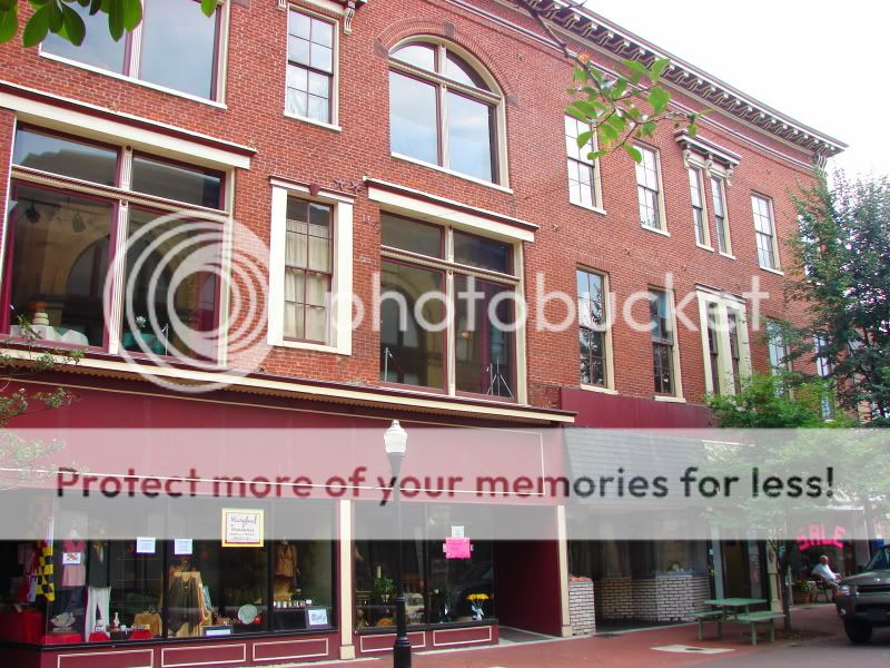
The main drag Downtown is a pedestrian street... I don't know what the history behind this one is... but these things don't usually pan out as planned... it's a really gorgeous street... big beautiful buildings lining a rather narrow corridor... but there weren't a ton of people about... and the plastic chairs everywhere were kinda ugly
so much bad street furniture

lovely view... but the kiosk is hideous

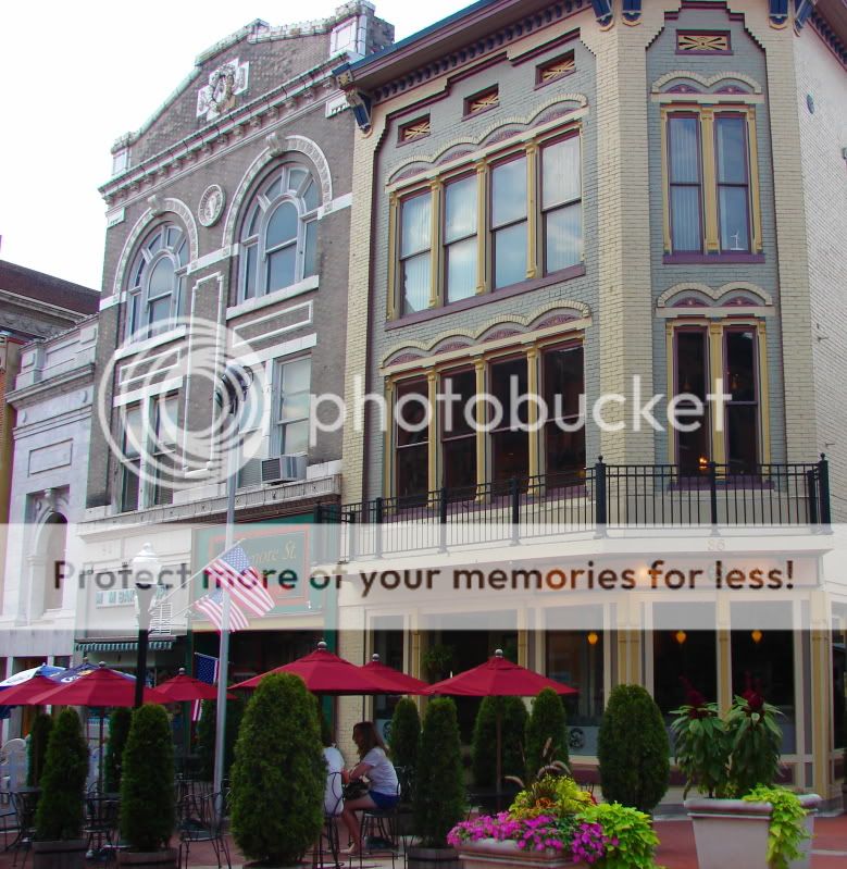

like so many historic downtowns... grand storefronts that once housed department stores now house chintzy art galleries

Cumberland almost has an "Olde Europe" skyline... dominated by steeples amidst the lush mountains

downtown fashion


that storefront sells Maryland-related gifts... it was interesting to see so much Maryland Pride in Cumberland... I thought perhaps due to their isolation geographically and culturally from 99% of Maryland that there might be less of a Maryland self-identification... but homes flew the distinctive Maryland flag and social clubs advertised crab bakes... Cumberland does fly the flags of West Virginia and Pennsylvania in addition to Maryland on this street, however.


crossing Wills Creek... joggers on the Great Allegheny Passage... which leads to Pittsburgh


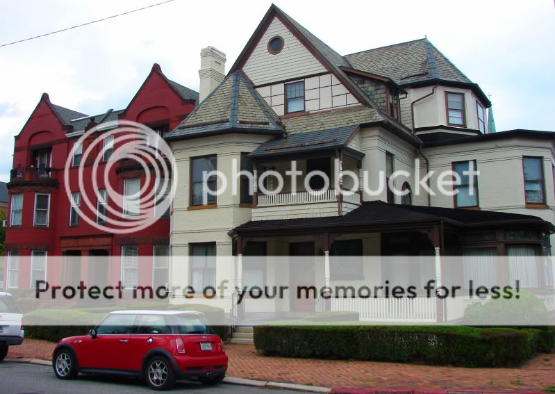
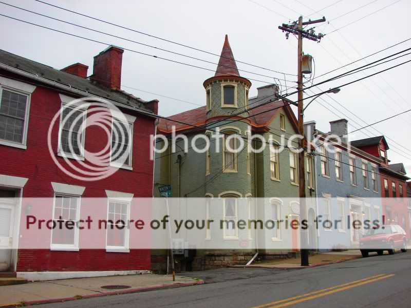
heading into the West Side of Cumberland... Washington Ave. is full of historic mansions

The Richardsonian Romanesque Allegany County Courthouse (1893) looms over the city from its hilltop perch


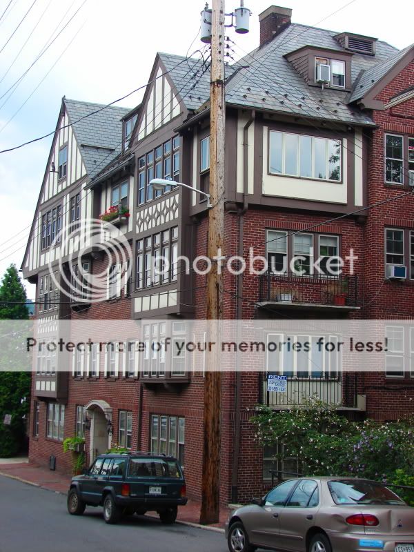
i love this apartment building


the incredible lushness of Cumberland

hilly cities are my favorite

the topography, architecture and neighborhoods result in a fascinating urban environment... Cumberland may be small in population... but it is endlessly fascinating


Urban Appalachia


Canal Place is an urban redevelopment at the western terminus of the C&O Canal... it features shops, restaurants, parkland, museums and trails... it seemed pretty lively but was overrun by ill-tempered teenaged stunt bikers


bridge crossing the Potomac

 Country roads... take me home

one of GW's HQs during the Whiskey Rebellion


This street gave me a Wheeling (WV) feeling

north of downtown... I wish I had more time to explore this working class neighborhood north of downtown... but alas...

...
Frostburg (pop. 7,873) is located 8 miles west of Cumberland on the eastern side of Big Savage Mountain. It has an urban cluster population of 10,916. Located about 2,000 feet above sea level, Frostburg is the highest city in Maryland. I can only assume its name comes from its frosty winters... which are long and cold and average over 100 inches of snow. Its summers are cool too... while it was eveningtime... it definitely felt significantly cooler in Frostburg than nearby Cumberland. Frostburg is home to Frostburg State University... which has the bleakest campus I've ever seen. Frostburg is also the hometown of marcus.

rolling into Frostburg was really impressive... with its main street climbing a hill and twisting around a bend (two things I love in a main street)


houses

I forget the name of this small village near the Pennsylvania border just south of Wellersburg, PA


 Prev
Prev


 Winchester, VA has the same pedestrian friendly downtown corridor, only without the ugly white plastic lawn chairs. And as you stated, it's amazing how some cities can pull that off.

 Thanks for posting these great pictures.

 Linear Mode
