Riverside is a neighborhood in the far northwestern corner of the City of Buffalo, along the Niagara River, about 5 miles (8 km) from Downtown Buffalo. Riverside developed as a working-class residential community in the late 19th and early 20th Century as residents of the adjacent Black Rock neighborhood sought to escape the growing industrial areas of Black Rock, and new workers for the growing industries of Tonawanda to the north sought housing. Riverside today still maintains a strong integrated working-class population, and has also become a popular destination for recent arrivals from other nations and migrants from the boroughs of NY City due to its inexpensive multi-family housing. While the population of the neighborhood has been slowly increasing due to the new residents, the business district is lagging in the recovery and growth seen in adjacent neighborhoods like Black Rock and North Buffalo, although this may be changing as more new residents seek alternatives from the more expensive neighborhoods nearby.
All My Buffalo Neighborhood Flickr Albums
The Niagara River is to the west of Riverside, with the Niagara Thruway (Interstate 190) running parallel to the river, built on the bed of the old Erie Canal. Strawberry Island, Grand Island, and Canada are in view. Riverside Park, originally called Germania Park, is an Olmsted Park constructed on the bluff overlooking the river that connects to the neighborhood.

Strawberry Island Forever by
bpawlik, on Flickr

Riverside Park Lighthouse by
bpawlik, on Flickr
At water’s edge, along the former canal towpath, there is a string of parks, bike paths, and marinas. The bike paths are part of a statewide system connecting the river to the Great Lakes and the Erie Canal bikeway.

3-1/2 Miles by
bpawlik, on Flickr

Rich by
bpawlik, on Flickr
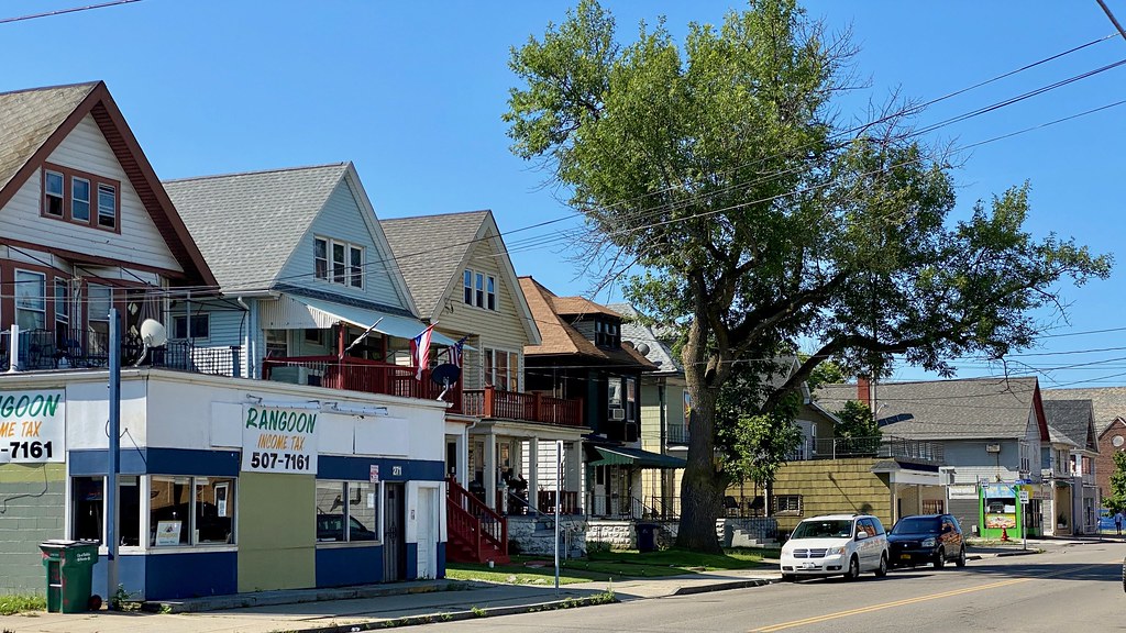
Businesses are intermixed with homes throughout much of the neighborhood, with some concentrated business areas running adjacent to the park on Tonawanda Street, and extending along Tonawanda to the Black Rock neighborhood. Other significant concentrations are also along Ontario Street and Niagara Street. Many of the businesses cater to the local immigrant community.

Riverside Social Distance by
bpawlik, on Flickr

IMG_2384 by
bpawlik, on Flickr

IMG_2388 by
bpawlik, on Flickr

IMG_2371 by
bpawlik, on Flickr

IMG_2368 by
bpawlik, on Flickr

+ Falafel by
bpawlik, on Flickr

Market and More by
bpawlik, on Flickr

T Street by
bpawlik, on Flickr

Ethiopian Orthodox by
bpawlik, on Flickr
Multi-family along Tonawanda Street

IMG_2347 by
bpawlik, on Flickr

Engine 26 by
bpawlik, on Flickr

IMG_2366 by
bpawlik, on Flickr

IMG_2367 by
bpawlik, on Flickr

Munchkinland by
bpawlik, on Flickr

This Must Be by
bpawlik, on Flickr
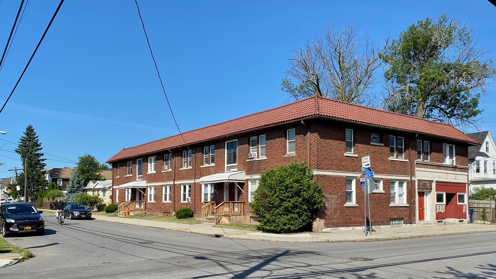
The interior of the neighborhood is a mix of all types of structures, along with many single family homes of varying size, built mainly from the 1890s until the early 1950s. Many of the homes were build with lumber recovered during the disassembly of the Pan-American Exposition of 1901.

Riverside Homes by
bpawlik, on Flickr

Riverside High by
bpawlik, on Flickr

The Academy by
bpawlik, on Flickr

IMG_2392 by
bpawlik, on Flickr

Q by
bpawlik, on Flickr

IMG_2858 by
bpawlik, on Flickr

IMG_2920 by
bpawlik, on Flickr

All Saints by
bpawlik, on Flickr

Unknown Club by
bpawlik, on Flickr
IMG_8102 by
bpawlik, on Flickr

IMG_2365 by
bpawlik, on Flickr

IMG_2874 by
bpawlik, on Flickr
IMG_2850 by
bpawlik, on Flickr

Esser Mini Mart by
bpawlik, on Flickr

Dalmatia by
bpawlik, on Flickr

Urban Cuts by
bpawlik, on Flickr
Industry, and the remnants of past industries, ring the edges of Riverside.

Edge City by
bpawlik, on Flickr

Chase Bag by
bpawlik, on Flickr
There are many streets that are affordable hidden gems, with sweeping views of the river nearby.

Homes Trees Water by
bpawlik, on Flickr

River View by
bpawlik, on Flickr


 Linear Mode
