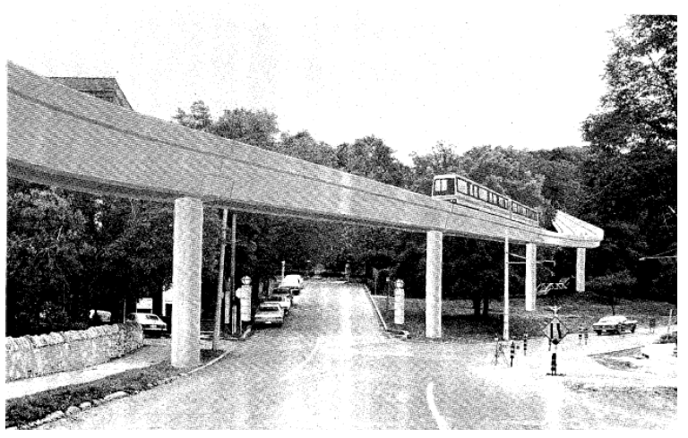
The Ontario government’s urban transportation policy of the 1970s and their formation of the Urban Transit Development Corporation (UTDC), now the Advanced Rapid Transit (ART) division of Bombardier, enabled the province to fund, design and eventually build a system similar to the original Hamilton Transit Plan backed by Mayor Copps, referred to as ICTS (Intermediate Capacity Transit System). Hamilton was to be a test city for a new rail technology using driverless trains on elevated guideways, powered by linear induction motors and magnetic fields. The cost of the system was projected to be $100 million with 90% of the funding coming from the federal government and the province, who wished to promote a new technology that propelled the train using a middle track and positional wheels, rather than traditional rail methods. This system is currently running in Vancouver as the Sky Train and in Toronto as the Scarborough RT.
The proposed Hamilton Rapid Transit Project of 1981 looked at a variety of corridors connecting the upper escarpment with the downtown core including two tunnelling routes, one starting at Fennell Avenue and Upper James and ending at lower James Street; the other starting at Inverness and Upper Wellington and ending at the start of the Claremont access and the Jolley Cut. The other two routes were to be built above ground using elevated guideways. The preferred route, “W” (see Figure 30) was chosen to run from Mohawk Road to the core using a tunnel at James Street.
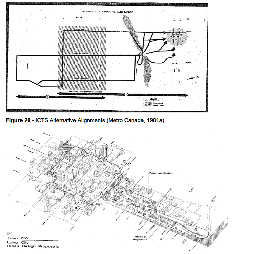 Figure 30
 - Four Proposed ICTS Alignments (Metro Canada, 1981c)
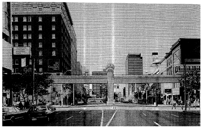
An example of the elevated guiderail and car can be seen in artist renderings of familiar Hamilton streetscapes. The first is a view of James Street South at the escarpment tunnel exit:
The second is at the Royal Connaught in the downtown core:
Proposed station stops included Upper James and Mohawk, Upper James and Fennell, St. Joseph’s Hospital, MacNab and King William Streets. The elevated track was to be a made-in-Hamilton design comprised of concrete in some areas and composite steel in others. Along the mountain corridor trains would travel along a median guideway carrying two way traffic, and a one-way looped guideway as they entered the central business district. Portions of the TH&B lands (at the present day GO terminal) were to be used as a maintenance facility. The full capital costs of the system were determined to be $111.1 million and operating costs were projected to be $3.5 million per year (Sicoli, 1981, June 17). Ridership estimates in peak hour traffic were 3,000 passengers per hour in 1986, and in 2001 they were projected to be 6,500 passengers per hour.
Early on in the transit planning process, during the 1970s, citizen and political support for the system was high; however as the more detailed planning and public consultation processes began in the 1980s, public opinion changed and support for the system dwindled, until the plans were eventually dropped in December of 1981. Some of the concerns included:
• Unsightly elevated guideways
• Negative impact on property values
• Burden on the taxpayer, especially due to unknown operating costs of the system (Rapid Transit Load Will Fall on City, 1981).
• Lack of political will, leadership and organization where rapid transit was concerned
• Improper timing and lack of need as transit needs are well served by bus routes.
• Population growth projections were too high.
• Coalitions of neighbourhood associations against the system.
• Reliance on un-proven, experimental technology.
• Insufficient access for the disabled.
• Traffic, emergency and personal safety hazards due to concrete guideways.
• The UTDC cars were to be made in Vancouver and not in Hamilton.
• Bus routes may still be required along ICTS routes since stations are too far apart.
• Bus routes require upgrading before money can be spent on new infrastructure.
• Does not service the proper areas such as the bayfront industrial core, which have a higher transit demand.
• Poor public engagement/consultation and an inability to answer to citizen concerns, coupled with reports of failure to provide accurate, unbiased reports on public opinion (Sicoli, 1981, Sept. 15).
• Distrust of the province’s intentions and the ability of the UTDC to deliver on their promises of prosperity and system functionality.
In addition to these concerns, Hamilton-Wentworth Regional transportation planners stunted the new transit system’s planning and installation by ranking it 8 out of 13 essential transportation projects for the city, far down the list from the top which contained mostly freeway projects including the Red Hill Valley and Lincoln Alexander Parkways (“Report Says No Urgency”, 1981). However, others believed that “rapid transit will be the thing of the future. We can’t keep constructing roads and carving up the escarpment for more automobile accesses.” (Scicoli, 1981, May 2).


 Prev
Prev


 Linear Mode
